Directions to 泰晤士小镇 (方松街道) with public transportation
The following transit lines have routes that pass near 泰晤士小镇
 Bus: 松江10路区间, 松江13路, 松江19路, 松江24路, 松江14路.
- Metro: 9号线 LINE 9.
- Cable Car: 松江有轨电车1号线, 松江有轨电车2号线.
How to get to 泰晤士小镇 by bus?
Click on the bus route to see step by step directions with maps, line arrival times and updated time schedules.
How to get to 泰晤士小镇 by metro?
Click on the metro route to see step by step directions with maps, line arrival times and updated time schedules.
Bus stops near 泰晤士小镇 in 方松街道
- 玉树北路, 5 min walk,
- 文诚路玉树北路, 8 min walk,
- 玉树北路思贤路, 9 min walk,
- 文诚路玉华路, 12 min walk,
- 思贤路玉树北路, 12 min walk,
- 思贤路玉华路, 16 min walk,
Cable Car station near 泰晤士小镇 in 方松街道
- 仓汇路, 13 min walk,
Bus lines to 泰晤士小镇 in 方松街道
- 松江13路, 松江火车站,
- 松江19路, 松江火车站,
- 松江10路区间, 车峰路,
- 松江24路, 松江客运中心,
- 松江14路, 正泰电气公司,
- 松江3路, 松江客运中心,
- 松江16路, 昆港公路,
What are the closest stations to 泰晤士小镇?
The closest stations to 泰晤士小镇 are:
- 玉树北路 is 288 meters away, 5 min walk.
- 文诚路玉树北路 is 526 meters away, 8 min walk.
- 玉树北路思贤路 is 605 meters away, 9 min walk.
- 文诚路玉华路 is 874 meters away, 12 min walk.
- 思贤路玉树北路 is 898 meters away, 12 min walk.
- 仓汇路 is 1015 meters away, 13 min walk.
- 思贤路玉华路 is 1159 meters away, 16 min walk.
Which bus lines stop near 泰晤士小镇?
These bus lines stop near 泰晤士小镇: 松江10路区间, 松江13路, 松江19路.
Which metro line stops near 泰晤士小镇?
9号线 LINE 9 (曹路→松江南站 Caolu→Songjiang South Railway Station)
What’s the nearest bus station to 泰晤士小镇 in 方松街道?
The nearest bus station to 泰晤士小镇 in 方松街道 is 玉树北路. It’s a 5 min walk away.
What’s the nearest cable car station to 泰晤士小镇 in 方松街道?
The nearest cable car station to 泰晤士小镇 in 方松街道 is 仓汇路. It’s a 13 min walk away.
What time is the first bus to 泰晤士小镇 in 方松街道?
The 松江14路 is the first bus that goes to 泰晤士小镇 in 方松街道. It stops nearby at 6:10 AM.
What time is the last bus to 泰晤士小镇 in 方松街道?
The 松江3路 is the last bus that goes to 泰晤士小镇 in 方松街道. It stops nearby at 11:14 PM.
What time is the first cable car to 泰晤士小镇 in 方松街道?
The 松江有轨电车1号线 is the first cable car that goes to 泰晤士小镇 in 方松街道. It stops nearby at 6:04 AM.
What time is the last cable car to 泰晤士小镇 in 方松街道?
The 松江有轨电车2号线 is the last cable car that goes to 泰晤士小镇 in 方松街道. It stops nearby at 10:59 PM.
See 泰晤士小镇, 方松街道, on the map
Public Transit to 泰晤士小镇 in 方松街道
Wondering how to get to 泰晤士小镇 in 方松街道? Moovit helps you find the best way to get to 泰晤士小镇 with step-by-step directions from the nearest public transit station.
Moovit provides free maps and live directions to help you navigate through your city. View schedules, routes, timetables, and find out how long does it take to get to 泰晤士小镇 in real time.
Looking for the nearest stop or station to 泰晤士小镇? Check out this list of stops closest to your destination: 玉树北路; 文诚路玉树北路; 玉树北路思贤路; 文诚路玉华路; 思贤路玉树北路; 仓汇路; 思贤路玉华路.
Bus: 松江10路区间, 松江13路, 松江19路, 松江24路, 松江14路.Metro: 9号线 LINE 9.Cable Car: 松江有轨电车1号线, 松江有轨电车2号线.
Want to see if there’s another route that gets you there at an earlier time? Moovit helps you find alternative routes or times. Get directions from and directions to 泰晤士小镇 easily from the Moovit App or Website.
We make riding to 泰晤士小镇 easy, which is why over 1.5 million users, including users in 方松街道, trust Moovit as the best app for public transit. You don’t need to download an individual bus app or train app, Moovit is your all-in-one transit app that helps you find the best bus time or train time available.
For information on prices of bus and metro, costs and ride fares to 泰晤士小镇, please check the Moovit app.
Use the app to navigate to popular places including to the airport, hospital, stadium, grocery store, mall, coffee shop, school, college, and university.
泰晤士小镇 Address: 上海市松江区三新北路900弄230號 street in 方松街道
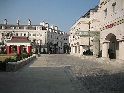
- Thames Town,
- 上海挑米汽车服务有限公司,
- 新乐坊招商中心,
- 美迅汽车表面快修中心(泰晤士店),
- 泰晤士小镇健身俱乐部-停车场,
- 泰晤士小镇健身俱乐部停车场-出入口,
- 玉树北路455弄,
- 海德果园,
- Ms Lynn’s 琳之音乐中心,
- 茗尚M.SHAIRSALON(海德店),
- 玉树北路465,
- 宝仁汽车(海德旗舰店),
- 思贤路/玉树路(路口),
- 宝隆花园酒店停车场-出入口,
- 泰晤士小镇G区,
- 梦红楼保健,
- YK CLUB酒吧,
- 伽音琴行(昌鑫店),
- BAR,
- 慕尼黑餐厅酒吧
Places Near 泰晤士小镇 (方松街道)
- 陆家嘴 Lujiazui, 陆家嘴,
- 武康大楼, 天平路街道,
- 大悦城(上海), 北站街道,
- Fairmont Peace Hotel (和平饭店), 外滩街道,
- 上海城隍庙, 豫园街道,
- 余庆路/武康路(路口),
- 复旦大学附属肿瘤医院,
- 宝华寺, 彭浦镇,
- LuOne凯德晶萃广场(地铁站出口), 打浦桥街道,
- 新场古镇, 新场镇,
- Wukang Road | 武康路, 湖南路街道,
- 七浦路服装批发市场, 北站街道,
- 上海新天地, 淮海中路街道,
- 朵云书院旗舰店, 陆家嘴,
- Wukang Building (武康大楼), 天平路街道,
- 新场古镇, 新场镇,
- 南京路步行街, 南京东路街道,
- 上海滩(外滩店), 外滩街道,
- 上海吴淞国际邮轮码头,
- Bailian Outlets Plaza (百联奥特莱斯广场)
How to get to popular places in Shanghai with public transit
Get around 方松街道 by public transit!
Traveling around 方松街道 has never been so easy. See step by step directions as you travel to any attraction, street or major public transit station. View bus and train schedules, arrival times, service alerts and detailed routes on a map, so you know exactly how to get to anywhere in 方松街道.
When traveling to any destination around 方松街道 use Moovit's Live Directions with Get Off Notifications to know exactly where and how far to walk, how long to wait for your line, and how many stops are left. Moovit will alert you when it's time to get off — no need to constantly re-check whether yours is the next stop.
Wondering how to use public transit in 方松街道 or how to pay for public transit in 方松街道? Moovit public transit app can help you navigate your way with public transit easily, and at minimum cost. It includes public transit fees, ticket prices, and costs. Looking for a map of 方松街道 public transit lines? Moovit public transit app shows all public transit maps in 方松街道 with all Bus, Train, Metro, Tram, Ferry, Cable Car and Maglev routes and stops on an interactive map.
Shanghai has 7 transit type(s), including: Bus, Train, Metro, Tram, Ferry, Cable Car and Maglev, operated by several transit agencies, including 上海地铁, 金山铁路, 张江有轨电车, 上海磁悬浮, 上海巴士, 浦东公交, 松江公交, 闵行客运, 金山巴士, 奉贤客运, 奉贤巴士, 金球出租, 青浦巴士, 众兴客运 and 智迅客运