Directions to 浅草橋駅北 station (千代田区) with public transit
The following transit lines have routes that pass near 浅草橋駅北
 Bus: 東42-1, 東42-2, 都02, 門33, 秋26.
- Metro: 中央・総武各駅停車 CHUO SOBU LOCAL LINE, 浅草線, 総武快速線 SOBU RAPID LINE.
How to get to 浅草橋駅北 station by bus?
Click on the bus route to see step by step directions with maps, line arrival times and updated time schedules.
How to get to 浅草橋駅北 station by metro?
Click on the metro route to see step by step directions with maps, line arrival times and updated time schedules.
Bus stops near 浅草橋駅北 stop in 千代田区
- 浅草橋, 3 min walk,
- 馬喰町, 6 min walk,
Metro stations near 浅草橋駅北 station in 千代田区
- 浅草橋, 3 min walk,
- 馬喰町 Bakurocho, 4 min walk,
Bus lines to 浅草橋駅北 station in 千代田区
- 東42-1, 東京駅八重洲口,
- 東42-2, 南千住車庫前,
- 秋26, 葛西駅前,
What are the closest stations to 浅草橋駅北?
The closest stations to 浅草橋駅北 are:
- 浅草橋 is 170 meters away, 3 min walk.
- 馬喰町 Bakurocho is 256 meters away, 4 min walk.
- 馬喰町 is 449 meters away, 6 min walk.
Which bus lines stop near 浅草橋駅北?
These bus lines stop near 浅草橋駅北: 東42-1, 東42-2, 都02, 門33.
Which metro lines stop near 浅草橋駅北?
These metro lines stop near 浅草橋駅北: 中央・総武各駅停車 CHUO SOBU LOCAL LINE, 浅草線.
What’s the nearest metro station to 浅草橋駅北 in 千代田区?
The nearest metro station to 浅草橋駅北 in 千代田区 is 浅草橋. It’s a 3 min walk away.
What’s the nearest bus station to 浅草橋駅北 in 千代田区?
The nearest bus station to 浅草橋駅北 in 千代田区 is 浅草橋. It’s a 3 min walk away.
What time is the first metro to 浅草橋駅北 in 千代田区?
The 中央・総武各駅停車 CHUO SOBU LOCAL LINE is the first metro that goes to 浅草橋駅北 in 千代田区. It stops nearby at 4:33 AM.
What time is the last metro to 浅草橋駅北 in 千代田区?
The 中央・総武各駅停車 CHUO SOBU LOCAL LINE is the last metro that goes to 浅草橋駅北 in 千代田区. It stops nearby at 12:31 AM.
What time is the first bus to 浅草橋駅北 in 千代田区?
The 東42-1 is the first bus that goes to 浅草橋駅北 in 千代田区. It stops nearby at 6:16 AM.
What time is the last bus to 浅草橋駅北 in 千代田区?
The 東42-1 is the last bus that goes to 浅草橋駅北 in 千代田区. It stops nearby at 11:00 PM.
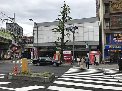
See 浅草橋駅北 station, 千代田区, on the map
Public Transit to 浅草橋駅北 in 千代田区
Looking for directions to 浅草橋駅北 in 千代田区, Japan?
Download the Moovit App to find the current schedule and step-by-step directions for Metro or Bus routes that pass through 浅草橋駅北.
Looking for the nearest stops closest to 浅草橋駅北 ? Check out this list of closest stops to your destination: 浅草橋; 馬喰町 Bakurocho; 馬喰町.
Bus: 東42-1, 東42-2, 都02, 門33, 秋26.Metro: 中央・総武各駅停車 CHUO SOBU LOCAL LINE, 浅草線, 総武快速線 SOBU RAPID LINE.
We make riding on public transit to 浅草橋駅北 easy, which is why over 1.5 million users, including users in 千代田区 trust Moovit as the best app for public transit.
Use the app to navigate to popular places including to the airport, hospital, stadium, grocery store, mall, coffee shop, school, college, and university.
Location: 千代田区, Tokyo
- 浅草橋,
- 馬喰町 Bakurocho
Metro stations near 浅草橋駅北 station
Get around 千代田区 by public transit!
Traveling around 千代田区 has never been so easy. See step by step directions as you travel to any attraction, street or major public transit station. View bus and train schedules, arrival times, service alerts and detailed routes on a map, so you know exactly how to get to anywhere in 千代田区.
When traveling to any destination around 千代田区 use Moovit's Live Directions with Get Off Notifications to know exactly where and how far to walk, how long to wait for your line, and how many stops are left. Moovit will alert you when it's time to get off — no need to constantly re-check whether yours is the next stop.
Wondering how to use public transit in 千代田区 or how to pay for public transit in 千代田区? Moovit public transit app can help you navigate your way with public transit easily, and at minimum cost. It includes public transit fees, ticket prices, and costs. Looking for a map of 千代田区 public transit lines? Moovit public transit app shows all public transit maps in 千代田区 with all Bus, Train, Metro and Light Rail routes and stops on an interactive map.
Tokyo has 4 transit type(s), including: Bus, Train, Metro and Light Rail, operated by several transit agencies, including JR East, Sagami Railway, 都営バス, Kokusai Kogyo Bus, 町田市コミュニティ, 東京メトロ, 羽村市(はむらん), 京成トランジットバス株式会社, 東京都交通局, 八王子市(はちバス), 日の出町(ぐるりーんひのでちゃん), 日立自動車交通株式会社, 西武バス, あきる野市(るのバス) and 西東京バス株式会社