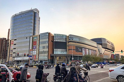
Directions to 清河中街 (清河地区) with public transportation
The following transit lines have routes that pass near 清河中街
 Bus: 307, 345, 355, 407, 518.
- Metro: 8, 13.
How to get to 清河中街 by bus?
Click on the bus route to see step by step directions with maps, line arrival times and updated time schedules.
How to get to 清河中街 by metro?
Click on the metro route to see step by step directions with maps, line arrival times and updated time schedules.
Bus stops near 清河中街 in 清河地区
- 清河, 6 min walk,
- 清河中街, 7 min walk,
- 毛纺路南口, 9 min walk,
- 永泰庄西路, 10 min walk,
- 永泰路, 14 min walk,
Metro stations near 清河中街 in 清河地区
- 永泰庄 Yongtaizhuang, 19 min walk,
- 上地 Shangdi, 51 min walk,
Bus lines to 清河中街 in 清河地区
- 407, 安定门,
- 606, 地铁霍营站南,
- 专60, 安宁庄东路南口,
- 305, 宝盛里小区 - 德胜门,
- 307, 巴沟村 - 回龙观公交场站,
- 315, 德胜门 - 新都东站,
- 345, 昌平北站 - 德胜门西,
- 355, 三义庙—育新小区,
- 392, 西直门南 - 西二旗北站,
- 398, 五道口公交场 - 育新小区,
- 478, 学知桥北 - 小辛庄村,
- 490, 阜成门内 - 宝盛里小区,
- 518, 西山林语公交场站 - 慧忠里,
- 607, 和平东桥 - 宏福苑小区西,
- 618, 回龙观公交场站 - 月坛体育场,
- 625, 鼓楼桥西 - 二拨子新村,
- 632, 五路 - 五彩城公交场站,
- 670, 德胜门西 - 百善镇政府,
- 693, 育新小区 - 阜永路口西,
- 753, 马连店 - 慧忠里,
What are the closest stations to 清河中街?
The closest stations to 清河中街 are:
- 清河 is 405 meters away, 6 min walk.
- 清河中街 is 491 meters away, 7 min walk.
- 毛纺路南口 is 637 meters away, 9 min walk.
- 永泰庄西路 is 773 meters away, 10 min walk.
- 永泰路 is 994 meters away, 14 min walk.
- 永泰庄 Yongtaizhuang is 1495 meters away, 19 min walk.
- 上地 Shangdi is 3924 meters away, 51 min walk.
Which bus lines stop near 清河中街?
These bus lines stop near 清河中街: 307, 345, 355, 407, 518, 632, 670, 670上东廓, 693.
Which metro line stops near 清河中街?
8 (往朱辛庄 Towards Zhuxinzhuang)
What’s the nearest metro station to 清河中街 in 清河地区?
The nearest metro station to 清河中街 in 清河地区 is 永泰庄 Yongtaizhuang. It’s a 19 min walk away.
What’s the nearest bus station to 清河中街 in 清河地区?
The nearest bus station to 清河中街 in 清河地区 is 清河. It’s a 6 min walk away.
What time is the first metro to 清河中街 in 清河地区?
The 8 is the first metro that goes to 清河中街 in 清河地区. It stops nearby at 4:51 AM.
What time is the last metro to 清河中街 in 清河地区?
The 13 is the last metro that goes to 清河中街 in 清河地区. It stops nearby at 12:00 AM.
What time is the first bus to 清河中街 in 清河地区?
The 夜4 is the first bus that goes to 清河中街 in 清河地区. It stops nearby at 3:05 AM.
What time is the last bus to 清河中街 in 清河地区?
The 夜4 is the last bus that goes to 清河中街 in 清河地区. It stops nearby at 3:37 AM.
See 清河中街, 清河地区, on the map
Public Transit to 清河中街 in 清河地区
How to get to 清河中街 in 清河地区, China?
It’s easy with Moovit. Type in your street address and Moovit’s route finder will locate the fastest way to get you there! Not sure where to get off on the street? Download the Moovit App to find live directions (including where to get off on 清河中街), see timetables and get the estimated arrival times for your favorite bus or metro lines.
Looking for the nearest stop or station to 清河中街? Check out this list of closest stops available to your destination: 清河; 清河中街; 毛纺路南口; 永泰庄西路; 永泰路; 永泰庄 Yongtaizhuang; 上地 Shangdi.
Bus: 307, 345, 355, 407, 518, 632, 670, 670上东廓, 693, 606, 专60, 305, 315, 577.Metro: 8, 13.
Download the Moovit App to see the current schedule and routes available for 清河地区. No need to install a special bus app to check the bus time or a train app to get train time. Moovit is the only all-in-one transit app that helps you get where you need to go.
We make riding on public transit to 清河中街 easy, which is why over 1.5 million users, including users in 清河地区 trust Moovit as the best app for public transit.
Use the app to navigate to popular places including to the airport, hospital, stadium, grocery store, mall, coffee shop, school, college, and university.
Location: 清河地区, Beijing
Get around 清河地区 by public transit!
Traveling around 清河地区 has never been so easy. See step by step directions as you travel to any attraction, street or major public transit station. View bus and train schedules, arrival times, service alerts and detailed routes on a map, so you know exactly how to get to anywhere in 清河地区.
When traveling to any destination around 清河地区 use Moovit's Live Directions with Get Off Notifications to know exactly where and how far to walk, how long to wait for your line, and how many stops are left. Moovit will alert you when it's time to get off — no need to constantly re-check whether yours is the next stop.
Wondering how to use public transit in 清河地区 or how to pay for public transit in 清河地区? Moovit public transit app can help you navigate your way with public transit easily, and at minimum cost. It includes public transit fees, ticket prices, and costs. Looking for a map of 清河地区 public transit lines? Moovit public transit app shows all public transit maps in 清河地区 with all Bus, Train, Metro, Cable Car and Funicular routes and stops on an interactive map.
Beijing has 5 transit type(s), including: Bus, Train, Metro, Cable Car and Funicular, operated by several transit agencies, including 北京地铁, 北京公交有轨电车有限公司, 北京市郊铁路局 and 北京公交