Directions to 漆咸道南 (油尖旺 Yau Tsim Mong) with public transportation
The following transit lines have routes that pass near 漆咸道南
 Bus: 171P, 213X, 26, 26X, 5.
- Subway: 屯馬綫 TUEN MA LINE, 東鐵綫 EAST RAIL LINE, 荃灣綫 TSUEN WAN LINE.
- Ferry: 水上的士.
How to get to 漆咸道南 by bus?
Click on the bus route to see step by step directions with maps, line arrival times and updated time schedules.
How to get to 漆咸道南 by subway?
Click on the subway route to see step by step directions with maps, line arrival times and updated time schedules.
Bus stops near 漆咸道南 in 油尖旺 Yau Tsim Mong
- 香港歷史博物館 Hong Kong Museum Of History, 2 min walk,
- 柯士甸道, 近嘉諾撒聖瑪利書院 Austin Road, Near St. Mary's Canossian College, 2 min walk,
- 香港科學館 Hong Kong Science Museum, 2 min walk,
- 香港理工大學 H.K. Polytechnic University, 2 min walk,
- 柯士甸道, 近槍會山軍營第14座 Austin Road, Near Gun Club Hill Barracks Block 14, 4 min walk,
- 柯士甸道, 近花園大廈 Austin Road, Near Garden Mansion, 4 min walk,
- 加連威老道98-100號 Granville Road No. 98-100, 5 min walk,
Subway stations near 漆咸道南 in 油尖旺 Yau Tsim Mong
- 紅磡 Hung Hom, 7 min walk,
- 尖沙咀 Tsim Sha Tsui, 9 min walk,
Ferry station near 漆咸道南 in 油尖旺 Yau Tsim Mong
- 尖沙咀1號梯台 Tsim Sha Tsui Landing No.1, 13 min walk,
Bus lines to 漆咸道南 in 油尖旺 Yau Tsim Mong
- 8, 忠孝街, 近欣圖軒第二座 Chung Hau Street, Near Cascades Block 2,
- 8S, 漢口道, 近騏生商業中心 Hankow Road, Near Kai Seng Commercial Centre,
- 5C, 尖沙咀碼頭 Star Ferry,
- 8, 九龍站 Kowloon Station,
- 8A, 黃埔花園 - 尖沙咀(循環線) Whampoa Garden - Tsim Sha Tsui (Circular),
- N41X, 青衣(長宏邨) Tsing Yi (Cheung Wang Estate),
- 87C, 馬鞍山(錦英苑) MA on Shan (Kam Ying Court),
- 87D, 馬鞍山(錦英苑) MA on Shan (Kam Ying Court),
- 208, 尖沙咀東 Tsim Sha Tsui East,
- N216, 油塘 Yau Tong,
- N241, 紅磡站 Hung Hom Station,
- N271, 大埔(富亨) Tai Po (Fu Heng),
- 271S, 大埔(太和) Tai Po (Tai Wo),
- N281, 馬鞍山(錦英苑) MA on Shan (Kam Ying Court),
- 287D, 馬鞍山(錦英苑) MA on Shan (Kam Ying Court),
- 26, 九龍站 Kowloon Station,
- 5, 富山邨 Fu Shan Estate - 尖沙咀碼頭 Star Ferry,
- 5P, 慈雲山(中) Tsz Wan Shan (Central) - 尖沙咀碼頭 Star Ferry,
- 13X, 寶達 Po Tat - 尖沙咀東 Tsim Sha Tsui East,
- A21, 紅磡站 Hung Hom Station - 機場 Airport,
What are the closest stations to 漆咸道南?
The closest stations to 漆咸道南 are:
- 香港歷史博物館 Hong Kong Museum Of History is 85 meters away, 2 min walk.
- 柯士甸道, 近嘉諾撒聖瑪利書院 Austin Road, Near St. Mary's Canossian College is 137 meters away, 2 min walk.
- 香港科學館 Hong Kong Science Museum is 145 meters away, 2 min walk.
- 香港理工大學 H.K. Polytechnic University is 149 meters away, 2 min walk.
- 柯士甸道, 近槍會山軍營第14座 Austin Road, Near Gun Club Hill Barracks Block 14 is 243 meters away, 4 min walk.
- 柯士甸道, 近花園大廈 Austin Road, Near Garden Mansion is 248 meters away, 4 min walk.
- 加連威老道98-100號 Granville Road No. 98-100 is 350 meters away, 5 min walk.
- 紅磡 Hung Hom is 481 meters away, 7 min walk.
- 尖沙咀 Tsim Sha Tsui is 621 meters away, 9 min walk.
- 尖沙咀1號梯台 Tsim Sha Tsui Landing No.1 is 944 meters away, 13 min walk.
Which bus lines stop near 漆咸道南?
These bus lines stop near 漆咸道南: 171P, 213X, 26, 26X, 5, 5C, 98P.
Which subway lines stop near 漆咸道南?
These subway lines stop near 漆咸道南: 屯馬綫 TUEN MA LINE, 東鐵綫 EAST RAIL LINE.
What’s the nearest subway station to 漆咸道南 in 油尖旺 Yau Tsim Mong?
The nearest subway station to 漆咸道南 in 油尖旺 Yau Tsim Mong is 紅磡 Hung Hom. It’s a 7 min walk away.
What’s the nearest bus station to 漆咸道南 in 油尖旺 Yau Tsim Mong?
The nearest bus stations to 漆咸道南 in 油尖旺 Yau Tsim Mong are 香港歷史博物館 Hong Kong Museum Of History, 柯士甸道, 近嘉諾撒聖瑪利書院 Austin Road, Near St. Mary's Canossian College, 香港科學館 Hong Kong Science Museum and 香港理工大學 H.K. Polytechnic University. The closest one is a 2 min walk away.
What’s the nearest ferry station to 漆咸道南 in 油尖旺 Yau Tsim Mong?
The nearest ferry station to 漆咸道南 in 油尖旺 Yau Tsim Mong is 尖沙咀1號梯台 Tsim Sha Tsui Landing No.1. It’s a 13 min walk away.
What time is the first subway to 漆咸道南 in 油尖旺 Yau Tsim Mong?
The 東鐵綫 EAST RAIL LINE is the first subway that goes to 漆咸道南 in 油尖旺 Yau Tsim Mong. It stops nearby at 5:35 AM.
What time is the last subway to 漆咸道南 in 油尖旺 Yau Tsim Mong?
The 東鐵綫 EAST RAIL LINE is the last subway that goes to 漆咸道南 in 油尖旺 Yau Tsim Mong. It stops nearby at 1:33 AM.
What time is the first bus to 漆咸道南 in 油尖旺 Yau Tsim Mong?
The N796 is the first bus that goes to 漆咸道南 in 油尖旺 Yau Tsim Mong. It stops nearby at 3:01 AM.
What time is the last bus to 漆咸道南 in 油尖旺 Yau Tsim Mong?
The N271 is the last bus that goes to 漆咸道南 in 油尖旺 Yau Tsim Mong. It stops nearby at 3:49 AM.
See 漆咸道南, 油尖旺 Yau Tsim Mong, on the map
Public Transit to 漆咸道南 in 油尖旺 Yau Tsim Mong
Wondering how to get to 漆咸道南 in 油尖旺 Yau Tsim Mong? Moovit helps you find the best way to get to 漆咸道南 with step-by-step directions from the nearest public transit station.
Moovit provides free maps and live directions to help you navigate through your city. View schedules, routes, timetables, and find out how long does it take to get to 漆咸道南 in real time.
Looking for the nearest stop or station to 漆咸道南? Check out this list of stops closest to your destination: 香港歷史博物館 Hong Kong Museum Of History; 柯士甸道; 香港科學館 Hong Kong Science Museum; 香港理工大學 H.K. Polytechnic University; 柯士甸道; 柯士甸道; 加連威老道98-100號 Granville Road No. 98-100; 紅磡 Hung Hom; 尖沙咀 Tsim Sha Tsui; 尖沙咀1號梯台 Tsim Sha Tsui Landing No.1.
Bus: 171P, 213X, 26, 26X, 5, 5C, 98P, 8, 8S, 8, 8A, 5P, 13X, A21.Subway: 屯馬綫 TUEN MA LINE, 東鐵綫 EAST RAIL LINE, 荃灣綫 TSUEN WAN LINE.Ferry: 水上的士.
Want to see if there’s another route that gets you there at an earlier time? Moovit helps you find alternative routes or times. Get directions from and directions to 漆咸道南 easily from the Moovit App or Website.
We make riding to 漆咸道南 easy, which is why over 1.5 million users, including users in 油尖旺 Yau Tsim Mong, trust Moovit as the best app for public transit. You don’t need to download an individual bus app or train app, Moovit is your all-in-one transit app that helps you find the best bus time or train time available.
For information on prices of bus and subway, costs and ride fares to 漆咸道南, please check the Moovit app.
Use the app to navigate to popular places including to the airport, hospital, stadium, grocery store, mall, coffee shop, school, college, and university.
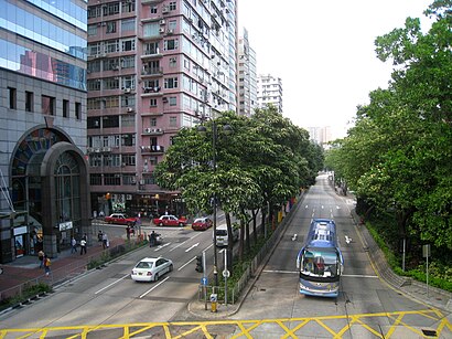
漆咸道南 Address: 香港漆咸道南 street in 油尖旺 Yau Tsim Mong
- Hong Kong Museum of History,
- 公教進行社 Catholic Centre,
- St. Mary's Canossian College (嘉諾撒聖瑪利書院),
- 新柯士甸商業中心,
- 天主教玫瑰堂,
- 柯士甸商業中心 Austin Commercial Centre,
- Popway Hotel Hong Kong,
- 117 Chatham Road South,
- 珀薈酒店 Popway Hotel,
- 富好中心 Foo Hoo Centre,
- 達成商業大廈,
- 達成商業大廈 Tak Sing Alliance Building,
- Rosary Church,
- 香港歷史博物館,
- 宏富大廈 Wang Fu Building,
- 香港工會聯合會 (香港文職及專業人員總會),
- 煥利商業大廈,
- 煥利商業大廈 Woon Lee Commercial Building,
- 美華閣,
- 多福大廈 Dolford Mansion
Places Near 漆咸道南 (油尖旺 Yau Tsim Mong)
- 威爾斯親王醫院, 沙田 Sha Tin,
- 香港教育大學, 大埔 Tai Po,
- 麗豪酒店, 沙田 Sha Tin,
- 香港東涌福朋喜來登酒店,
- 啟德體育園 Kai Tak Sports Park, 九龍 Kowloon City,
- 九龍灣健康中心 Kowloon Bay Health Centre, 觀塘 Kwun Tong,
- 中港城,
- 沙田馬場 Sha Tin Racecourse, 沙田 Sha Tin,
- 富麗敦海洋公園酒店 the Fullerton Hotel: Ocean Park,
- 林村許願樹, 大埔 Tai Po,
- 大埔海濱公園, 大埔 Tai Po,
- 入境事務處人事登記處辦事處, 觀塘 Kwun Tong,
- 大欖涌燒烤樂園 Tai Lam Chung Bbq Club, 屯門 Tuen Mun,
- 屯門兆麟政府綜合大樓 Tuen Mun Siu Lun Government Complex, 屯門 Tuen Mun,
- China Travel Service Tuen Mun Entry Permit Service Centre 中國旅行社屯門證件服務中心, 屯門 Tuen Mun,
- Airside, 九龍 Kowloon City,
- 天水圍(天業路)社區健康中心 Tin Shui Wai (Tin Yip Road) Community Health Centre, 元朗 Yuen Long,
- 宏利金融中心 Manulife Financial Centre, 觀塘 Kwun Tong,
- Shatin Hospital 沙田醫院, 沙田 Sha Tin,
- 香港駕駛學院沙田安全駕駛中心, 沙田 Sha Tin
How to get to popular places in Hong Kong with public transit
Get around 油尖旺 Yau Tsim Mong by public transit!
Traveling around 油尖旺 Yau Tsim Mong has never been so easy. See step by step directions as you travel to any attraction, street or major public transit station. View bus and train schedules, arrival times, service alerts and detailed routes on a map, so you know exactly how to get to anywhere in 油尖旺 Yau Tsim Mong.
When traveling to any destination around 油尖旺 Yau Tsim Mong use Moovit's Live Directions with Get Off Notifications to know exactly where and how far to walk, how long to wait for your line, and how many stops are left. Moovit will alert you when it's time to get off — no need to constantly re-check whether yours is the next stop.
Wondering how to use public transit in 油尖旺 Yau Tsim Mong or how to pay for public transit in 油尖旺 Yau Tsim Mong? Moovit public transit app can help you navigate your way with public transit easily, and at minimum cost. It includes public transit fees, ticket prices, and costs. Looking for a map of 油尖旺 Yau Tsim Mong public transit lines? Moovit public transit app shows all public transit maps in 油尖旺 Yau Tsim Mong with all Bus, Subway, Light Rail, Ferry, Cable Car and Funicular routes and stops on an interactive map.
Hong Kong has 6 transit type(s), including: Bus, Subway, Light Rail, Ferry, Cable Car and Funicular, operated by several transit agencies, including 港鐵 MTR, 天星小輪 Star Ferry, 九巴 KMB, 城巴 Citybus, 城巴機場快線 Cityflyer, 龍運巴士 LWB, 九巴 KMB / 城巴 CTB, 龍運巴士 LWB / 城巴 CTB, 新大嶼山巴士 NLB, 愉景灣巴士 DB, 香港電車 Hong Kong Tramways, 香港中文大學 The Chinese University of Hong Kong, 港島區專線小巴 GMB HK Island, 九龍區專線小巴 GMB Kowloon and 新界區專線小巴 GMB New Territories