Directions to 环贸iapm (湖南路街道) with public transportation
The following transit lines have routes that pass near 环贸iapm
 Bus: 146路, 167路, 198路, 45路, 911路.
- Metro: 10号线 LINE 10, 12号线 LINE 12, 1号线 LINE 1, 7号线 LINE 7, 13号线 LINE 13.
How to get to 环贸iapm by bus?
Click on the bus route to see step by step directions with maps, line arrival times and updated time schedules.
How to get to 环贸iapm by metro?
Click on the metro route to see step by step directions with maps, line arrival times and updated time schedules.
Bus stops near 环贸iapm in 湖南路街道
- 陕西南路淮海中路, 2 min walk,
- 淮海中路陕西南路, 3 min walk,
- 襄阳北路长乐路, 5 min walk,
- 襄阳公园, 6 min walk,
- 长乐路陕西南路, 6 min walk,
- 复兴中路陕西南路, 9 min walk,
Metro stations near 环贸iapm in 湖南路街道
- 陕西南路 South Shaanxi Road, 3 min walk,
- 常熟路 Changshu Road, 10 min walk,
- 淮海中路 Middle Huaihai Road, 10 min walk,
- 静安寺 Jing'An Temple, 18 min walk,
Bus lines to 环贸iapm in 湖南路街道
- 104路, 上海火车站(南广场) - 龙华,
- 146路, 卢浦大桥,
- 24路, 长寿新村 - 豆市街复兴东路,
- 301路, 上海火车站(南广场) - 上海南站(北广场),
- 304路, 老西门 - 长寿新村,
- 41路, 龙华 - 沪太新村,
- 955路, 芦恒路枢纽站 - 上海火车站(南广场),
- 167路, 龙耀路云锦路 - 伊敏河路巴林路,
- 320路, 虹桥西交通中心 - 延安东路中山东一路,
- 42路, 上海体育馆 - 龙门路淮海中路,
- 911路, 老西门 - 航南路航东路,
- 920路, 宜山北路虹桥路 - 老西门,
- 926路, 上海体育馆 - 中山东二路新开河路,
- 198路, 七宝农贸市场,
- 94路, 建德花园,
- 327路, 曹家渡,
- 45路, 南浦大桥(沪军营路),
- 26路, 广元西路虹桥路,
- 96路, 中山公园地铁站,
What are the closest stations to 环贸iapm?
The closest stations to 环贸iapm are:
- 陕西南路淮海中路 is 80 meters away, 2 min walk.
- 陕西南路 South Shaanxi Road is 161 meters away, 3 min walk.
- 淮海中路陕西南路 is 225 meters away, 3 min walk.
- 襄阳北路长乐路 is 348 meters away, 5 min walk.
- 襄阳公园 is 402 meters away, 6 min walk.
- 长乐路陕西南路 is 450 meters away, 6 min walk.
- 复兴中路陕西南路 is 633 meters away, 9 min walk.
- 常熟路 Changshu Road is 752 meters away, 10 min walk.
- 淮海中路 Middle Huaihai Road is 766 meters away, 10 min walk.
- 静安寺 Jing'An Temple is 1346 meters away, 18 min walk.
Which bus lines stop near 环贸iapm?
These bus lines stop near 环贸iapm: 146路, 167路, 198路, 45路, 911路, 926路.
Which metro lines stop near 环贸iapm?
These metro lines stop near 环贸iapm: 10号线 LINE 10, 12号线 LINE 12, 1号线 LINE 1.
What’s the nearest metro station to 环贸iapm in 湖南路街道?
The nearest metro station to 环贸iapm in 湖南路街道 is 陕西南路 South Shaanxi Road. It’s a 3 min walk away.
What’s the nearest bus station to 环贸iapm in 湖南路街道?
The nearest bus station to 环贸iapm in 湖南路街道 is 陕西南路淮海中路. It’s a 2 min walk away.
What time is the first metro to 环贸iapm in 湖南路街道?
The 1号线 LINE 1 is the first metro that goes to 环贸iapm in 湖南路街道. It stops nearby at 5:06 AM.
What time is the last metro to 环贸iapm in 湖南路街道?
The 2号线 LINE 2 is the last metro that goes to 环贸iapm in 湖南路街道. It stops nearby at 11:54 PM.
What time is the first bus to 环贸iapm in 湖南路街道?
The 301路 is the first bus that goes to 环贸iapm in 湖南路街道. It stops nearby at 3:01 AM.
What time is the last bus to 环贸iapm in 湖南路街道?
The 320路 is the last bus that goes to 环贸iapm in 湖南路街道. It stops nearby at 3:26 AM.
See 环贸iapm, 湖南路街道, on the map
Public Transit to 环贸iapm in 湖南路街道
Wondering how to get to 环贸iapm in 湖南路街道? Moovit helps you find the best way to get to 环贸iapm with step-by-step directions from the nearest public transit station.
Moovit provides free maps and live directions to help you navigate through your city. View schedules, routes, timetables, and find out how long does it take to get to 环贸iapm in real time.
Looking for the nearest stop or station to 环贸iapm? Check out this list of stops closest to your destination: 陕西南路淮海中路; 陕西南路 South Shaanxi Road; 淮海中路陕西南路; 襄阳北路长乐路; 襄阳公园; 长乐路陕西南路; 复兴中路陕西南路; 常熟路 Changshu Road; 淮海中路 Middle Huaihai Road; 静安寺 Jing'An Temple.
Bus: 146路, 167路, 198路, 45路, 911路, 926路, 104路, 24路, 301路, 304路, 320路, 42路, 920路.Metro: 10号线 LINE 10, 12号线 LINE 12, 1号线 LINE 1, 7号线 LINE 7, 13号线 LINE 13, 2号线 LINE 2.
Want to see if there’s another route that gets you there at an earlier time? Moovit helps you find alternative routes or times. Get directions from and directions to 环贸iapm easily from the Moovit App or Website.
We make riding to 环贸iapm easy, which is why over 1.5 million users, including users in 湖南路街道, trust Moovit as the best app for public transit. You don’t need to download an individual bus app or train app, Moovit is your all-in-one transit app that helps you find the best bus time or train time available.
For information on prices of metro and bus, costs and ride fares to 环贸iapm, please check the Moovit app.
Use the app to navigate to popular places including to the airport, hospital, stadium, grocery store, mall, coffee shop, school, college, and university.
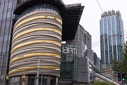
环贸iapm Address: 淮海中路999号 street in 湖南路街道
- 阿联酋航空,
- 红银财富中心(环贸广场分部),
- 第一太平戴维斯,
- 红歆财富公司,
- 705酒吧,
- Moosan Seafood (木桑水产),
- FANCY FRUIT(环贸iapm),
- 木桑水产(iapm环贸广场),
- Ed Hardy,
- THE NORTH FACE(环贸iapm店),
- life超市,
- PORTSPURE,
- Xǐ Yì (囍艺),
- 环贸iapm商场-洗手间,
- 淮海中路999号l1125,
- LENS CRAFTERS,
- Emporio Armani EA7,
- Ea7,
- LAMY Design Made in Germany(环贸iapm商场店),
- GAIA 2
Places Near 环贸iapm (湖南路街道)
- 上海城隍庙, 豫园街道,
- 朵云书院旗舰店, 陆家嘴,
- 南京路步行街, 南京东路街道,
- 宝华寺, 彭浦镇,
- 上海吴淞国际邮轮码头,
- 新场古镇, 新场镇,
- 七浦路服装批发市场, 北站街道,
- 余庆路/武康路(路口),
- 复旦大学附属肿瘤医院,
- LuOne凯德晶萃广场(地铁站出口), 打浦桥街道,
- 新场古镇, 新场镇,
- 上海新天地, 淮海中路街道,
- Bailian Outlets Plaza (百联奥特莱斯广场),
- 武康大楼, 天平路街道,
- 大悦城(上海), 北站街道,
- Fairmont Peace Hotel (和平饭店), 外滩街道,
- 陆家嘴 Lujiazui, 陆家嘴,
- 上海滩(外滩店), 外滩街道,
- Wukang Road | 武康路, 湖南路街道,
- Wukang Building (武康大楼), 天平路街道
How to get to popular places in Shanghai with public transit
Get around 湖南路街道 by public transit!
Traveling around 湖南路街道 has never been so easy. See step by step directions as you travel to any attraction, street or major public transit station. View bus and train schedules, arrival times, service alerts and detailed routes on a map, so you know exactly how to get to anywhere in 湖南路街道.
When traveling to any destination around 湖南路街道 use Moovit's Live Directions with Get Off Notifications to know exactly where and how far to walk, how long to wait for your line, and how many stops are left. Moovit will alert you when it's time to get off — no need to constantly re-check whether yours is the next stop.
Wondering how to use public transit in 湖南路街道 or how to pay for public transit in 湖南路街道? Moovit public transit app can help you navigate your way with public transit easily, and at minimum cost. It includes public transit fees, ticket prices, and costs. Looking for a map of 湖南路街道 public transit lines? Moovit public transit app shows all public transit maps in 湖南路街道 with all Bus, Train, Metro, Tram, Ferry, Cable Car and Maglev routes and stops on an interactive map.
Shanghai has 7 transit type(s), including: Bus, Train, Metro, Tram, Ferry, Cable Car and Maglev, operated by several transit agencies, including 上海地铁, 金山铁路, 张江有轨电车, 上海磁悬浮, 上海巴士, 浦东公交, 松江公交, 闵行客运, 金山巴士, 奉贤客运, 奉贤巴士, 金球出租, 青浦巴士, 众兴客运 and 智迅客运