Directions to 白普理叁養中心 (沙田 Sha Tin) with public transportation
The following transit lines have routes that pass near 白普理叁養中心
 Bus: 67K, NA40, 40X, A41P, N42.
- Subway: 東鐵綫 EAST RAIL LINE, 屯馬綫 TUEN MA LINE.
- Ferry: 三門仔 - 大水坑/荔枝窩/吉澳/鴨洲, 大水坑 - 馬料水 - 大美篤.
How to get to 白普理叁養中心 by bus?
Click on the bus route to see step by step directions with maps, line arrival times and updated time schedules.
Bus stops near 白普理叁養中心 in 沙田 Sha Tin
- 亞公角山路, 近賽馬會善寧之家 A Kung Kok Shan Road, Near Jockey Club Home For Hospice, 1 min walk,
- 沙田醫院 Shatin Hospital, 9 min walk,
- 亞公角街, 沙田醫院外 A Kung Kok Street, Outside Shatin Hospital, 9 min walk,
- 未命名通道, 近沙田醫院賽馬會耆智園 Unnamed Access Road, Near Jockey Club Centre For Positive Ageing, Shatin Hospital, 11 min walk,
Subway stations near 白普理叁養中心 in 沙田 Sha Tin
- 火炭 Fo Tan, 9 min walk,
- 石門 Shek Mun, 11 min walk,
Ferry station near 白普理叁養中心 in 沙田 Sha Tin
- 大水坑(沙田77區梯台) Tai Shui Hang (Shatin Area 77 Landing), 19 min walk,
Bus lines to 白普理叁養中心 in 沙田 Sha Tin
- 67K, 亞公角山路, 近鄰舍輔導會怡欣山莊 A Kung Kok Shan Road, Near the Neighbourhood Advice-Action Council Harmony Manor,
- NA40, 機場 / 港珠澳大橋香港口岸 Airport / HZMB Hong Kong Port - 烏溪沙站 Wu Kai Sha Station,
- 40X, 烏溪沙站 Wu Kai Sha Station - 葵涌邨 Kwai Chung Estate,
- A41P, 烏溪沙站 Wu Kai Sha Station - 機場 Airport,
- N42, 馬鞍山(耀安) Ma On Shan (Yiu On) - 東涌站 Tung Chung Station,
- 43X, 馬鞍山(耀安) Ma On Shan (Yiu On) - 荃灣西站 Tsuen Wan West Station,
- 81C, 馬鞍山(耀安) Ma On Shan (Yiu On) - 尖沙咀東(麼地道) Tsim Sha Tsui East (Mody Road),
- 84M, 富安花園 Chevalier Garden - 樂富 Lok Fu,
- 85K, 恆安 Heng On - 沙田站 Sha Tin Station,
- 85M, 錦英苑 Kam Ying Court - 黃大仙(循環線) Wong Tai Sin (Circular),
- 85S, 馬鞍山(耀安) Ma On Shan (Yiu On) - 紅磡(紅鸞道) Hung Hom (Hung Luen Road),
- 85X, 馬鞍山市中心 Ma On Shan Town Centre - 紅磡(紅鸞道) Hung Hom (Hung Luen Road),
- 86C, 馬鞍山(利安) Ma On Shan (Lee On) - 長沙灣 Cheung Sha Wan,
- 86K, 錦英苑 Kam Ying Court - 沙田站 Sha Tin Station,
- 86S, 錦英苑 Kam Ying Court - 沙田站 Sha Tin Station,
- 87D, 馬鞍山(錦英苑) Ma On Shan (Kam Ying Court) - 紅磡站 Hung Hom Station,
- 89C, 恒安 Heng On - 觀塘(翠屏道) Kwun Tong (Tsui Ping Road),
- 89D, 烏溪沙站 Wu Kai Sha Station - 藍田站 Lam Tin Station,
- 89P, 馬鞍山市中心 Ma On Shan Town Centre - 藍田站 Lam Tin Station,
- 89S, 水泉澳 Shui Chuen O - 烏溪沙站 Wu Kai Sha Station,
What are the closest stations to 白普理叁養中心?
The closest stations to 白普理叁養中心 are:
- 亞公角山路, 近賽馬會善寧之家 A Kung Kok Shan Road, Near Jockey Club Home For Hospice is 7 meters away, 1 min walk.
- 沙田醫院 Shatin Hospital is 633 meters away, 9 min walk.
- 亞公角街, 沙田醫院外 A Kung Kok Street, Outside Shatin Hospital is 664 meters away, 9 min walk.
- 火炭 Fo Tan is 679 meters away, 9 min walk.
- 石門 Shek Mun is 765 meters away, 11 min walk.
- 未命名通道, 近沙田醫院賽馬會耆智園 Unnamed Access Road, Near Jockey Club Centre For Positive Ageing, Shatin Hospital is 775 meters away, 11 min walk.
- 大水坑(沙田77區梯台) Tai Shui Hang (Shatin Area 77 Landing) is 1433 meters away, 19 min walk.
Which bus line stops near 白普理叁養中心?
67K (亞公角山路, 近鄰舍輔導會怡欣山莊 A Kung Kok Shan Road, Near the Neighbourhood Advice-Action Council Harmony Manor)
What’s the nearest subway station to 白普理叁養中心 in 沙田 Sha Tin?
The nearest subway station to 白普理叁養中心 in 沙田 Sha Tin is 火炭 Fo Tan. It’s a 9 min walk away.
What’s the nearest bus station to 白普理叁養中心 in 沙田 Sha Tin?
The nearest bus station to 白普理叁養中心 in 沙田 Sha Tin is 亞公角山路, 近賽馬會善寧之家 A Kung Kok Shan Road, Near Jockey Club Home For Hospice. It’s a 1 min walk away.
What’s the nearest ferry station to 白普理叁養中心 in 沙田 Sha Tin?
The nearest ferry station to 白普理叁養中心 in 沙田 Sha Tin is 大水坑(沙田77區梯台) Tai Shui Hang (Shatin Area 77 Landing). It’s a 19 min walk away.
What time is the first subway to 白普理叁養中心 in 沙田 Sha Tin?
The 東鐵綫 EAST RAIL LINE is the first subway that goes to 白普理叁養中心 in 沙田 Sha Tin. It stops nearby at 5:38 AM.
What time is the last subway to 白普理叁養中心 in 沙田 Sha Tin?
The 屯馬綫 TUEN MA LINE is the last subway that goes to 白普理叁養中心 in 沙田 Sha Tin. It stops nearby at 1:22 AM.
What time is the first bus to 白普理叁養中心 in 沙田 Sha Tin?
The N680 is the first bus that goes to 白普理叁養中心 in 沙田 Sha Tin. It stops nearby at 3:04 AM.
What time is the last bus to 白普理叁養中心 in 沙田 Sha Tin?
The N680 is the last bus that goes to 白普理叁養中心 in 沙田 Sha Tin. It stops nearby at 3:43 AM.
See 白普理叁養中心, 沙田 Sha Tin, on the map
Public Transit to 白普理叁養中心 in 沙田 Sha Tin
Wondering how to get to 白普理叁養中心 in 沙田 Sha Tin? Moovit helps you find the best way to get to 白普理叁養中心 with step-by-step directions from the nearest public transit station.
Moovit provides free maps and live directions to help you navigate through your city. View schedules, routes, timetables, and find out how long does it take to get to 白普理叁養中心 in real time.
Looking for the nearest stop or station to 白普理叁養中心? Check out this list of stops closest to your destination: 亞公角山路; 沙田醫院 Shatin Hospital; 亞公角街; 火炭 Fo Tan; 石門 Shek Mun; 未命名通道; 大水坑(沙田77區梯台) Tai Shui Hang (Shatin Area 77 Landing).
Bus: 67K, NA40, 40X, A41P, N42, 43X, 803, 805S, 806B, 808, 808P.Subway: 東鐵綫 EAST RAIL LINE, 屯馬綫 TUEN MA LINE.Ferry: 三門仔 - 大水坑/荔枝窩/吉澳/鴨洲, 大水坑 - 馬料水 - 大美篤.
Want to see if there’s another route that gets you there at an earlier time? Moovit helps you find alternative routes or times. Get directions from and directions to 白普理叁養中心 easily from the Moovit App or Website.
We make riding to 白普理叁養中心 easy, which is why over 1.5 million users, including users in 沙田 Sha Tin, trust Moovit as the best app for public transit. You don’t need to download an individual bus app or train app, Moovit is your all-in-one transit app that helps you find the best bus time or train time available.
For information on prices of bus and subway, costs and ride fares to 白普理叁養中心, please check the Moovit app.
Use the app to navigate to popular places including to the airport, hospital, stadium, grocery store, mall, coffee shop, school, college, and university.
白普理叁養中心 Address: 亞公角山路 17 沙田区, 新界 street in 沙田 Sha Tin
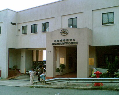
- 白普理寧養中心 Bradbury Hospice,
- The Jockey Club Home for Hospice, Shatin,
- 善寧之家,
- 亞公角山路,
- 賽馬會善寧之家 Jockey Club Home For Hospice,
- 賽馬會耆智園 Jockey Club Centre For Positive Ageing,
- 沙田醫院停車場,
- 亞公角食水配水庫,
- 沙田醫院調遷大樓 Shatin Hospital Decanting Building,
- 沙田慈氏護養院 Cheshire Home Shatin,
- 白端良小屋,
- Shatin Hospital,
- Cheshire Home Shatin,
- 沙田慈氏護養院,
- 沙田醫院職員飯堂,
- 沙田醫院,
- 沙田市中心出口,
- Shatin Hospital 沙田醫院,
- Dr. Leung Chi Wang (梁智宏醫生),
- 慈氏護養院
Places Near 白普理叁養中心 (沙田 Sha Tin)
- 啟德體育園 Kai Tak Sports Park, 九龍 Kowloon City,
- 香港教育大學, 大埔 Tai Po,
- 大埔海濱公園, 大埔 Tai Po,
- 屯門兆麟政府綜合大樓 Tuen Mun Siu Lun Government Complex, 屯門 Tuen Mun,
- 富麗敦海洋公園酒店 the Fullerton Hotel: Ocean Park,
- 宏利金融中心 Manulife Financial Centre, 觀塘 Kwun Tong,
- 林村許願樹, 大埔 Tai Po,
- 中港城,
- 大欖涌燒烤樂園 Tai Lam Chung Bbq Club, 屯門 Tuen Mun,
- 香港駕駛學院沙田安全駕駛中心, 沙田 Sha Tin,
- 天水圍(天業路)社區健康中心 Tin Shui Wai (Tin Yip Road) Community Health Centre, 元朗 Yuen Long,
- 九龍灣健康中心 Kowloon Bay Health Centre, 觀塘 Kwun Tong,
- 香港東涌福朋喜來登酒店,
- China Travel Service Tuen Mun Entry Permit Service Centre 中國旅行社屯門證件服務中心, 屯門 Tuen Mun,
- 麗豪酒店, 沙田 Sha Tin,
- Shatin Hospital 沙田醫院, 沙田 Sha Tin,
- Airside, 九龍 Kowloon City,
- 沙田馬場 Sha Tin Racecourse, 沙田 Sha Tin,
- 威爾斯親王醫院, 沙田 Sha Tin,
- 入境事務處人事登記處辦事處, 觀塘 Kwun Tong
How to get to popular places in Hong Kong with public transit
Get around 沙田 Sha Tin by public transit!
Traveling around 沙田 Sha Tin has never been so easy. See step by step directions as you travel to any attraction, street or major public transit station. View bus and train schedules, arrival times, service alerts and detailed routes on a map, so you know exactly how to get to anywhere in 沙田 Sha Tin.
When traveling to any destination around 沙田 Sha Tin use Moovit's Live Directions with Get Off Notifications to know exactly where and how far to walk, how long to wait for your line, and how many stops are left. Moovit will alert you when it's time to get off — no need to constantly re-check whether yours is the next stop.
Wondering how to use public transit in 沙田 Sha Tin or how to pay for public transit in 沙田 Sha Tin? Moovit public transit app can help you navigate your way with public transit easily, and at minimum cost. It includes public transit fees, ticket prices, and costs. Looking for a map of 沙田 Sha Tin public transit lines? Moovit public transit app shows all public transit maps in 沙田 Sha Tin with all Bus, Subway, Light Rail, Ferry, Cable Car and Funicular routes and stops on an interactive map.
Hong Kong has 6 transit type(s), including: Bus, Subway, Light Rail, Ferry, Cable Car and Funicular, operated by several transit agencies, including 港鐵 MTR, 天星小輪 Star Ferry, 九巴 KMB, 城巴 Citybus, 城巴機場快線 Cityflyer, 龍運巴士 LWB, 九巴 KMB / 城巴 CTB, 龍運巴士 LWB / 城巴 CTB, 新大嶼山巴士 NLB, 愉景灣巴士 DB, 香港電車 Hong Kong Tramways, 香港中文大學 The Chinese University of Hong Kong, 港島區專線小巴 GMB HK Island, 九龍區專線小巴 GMB Kowloon and 新界區專線小巴 GMB New Territories