Directions to 空港新城江宁 (江宁区) with public transportation
The following transit lines have routes that pass near 空港新城江宁
 Bus: 862路.
- Metro: S1号线(机场线), S7号线(宁溧城际), S9号线 (宁高城际).
How to get to 空港新城江宁 by bus?
Click on the bus route to see step by step directions with maps, line arrival times and updated time schedules.
How to get to 空港新城江宁 by metro?
Click on the metro route to see step by step directions with maps, line arrival times and updated time schedules.
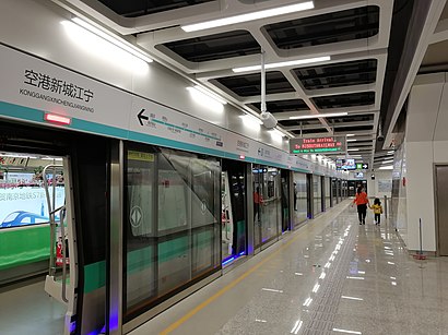
Metro stations near 空港新城江宁 in 江宁区
- 空港新城江宁, 6 min walk,
- 铜山, 15 min walk,
Bus stop near 空港新城江宁 in 江宁区
- 机场路, 16 min walk,
Bus lines to 空港新城江宁 in 江宁区
- 862路, 铜山车站,
What are the closest stations to 空港新城江宁?
The closest stations to 空港新城江宁 are:
- 空港新城江宁 is 368 meters away, 6 min walk.
- 铜山 is 957 meters away, 15 min walk.
- 机场路 is 1190 meters away, 16 min walk.
Which bus line stops near 空港新城江宁?
862路 (翔宇路北→铜山车站)
Which metro line stops near 空港新城江宁?
S1号线(机场线) (禄口机场)
What’s the nearest metro station to 空港新城江宁 in 江宁区?
The nearest metro station to 空港新城江宁 in 江宁区 is 空港新城江宁. It’s a 6 min walk away.
What time is the first metro to 空港新城江宁 in 江宁区?
The S7号线(宁溧城际) is the first metro that goes to 空港新城江宁 in 江宁区. It stops nearby at 6:00 AM.
What time is the last metro to 空港新城江宁 in 江宁区?
The S1号线(机场线) is the last metro that goes to 空港新城江宁 in 江宁区. It stops nearby at 10:39 PM.
What time is the first bus to 空港新城江宁 in 江宁区?
The 862路 is the first bus that goes to 空港新城江宁 in 江宁区. It stops nearby at 6:14 AM.
What time is the last bus to 空港新城江宁 in 江宁区?
The 862路 is the last bus that goes to 空港新城江宁 in 江宁区. It stops nearby at 10:30 PM.
See 空港新城江宁, 江宁区, on the map
Public Transit to 空港新城江宁 in 江宁区
Wondering how to get to 空港新城江宁 in 江宁区? Moovit helps you find the best way to get to 空港新城江宁 with step-by-step directions from the nearest public transit station.
Moovit provides free maps and live directions to help you navigate through your city. View schedules, routes, timetables, and find out how long does it take to get to 空港新城江宁 in real time.
Looking for the nearest stop or station to 空港新城江宁? Check out this list of stops closest to your destination: 空港新城江宁; 铜山; 机场路.
Bus: 862路.Metro: S1号线(机场线), S7号线(宁溧城际), S9号线 (宁高城际).
Want to see if there’s another route that gets you there at an earlier time? Moovit helps you find alternative routes or times. Get directions from and directions to 空港新城江宁 easily from the Moovit App or Website.
We make riding to 空港新城江宁 easy, which is why over 1.5 million users, including users in 江宁区, trust Moovit as the best app for public transit. You don’t need to download an individual bus app or train app, Moovit is your all-in-one transit app that helps you find the best bus time or train time available.
For information on prices of metro and bus, costs and ride fares to 空港新城江宁, please check the Moovit app.
Use the app to navigate to popular places including to the airport, hospital, stadium, grocery store, mall, coffee shop, school, college, and university.
Location: 江宁区, Nanjing
- 南京禄口机场远航宾馆二店,
- 空港停车场,
- 空勤业务楼,
- 世纪华联超市(纬三路),
- 南京空港油料有限公司,
- 秦村,
- 民航南京禄口国际机场公安局,
- 地铁s1号线(空港新城江宁-南京南站),
- 南京福禄苑宾馆,
- 经十二路,
- 空港新城江宁地铁站-2口,
- 东方航空江苏公司停车场,
- 纬一路/翔燕路(路口),
- 东航华美达中餐厅·三味珍火龙虾,
- 西饼屋(禄口店),
- 南京市口岸管委会机场办事处,
- 南京东航华美达酒店-健身房,
- 中国东方航空江苏有限公司-南门,
- 南京东航华美达酒店-东门,
- 入境航班专用航站区
Places Near 空港新城江宁 (江宁区)
- 龙泉古苑塔陵(南京龙泉寺), 雨花台区,
- 南京晓庄市场·农副产品批发市场, 栖霞区,
- 玄武湖, 玄武区,
- 东庐山观音寺,
- 南京夫子庙, 秦淮区,
- 南京明基医院, 建邺区,
- 鼓楼医院江北分院, 浦口区,
- 华东饭店-D楼, 鼓楼区,
- 南京大屠杀遇难同胞纪念馆, 建邺区,
- 南京博物院,
- 江苏省人民医院,
- 中大医院-门诊部, 鼓楼区,
- 中国人民解放军东部战区总医院, 玄武区,
- 南京禄口国际机场T2航站楼-国际/港澳台到达, 江宁区,
- 老门东步行街, 秦淮区,
- 德基广场, 玄武区,
- 南京市第一医院(河西院区), 建邺区,
- 南京鼓楼医院, 鼓楼区,
- 南京砂之船奥莱, 江宁区,
- 江宁会展中心, 江宁区
How to get to popular places in Nanjing with public transit
Get around 江宁区 by public transit!
Traveling around 江宁区 has never been so easy. See step by step directions as you travel to any attraction, street or major public transit station. View bus and train schedules, arrival times, service alerts and detailed routes on a map, so you know exactly how to get to anywhere in 江宁区.
When traveling to any destination around 江宁区 use Moovit's Live Directions with Get Off Notifications to know exactly where and how far to walk, how long to wait for your line, and how many stops are left. Moovit will alert you when it's time to get off — no need to constantly re-check whether yours is the next stop.
Wondering how to use public transit in 江宁区 or how to pay for public transit in 江宁区? Moovit public transit app can help you navigate your way with public transit easily, and at minimum cost. It includes public transit fees, ticket prices, and costs. Looking for a map of 江宁区 public transit lines? Moovit public transit app shows all public transit maps in 江宁区 with all Bus, Metro, Light Rail and Cable Car routes and stops on an interactive map.
Nanjing has 4 transit type(s), including: Bus, Metro, Light Rail and Cable Car, operated by several transit agencies, including 南京地铁, 南京有轨电车 and 南京公交