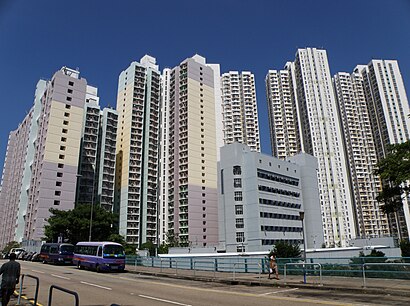
Directions to 紅磡邨 (九龍 Kowloon City) with public transportation
The following transit lines have routes that pass near 紅磡邨
 Bus: 107, 116, 85X, 土瓜灣(欣榮花園) — 美孚, 土瓜灣(欣榮花園) — 荃灣(福來邨).
- Subway: 屯馬綫 TUEN MA LINE, 觀塘綫 KWUN TONG LINE, 東鐵綫 EAST RAIL LINE.
- Ferry: 北角 - 九龍城.
How to get to 紅磡邨 by bus?
Click on the bus route to see step by step directions with maps, line arrival times and updated time schedules.
How to get to 紅磡邨 by subway?
Click on the subway route to see step by step directions with maps, line arrival times and updated time schedules.
Bus stops near 紅磡邨 in 九龍 Kowloon City
- 機利士路郵政局 Gillies Avenue Post Office, 1 min walk,
- 北拱街 Pak Kung Street, 2 min walk,
- 新柳街 San Lau Street, 2 min walk,
- 馬頭圍道, 近啟岸 MA Tau Wai Road, Near the Vantage, 2 min walk,
- 紅磡北拱街 Pak Kung Street Hung Hom, 2 min walk,
- 馬頭圍道, 近石塘街 MA Tau Wai Road, Near Shek Tong Street, 2 min walk,
- 環安街 Wan on Street, 3 min walk,
- 紅磡庇利街 Bailey Street Hung Hom, 3 min walk,
- 北拱街漆咸道北 Pak Kung Street Chatham Rd. North, 4 min walk,
- 信用街, 高山道海關已婚關員宿舍外 Shun Yung Street, Outside Custom & Excise Service Married Quarters, 5 min walk,
Subway stations near 紅磡邨 in 九龍 Kowloon City
- 黃埔 Whampoa, 5 min walk,
- 何文田 Ho Man Tin, 8 min walk,
- 紅磡 Hung Hom, 12 min walk,
Ferry station near 紅磡邨 in 九龍 Kowloon City
- 九龍城渡輪碼頭 Kowloon City Ferry Pier, 17 min walk,
Bus lines to 紅磡邨 in 九龍 Kowloon City
- 28, 樂華 LOK Wah,
- A22, 藍田站 Lam Tin Station,
- N23, 東涌站 Tung Chung Station,
- 5, 富山邨 Fu Shan Estate - 尖沙咀碼頭 Star Ferry,
- 5A, 啟德(啟晴邨) Kai Tak (Kai Ching Estate) - 尖沙咀碼頭 Star Ferry,
- 5P, 慈雲山(中) Tsz Wan Shan (Central) - 尖沙咀碼頭 Star Ferry,
- 11, 鑽石山站 Diamond Hill Station - 九龍站 Kowloon Station,
- 14, 鯉魚門邨 Lei Yue Mun Estate - 中港碼頭 China Ferry Terminal,
- 26, 順天 Shun Tin - 尖沙咀東 Tsim Sha Tsui East,
- 93K, 寶林 Po Lam - 旺角東站 Mong Kok East Station,
- 2, 又一城公共交通總站 Festival Walk Public Transport Terminus,
- 西環(修打蘭街) — 觀塘(宜安街), Sai Wan (Sutherland St) - Kwun Tong (Yee On St),
- 銅鑼灣(鵝頸橋) - 牛頭角/觀塘, Causeway Bay (Canal Rd Flyover) - Ngau Tau Kok and Kwun Tong,
- 銅鑼灣(鵝頸橋) — 慈雲山, Causeway Bay (Canal Rd Flyover) - Tsz Wan Shan,
- 101, 觀塘(裕民坊) Kwun Tong (Yue Man Square) - 堅尼地城 Kennedy Town,
- 107, 九龍灣 Kowloon Bay - 華貴 Wah Kwai,
- 108, 啟業 Kai Yip - 寶馬山 Braemar Hill,
- 111, 坪石 Ping Shek - 中環(港澳碼頭) Central (Macau Ferry),
- 111P, 彩福 Choi Fook - 中環(港澳碼頭) Central (Macau Ferry),
- 116, 慈雲山(中) Tsz Wan Shan (Central) - 鰂魚涌 Quarry Bay,
What are the closest stations to 紅磡邨?
The closest stations to 紅磡邨 are:
- 機利士路郵政局 Gillies Avenue Post Office is 61 meters away, 1 min walk.
- 北拱街 Pak Kung Street is 110 meters away, 2 min walk.
- 新柳街 San Lau Street is 115 meters away, 2 min walk.
- 馬頭圍道, 近啟岸 MA Tau Wai Road, Near the Vantage is 121 meters away, 2 min walk.
- 紅磡北拱街 Pak Kung Street Hung Hom is 124 meters away, 2 min walk.
- 馬頭圍道, 近石塘街 MA Tau Wai Road, Near Shek Tong Street is 126 meters away, 2 min walk.
- 環安街 Wan on Street is 159 meters away, 3 min walk.
- 紅磡庇利街 Bailey Street Hung Hom is 186 meters away, 3 min walk.
- 北拱街漆咸道北 Pak Kung Street Chatham Rd. North is 230 meters away, 4 min walk.
- 信用街, 高山道海關已婚關員宿舍外 Shun Yung Street, Outside Custom & Excise Service Married Quarters is 311 meters away, 5 min walk.
- 黃埔 Whampoa is 311 meters away, 5 min walk.
- 何文田 Ho Man Tin is 538 meters away, 8 min walk.
- 紅磡 Hung Hom is 857 meters away, 12 min walk.
- 九龍城渡輪碼頭 Kowloon City Ferry Pier is 1254 meters away, 17 min walk.
Which bus lines stop near 紅磡邨?
These bus lines stop near 紅磡邨: 107, 116, 85X, 土瓜灣(欣榮花園) — 美孚, 土瓜灣(欣榮花園) — 荃灣(福來邨).
Which subway line stops near 紅磡邨?
屯馬綫 TUEN MA LINE (往屯門 To Tuen Mun)
What’s the nearest subway station to 紅磡邨 in 九龍 Kowloon City?
The nearest subway station to 紅磡邨 in 九龍 Kowloon City is 黃埔 Whampoa. It’s a 5 min walk away.
What’s the nearest bus station to 紅磡邨 in 九龍 Kowloon City?
The nearest bus station to 紅磡邨 in 九龍 Kowloon City is 機利士路郵政局 Gillies Avenue Post Office. It’s a 1 min walk away.
What’s the nearest ferry station to 紅磡邨 in 九龍 Kowloon City?
The nearest ferry station to 紅磡邨 in 九龍 Kowloon City is 九龍城渡輪碼頭 Kowloon City Ferry Pier. It’s a 17 min walk away.
What time is the first subway to 紅磡邨 in 九龍 Kowloon City?
The 東鐵綫 EAST RAIL LINE is the first subway that goes to 紅磡邨 in 九龍 Kowloon City. It stops nearby at 5:35 AM.
What time is the last subway to 紅磡邨 in 九龍 Kowloon City?
The 東鐵綫 EAST RAIL LINE is the last subway that goes to 紅磡邨 in 九龍 Kowloon City. It stops nearby at 1:33 AM.
What time is the first bus to 紅磡邨 in 九龍 Kowloon City?
The 銅鑼灣(鵝頸橋) - 牛頭角/觀塘 is the first bus that goes to 紅磡邨 in 九龍 Kowloon City. It stops nearby at 3:00 AM.
What time is the last bus to 紅磡邨 in 九龍 Kowloon City?
The N121 is the last bus that goes to 紅磡邨 in 九龍 Kowloon City. It stops nearby at 3:06 AM.
What time is the first ferry to 紅磡邨 in 九龍 Kowloon City?
The 北角 - 九龍城 is the first ferry that goes to 紅磡邨 in 九龍 Kowloon City. It stops nearby at 8:05 AM.
What time is the last ferry to 紅磡邨 in 九龍 Kowloon City?
The 北角 - 九龍城 is the last ferry that goes to 紅磡邨 in 九龍 Kowloon City. It stops nearby at 7:35 PM.
See 紅磡邨, 九龍 Kowloon City, on the map
Public Transit to 紅磡邨 in 九龍 Kowloon City
Wondering how to get to 紅磡邨 in 九龍 Kowloon City? Moovit helps you find the best way to get to 紅磡邨 with step-by-step directions from the nearest public transit station.
Moovit provides free maps and live directions to help you navigate through your city. View schedules, routes, timetables, and find out how long does it take to get to 紅磡邨 in real time.
Looking for the nearest stop or station to 紅磡邨? Check out this list of stops closest to your destination: 機利士路郵政局 Gillies Avenue Post Office; 北拱街 Pak Kung Street; 新柳街 San Lau Street; 馬頭圍道; 紅磡北拱街 Pak Kung Street Hung Hom; 馬頭圍道; 環安街 Wan on Street; 紅磡庇利街 Bailey Street Hung Hom; 北拱街漆咸道北 Pak Kung Street Chatham Rd. North; 信用街; 黃埔 Whampoa; 何文田 Ho Man Tin; 紅磡 Hung Hom; 九龍城渡輪碼頭 Kowloon City Ferry Pier.
Bus: 107, 116, 85X, 土瓜灣(欣榮花園) — 美孚, 土瓜灣(欣榮花園) — 荃灣(福來邨), 28, A22, N23.Subway: 屯馬綫 TUEN MA LINE, 觀塘綫 KWUN TONG LINE, 東鐵綫 EAST RAIL LINE.Ferry: 北角 - 九龍城.
Want to see if there’s another route that gets you there at an earlier time? Moovit helps you find alternative routes or times. Get directions from and directions to 紅磡邨 easily from the Moovit App or Website.
We make riding to 紅磡邨 easy, which is why over 1.5 million users, including users in 九龍 Kowloon City, trust Moovit as the best app for public transit. You don’t need to download an individual bus app or train app, Moovit is your all-in-one transit app that helps you find the best bus time or train time available.
For information on prices of bus and subway, costs and ride fares to 紅磡邨, please check the Moovit app.
Use the app to navigate to popular places including to the airport, hospital, stadium, grocery store, mall, coffee shop, school, college, and university.
紅磡邨 Address: Tai Wan Rd street in 九龍 Kowloon City
- 機利士路郵政局,
- Gillies Avenue Post Office (機利士路郵政局),
- 馬頭圍道164-180號,
- 海逸皇宮大酒樓,
- 1 新圍街,
- 寶御 Star Ruby,
- St. Timothy's Primary School 聖提摩太小學,
- 新柳街2-16號,
- Bar Pacific 太平洋酒吧,
- 幸福樓海鮮酒家,
- Abundant Life Christian Church 基督教豐盛生命堂,
- Dr. Ng Tin Chue Helmut (吳天柱醫生),
- 新明華苑茶餐廳,
- 薈點 the Met Focus,
- 昌盛金鋪大樓 Cheong Shing Court,
- 北帝廟,
- The Met Focus 薈點,
- 合和汽車運輸有限公司,
- 北拱街18-20號,
- 富運大廈 Full Wing Building
Places Near 紅磡邨 (九龍 Kowloon City)
- 威爾斯親王醫院, 沙田 Sha Tin,
- 香港東涌福朋喜來登酒店,
- Airside, 九龍 Kowloon City,
- 林村許願樹, 大埔 Tai Po,
- 香港駕駛學院沙田安全駕駛中心, 沙田 Sha Tin,
- China Travel Service Tuen Mun Entry Permit Service Centre 中國旅行社屯門證件服務中心, 屯門 Tuen Mun,
- 富麗敦海洋公園酒店 the Fullerton Hotel: Ocean Park,
- 啟德體育園 Kai Tak Sports Park, 九龍 Kowloon City,
- 天水圍(天業路)社區健康中心 Tin Shui Wai (Tin Yip Road) Community Health Centre, 元朗 Yuen Long,
- 屯門兆麟政府綜合大樓 Tuen Mun Siu Lun Government Complex, 屯門 Tuen Mun,
- 入境事務處人事登記處辦事處, 觀塘 Kwun Tong,
- 大埔海濱公園, 大埔 Tai Po,
- 香港教育大學, 大埔 Tai Po,
- 麗豪酒店, 沙田 Sha Tin,
- 中港城,
- Shatin Hospital 沙田醫院, 沙田 Sha Tin,
- 宏利金融中心 Manulife Financial Centre, 觀塘 Kwun Tong,
- 大欖涌燒烤樂園 Tai Lam Chung Bbq Club, 屯門 Tuen Mun,
- 九龍灣健康中心 Kowloon Bay Health Centre, 觀塘 Kwun Tong,
- 沙田馬場 Sha Tin Racecourse, 沙田 Sha Tin
How to get to popular places in Hong Kong with public transit
Get around 九龍 Kowloon City by public transit!
Traveling around 九龍 Kowloon City has never been so easy. See step by step directions as you travel to any attraction, street or major public transit station. View bus and train schedules, arrival times, service alerts and detailed routes on a map, so you know exactly how to get to anywhere in 九龍 Kowloon City.
When traveling to any destination around 九龍 Kowloon City use Moovit's Live Directions with Get Off Notifications to know exactly where and how far to walk, how long to wait for your line, and how many stops are left. Moovit will alert you when it's time to get off — no need to constantly re-check whether yours is the next stop.
Wondering how to use public transit in 九龍 Kowloon City or how to pay for public transit in 九龍 Kowloon City? Moovit public transit app can help you navigate your way with public transit easily, and at minimum cost. It includes public transit fees, ticket prices, and costs. Looking for a map of 九龍 Kowloon City public transit lines? Moovit public transit app shows all public transit maps in 九龍 Kowloon City with all Bus, Subway, Light Rail, Ferry, Cable Car and Funicular routes and stops on an interactive map.
Hong Kong has 6 transit type(s), including: Bus, Subway, Light Rail, Ferry, Cable Car and Funicular, operated by several transit agencies, including 港鐵 MTR, 天星小輪 Star Ferry, 九巴 KMB, 城巴 Citybus, 城巴機場快線 Cityflyer, 龍運巴士 LWB, 九巴 KMB / 城巴 CTB, 龍運巴士 LWB / 城巴 CTB, 新大嶼山巴士 NLB, 愉景灣巴士 DB, 香港電車 Hong Kong Tramways, 香港中文大學 The Chinese University of Hong Kong, 港島區專線小巴 GMB HK Island, 九龍區專線小巴 GMB Kowloon and 新界區專線小巴 GMB New Territories