Directions to 芙蓉区政府 with public transportation
The following transit lines have routes that pass near 芙蓉区政府
 Bus: 168路, 703路, 临156路, 临317路, 503路.
- Metro: 2号线, 5号线.
How to get to 芙蓉区政府 by bus?
Click on the bus route to see step by step directions with maps, line arrival times and updated time schedules.
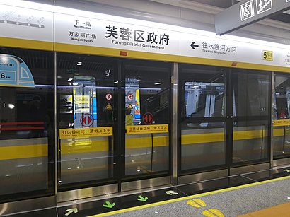
How to get to 芙蓉区政府 by metro?
Click on the metro route to see step by step directions with maps, line arrival times and updated time schedules.
Bus stops near 芙蓉区政府
- 古曲路人民东路口, 3 min walk,
- 古曲路口, 6 min walk,
- 嘉雨路朝晖路口, 10 min walk,
- 圭塘河, 11 min walk,
- 芙蓉区政府东, 12 min walk,
Metro stations near 芙蓉区政府
- 高桥北, 13 min walk,
- 万家丽广场, 13 min walk,
Bus lines to 芙蓉区政府
- 临156路, 烈士公园东门,
- 703路, 长沙卫校,
- 临317路, 长华小区,
- 168路, 汽车西,
- 503路, 长沙火车南,
- 809路, 新开铺污水处理厂,
- 208路, 长沙火车南,
- 143路内环, 圭塘河,
- 143路外环, 圭塘河,
- 702路, 扬帆小区,
What are the closest stations to 芙蓉区政府?
The closest stations to 芙蓉区政府 are:
- 古曲路人民东路口 is 153 meters away, 3 min walk.
- 古曲路口 is 438 meters away, 6 min walk.
- 嘉雨路朝晖路口 is 760 meters away, 10 min walk.
- 圭塘河 is 779 meters away, 11 min walk.
- 芙蓉区政府东 is 871 meters away, 12 min walk.
- 高桥北 is 927 meters away, 13 min walk.
- 万家丽广场 is 982 meters away, 13 min walk.
Which bus lines stop near 芙蓉区政府?
These bus lines stop near 芙蓉区政府: 168路, 703路, 临156路, 临317路.
Which metro line stops near 芙蓉区政府?
2号线 (梅溪湖西)
What’s the nearest metro station to 芙蓉区政府?
The nearest metro stations to 芙蓉区政府 are 高桥北 and 万家丽广场. The closest one is a 13 min walk away.
What’s the nearest bus station to 芙蓉区政府?
The nearest bus station to 芙蓉区政府 is 古曲路人民东路口. It’s a 3 min walk away.
What time is the first metro to 芙蓉区政府?
The 5号线 is the first metro that goes to 芙蓉区政府. It stops nearby at 6:30 AM.
What time is the last metro to 芙蓉区政府?
The 2号线 is the last metro that goes to 芙蓉区政府. It stops nearby at 11:35 PM.
What time is the first bus to 芙蓉区政府?
The 143路内环 is the first bus that goes to 芙蓉区政府. It stops nearby at 6:00 AM.
What time is the last bus to 芙蓉区政府?
The 143路内环 is the last bus that goes to 芙蓉区政府. It stops nearby at 11:02 PM.
See 芙蓉区政府 on the map
Public Transportation to 芙蓉区政府
Wondering how to get to 芙蓉区政府? Moovit helps you find the best way to get to 芙蓉区政府 with step-by-step directions from the nearest public transit station.
Moovit provides free maps and live directions to help you navigate through your city. View schedules, routes, timetables, and find out how long does it take to get to 芙蓉区政府 in real time.
Looking for the nearest stop or station to 芙蓉区政府? Check out this list of stops closest to your destination: 古曲路人民东路口; 古曲路口; 嘉雨路朝晖路口; 圭塘河; 芙蓉区政府东; 高桥北; 万家丽广场.
Bus: 168路, 703路, 临156路, 临317路, 503路, 809路, 208路, 143路内环, 143路外环.Metro: 2号线, 5号线.
Want to see if there’s another route that gets you there at an earlier time? Moovit helps you find alternative routes or times. Get directions from and directions to 芙蓉区政府 easily from the Moovit App or Website.
We make riding to 芙蓉区政府 easy, which is why over 1.5 million users, including users in 芙蓉区, trust Moovit as the best app for public transit. You don’t need to download an individual bus app or train app, Moovit is your all-in-one transit app that helps you find the best bus time or train time available.
For information on prices of bus and metro, costs and ride fares to 芙蓉区政府, please check the Moovit app.
Use the app to navigate to popular places including to the airport, hospital, stadium, grocery store, mall, coffee shop, school, college, and university.
芙蓉区政府 Address: 长沙市芙蓉区人民东路189号 street in 芙蓉区
- 洁月食品经营部,
- 长沙银行24小时自助银行(银港水晶城社区支行),
- E Shah,
- 百味粉店(凯乐湘园店),
- Furong Qu,
- 东屯渡,
- 兴业银行(长沙仁和社区支行),
- 虾团鲜生西街花园店,
- 斯年教育(西街花园分校),
- 湖南旺旺医院-门诊中心,
- 中国工商银行24小时自助银行(西街花园支行),
- 湖南旺旺医院-综合楼,
- 心相邻(千旺店),
- 西街花园A17-105号,
- 克丽缇娜(仁和店),
- 嘉雨社区卫生站,
- 隆禹蔬菜(古曲中路),
- 中国银行(长沙市德政支行),
- 3只萝卜,
- 万科西街庭院-北门
Places Near 芙蓉区政府
- 湖南省肿瘤医院, 岳麓区,
- 杜甫江阁, 天心区,
- 国防科技大学(北门), 开福区,
- 岳麓山橘子洲旅游区, 岳麓区,
- 湖南省人民医院马王堆院区, 芙蓉区,
- 星沙派出所松雅社区警务室, 长沙县,
- 湖南省儿童医院, 雨花区,
- 德思勤城市广场, 雨花区,
- 万家丽国际mall, 芙蓉区,
- 湖南中医药大学第一附属医院, 雨花区,
- Apple授权经销商(山姆长沙店), 雨花区,
- 长沙南站广场, 岳麓区,
- 第一会所, 开福区,
- 湖南中医药大学第一附属医院-门诊部, 雨花区,
- 湖南省妇幼保健院-门诊, 开福区,
- 特斯拉超级充电站(太阳星城站), 开福区,
- 长沙南站, 雨花区,
- 长沙阳明山殡仪馆, 雨花区,
- 湖南省博物馆-多功能厅, 开福区,
- 中南大学湘雅医院, 开福区
How to get to popular places in Changsha with public transit
Get around 芙蓉区 by public transit!
Traveling around 芙蓉区 has never been so easy. See step by step directions as you travel to any attraction, street or major public transit station. View bus and train schedules, arrival times, service alerts and detailed routes on a map, so you know exactly how to get to anywhere in 芙蓉区.
When traveling to any destination around 芙蓉区 use Moovit's Live Directions with Get Off Notifications to know exactly where and how far to walk, how long to wait for your line, and how many stops are left. Moovit will alert you when it's time to get off — no need to constantly re-check whether yours is the next stop.
Wondering how to use public transit in 芙蓉区 or how to pay for public transit in 芙蓉区? Moovit public transit app can help you navigate your way with public transit easily, and at minimum cost. It includes public transit fees, ticket prices, and costs. Looking for a map of 芙蓉区 public transit lines? Moovit public transit app shows all public transit maps in 芙蓉区 with all Bus and Metro routes and stops on an interactive map.
Changsha has 2 transit type(s), including: Bus and Metro, operated by several transit agencies, including 长沙地铁 and 长沙公交集团