Directions to 蔡意橋站 (屯門 Tuen Mun) with public transportation
The following transit lines have routes that pass near 蔡意橋站
 Bus: 44A, 63X, A33X, A36, AN8.
- Subway: 屯馬綫 TUEN MA LINE.
- Light Rail: 507, 610, 751.
How to get to 蔡意橋站 by bus?
Click on the bus route to see step by step directions with maps, line arrival times and updated time schedules.
How to get to 蔡意橋站 by subway?
Click on the subway route to see step by step directions with maps, line arrival times and updated time schedules.
Bus stops near 蔡意橋站 in 屯門 Tuen Mun
- 卓爾居 Chelsea Heights, 1 min walk,
- 震寰路, 卓爾居外 Tsun Wen Road, Outside Chelsea Heights, 2 min walk,
- 震寰路, 大興政府合署外 Tsun Wen Road, Outside Tai Hing Government Offices, 2 min walk,
- 石排頭路, 近馬錦明慈善基金馬可賓紀念中學 Shek Pai Tau Road, Near MA Kam Ming Charitable Foundation MA Ko Pan Memorial College, 3 min walk,
- 屯門鄉事會路, 近雅都花園 Tuen Mun Heung Sze Wui Road, Near Eldo Court Block 2, 4 min walk,
- 雅都商場 Acme Shopping Arcade, 4 min walk,
- 大興花園第1期 Tai Hing Gardens Phase I, 4 min walk,
- 翠林花園 Greenland Garden, 5 min walk,
- 台山小學 Toi Shan Association Primary School, 5 min walk,
- 大興邨興偉樓 Hing Wai House Tai Hing Estate, 5 min walk,
- 新墟街市 San Hui Market, 6 min walk,
Light Rail stations near 蔡意橋站 in 屯門 Tuen Mun
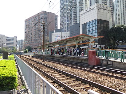
- 蔡意橋 Choy Yee Bridge, 5 min walk,
- 大興(南) Tai Hing (South), 7 min walk,
- 新墟 San Hui, 7 min walk,
Bus lines to 蔡意橋站 in 屯門 Tuen Mun
- NR710, 山景邨 / 田景邨 Shan King Estate / Tin King Estate,
- 42, 青磚圍路, 青磚圍 Tsing Chuen Wai Road, Tsing Chuen Wai,
- 40, 小坑村小巴總站 Siu Hang Tsuen Minibus Terminus,
- 44A, 上水站小巴總站 Sheung Shui Station Public Light Bus Terminus,
- 44B, 落馬洲(新田)公共運輸交匯處 LOK MA Chau (San Tin) Public Transport Interchange,
- N44B, 落馬洲管制站 LOK MA Chau Control Point,
- 49S, 青麟路, 近欣田邨 Tsing Lun Road, Near Yin Tin Estate,
- 610S, 海防道及樂道交界 Haiphong Road, Junction With Lock Road,
- 45, 河旺街, 大興花園第1期外 Ho Wong Street, Outside Tai Hing Gardens Phase I,
- 46, 富泰邨服務設施大樓 Fu Tai Estate,
- 46A, 景峰徑, 近景峰豪庭 King Fung Path, Near Noble Place Block 2,
- 46X, 富泰邨服務設施大樓 Fu Tai Estate,
- K51, 大欖 Tai Lam,
- K51A, 掃管笏 So Kwun WAT,
- NR707, 紅磡碼頭 Hung Hom Pier,
- NR716, 屯門翠林花園 Greenland Garden,
- NR707/NR720, 寶田 Po Tin (新填地街開 From Mong Kok Reclamation Street),
- B3A, 山景邨 Shan King Estate,
- NA33, 機場 / 國泰城 Airport / Cathay City,
- A34, 機場 Airport,
What are the closest stations to 蔡意橋站?
The closest stations to 蔡意橋站 are:
- 卓爾居 Chelsea Heights is 47 meters away, 1 min walk.
- 震寰路, 卓爾居外 Tsun Wen Road, Outside Chelsea Heights is 105 meters away, 2 min walk.
- 震寰路, 大興政府合署外 Tsun Wen Road, Outside Tai Hing Government Offices is 132 meters away, 2 min walk.
- 石排頭路, 近馬錦明慈善基金馬可賓紀念中學 Shek Pai Tau Road, Near MA Kam Ming Charitable Foundation MA Ko Pan Memorial College is 194 meters away, 3 min walk.
- 屯門鄉事會路, 近雅都花園 Tuen Mun Heung Sze Wui Road, Near Eldo Court Block 2 is 241 meters away, 4 min walk.
- 雅都商場 Acme Shopping Arcade is 246 meters away, 4 min walk.
- 大興花園第1期 Tai Hing Gardens Phase I is 297 meters away, 4 min walk.
- 蔡意橋 Choy Yee Bridge is 309 meters away, 5 min walk.
- 翠林花園 Greenland Garden is 329 meters away, 5 min walk.
- 台山小學 Toi Shan Association Primary School is 332 meters away, 5 min walk.
- 大興邨興偉樓 Hing Wai House Tai Hing Estate is 358 meters away, 5 min walk.
- 新墟街市 San Hui Market is 400 meters away, 6 min walk.
- 大興(南) Tai Hing (South) is 488 meters away, 7 min walk.
- 新墟 San Hui is 526 meters away, 7 min walk.
Which bus lines stop near 蔡意橋站?
These bus lines stop near 蔡意橋站: 44A, 63X, A33X, A36, AN8, E36A.
Which subway line stops near 蔡意橋站?
屯馬綫 TUEN MA LINE (往屯門 To Tuen Mun)
Which light rail lines stop near 蔡意橋站?
These light rail lines stop near 蔡意橋站: 507, 610, 751.
What’s the nearest light rail station to 蔡意橋站 in 屯門 Tuen Mun?
The nearest light rail station to 蔡意橋站 in 屯門 Tuen Mun is 蔡意橋 Choy Yee Bridge. It’s a 5 min walk away.
What’s the nearest bus station to 蔡意橋站 in 屯門 Tuen Mun?
The nearest bus station to 蔡意橋站 in 屯門 Tuen Mun is 卓爾居 Chelsea Heights. It’s a 1 min walk away.
What time is the first light rail to 蔡意橋站 in 屯門 Tuen Mun?
The 751 is the first light rail that goes to 蔡意橋站 in 屯門 Tuen Mun. It stops nearby at 5:28 AM.
What time is the last light rail to 蔡意橋站 in 屯門 Tuen Mun?
The 751 is the last light rail that goes to 蔡意橋站 in 屯門 Tuen Mun. It stops nearby at 1:19 AM.
What time is the first bus to 蔡意橋站 in 屯門 Tuen Mun?
The NA36 is the first bus that goes to 蔡意橋站 in 屯門 Tuen Mun. It stops nearby at 3:02 AM.
What time is the last bus to 蔡意橋站 in 屯門 Tuen Mun?
The 48S is the last bus that goes to 蔡意橋站 in 屯門 Tuen Mun. It stops nearby at 3:32 AM.
See 蔡意橋站, 屯門 Tuen Mun, on the map
Public Transit to 蔡意橋站 in 屯門 Tuen Mun
Wondering how to get to 蔡意橋站 in 屯門 Tuen Mun? Moovit helps you find the best way to get to 蔡意橋站 with step-by-step directions from the nearest public transit station.
Moovit provides free maps and live directions to help you navigate through your city. View schedules, routes, timetables, and find out how long does it take to get to 蔡意橋站 in real time.
Looking for the nearest stop or station to 蔡意橋站? Check out this list of stops closest to your destination: 卓爾居 Chelsea Heights; 震寰路; 震寰路; 石排頭路; 屯門鄉事會路; 雅都商場 Acme Shopping Arcade; 大興花園第1期 Tai Hing Gardens Phase I; 蔡意橋 Choy Yee Bridge; 翠林花園 Greenland Garden; 台山小學 Toi Shan Association Primary School; 大興邨興偉樓 Hing Wai House Tai Hing Estate; 新墟街市 San Hui Market; 大興(南) Tai Hing (South); 新墟 San Hui.
Bus: 44A, 63X, A33X, A36, AN8, E36A, NR710, 42, 40, 44B, N44B, 49S, 45, 46, 46A, 46X, K51, K51A.Subway: 屯馬綫 TUEN MA LINE.Light Rail: 507, 610, 751.
Want to see if there’s another route that gets you there at an earlier time? Moovit helps you find alternative routes or times. Get directions from and directions to 蔡意橋站 easily from the Moovit App or Website.
We make riding to 蔡意橋站 easy, which is why over 1.5 million users, including users in 屯門 Tuen Mun, trust Moovit as the best app for public transit. You don’t need to download an individual bus app or train app, Moovit is your all-in-one transit app that helps you find the best bus time or train time available.
For information on prices of bus, subway and light rail, costs and ride fares to 蔡意橋站, please check the Moovit app.
Use the app to navigate to popular places including to the airport, hospital, stadium, grocery store, mall, coffee shop, school, college, and university.
蔡意橋站 Address: Choy Yee Bridge street in 屯門 Tuen Mun
- LRT Choy Yee Bridge Station (蔡意橋站),
- 裕滿人家,
- 社會福利署大興社會保障辦事處,
- 社會福利署西屯門綜合家庭服務中心,
- 偉昌工業中心,
- 1 Shek Pai Tau Path,
- 屯門,
- 大興政府合署,
- 美國冒險樂園,
- 米線陣,
- 卓爾居二期6座,
- 卓爾居 明將迴轉壽司,
- Victoria Harbour Restaurant 海港酒家,
- 卓爾居第二期 Chelsea Heights Phase 2 / 卓爾廣場,
- Choi Yee Bridge Road,
- 屯門學童牙科診所,
- SMKMCF Ma Ko Pan Memorial College 馬錦明慈善基金馬可賓紀念中學,
- 香港达人 (卓尔广场),
- 劍橋聯合醫務中心,
- 卓爾居公眾公園
Places Near 蔡意橋站 (屯門 Tuen Mun)
- Shatin Hospital 沙田醫院, 沙田 Sha Tin,
- 大欖涌燒烤樂園 Tai Lam Chung Bbq Club, 屯門 Tuen Mun,
- 沙田馬場 Sha Tin Racecourse, 沙田 Sha Tin,
- Airside, 九龍 Kowloon City,
- 大埔海濱公園, 大埔 Tai Po,
- 林村許願樹, 大埔 Tai Po,
- 香港駕駛學院沙田安全駕駛中心, 沙田 Sha Tin,
- 麗豪酒店, 沙田 Sha Tin,
- 威爾斯親王醫院, 沙田 Sha Tin,
- 天水圍(天業路)社區健康中心 Tin Shui Wai (Tin Yip Road) Community Health Centre, 元朗 Yuen Long,
- China Travel Service Tuen Mun Entry Permit Service Centre 中國旅行社屯門證件服務中心, 屯門 Tuen Mun,
- 宏利金融中心 Manulife Financial Centre, 觀塘 Kwun Tong,
- 啟德體育園 Kai Tak Sports Park, 九龍 Kowloon City,
- 香港東涌福朋喜來登酒店,
- 九龍灣健康中心 Kowloon Bay Health Centre, 觀塘 Kwun Tong,
- 入境事務處人事登記處辦事處, 觀塘 Kwun Tong,
- 屯門兆麟政府綜合大樓 Tuen Mun Siu Lun Government Complex, 屯門 Tuen Mun,
- 中港城,
- 富麗敦海洋公園酒店 the Fullerton Hotel: Ocean Park,
- 香港教育大學, 大埔 Tai Po
How to get to popular places in Hong Kong with public transit
Get around 屯門 Tuen Mun by public transit!
Traveling around 屯門 Tuen Mun has never been so easy. See step by step directions as you travel to any attraction, street or major public transit station. View bus and train schedules, arrival times, service alerts and detailed routes on a map, so you know exactly how to get to anywhere in 屯門 Tuen Mun.
When traveling to any destination around 屯門 Tuen Mun use Moovit's Live Directions with Get Off Notifications to know exactly where and how far to walk, how long to wait for your line, and how many stops are left. Moovit will alert you when it's time to get off — no need to constantly re-check whether yours is the next stop.
Wondering how to use public transit in 屯門 Tuen Mun or how to pay for public transit in 屯門 Tuen Mun? Moovit public transit app can help you navigate your way with public transit easily, and at minimum cost. It includes public transit fees, ticket prices, and costs. Looking for a map of 屯門 Tuen Mun public transit lines? Moovit public transit app shows all public transit maps in 屯門 Tuen Mun with all Bus, Subway, Light Rail, Ferry, Cable Car and Funicular routes and stops on an interactive map.
Hong Kong has 6 transit type(s), including: Bus, Subway, Light Rail, Ferry, Cable Car and Funicular, operated by several transit agencies, including 港鐵 MTR, 天星小輪 Star Ferry, 九巴 KMB, 城巴 Citybus, 城巴機場快線 Cityflyer, 龍運巴士 LWB, 九巴 KMB / 城巴 CTB, 龍運巴士 LWB / 城巴 CTB, 新大嶼山巴士 NLB, 愉景灣巴士 DB, 香港電車 Hong Kong Tramways, 香港中文大學 The Chinese University of Hong Kong, 港島區專線小巴 GMB HK Island, 九龍區專線小巴 GMB Kowloon and 新界區專線小巴 GMB New Territories