Directions to 衛生福利部臺北醫院 (新莊區) with public transportation
The following transit lines have routes that pass near 衛生福利部臺北醫院
 Bus: 616經黎明, 801, 835, 918, 982.
- Metro: 中和新蘆線, 環狀線, 板南線.
How to get to 衛生福利部臺北醫院 by bus?
Click on the bus route to see step by step directions with maps, line arrival times and updated time schedules.
How to get to 衛生福利部臺北醫院 by metro?
Click on the metro route to see step by step directions with maps, line arrival times and updated time schedules.
Bus stops near 衛生福利部臺北醫院 in 新莊區
- 臺北醫院 Taipei Hospital, 2 min walk,
- 臺北醫院(復興路) Taipei Hospital(Fuxing Rd.), 4 min walk,
- 思賢國小 Si Xian Elementary School, 5 min walk,
- 捷運頭前庄站(思源路) Mrt Touqianzhuang Sta. (Siyuan Rd.), 6 min walk,
Metro stations near 衛生福利部臺北醫院 in 新莊區
- 頭前庄 Touqian Zhuang, 8 min walk,
- 江子翠 Jiangzicui, 12 min walk,
Bus lines to 衛生福利部臺北醫院 in 新莊區
- 257路, 南港花園社區五 Nangang Garden Community 5,
- 805捷運永寧站, 土城 Tucheng - 五股 Wugu,
- 813區, 中和 Zhonghe - 行政院新莊聯合辦公大樓 Xinzhuang Central Government Offices Building,
- 813明日世界, 五股 Wugu - 中和 Zhonghe,
- 845, 新莊 Xinzhuang - 捷運新埔站 MRT Xinpu Sta.,
- 918, 泰山 Taishan - 新店 Xindian,
- 918區, 泰山 Taishan - 板橋 Banqiao,
- 920, 林口 Linkou - 捷運府中站 MRT Banqiao Sta.,
- 920A, 林口(去程不繞龜山) Linkou - 捷運府中站 MRT Banqiao Sta.,
- 920副, 林口轉運站 Linkou Bus Station - 捷運府中站 MRT Fuzhong Station,
- 982, 新莊 Xinzhuang - 新店 Xindian,
- 982區, 新莊 Xinzhuang - 捷運新埔站 MRT Xinpu Sta.,
- 99民安站, 新莊 Xinzhuang - 板橋 Banqiao,
- F202, 新莊高中 Xinzhuang Senior High School - 新莊高中 Xinzhuang Senior High School,
- F218明志路三段發車, 明志路三段 Mingzhi Rd. Sec. 3 - 署立臺北醫院 Taipei Hospital,
- 林口-板橋, 林口站 Linkou Stop - 捷運府中站 Fuzhong Station,
- 藍18中和站, 中和 Zhonghe - 新莊 Xinzhuang,
- 820, 成淵高中 Chengyuan Senior High School,
- 835, 捷運台大醫院站 Mrt Ntu Hospital Station,
- 616經黎明, 黎明技術學院 Leeming Institute Of Technology,
What are the closest stations to 衛生福利部臺北醫院?
The closest stations to 衛生福利部臺北醫院 are:
- 臺北醫院 Taipei Hospital is 79 meters away, 2 min walk.
- 臺北醫院(復興路) Taipei Hospital(Fuxing Rd.) is 290 meters away, 4 min walk.
- 思賢國小 Si Xian Elementary School is 330 meters away, 5 min walk.
- 捷運頭前庄站(思源路) Mrt Touqianzhuang Sta. (Siyuan Rd.) is 385 meters away, 6 min walk.
- 頭前庄 Touqian Zhuang is 600 meters away, 8 min walk.
- 江子翠 Jiangzicui is 890 meters away, 12 min walk.
Which bus lines stop near 衛生福利部臺北醫院?
These bus lines stop near 衛生福利部臺北醫院: 616經黎明, 801, 835, 918, 982, 藍18中和站.
Which metro line stops near 衛生福利部臺北醫院?
中和新蘆線 (迴龍 Huilong)
What’s the nearest metro station to 衛生福利部臺北醫院 in 新莊區?
The nearest metro station to 衛生福利部臺北醫院 in 新莊區 is 頭前庄 Touqian Zhuang. It’s a 8 min walk away.
What’s the nearest bus station to 衛生福利部臺北醫院 in 新莊區?
The nearest bus station to 衛生福利部臺北醫院 in 新莊區 is 臺北醫院 Taipei Hospital. It’s a 2 min walk away.
What time is the first metro to 衛生福利部臺北醫院 in 新莊區?
The 環狀線 is the first metro that goes to 衛生福利部臺北醫院 in 新莊區. It stops nearby at 6:02 AM.
What time is the last metro to 衛生福利部臺北醫院 in 新莊區?
The 中和新蘆線 is the last metro that goes to 衛生福利部臺北醫院 in 新莊區. It stops nearby at 12:39 AM.
What time is the first bus to 衛生福利部臺北醫院 in 新莊區?
The 920 is the first bus that goes to 衛生福利部臺北醫院 in 新莊區. It stops nearby at 5:07 AM.
What time is the last bus to 衛生福利部臺北醫院 in 新莊區?
The 藍18中和站 is the last bus that goes to 衛生福利部臺北醫院 in 新莊區. It stops nearby at 11:15 PM.
See 衛生福利部臺北醫院, 新莊區, on the map
Public Transit to 衛生福利部臺北醫院 in 新莊區
Wondering how to get to 衛生福利部臺北醫院 in 新莊區? Moovit helps you find the best way to get to 衛生福利部臺北醫院 with step-by-step directions from the nearest public transit station.
Moovit provides free maps and live directions to help you navigate through your city. View schedules, routes, timetables, and find out how long does it take to get to 衛生福利部臺北醫院 in real time.
Looking for the nearest stop or station to 衛生福利部臺北醫院? Check out this list of stops closest to your destination: 臺北醫院 Taipei Hospital; 臺北醫院(復興路) Taipei Hospital(Fuxing Rd.); 思賢國小 Si Xian Elementary School; 捷運頭前庄站(思源路) Mrt Touqianzhuang Sta. (Siyuan Rd.); 頭前庄 Touqian Zhuang; 江子翠 Jiangzicui.
Bus: 616經黎明, 801, 835, 918, 982, 藍18中和站, 257路, 805捷運永寧站, 813區, 813明日世界, 845, 820.Metro: 中和新蘆線, 環狀線, 板南線.
Want to see if there’s another route that gets you there at an earlier time? Moovit helps you find alternative routes or times. Get directions from and directions to 衛生福利部臺北醫院 easily from the Moovit App or Website.
We make riding to 衛生福利部臺北醫院 easy, which is why over 1.5 million users, including users in 新莊區, trust Moovit as the best app for public transit. You don’t need to download an individual bus app or train app, Moovit is your all-in-one transit app that helps you find the best bus time or train time available.
For information on prices of bus and metro, costs and ride fares to 衛生福利部臺北醫院, please check the Moovit app.
Use the app to navigate to popular places including to the airport, hospital, stadium, grocery store, mall, coffee shop, school, college, and university.
衛生福利部臺北醫院 Address: 思源路129巷 street in 新莊區
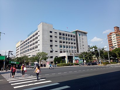
The Taipei Hospital (traditional Chinese: 衛生福利部臺北醫院; simplified Chinese: 卫生福利部台北医院; pinyin: Wèishēng Fúlì Bù Táiběi Yīyuàn) is a public hospital in Xinzhuang District, New Taipei, Taiwan.Wiki
- 臺北醫院,
- 晶宴會館新莊館,
- Nissan 裕信汽車 新莊廠啊~,
- 涮來涮去精緻鍋,
- 長疆碳燒羊肉爐新莊店打卡用,
- 艾瑞兒瑜珈生活館,
- 弘道老人福利基金會新莊志工站,
- 晶宴會館,
- 民樂街,
- 捷安特新莊店,
- 涅世水族,
- Aloha阿囉哈led總匯批發廣場,
- 停車場,
- 祖德素食,
- 曼谷養身舒體會館,
- 雅緹汽車旅館,
- 璟順骨科診所,
- 捷運大世紀社區,
- 台灣自來水公司新莊服務所,
- 可魯菓子早午餐
Places Near 衛生福利部臺北醫院 (新莊區)
- 新東南海鮮餐廳, 中正區,
- 重新橋跳蚤市場, 三重區,
- 新北市立殯儀館, 板橋區,
- 我家牛排(中和連城店), 中和區,
- 濱江市場, 中山區,
- 小潘鳳梨酥, 板橋區,
- 好市多中和店, 中和區,
- 新莊頤品大飯店, 新莊區,
- 好市多內湖店, 內湖區,
- 新莊宏泰市場, 新莊區,
- COSTCO (Chungho) (好市多中和店), 中和區,
- 建國假日花市, 大安區,
- 中和環球購物中心, 中和區,
- 龍華會館, 板橋區,
- 好市多 Costco, 汐止區,
- 中和Costco好市多, 中和區,
- 樹林秀泰影城, 樹林區,
- 小潘蛋糕坊, 板橋區,
- COSTCO (Neihu) (好市多), 內湖區,
- 好市多 COSTCO(新莊店), 新莊區
How to get to popular places in Taipei - New Taipei with public transit
Get around 新莊區 by public transit!
Traveling around 新莊區 has never been so easy. See step by step directions as you travel to any attraction, street or major public transit station. View bus and train schedules, arrival times, service alerts and detailed routes on a map, so you know exactly how to get to anywhere in 新莊區.
When traveling to any destination around 新莊區 use Moovit's Live Directions with Get Off Notifications to know exactly where and how far to walk, how long to wait for your line, and how many stops are left. Moovit will alert you when it's time to get off — no need to constantly re-check whether yours is the next stop.
Wondering how to use public transit in 新莊區 or how to pay for public transit in 新莊區? Moovit public transit app can help you navigate your way with public transit easily, and at minimum cost. It includes public transit fees, ticket prices, and costs. Looking for a map of 新莊區 public transit lines? Moovit public transit app shows all public transit maps in 新莊區 with all Bus, Train, Metro, Light Rail and Gondola routes and stops on an interactive map.
Taipei - New Taipei has 5 transit type(s), including: Bus, Train, Metro, Light Rail and Gondola, operated by several transit agencies, including 臺北捷運 Taipei Metro, 新北捷運 New Taipei Metro, 桃園捷運Taoyuan Metro, 臺鐵 Taiwan Railway, 貓空纜車 Maokong Gondola, 首都客運 Capital Bus Co., Ltd., 欣欣客運 Shin-Shin Bus Co., Ltd., 大都會客運 Metropolitan Bus Co., Ltd., 大有巴士 Citiair Bus Co., Ltd., 東南客運 Southeast Bus Co., Ltd., 大南汽車 Danan Bus Co., Ltd., 指南客運 Zhinan Bus Co., Ltd., 光華巴士 Kuang-Hua Bus Co., Ltd., 中興巴士 Zhongxing Bus and 皇家客運 Royal Bus Co., Ltd.