Directions to 衛生福利部雙和醫院 (中和區) with public transportation
The following transit lines have routes that pass near 衛生福利部雙和醫院
 Bus: 307莒光往板橋前站, 933, 橘2, 橘9, 藍41.
- Metro: 中和新蘆線, 環狀線.
How to get to 衛生福利部雙和醫院 by bus?
Click on the bus route to see step by step directions with maps, line arrival times and updated time schedules.
How to get to 衛生福利部雙和醫院 by metro?
Click on the metro route to see step by step directions with maps, line arrival times and updated time schedules.
Bus stops near 衛生福利部雙和醫院 in 中和區
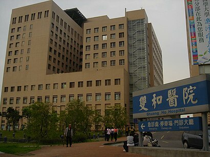
- 雙和醫院(院區) Shuanghe Hospital, 2 min walk,
- 雙和醫院 Shuang Ho Hospital, 3 min walk,
- 雙和醫院(圓通路) Shuang Ho Hospital, 3 min walk,
- 錦和高中 Jinhan High School, 9 min walk,
Metro station near 衛生福利部雙和醫院 in 中和區
- 景安 Jingan, 16 min walk,
Bus lines to 衛生福利部雙和醫院 in 中和區
- 橘9, 雙和醫院 Shuang Ho Hospital,
- 藍41, 捷運永安市場站 Mrt Yungan Market Station,
- 藍41延和, 捷運永安市場站 Mrt Yungan Market Station,
- 9001, 市府轉運站 Taipei City Hall Bus Station,
- 933, 捷運動物園站 Mrt Taipei Zoo Sta.,
- F512, 中興街口 Zhongxing St. Entrance,
- 捷運景安站-三峽臺北大學去, 三峽二站 Sanxia Second Stations,
- 橘5, 藝香公園(果菜市場) Yixiang Park (Agriculture Product Market),
- 242, 峨眉街口(中醫院區) Emei St. Entrance,
- F513, 秀山站 Xiushan Stop,
- 橘2, 中和站 Zhonghe Stop,
- 201, 中和 Zhonghe - 捷運龍山寺站 MRT Longshan Temple Sta.,
- 241, 中和 Zhonghe - 博愛路 Boai Rd.,
- 243, 中和 Zhonghe - 西門 Ximen,
- 藍18中和站, 中和 Zhonghe - 新莊 Xinzhuang,
What are the closest stations to 衛生福利部雙和醫院?
The closest stations to 衛生福利部雙和醫院 are:
- 雙和醫院(院區) Shuanghe Hospital is 64 meters away, 2 min walk.
- 雙和醫院 Shuang Ho Hospital is 121 meters away, 3 min walk.
- 雙和醫院(圓通路) Shuang Ho Hospital is 128 meters away, 3 min walk.
- 錦和高中 Jinhan High School is 576 meters away, 9 min walk.
- 景安 Jingan is 1199 meters away, 16 min walk.
Which bus lines stop near 衛生福利部雙和醫院?
These bus lines stop near 衛生福利部雙和醫院: 307莒光往板橋前站, 933, 橘2, 橘9.
Which metro lines stop near 衛生福利部雙和醫院?
These metro lines stop near 衛生福利部雙和醫院: 中和新蘆線, 環狀線.
What’s the nearest metro station to 衛生福利部雙和醫院 in 中和區?
The nearest metro station to 衛生福利部雙和醫院 in 中和區 is 景安 Jingan. It’s a 16 min walk away.
What’s the nearest bus station to 衛生福利部雙和醫院 in 中和區?
The nearest bus station to 衛生福利部雙和醫院 in 中和區 is 雙和醫院(院區) Shuanghe Hospital. It’s a 2 min walk away.
What time is the first metro to 衛生福利部雙和醫院 in 中和區?
The 中和新蘆線 is the first metro that goes to 衛生福利部雙和醫院 in 中和區. It stops nearby at 6:00 AM.
What time is the last metro to 衛生福利部雙和醫院 in 中和區?
The 中和新蘆線 is the last metro that goes to 衛生福利部雙和醫院 in 中和區. It stops nearby at 12:47 AM.
What time is the first bus to 衛生福利部雙和醫院 in 中和區?
The 橘2 is the first bus that goes to 衛生福利部雙和醫院 in 中和區. It stops nearby at 6:00 AM.
What time is the last bus to 衛生福利部雙和醫院 in 中和區?
The 藍41 is the last bus that goes to 衛生福利部雙和醫院 in 中和區. It stops nearby at 11:17 PM.
See 衛生福利部雙和醫院, 中和區, on the map
Public Transit to 衛生福利部雙和醫院 in 中和區
Wondering how to get to 衛生福利部雙和醫院 in 中和區? Moovit helps you find the best way to get to 衛生福利部雙和醫院 with step-by-step directions from the nearest public transit station.
Moovit provides free maps and live directions to help you navigate through your city. View schedules, routes, timetables, and find out how long does it take to get to 衛生福利部雙和醫院 in real time.
Looking for the nearest stop or station to 衛生福利部雙和醫院? Check out this list of stops closest to your destination: 雙和醫院(院區) Shuanghe Hospital; 雙和醫院 Shuang Ho Hospital; 雙和醫院(圓通路) Shuang Ho Hospital; 錦和高中 Jinhan High School; 景安 Jingan.
Bus: 307莒光往板橋前站, 933, 橘2, 橘9, 藍41, 藍41延和, 9001, F512, 捷運景安站-三峽臺北大學去, 橘5, 242, F513, 201, 241, 243, 藍18中和站.Metro: 中和新蘆線, 環狀線.
Want to see if there’s another route that gets you there at an earlier time? Moovit helps you find alternative routes or times. Get directions from and directions to 衛生福利部雙和醫院 easily from the Moovit App or Website.
We make riding to 衛生福利部雙和醫院 easy, which is why over 1.5 million users, including users in 中和區, trust Moovit as the best app for public transit. You don’t need to download an individual bus app or train app, Moovit is your all-in-one transit app that helps you find the best bus time or train time available.
For information on prices of bus and metro, costs and ride fares to 衛生福利部雙和醫院, please check the Moovit app.
Use the app to navigate to popular places including to the airport, hospital, stadium, grocery store, mall, coffee shop, school, college, and university.
衛生福利部雙和醫院 Address: 台64線-新店方向 street in 中和區
- Shuang Ho Hospital,
- 行政大樓一樓階梯教室,
- 雙和醫院,
- 建華汽車,
- 起亞汽車,
- 順益汽車保養廠,
- Louisa Coffee 路易莎咖啡(雙和圓通店),
- 衛生福利部雙和醫院B基地,
- 新北市立錦和高級中學,
- 福祥素食麵包店,
- 新北市錦和派出所,
- 方便箱國際物流,
- 新北市中和地區農會錦和分部,
- 北城脆皮烤鴨,
- 淡水老街,
- 市立錦和高中圖書館,
- 市立錦和高中附設國中,
- 北城脆皮烤鴨中和旗艦總店,
- 吉音汽車音響,
- 小北百貨
Places Near 衛生福利部雙和醫院 (中和區)
- 建國假日花市, 大安區,
- 新莊頤品大飯店, 新莊區,
- 新莊宏泰市場, 新莊區,
- COSTCO (Chungho) (好市多中和店), 中和區,
- 好市多內湖店, 內湖區,
- 樹林秀泰影城, 樹林區,
- 好市多 Costco, 汐止區,
- 濱江市場, 中山區,
- 小潘鳳梨酥, 板橋區,
- 我家牛排(中和連城店), 中和區,
- COSTCO (Neihu) (好市多), 內湖區,
- 好市多中和店, 中和區,
- 新北市立殯儀館, 板橋區,
- 中和Costco好市多, 中和區,
- 好市多 COSTCO(新莊店), 新莊區,
- 中和環球購物中心, 中和區,
- 新東南海鮮餐廳, 中正區,
- 小潘蛋糕坊, 板橋區,
- 重新橋跳蚤市場, 三重區,
- 龍華會館, 板橋區
How to get to popular places in Taipei - New Taipei with public transit
Get around 中和區 by public transit!
Traveling around 中和區 has never been so easy. See step by step directions as you travel to any attraction, street or major public transit station. View bus and train schedules, arrival times, service alerts and detailed routes on a map, so you know exactly how to get to anywhere in 中和區.
When traveling to any destination around 中和區 use Moovit's Live Directions with Get Off Notifications to know exactly where and how far to walk, how long to wait for your line, and how many stops are left. Moovit will alert you when it's time to get off — no need to constantly re-check whether yours is the next stop.
Wondering how to use public transit in 中和區 or how to pay for public transit in 中和區? Moovit public transit app can help you navigate your way with public transit easily, and at minimum cost. It includes public transit fees, ticket prices, and costs. Looking for a map of 中和區 public transit lines? Moovit public transit app shows all public transit maps in 中和區 with all Bus, Train, Metro, Light Rail and Gondola routes and stops on an interactive map.
Taipei - New Taipei has 5 transit type(s), including: Bus, Train, Metro, Light Rail and Gondola, operated by several transit agencies, including 臺北捷運 Taipei Metro, 新北捷運 New Taipei Metro, 桃園捷運Taoyuan Metro, 臺鐵 Taiwan Railway, 貓空纜車 Maokong Gondola, 首都客運 Capital Bus Co., Ltd., 欣欣客運 Shin-Shin Bus Co., Ltd., 大都會客運 Metropolitan Bus Co., Ltd., 大有巴士 Citiair Bus Co., Ltd., 東南客運 Southeast Bus Co., Ltd., 大南汽車 Danan Bus Co., Ltd., 指南客運 Zhinan Bus Co., Ltd., 光華巴士 Kuang-Hua Bus Co., Ltd., 中興巴士 Zhongxing Bus and 皇家客運 Royal Bus Co., Ltd.