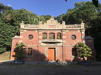
Directions to 郭子儀紀念堂 (內湖區) with public transportation
The following transit lines have routes that pass near 郭子儀紀念堂
 Bus: 214, 617, 630(欣欣)往東園, 內湖幹線, 北環幹線繞駛士科路返程半.
- Metro: 文湖線.
How to get to 郭子儀紀念堂 by bus?
Click on the bus route to see step by step directions with maps, line arrival times and updated time schedules.
How to get to 郭子儀紀念堂 by metro?
Click on the metro route to see step by step directions with maps, line arrival times and updated time schedules.
Metro station near 郭子儀紀念堂 in 內湖區
- 文德 Wende, 3 min walk,
Bus stops near 郭子儀紀念堂 in 內湖區
- 內湖高中 Neihu High School, 4 min walk,
- 捷運文德站(碧湖公園) Mrt Wende Sta. (Bihu Park), 5 min walk,
- 達人高中(臺灣戲曲學院) Da Ren Catholic High School (National Taiwan College Of Performing Arts), 6 min walk,
- 內湖國中 Neihu Jr. High School, 7 min walk,
- 國立臺灣戲曲學院 National Taiwan College Of Performing Arts, 8 min walk,
Bus lines to 郭子儀紀念堂 in 內湖區
- 蘆洲-內湖, 港墘派出所 Gangqian Police Station,
- 0東, 瑞湖街口 Ruihu St.Entrance,
- 214, 中和高中 Zhonghe High School,
- 222, 衡陽路 Hengyang Rd.,
- 286副, 永春高中 Yongchun High School,
- 287區, 大龍街口 Dalong St. Entrance,
- 652, 中港大排願景館 Vision Of Zhonggang Main Drainage,
- 681往陽明山, 東湖站 Donghu Stop,
- 683, 南港高工(南港路) Nangang Vocational High School (Nangang Rd.),
- 內湖幹線, 二二八和平公園 2/28 Peace Park,
- 內科22(上午), 捷運圓山站 Mrt Yuanshan Sta.,
- 北環幹線繞駛士科路返程半, 中華科技大學(正門) China U. Of Science & Technology (Main Entrance),
- 紅2, 社后消防隊 Shehou Fire Brigade,
- 藍20區經三總, 南港高工(重陽) Nangang Vocational High School (Chongyang),
- 1801A, 基隆轉運站 Keelung Transit Station,
- 萬里-內湖科技園區去, 基湖路口 Jihu Rd. Entrance,
- 1801, 基隆轉運站 Keelung Transit Station,
- 278, 景福街 Jingfu St.,
- 247, 二二八和平公園 2/28 Peace Park,
- 247區, 威剛科技總部大樓 Adata Technology Headquarters Building,
What are the closest stations to 郭子儀紀念堂?
The closest stations to 郭子儀紀念堂 are:
- 文德 Wende is 197 meters away, 3 min walk.
- 內湖高中 Neihu High School is 247 meters away, 4 min walk.
- 捷運文德站(碧湖公園) Mrt Wende Sta. (Bihu Park) is 328 meters away, 5 min walk.
- 達人高中(臺灣戲曲學院) Da Ren Catholic High School (National Taiwan College Of Performing Arts) is 440 meters away, 6 min walk.
- 內湖國中 Neihu Jr. High School is 534 meters away, 7 min walk.
- 國立臺灣戲曲學院 National Taiwan College Of Performing Arts is 560 meters away, 8 min walk.
Which bus lines stop near 郭子儀紀念堂?
These bus lines stop near 郭子儀紀念堂: 214, 617, 630(欣欣)往東園, 內湖幹線, 北環幹線繞駛士科路返程半, 南京幹線.
Which metro line stops near 郭子儀紀念堂?
文湖線 (南港展覽館 Taipei Nangang Exhibition Center)
What’s the nearest metro station to 郭子儀紀念堂 in 內湖區?
The nearest metro station to 郭子儀紀念堂 in 內湖區 is 文德 Wende. It’s a 3 min walk away.
What’s the nearest bus station to 郭子儀紀念堂 in 內湖區?
The nearest bus station to 郭子儀紀念堂 in 內湖區 is 內湖高中 Neihu High School. It’s a 4 min walk away.
What time is the first metro to 郭子儀紀念堂 in 內湖區?
The 文湖線 is the first metro that goes to 郭子儀紀念堂 in 內湖區. It stops nearby at 6:07 AM.
What time is the last metro to 郭子儀紀念堂 in 內湖區?
The 文湖線 is the last metro that goes to 郭子儀紀念堂 in 內湖區. It stops nearby at 12:37 AM.
What time is the first bus to 郭子儀紀念堂 in 內湖區?
The 小2區 is the first bus that goes to 郭子儀紀念堂 in 內湖區. It stops nearby at 4:30 AM.
What time is the last bus to 郭子儀紀念堂 in 內湖區?
The 內湖幹線 is the last bus that goes to 郭子儀紀念堂 in 內湖區. It stops nearby at 12:26 AM.
See 郭子儀紀念堂, 內湖區, on the map
Public Transit to 郭子儀紀念堂 in 內湖區
Wondering how to get to 郭子儀紀念堂 in 內湖區? Moovit helps you find the best way to get to 郭子儀紀念堂 with step-by-step directions from the nearest public transit station.
Moovit provides free maps and live directions to help you navigate through your city. View schedules, routes, timetables, and find out how long does it take to get to 郭子儀紀念堂 in real time.
Looking for the nearest stop or station to 郭子儀紀念堂? Check out this list of stops closest to your destination: 文德 Wende; 內湖高中 Neihu High School; 捷運文德站(碧湖公園) Mrt Wende Sta. (Bihu Park); 達人高中(臺灣戲曲學院) Da Ren Catholic High School (National Taiwan College Of Performing Arts); 內湖國中 Neihu Jr. High School; 國立臺灣戲曲學院 National Taiwan College Of Performing Arts.
Bus: 214, 617, 630(欣欣)往東園, 內湖幹線, 北環幹線繞駛士科路返程半, 南京幹線, 0東, 222, 286副, 287區, 蘆洲-內湖, 1801A, 萬里-內湖科技園區去, 278.Metro: 文湖線.
Want to see if there’s another route that gets you there at an earlier time? Moovit helps you find alternative routes or times. Get directions from and directions to 郭子儀紀念堂 easily from the Moovit App or Website.
We make riding to 郭子儀紀念堂 easy, which is why over 1.5 million users, including users in 內湖區, trust Moovit as the best app for public transit. You don’t need to download an individual bus app or train app, Moovit is your all-in-one transit app that helps you find the best bus time or train time available.
For information on prices of metro and bus, costs and ride fares to 郭子儀紀念堂, please check the Moovit app.
Use the app to navigate to popular places including to the airport, hospital, stadium, grocery store, mall, coffee shop, school, college, and university.
郭子儀紀念堂 Address: 文德路267巷 street in 內湖區
- 天主教達人女中,
- 全聯福利中心 內湖文德店,
- 雲門舞集舞蹈教室,
- 霸味薑母鴨,
- 捷運文德站(2號出口),
- 捷運文德站 MRT Wende Station,
- 國立台灣戲曲學院 - 內湖校區,
- 適康復健科診所,
- Neihu District,
- 弘爺漢堡 Hong Ya Hamburger,
- 星巴克 Starbucks 內湖文德門市,
- 方濟中學,
- 大埤岸福德宮,
- 維康動物醫院,
- 捷運文德站 (碧湖公園),
- 香港成記燒臘店,
- 陽光公園,
- 內湖區農會,
- 孫東寶牛排 內湖成功店,
- 食將王鐵板燒
Places Near 郭子儀紀念堂 (內湖區)
- 我家牛排(中和連城店), 中和區,
- 中和Costco好市多, 中和區,
- 重新橋跳蚤市場, 三重區,
- 好市多 Costco, 汐止區,
- 新北市立殯儀館, 板橋區,
- 好市多內湖店, 內湖區,
- 建國假日花市, 大安區,
- COSTCO (Chungho) (好市多中和店), 中和區,
- 龍華會館, 板橋區,
- 好市多 COSTCO(新莊店), 新莊區,
- 中和環球購物中心, 中和區,
- 好市多中和店, 中和區,
- 小潘蛋糕坊, 板橋區,
- COSTCO (Neihu) (好市多), 內湖區,
- 樹林秀泰影城, 樹林區,
- 小潘鳳梨酥, 板橋區,
- 新東南海鮮餐廳, 中正區,
- 新莊宏泰市場, 新莊區,
- 新莊頤品大飯店, 新莊區,
- 濱江市場, 中山區
How to get to popular places in Taipei - New Taipei with public transit
Get around 內湖區 by public transit!
Traveling around 內湖區 has never been so easy. See step by step directions as you travel to any attraction, street or major public transit station. View bus and train schedules, arrival times, service alerts and detailed routes on a map, so you know exactly how to get to anywhere in 內湖區.
When traveling to any destination around 內湖區 use Moovit's Live Directions with Get Off Notifications to know exactly where and how far to walk, how long to wait for your line, and how many stops are left. Moovit will alert you when it's time to get off — no need to constantly re-check whether yours is the next stop.
Wondering how to use public transit in 內湖區 or how to pay for public transit in 內湖區? Moovit public transit app can help you navigate your way with public transit easily, and at minimum cost. It includes public transit fees, ticket prices, and costs. Looking for a map of 內湖區 public transit lines? Moovit public transit app shows all public transit maps in 內湖區 with all Bus, Train, Metro, Light Rail and Gondola routes and stops on an interactive map.
Taipei - New Taipei has 5 transit type(s), including: Bus, Train, Metro, Light Rail and Gondola, operated by several transit agencies, including 臺北捷運 Taipei Metro, 新北捷運 New Taipei Metro, 桃園捷運Taoyuan Metro, 臺鐵 Taiwan Railway, 貓空纜車 Maokong Gondola, 首都客運 Capital Bus Co., Ltd., 欣欣客運 Shin-Shin Bus Co., Ltd., 大都會客運 Metropolitan Bus Co., Ltd., 大有巴士 Citiair Bus Co., Ltd., 東南客運 Southeast Bus Co., Ltd., 大南汽車 Danan Bus Co., Ltd., 指南客運 Zhinan Bus Co., Ltd., 光華巴士 Kuang-Hua Bus Co., Ltd., 中興巴士 Zhongxing Bus and 皇家客運 Royal Bus Co., Ltd.