Directions to 青浦区 (青浦镇) with public transportation
The following transit lines have routes that pass near 青浦区
 Bus: 上朱线, 上朱线区间, 沪青专线, 青浦四线, 青黄专线.
- Metro: 17号线 LINE 17.
How to get to 青浦区 by bus?
Click on the bus route to see step by step directions with maps, line arrival times and updated time schedules.
How to get to 青浦区 by metro?
Click on the metro route to see step by step directions with maps, line arrival times and updated time schedules.
Bus stops near 青浦区 in 青浦镇
- 公园东路保安路, 3 min walk,
- 公园路外青松公路, 3 min walk,
- 公园路保安路(招呼站), 4 min walk,
- 外青松公路公园路(桂花园), 5 min walk,
- 浦仓路公园路, 6 min walk,
- 桂花园, 6 min walk,
- 城东中路保安路 (东门小学), 8 min walk,
Metro station near 青浦区 in 青浦镇
- 青浦新城 Qingpu Xincheng, 26 min walk,
Bus lines to 青浦区 in 青浦镇
- 上朱线区间, 上海南站(南广场) - 青浦汽车站,
- 沪青专线, 普安路延安东路 - 青浦汽车站,
- 青徐线区间, 金葫芦二区 - 青浦汽车站,
- 青浦16路, 秀沁路崧涟二路 - 清河湾路漕盈路,
- 青黄专线, 青浦汽车站 - 绿苑路黄渡,
- 青浦9路, 华青南路沪青平公路,
- 青浦四线, 青浦汽车站,
- 上朱线, 上海南站(南广场),
- 松青线, 松江汽车东站,
- 青浦6路, 青湖路华乐路(豫英学校),
- 沪青高速专线, 老成都北路大沽路,
- 青浦12路, 北青公路出口加工区,
- 青浦1路, 青浦高级中学 - 青浦汽车站,
- 青浦二线, 中山医院青浦分院 - 青浦汽车站,
- 朱徐线, 朱家角汽车站 - 地铁2号线徐泾东,
- 青浦11路, 汇金路站 - 沪青平公路漕盈路,
- 青浦3路, 公园路华浦路 - 青浦汽车站,
- 青浦三线, 博物馆 - 青浦汽车站,
What are the closest stations to 青浦区?
The closest stations to 青浦区 are:
- 公园东路保安路 is 105 meters away, 3 min walk.
- 公园路外青松公路 is 115 meters away, 3 min walk.
- 公园路保安路(招呼站) is 186 meters away, 4 min walk.
- 外青松公路公园路(桂花园) is 339 meters away, 5 min walk.
- 浦仓路公园路 is 365 meters away, 6 min walk.
- 桂花园 is 405 meters away, 6 min walk.
- 城东中路保安路 (东门小学) is 535 meters away, 8 min walk.
- 青浦新城 Qingpu Xincheng is 1983 meters away, 26 min walk.
Which bus lines stop near 青浦区?
These bus lines stop near 青浦区: 上朱线, 上朱线区间, 沪青专线, 青浦四线, 青黄专线.
Which metro line stops near 青浦区?
17号线 LINE 17 (东方绿舟→虹桥火车站 Oriental Land→Hongqiao Railway Station)
What’s the nearest metro station to 青浦区 in 青浦镇?
The nearest metro station to 青浦区 in 青浦镇 is 青浦新城 Qingpu Xincheng. It’s a 26 min walk away.
What’s the nearest bus station to 青浦区 in 青浦镇?
The nearest bus stations to 青浦区 in 青浦镇 are 公园东路保安路 and 公园路外青松公路. The closest one is a 3 min walk away.
What time is the first metro to 青浦区 in 青浦镇?
The 17号线 LINE 17 is the first metro that goes to 青浦区 in 青浦镇. It stops nearby at 5:48 AM.
What time is the last metro to 青浦区 in 青浦镇?
The 17号线 LINE 17 is the last metro that goes to 青浦区 in 青浦镇. It stops nearby at 11:41 PM.
What time is the first bus to 青浦区 in 青浦镇?
The 沪青专线 is the first bus that goes to 青浦区 in 青浦镇. It stops nearby at 4:52 AM.
What time is the last bus to 青浦区 in 青浦镇?
The 朱徐线 is the last bus that goes to 青浦区 in 青浦镇. It stops nearby at 12:54 AM.
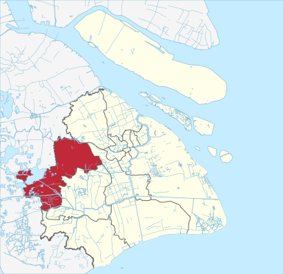
See 青浦区, 青浦镇, on the map
Public Transit to 青浦区 in 青浦镇
Wondering how to get to 青浦区 in 青浦镇? Moovit helps you find the best way to get to 青浦区 with step-by-step directions from the nearest public transit station.
Moovit provides free maps and live directions to help you navigate through your city. View schedules, routes, timetables, and find out how long does it take to get to 青浦区 in real time.
Looking for the nearest stop or station to 青浦区? Check out this list of stops closest to your destination: 公园东路保安路; 公园路外青松公路; 公园路保安路(招呼站); 外青松公路公园路(桂花园); 浦仓路公园路; 桂花园; 城东中路保安路 (东门小学); 青浦新城 Qingpu Xincheng.
Bus: 上朱线, 上朱线区间, 沪青专线, 青浦四线, 青黄专线, 青浦9路, 青徐线区间, 青浦16路, 松青线, 青浦6路.Metro: 17号线 LINE 17.
Want to see if there’s another route that gets you there at an earlier time? Moovit helps you find alternative routes or times. Get directions from and directions to 青浦区 easily from the Moovit App or Website.
We make riding to 青浦区 easy, which is why over 1.5 million users, including users in 青浦镇, trust Moovit as the best app for public transit. You don’t need to download an individual bus app or train app, Moovit is your all-in-one transit app that helps you find the best bus time or train time available.
For information on prices of bus and metro, costs and ride fares to 青浦区, please check the Moovit app.
Use the app to navigate to popular places including to the airport, hospital, stadium, grocery store, mall, coffee shop, school, college, and university.
Location: 青浦镇, Shanghai
- 青浦区工商联,
- 青浦区经委,
- 青浦区发改委,
- 青浦区人大,
- 青浦区政法委,
- 上海市青浦区人民政府-西南门,
- 青岛长寿食品有限公司驻沪办事处,
- 银来凤菜馆,
- 青浦美利达自行车专卖店,
- McDonald's (麦当劳),
- 黄浦区体育中心-南停车场,
- 青浦体育馆-停车场,
- 西希旅馆,
- 上海小红帽艺校,
- 上海元也塑胶有限公司,
- 上海青浦报关行有限公司,
- 快乐星艺校,
- 上海千塑国际贸易有限公司,
- 上海枢捷实业有限公司,
- 公园路外青松公路(招呼站)
Places Near 青浦区 (青浦镇)
- Wukang Building (武康大楼), 天平路街道,
- 宝华寺, 彭浦镇,
- 新场古镇, 新场镇,
- 上海新天地, 淮海中路街道,
- 大悦城(上海), 北站街道,
- Wukang Road | 武康路, 湖南路街道,
- 朵云书院旗舰店, 陆家嘴,
- Bailian Outlets Plaza (百联奥特莱斯广场),
- 南京路步行街, 南京东路街道,
- 复旦大学附属肿瘤医院,
- 七浦路服装批发市场, 北站街道,
- Fairmont Peace Hotel (和平饭店), 外滩街道,
- 陆家嘴 Lujiazui, 陆家嘴,
- 武康大楼, 天平路街道,
- 余庆路/武康路(路口),
- 上海城隍庙, 豫园街道,
- 新场古镇, 新场镇,
- 上海吴淞国际邮轮码头,
- LuOne凯德晶萃广场(地铁站出口), 打浦桥街道,
- 上海滩(外滩店), 外滩街道
How to get to popular places in Shanghai with public transit
Get around 青浦镇 by public transit!
Traveling around 青浦镇 has never been so easy. See step by step directions as you travel to any attraction, street or major public transit station. View bus and train schedules, arrival times, service alerts and detailed routes on a map, so you know exactly how to get to anywhere in 青浦镇.
When traveling to any destination around 青浦镇 use Moovit's Live Directions with Get Off Notifications to know exactly where and how far to walk, how long to wait for your line, and how many stops are left. Moovit will alert you when it's time to get off — no need to constantly re-check whether yours is the next stop.
Wondering how to use public transit in 青浦镇 or how to pay for public transit in 青浦镇? Moovit public transit app can help you navigate your way with public transit easily, and at minimum cost. It includes public transit fees, ticket prices, and costs. Looking for a map of 青浦镇 public transit lines? Moovit public transit app shows all public transit maps in 青浦镇 with all Bus, Train, Metro, Tram, Ferry, Cable Car and Maglev routes and stops on an interactive map.
Shanghai has 7 transit type(s), including: Bus, Train, Metro, Tram, Ferry, Cable Car and Maglev, operated by several transit agencies, including 上海地铁, 金山铁路, 张江有轨电车, 上海磁悬浮, 上海巴士, 浦东公交, 松江公交, 闵行客运, 金山巴士, 奉贤客运, 奉贤巴士, 金球出租, 青浦巴士, 众兴客运 and 智迅客运