Directions to 青衣運動場 (葵興 Kwai Tsing) with public transportation
The following transit lines have routes that pass near 青衣運動場
 Bus: 249X, 409S, 41A, 49X, 68E.
- Subway: 東涌綫 TUNG CHUNG LINE, 荃灣綫 TSUEN WAN LINE, 機場快綫 AIRPORT EXPRESS, 屯馬綫 TUEN MA LINE.
- Ferry: 珀麗灣 - 荃灣.
How to get to 青衣運動場 by bus?
Click on the bus route to see step by step directions with maps, line arrival times and updated time schedules.
How to get to 青衣運動場 by subway?
Click on the subway route to see step by step directions with maps, line arrival times and updated time schedules.
Subway stations near 青衣運動場 in 葵興 Kwai Tsing
- 荔景 Lai King, 1 min walk,
- 青衣 Tsing Yi, 10 min walk,
- 荃灣西 Tsuen Wan West, 16 min walk,
Bus stops near 青衣運動場 in 葵興 Kwai Tsing
- 宏福花園 Tivoli Garden, 3 min walk,
- 青敬路, 聖保祿村對面 Tsing King Road, Opposit To St. Pauls Village, 3 min walk,
- 宏福花園小巴總站 Tivoli Garden Minibus Terminus, 3 min walk,
- 楓樹窩路, 翠怡花園外 Fung Shue Wo Road, Outside Greenfield Garden, 4 min walk,
- 青衣街市 Tsing Yi Market, 5 min walk,
- 青衣站 Tsing Yi Station, 5 min walk,
- 楓樹窩路, 近海悅花園商場 Fung Shue Wo Road, Near Shopping Centre, Serene Garden, 5 min walk,
- 青衣碼頭總站 Tsing Yi Ferry B/T, 5 min walk,
- 青衣碼頭總站 Tsing Yi Ferry Pier Minibus Terminus, 7 min walk,
Ferry station near 青衣運動場 in 葵興 Kwai Tsing
- 荃灣 Tsuen Wan, 17 min walk,
Bus lines to 青衣運動場 in 葵興 Kwai Tsing
- 49M, 青富苑 - 青衣站(循環線) Ching Fu Court - Tsing Yi Station (Circular),
- 249M, 青衣站 - 美景花園(循環線) Tsing Yi Station - Mayfair Gardens (Circular),
- 413, 瑪嘉列醫院 Princess Magaret Hospital,
- 88D, 興寧路,近新都會廣場 Hing Ning Road, Near Metroplaza,
- 402S, 寮肚路, 長亨邨巴士總站 Liu To Road, Cheung Hang Estate Bus Terminus,
- A32, 機場 Airport,
- NA32, 機場 / 港珠澳大橋香港口岸 Airport / Hzmb Hong Kong Port,
- 41A, 尖沙咀東 Tsim Sha Tsui East,
- 41M, 荃灣站 Tsuen Wan Station,
- 44, 青衣邨 Tsing Yi Estate,
- 409, 青衣(長亨) Tsing Yi (Cheung Hang) - 荃灣(荃灣街市街)(循環線) Tsuen Wan (Tsuen Wan Market Street)(Circular),
- 409K, 青衣(長亨) Tsing Yi (Cheung Hang) - 荃灣西站(循環線) Tsuen Wan West Station (Circular),
- 409S, 青衣(長亨) Tsing Yi (Cheung Hang) - 荃灣(荃灣街市街)經德海街(循環線) Tsuen Wan (Tsuen Wan Market Street) via Tak Hoi Street(Circular),
- NR330, 珀麗灣 Park Island,
- NR332, 港鐵葵芳站(經港鐵青衣站) Mtr Kwai Fong Station (Via Mtr Tsing Yi Station),
- NR412, 曉峰園 Mount Haven,
- 88B, 楓樹窩路, 近翠怡花園第七座 Fung Shue Wo Road, Near Greenfield Garden Block 7,
- 43B, 荃灣西站 Tsuen Wan West Station,
- 49P, 青衣碼頭 Tsing Yi Ferry,
- 49X, 沙田(廣源) Sha Tin (Kwong Yuen),
What are the closest stations to 青衣運動場?
The closest stations to 青衣運動場 are:
- 荔景 Lai King is 43 meters away, 1 min walk.
- 宏福花園 Tivoli Garden is 163 meters away, 3 min walk.
- 青敬路, 聖保祿村對面 Tsing King Road, Opposit To St. Pauls Village is 174 meters away, 3 min walk.
- 宏福花園小巴總站 Tivoli Garden Minibus Terminus is 199 meters away, 3 min walk.
- 楓樹窩路, 翠怡花園外 Fung Shue Wo Road, Outside Greenfield Garden is 254 meters away, 4 min walk.
- 青衣街市 Tsing Yi Market is 286 meters away, 5 min walk.
- 青衣站 Tsing Yi Station is 324 meters away, 5 min walk.
- 楓樹窩路, 近海悅花園商場 Fung Shue Wo Road, Near Shopping Centre, Serene Garden is 333 meters away, 5 min walk.
- 青衣碼頭總站 Tsing Yi Ferry B/T is 336 meters away, 5 min walk.
- 青衣碼頭總站 Tsing Yi Ferry Pier Minibus Terminus is 488 meters away, 7 min walk.
- 青衣 Tsing Yi is 738 meters away, 10 min walk.
- 荃灣西 Tsuen Wan West is 1216 meters away, 16 min walk.
- 荃灣 Tsuen Wan is 1307 meters away, 17 min walk.
Which bus lines stop near 青衣運動場?
These bus lines stop near 青衣運動場: 249X, 409S, 41A, 49X, 68E.
Which subway line stops near 青衣運動場?
東涌綫 TUNG CHUNG LINE (往東涌 To Tung Chung)
What’s the nearest subway station to 青衣運動場 in 葵興 Kwai Tsing?
The nearest subway station to 青衣運動場 in 葵興 Kwai Tsing is 荔景 Lai King. It’s a 1 min walk away.
What’s the nearest bus station to 青衣運動場 in 葵興 Kwai Tsing?
The nearest bus stations to 青衣運動場 in 葵興 Kwai Tsing are 宏福花園 Tivoli Garden, 青敬路, 聖保祿村對面 Tsing King Road, Opposit To St. Pauls Village and 宏福花園小巴總站 Tivoli Garden Minibus Terminus. The closest one is a 3 min walk away.
What’s the nearest ferry station to 青衣運動場 in 葵興 Kwai Tsing?
The nearest ferry station to 青衣運動場 in 葵興 Kwai Tsing is 荃灣 Tsuen Wan. It’s a 17 min walk away.
What time is the first subway to 青衣運動場 in 葵興 Kwai Tsing?
The 東涌綫 TUNG CHUNG LINE is the first subway that goes to 青衣運動場 in 葵興 Kwai Tsing. It stops nearby at 5:59 AM.
What time is the last subway to 青衣運動場 in 葵興 Kwai Tsing?
The 荃灣綫 TSUEN WAN LINE is the last subway that goes to 青衣運動場 in 葵興 Kwai Tsing. It stops nearby at 1:19 AM.
What time is the first bus to 青衣運動場 in 葵興 Kwai Tsing?
The NR330 is the first bus that goes to 青衣運動場 in 葵興 Kwai Tsing. It stops nearby at 3:04 AM.
What time is the last bus to 青衣運動場 in 葵興 Kwai Tsing?
The 402S is the last bus that goes to 青衣運動場 in 葵興 Kwai Tsing. It stops nearby at 2:54 AM.
What time is the first ferry to 青衣運動場 in 葵興 Kwai Tsing?
The 珀麗灣 - 荃灣 is the first ferry that goes to 青衣運動場 in 葵興 Kwai Tsing. It stops nearby at 10:27 AM.
What time is the last ferry to 青衣運動場 in 葵興 Kwai Tsing?
The 珀麗灣 - 荃灣 is the last ferry that goes to 青衣運動場 in 葵興 Kwai Tsing. It stops nearby at 4:35 PM.
See 青衣運動場, 葵興 Kwai Tsing, on the map
Public Transit to 青衣運動場 in 葵興 Kwai Tsing
Wondering how to get to 青衣運動場 in 葵興 Kwai Tsing? Moovit helps you find the best way to get to 青衣運動場 with step-by-step directions from the nearest public transit station.
Moovit provides free maps and live directions to help you navigate through your city. View schedules, routes, timetables, and find out how long does it take to get to 青衣運動場 in real time.
Looking for the nearest stop or station to 青衣運動場? Check out this list of stops closest to your destination: 荔景 Lai King; 宏福花園 Tivoli Garden; 青敬路; 宏福花園小巴總站 Tivoli Garden Minibus Terminus; 楓樹窩路; 青衣街市 Tsing Yi Market; 青衣站 Tsing Yi Station; 楓樹窩路; 青衣碼頭總站 Tsing Yi Ferry B/T; 青衣碼頭總站 Tsing Yi Ferry Pier Minibus Terminus; 青衣 Tsing Yi; 荃灣西 Tsuen Wan West; 荃灣 Tsuen Wan.
Bus: 249X, 409S, 41A, 49X, 68E, 49M, 249M, 413.Subway: 東涌綫 TUNG CHUNG LINE, 荃灣綫 TSUEN WAN LINE, 機場快綫 AIRPORT EXPRESS, 屯馬綫 TUEN MA LINE.Ferry: 珀麗灣 - 荃灣.
Want to see if there’s another route that gets you there at an earlier time? Moovit helps you find alternative routes or times. Get directions from and directions to 青衣運動場 easily from the Moovit App or Website.
We make riding to 青衣運動場 easy, which is why over 1.5 million users, including users in 葵興 Kwai Tsing, trust Moovit as the best app for public transit. You don’t need to download an individual bus app or train app, Moovit is your all-in-one transit app that helps you find the best bus time or train time available.
For information on prices of subway and bus, costs and ride fares to 青衣運動場, please check the Moovit app.
Use the app to navigate to popular places including to the airport, hospital, stadium, grocery store, mall, coffee shop, school, college, and university.
青衣運動場 Address: 青敬路 street in 葵興 Kwai Tsing
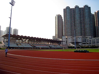
- Tsing Yi Sports Ground,
- 電動汽車充電站,
- 青衣海濱公園 Tsing Yi Promenade,
- 微笑,
- 青衣運動場11人天然草地足球場,
- 青敬路 近青衣公園,
- Av Life,
- 盈翠半島3A座,
- 盈翠半島6座,
- 青衣城,
- 青衣運動場88D小巴站,
- 謝寶樹醫生,
- 宏福中英文幼稚園,
- 青衣運動場及游泳池停車場,
- 青衣游泳池,
- 宏福花園停車場,
- 香港上海滙豐銀行有限公司,
- 青衣花園小廣場,
- Lenscrafters,
- 青敬路 聖保祿村對面
Places Near 青衣運動場 (葵興 Kwai Tsing)
- 麗豪酒店, 沙田 Sha Tin,
- 香港駕駛學院沙田安全駕駛中心, 沙田 Sha Tin,
- 沙田馬場 Sha Tin Racecourse, 沙田 Sha Tin,
- Airside, 九龍 Kowloon City,
- 林村許願樹, 大埔 Tai Po,
- 中港城,
- 九龍灣健康中心 Kowloon Bay Health Centre, 觀塘 Kwun Tong,
- 宏利金融中心 Manulife Financial Centre, 觀塘 Kwun Tong,
- 大埔海濱公園, 大埔 Tai Po,
- 富麗敦海洋公園酒店 the Fullerton Hotel: Ocean Park,
- 大欖涌燒烤樂園 Tai Lam Chung Bbq Club, 屯門 Tuen Mun,
- 香港教育大學, 大埔 Tai Po,
- 香港東涌福朋喜來登酒店,
- 屯門兆麟政府綜合大樓 Tuen Mun Siu Lun Government Complex, 屯門 Tuen Mun,
- China Travel Service Tuen Mun Entry Permit Service Centre 中國旅行社屯門證件服務中心, 屯門 Tuen Mun,
- 威爾斯親王醫院, 沙田 Sha Tin,
- Shatin Hospital 沙田醫院, 沙田 Sha Tin,
- 啟德體育園 Kai Tak Sports Park, 九龍 Kowloon City,
- 入境事務處人事登記處辦事處, 觀塘 Kwun Tong,
- 天水圍(天業路)社區健康中心 Tin Shui Wai (Tin Yip Road) Community Health Centre, 元朗 Yuen Long
How to get to popular places in Hong Kong with public transit
Get around 葵興 Kwai Tsing by public transit!
Traveling around 葵興 Kwai Tsing has never been so easy. See step by step directions as you travel to any attraction, street or major public transit station. View bus and train schedules, arrival times, service alerts and detailed routes on a map, so you know exactly how to get to anywhere in 葵興 Kwai Tsing.
When traveling to any destination around 葵興 Kwai Tsing use Moovit's Live Directions with Get Off Notifications to know exactly where and how far to walk, how long to wait for your line, and how many stops are left. Moovit will alert you when it's time to get off — no need to constantly re-check whether yours is the next stop.
Wondering how to use public transit in 葵興 Kwai Tsing or how to pay for public transit in 葵興 Kwai Tsing? Moovit public transit app can help you navigate your way with public transit easily, and at minimum cost. It includes public transit fees, ticket prices, and costs. Looking for a map of 葵興 Kwai Tsing public transit lines? Moovit public transit app shows all public transit maps in 葵興 Kwai Tsing with all Bus, Subway, Light Rail, Ferry, Cable Car and Funicular routes and stops on an interactive map.
Hong Kong has 6 transit type(s), including: Bus, Subway, Light Rail, Ferry, Cable Car and Funicular, operated by several transit agencies, including 港鐵 MTR, 天星小輪 Star Ferry, 九巴 KMB, 城巴 Citybus, 城巴機場快線 Cityflyer, 龍運巴士 LWB, 九巴 KMB / 城巴 CTB, 龍運巴士 LWB / 城巴 CTB, 新大嶼山巴士 NLB, 愉景灣巴士 DB, 香港電車 Hong Kong Tramways, 香港中文大學 The Chinese University of Hong Kong, 港島區專線小巴 GMB HK Island, 九龍區專線小巴 GMB Kowloon and 新界區專線小巴 GMB New Territories