Directions to 龙嘉机场 (二道区) with public transportation
The following transit lines have routes that pass near 龙嘉机场
 Bus: 机场巴士5号线, 机场巴士一号线, 机场巴士二号线, 机场巴士2号线, 机场巴士3号线.
How to get to 龙嘉机场 by bus?
Click on the bus route to see step by step directions with maps, line arrival times and updated time schedules.
Bus stops near 龙嘉机场 in 二道区
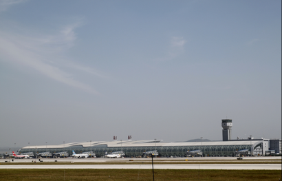
- 长春龙嘉国际机场, 6 min walk,
Bus lines to 龙嘉机场 in 二道区
- 机场巴士二号线, 吉林市江城广场,
- 机场巴士一号线, 人民广场,
- 机场巴士2号线, 汽贸城,
- 机场巴士3号线, 高速客运,
- 机场巴士5号线, 长春龙嘉国际机场,
What are the closest stations to 龙嘉机场?
The closest stations to 龙嘉机场 are:
- 长春龙嘉国际机场 is 434 meters away, 6 min walk.
Which bus lines stop near 龙嘉机场?
These bus lines stop near 龙嘉机场: 机场巴士5号线, 机场巴士一号线.
What’s the nearest bus station to 龙嘉机场 in 二道区?
The nearest bus station to 龙嘉机场 in 二道区 is 长春龙嘉国际机场. It’s a 6 min walk away.
What time is the first bus to 龙嘉机场 in 二道区?
The 机场巴士一号线 is the first bus that goes to 龙嘉机场 in 二道区. It stops nearby at 6:00 AM.
What time is the last bus to 龙嘉机场 in 二道区?
The 机场巴士一号线 is the last bus that goes to 龙嘉机场 in 二道区. It stops nearby at 8:25 PM.
See 龙嘉机场, 二道区, on the map
Public Transit to 龙嘉机场 in 二道区
Wondering how to get to 龙嘉机场 in 二道区? Moovit helps you find the best way to get to 龙嘉机场 with step-by-step directions from the nearest public transit station.
Moovit provides free maps and live directions to help you navigate through your city. View schedules, routes, timetables, and find out how long does it take to get to 龙嘉机场 in real time.
Looking for the nearest stop or station to 龙嘉机场? Check out this list of stops closest to your destination: 长春龙嘉国际机场.
Bus: 机场巴士5号线, 机场巴士一号线, 机场巴士二号线, 机场巴士2号线, 机场巴士3号线.
Want to see if there’s another route that gets you there at an earlier time? Moovit helps you find alternative routes or times. Get directions from and directions to 龙嘉机场 easily from the Moovit App or Website.
We make riding to 龙嘉机场 easy, which is why over 1.5 million users, including users in 二道区, trust Moovit as the best app for public transit. You don’t need to download an individual bus app or train app, Moovit is your all-in-one transit app that helps you find the best bus time or train time available.
For information on prices of bus, costs and ride fares to 龙嘉机场, please check the Moovit app.
Use the app to navigate to popular places including to the airport, hospital, stadium, grocery store, mall, coffee shop, school, college, and university.
龙嘉机场 Address: 机场巴士1号线;机场巴士2号线 street in 二道区
- 肯德基(龙嘉T2餐厅),
- Nearby Airports,
- 阿满馋吧,
- 中国民用航空东北地区空中交管局吉林分局,
- Changchun Longjia International Airport Terminal 2,
- 职工之家,
- 长春龙嘉国际机场-1号停车场,
- 长春龙嘉国际机场-国内到达,
- Changchun Longjia Airport Gate 33,
- Vip lounge 贵宾休息室,
- Changchun Longjia Airport,
- Security Checkpoint,
- Changchun Longjia International Airport (CGQ) (长春龙嘉国际机场),
- 机场,
- First Class Lounge,
- 售票处,
- 长春龙嘉国际机场-航站楼,
- FM9180,
- 龙嘉,
- 龙嘉火车站
Places Near 龙嘉机场 (二道区)
- 吉林省人民医院, 朝阳区,
- 陈家屯, 南关区,
- 长春中医药大学附属医院, 朝阳区,
- 和悦塘足道养生会所, 朝阳区,
- 交通银行(珠海路支行), 二道区,
- 吉林大学白求恩第二医院眼科医院(亚泰院区), 南关区,
- 吉林大学白求恩第一医院, 朝阳区,
- 长春中医药大学附属医院-停车场, 朝阳区,
- 吉林大学第三医院(中日联谊二部)-停车场, 朝阳区,
- 长春轻轨摩天活力城, 二道区,
- 吉林大学中日联谊医院南湖院区, 朝阳区,
- 东北师大附中(初中部明珠校区), 南关区,
- 长春万达中心, 朝阳区,
- 砂之船(中东)奥莱招商中心, 宽城区,
- 吉林省肿瘤医院, 朝阳区,
- 吉林大学白求恩第二医院, 南关区,
- 长春龙嘉国际机场城市候机楼, 南关区,
- 砂之船中东奥莱, 朝阳区,
- 菜鸟驿站(长春朝阳桂林路店), 朝阳区,
- 长春新城吾悦广场(北1门), 绿园区
How to get to popular places in Changchun with public transit
Get around 二道区 by public transit!
Traveling around 二道区 has never been so easy. See step by step directions as you travel to any attraction, street or major public transit station. View bus and train schedules, arrival times, service alerts and detailed routes on a map, so you know exactly how to get to anywhere in 二道区.
When traveling to any destination around 二道区 use Moovit's Live Directions with Get Off Notifications to know exactly where and how far to walk, how long to wait for your line, and how many stops are left. Moovit will alert you when it's time to get off — no need to constantly re-check whether yours is the next stop.
Wondering how to use public transit in 二道区 or how to pay for public transit in 二道区? Moovit public transit app can help you navigate your way with public transit easily, and at minimum cost. It includes public transit fees, ticket prices, and costs. Looking for a map of 二道区 public transit lines? Moovit public transit app shows all public transit maps in 二道区 with all Bus, Metro and Light Rail routes and stops on an interactive map.
Changchun has 3 transit type(s), including: Bus, Metro and Light Rail, operated by several transit agencies, including 轨道交通 and 公交