Directions to 방산시장 (중구, 서울시) with public transportation
The following transit lines have routes that pass near 방산시장
 Bus: 100, 140, 160, 202, 301.
- Subway: 2, 3, 5, 4, 1.
How to get to 방산시장 by bus?
Click on the bus route to see step by step directions with maps, line arrival times and updated time schedules.
How to get to 방산시장 by subway?
Click on the subway route to see step by step directions with maps, line arrival times and updated time schedules.
Bus stops near 방산시장 in 중구, 서울시
- 을지로5가, 2 min walk,
- 아카시아호텔.웨스턴코업레지던스, 2 min walk,
- 을지로4가.베스트웨스턴국도, 5 min walk,
- 청계4가.배오개다리, 5 min walk,
- 방산시장, 5 min walk,
- 광장시장, 6 min walk,
- 종로5가.광장시장(중) Gwangjang Market, 8 min walk,
Subway stations near 방산시장 in 중구, 서울시
- 을지로3가 Euljiro 3-Ga, 2 min walk,
- 동대문역사문화공원 Dongdaemun History & Culture Park, 3 min walk,
- 종로5가 Jongno 5(O)-Ga, 9 min walk,
Bus lines to 방산시장 in 중구, 서울시
- 152, 화계사,
- 202, 불암동,
- 261, 장위동,
- 6001, 동대문,
- 100, 하계동,
- 104, 강북청소년수련관,
- 105, 상계주공7단지 - 숭례문,
- 604, 신월동 - 중구청,
- 6015, 충무로역 - 세종호텔(명동역),
- 7011, 은평공영차고지 - 중구청,
- 163, 월계동,
- 407, 동대문,
- 2014, 동대문역사문화공원,
- 140, 내곡Ic,
- 106, 현대힐스테이트아파트 - 종로5가 (Hyundai Hillstate - Gwangjang Market),
- 143, 정릉 - 개포동,
- 150, 도봉산역광역환승센터 - 기아대교,
- 160, 도봉산역광역환승센터 - 온수동,
- 273, 중랑공영차고지 - 동교동,
What are the closest stations to 방산시장?
The closest stations to 방산시장 are:
- 을지로5가 is 75 meters away, 2 min walk.
- 을지로3가 Euljiro 3-Ga is 99 meters away, 2 min walk.
- 아카시아호텔.웨스턴코업레지던스 is 119 meters away, 2 min walk.
- 동대문역사문화공원 Dongdaemun History & Culture Park is 223 meters away, 3 min walk.
- 을지로4가.베스트웨스턴국도 is 311 meters away, 5 min walk.
- 청계4가.배오개다리 is 333 meters away, 5 min walk.
- 방산시장 is 350 meters away, 5 min walk.
- 광장시장 is 389 meters away, 6 min walk.
- 종로5가.광장시장(중) Gwangjang Market is 583 meters away, 8 min walk.
- 종로5가 Jongno 5(O)-Ga is 671 meters away, 9 min walk.
Which bus lines stop near 방산시장?
These bus lines stop near 방산시장: 100, 140, 160, 202, 301.
Which subway lines stop near 방산시장?
These subway lines stop near 방산시장: 2, 3, 5.
What’s the nearest subway station to 방산시장 in 중구, 서울시?
The nearest subway station to 방산시장 in 중구, 서울시 is 을지로3가 Euljiro 3-Ga. It’s a 2 min walk away.
What’s the nearest bus station to 방산시장 in 중구, 서울시?
The nearest bus stations to 방산시장 in 중구, 서울시 are 을지로5가 and 아카시아호텔.웨스턴코업레지던스. The closest one is a 2 min walk away.
What time is the first subway to 방산시장 in 중구, 서울시?
The 1 is the first subway that goes to 방산시장 in 중구, 서울시. It stops nearby at 5:21 AM.
What time is the last subway to 방산시장 in 중구, 서울시?
The 1 is the last subway that goes to 방산시장 in 중구, 서울시. It stops nearby at 12:18 AM.
What time is the first bus to 방산시장 in 중구, 서울시?
The 106 is the first bus that goes to 방산시장 in 중구, 서울시. It stops nearby at 4:00 AM.
What time is the last bus to 방산시장 in 중구, 서울시?
The 407 is the last bus that goes to 방산시장 in 중구, 서울시. It stops nearby at 12:18 AM.
See 방산시장, 중구, 서울시, on the map
Public Transit to 방산시장 in 중구, 서울시
Wondering how to get to 방산시장 in 중구, 서울시? Moovit helps you find the best way to get to 방산시장 with step-by-step directions from the nearest public transit station.
Moovit provides free maps and live directions to help you navigate through your city. View schedules, routes, timetables, and find out how long does it take to get to 방산시장 in real time.
Looking for the nearest stop or station to 방산시장? Check out this list of stops closest to your destination: 을지로5가; 을지로3가 Euljiro 3-Ga; 아카시아호텔.웨스턴코업레지던스; 동대문역사문화공원 Dongdaemun History & Culture Park; 을지로4가.베스트웨스턴국도; 청계4가.배오개다리; 방산시장; 광장시장; 종로5가.광장시장(중) Gwangjang Market; 종로5가 Jongno 5(O)-Ga.
Bus: 100, 140, 160, 202, 301, 152, 261, 6001, 105, 604, 6015, 7011.Subway: 2, 3, 5, 4, 1.
Want to see if there’s another route that gets you there at an earlier time? Moovit helps you find alternative routes or times. Get directions from and directions to 방산시장 easily from the Moovit App or Website.
We make riding to 방산시장 easy, which is why over 1.5 million users, including users in 중구, 서울시, trust Moovit as the best app for public transit. You don’t need to download an individual bus app or train app, Moovit is your all-in-one transit app that helps you find the best bus time or train time available.
For information on prices of subway and bus, costs and ride fares to 방산시장, please check the Moovit app.
Use the app to navigate to popular places including to the airport, hospital, stadium, grocery store, mall, coffee shop, school, college, and university.
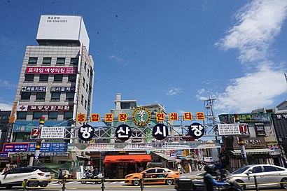
방산시장 Address: 중구 을지로33길 18-1 street in 중구, 서울시
- 을지로4가역 6번출구,
- 자성화 맛집 코다리네,
- Euljiro Underground Shopping Center,
- 중부시장,
- 우래옥,
- 우래옥(Woo Lae Oak),
- 방산시장B동,
- Euljiro 4 ga Station,
- Hostel J Stay Seoul,
- 청계천로,
- Euljiro 5 ga,
- Hotel U5,
- 고려빌딩,
- 대일특수조명,
- 주유소식당 Juyuso Sikdang,
- 을지로4가역 10번출구,
- 중부시장 신중부시장(건어물),
- Travelodge Dongdaemun Seoul,
- 을지트윈타워,
- 바다극장
Places Near 방산시장 (중구, 서울시)
- 중부시장, 중구, 서울시,
- 영종도,
- 국회의사당, 영등포구, 서울시,
- 허리우드24시성인정용극장3f.휴계실, 수원시, 경기도,
- 가톨릭대학교 은평성모병원, 은평구, 서울시,
- 서부운전면허시험장, 마포구, 서울시,
- 인천운전면허시험장, 남동구, 인천시,
- 서울구치소, 의왕시, 경기도,
- 판교역, 성남시, 경기도,
- 국가정보원, 서초구, 서울시,
- 원자력병원입구, 노원구, 서울시,
- 코스트코 양재점, 서초구, 서울시,
- 일산, 고양시, 경기도,
- 용인운전면허시험장, 용인시, 경기도,
- 인천연안부두, 남구, 인천시,
- 엘지마곡사이언스파크 통근버스 승강장, 동작구, 서울시,
- 안국역, 종로구, 서울시,
- 남대문시장, 중구, 서울시,
- SK하이닉스 셔틀버스주차장, 이천시, 경기도,
- 삼성전자 통근버스정류장장, 수원시, 경기도
How to get to popular places in Seoul with public transit
Get around 중구, 서울시 by public transit!
Traveling around 중구, 서울시 has never been so easy. See step by step directions as you travel to any attraction, street or major public transit station. View bus and train schedules, arrival times, service alerts and detailed routes on a map, so you know exactly how to get to anywhere in 중구, 서울시.
When traveling to any destination around 중구, 서울시 use Moovit's Live Directions with Get Off Notifications to know exactly where and how far to walk, how long to wait for your line, and how many stops are left. Moovit will alert you when it's time to get off — no need to constantly re-check whether yours is the next stop.
Wondering how to use public transit in 중구, 서울시 or how to pay for public transit in 중구, 서울시? Moovit public transit app can help you navigate your way with public transit easily, and at minimum cost. It includes public transit fees, ticket prices, and costs. Looking for a map of 중구, 서울시 public transit lines? Moovit public transit app shows all public transit maps in 중구, 서울시 with all Bus, Subway and Light Rail routes and stops on an interactive map.
Seoul has 3 transit type(s), including: Bus, Subway and Light Rail, operated by several transit agencies, including 서울교통공사, 인천교통공사, 네오트랜스, 한국철도공사, 경기, 공항, 간선, 지선, 순환, 광역, 인천, 김포 도시철도, 경기고속, 대원고속 and 삼환교통