범내골 stop - Saturday schedule
| Line | Direction | Time |
|---|---|---|
| 23 | 감만시장 | 오전 4:41 |
| 23 | 감만시장 | 오전 4:45 |
| 23 | 감만시장 | 오전 4:49 |
| 23 | 감만시장 | 오전 4:53 |
| 17 | 영합의원 | 오전 4:53 |
| 23 | 감만시장 | 오전 4:57 |
| 17 | 영합의원 | 오전 4:59 |
| 23 | 감만시장 | 오전 5:01 |
| 68 | 용당동 | 오전 5:01 |
| 23 | 감만시장 | 오전 5:05 |
| 17 | 영합의원 | 오전 5:06 |
| 68 | 용당동 | 오전 5:07 |
| 23 | 감만시장 | 오전 5:09 |
| 17 | 영합의원 | 오전 5:12 |
| 23 | 감만시장 | 오전 5:14 |
| 68 | 용당동 | 오전 5:14 |
| 23 | 감만시장 | 오전 5:18 |
| 17 | 영합의원 | 오전 5:19 |
| 68 | 용당동 | 오전 5:20 |
| 83 | Mbc방송국 | 오전 5:21 |
| 23 | 감만시장 | 오전 5:22 |
| 108 | 민락동골목시장 | 오전 5:22 |
| 17 | 영합의원 | 오전 5:25 |
| 23 | 감만시장 | 오전 5:26 |
| 68 | 용당동 | 오전 5:26 |
Directions to 범내골 stop (부산진구) with public transit
The following transit lines have routes that pass near 범내골
 Bus: 1010, 17, 43, 68, 81.
- Metro: 1, 2.
How to get to 범내골 stop by bus?
Click on the bus route to see step by step directions with maps, line arrival times and updated time schedules.
How to get to 범내골 stop by metro?
Click on the metro route to see step by step directions with maps, line arrival times and updated time schedules.
Bus stops near 범내골 stop in 부산진구
- 범내골, 1 min walk,
- 혜화사관학원, 4 min walk,
- 교보생명, 4 min walk,
- 춘해병원, 4 min walk,
- 상공회의소, 4 min walk,
- 지오플레이스, 9 min walk,
- 경남공고, 9 min walk,
Metro stations near 범내골 station in 부산진구
- 국제금융센터, 5 min walk,
- 범내골, 11 min walk,
Bus lines to 범내골 stop in 부산진구
- 10, 사직동 - 부경대,
- 43, 반여농산물시장 - 중앙공원사무소,
- 5-1, 반여1동 - 충무동,
- 52, 반여3동 - 수정4동,
- 57, 사직동 - 진시장,
- 63, 청강리 - 부산진시장,
- 80, 범어사입구 - 진시장,
- 81, 초읍 - 서대신금호A,
- 83, 민락동 - 부전시장,
- 99, 회동동 - 부산진시장,
- 111, 금곡동 - 진시장,
- 583, 용당동 - 자유시장,
- 83-1, 민락동 - 사직동,
- 1000, 다대포 - 서면,
- 1000(심야), 다대포 - 서면,
- 1004(심야), 김해 구산동 - 서구청,
- 23, 감만동 - 선암사,
- 67, 동서대 - 남태평양호텔,
- 68, 용당동 - 하단,
- 85, 영도청학동 - 서면,
What are the closest stations to 범내골?
The closest stations to 범내골 are:
- 범내골 is 9 meters away, 1 min walk.
- 혜화사관학원 is 234 meters away, 4 min walk.
- 교보생명 is 262 meters away, 4 min walk.
- 춘해병원 is 272 meters away, 4 min walk.
- 상공회의소 is 286 meters away, 4 min walk.
- 국제금융센터 is 311 meters away, 5 min walk.
- 지오플레이스 is 635 meters away, 9 min walk.
- 경남공고 is 670 meters away, 9 min walk.
Which bus lines stop near 범내골?
These bus lines stop near 범내골: 1010, 17, 43, 68, 81, 83, 86, 88(B).
Which metro lines stop near 범내골?
These metro lines stop near 범내골: 1, 2.
What’s the nearest metro station to 범내골 in 부산진구?
The nearest metro station to 범내골 in 부산진구 is 국제금융센터. It’s a 5 min walk away.
What’s the nearest bus station to 범내골 in 부산진구?
The nearest bus station to 범내골 in 부산진구 is 범내골. It’s a 1 min walk away.
What time is the first metro to 범내골 in 부산진구?
The 2 is the first metro that goes to 범내골 in 부산진구. It stops nearby at 5:24 AM.
What time is the last metro to 범내골 in 부산진구?
The 2 is the last metro that goes to 범내골 in 부산진구. It stops nearby at 12:18 AM.
What time is the first bus to 범내골 in 부산진구?
The 81 is the first bus that goes to 범내골 in 부산진구. It stops nearby at 4:53 AM.
What time is the last bus to 범내골 in 부산진구?
The 1000(심야) is the last bus that goes to 범내골 in 부산진구. It stops nearby at 12:50 AM.
See 범내골 stop, 부산진구, on the map
Public transit to 범내골 stop in 부산진구
Looking for directions to 범내골 in 부산진구, South Korea?
Download the Moovit App to find the current schedule and step-by-step directions for Bus or Metro routes that pass through 범내골.
Looking for the nearest stops closest to 범내골 ? Check out this list of closest stops to your destination: 범내골; 혜화사관학원; 교보생명; 춘해병원; 상공회의소; 국제금융센터; 지오플레이스; 경남공고.
Bus: 1010, 17, 43, 68, 81, 83, 86, 88(B), 10, 5-1, 52, 57, 23, 67, 85, 108, 24, 54, 29, 38.Metro: 1, 2.
We make riding on public transit to 범내골 easy, which is why over 1.5 million users, including users in 부산진구 trust Moovit as the best app for public transit.
Use the app to navigate to popular places including to the airport, hospital, stadium, grocery store, mall, coffee shop, school, college, and university.
The first line to this stop is 23, at 오전 4:41, and the last line is 1004(심야) at 오전 12:30.
South Korea Busan Saha-gu 중앙대로 632
This stop serves Night Bus (Express), Seated Bus (Yongwon), Night Bus (Regular) and Seated Bus (Jangyu)’s lines
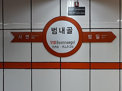
Beomnaegol Station (Korean: 범내골역) is a station of the Busan Metro Line 1 in Beomcheon-dong, Busanjin District, Busan, South Korea.Wiki
Get around 부산진구 by public transit!
Traveling around 부산진구 has never been so easy. See step by step directions as you travel to any attraction, street or major public transit station. View bus and train schedules, arrival times, service alerts and detailed routes on a map, so you know exactly how to get to anywhere in 부산진구.
When traveling to any destination around 부산진구 use Moovit's Live Directions with Get Off Notifications to know exactly where and how far to walk, how long to wait for your line, and how many stops are left. Moovit will alert you when it's time to get off — no need to constantly re-check whether yours is the next stop.
Wondering how to use public transit in 부산진구 or how to pay for public transit in 부산진구? Moovit public transit app can help you navigate your way with public transit easily, and at minimum cost. It includes public transit fees, ticket prices, and costs. Looking for a map of 부산진구 public transit lines? Moovit public transit app shows all public transit maps in 부산진구 with all Bus, Metro and Light Rail routes and stops on an interactive map.
Busan has 3 transit type(s), including: Bus, Metro and Light Rail, operated by several transit agencies, including 부산교통공사, 일반버스, 급행버스, 심야버스(급행), 심야버스(일반), 좌석버스(산성), 좌석버스(장유) and 좌석버스(용원)