Directions to 서울로 7017 (중구, 서울시) with public transportation
The following transit lines have routes that pass near 서울로 7017
 Bus: 105, 163, 262, 402, 463.
- Subway: 1, 4, 2, 경의선 (GYEONGUI LINE), 공항철도 (AREX).
How to get to 서울로 7017 by bus?
Click on the bus route to see step by step directions with maps, line arrival times and updated time schedules.
How to get to 서울로 7017 by subway?
Click on the subway route to see step by step directions with maps, line arrival times and updated time schedules.
Bus stops near 서울로 7017 in 중구, 서울시
- 남대문시장.회현역, 2 min walk,
- 남대문시장악세사리전문상가, 3 min walk,
- 밀레니엄힐튼호텔.하차(가상), 5 min walk,
- 숭례문, 5 min walk,
- 북창동.남대문시장, 6 min walk,
Subway stations near 서울로 7017 in 중구, 서울시
- 시청 City Hall, 7 min walk,
- 서울 Seoul, 8 min walk,
- 서울(경의선), 8 min walk,
Bus lines to 서울로 7017 in 중구, 서울시
- N16, 도봉산역광역환승센터 - 온수동,
- 104, 강북청소년수련관 - 숭례문,
- 105, 상계주공7단지 - 숭례문,
- 604, 신월동 - 중구청,
- 7011, 은평공영차고지 - 중구청,
- 03, 남산서울타워,
- 421, 옥수동,
- 463, 염곡동,
- 505, 서울역,
- 507, 동대문역사문화공원,
- 7013A, 남대문시장,
- 7013B, 남대문시장,
- 05, 남산서울타워,
- 402, 장지공영차고지,
- 405, 종로1가,
- 6702, 인천공항,
- N15, 우이동 - 사당역,
- 103, 월계동 - 서울역,
- 163, 월계동 - 목동,
- 201, 수택동 - 서울역,
What are the closest stations to 서울로 7017?
The closest stations to 서울로 7017 are:
- 남대문시장.회현역 is 73 meters away, 2 min walk.
- 남대문시장악세사리전문상가 is 185 meters away, 3 min walk.
- 밀레니엄힐튼호텔.하차(가상) is 345 meters away, 5 min walk.
- 숭례문 is 347 meters away, 5 min walk.
- 북창동.남대문시장 is 414 meters away, 6 min walk.
- 시청 City Hall is 464 meters away, 7 min walk.
- 서울 Seoul is 564 meters away, 8 min walk.
- 서울(경의선) is 564 meters away, 8 min walk.
Which bus lines stop near 서울로 7017?
These bus lines stop near 서울로 7017: 105, 163, 262, 402, 463, 604, 7011, 7016, 773.
Which subway lines stop near 서울로 7017?
These subway lines stop near 서울로 7017: 1, 4.
What’s the nearest subway station to 서울로 7017 in 중구, 서울시?
The nearest subway station to 서울로 7017 in 중구, 서울시 is 시청 City Hall. It’s a 7 min walk away.
What’s the nearest bus station to 서울로 7017 in 중구, 서울시?
The nearest bus station to 서울로 7017 in 중구, 서울시 is 남대문시장.회현역. It’s a 2 min walk away.
What time is the first subway to 서울로 7017 in 중구, 서울시?
The 1 is the first subway that goes to 서울로 7017 in 중구, 서울시. It stops nearby at 5:20 AM.
What time is the last subway to 서울로 7017 in 중구, 서울시?
The 1 is the last subway that goes to 서울로 7017 in 중구, 서울시. It stops nearby at 12:58 AM.
What time is the first bus to 서울로 7017 in 중구, 서울시?
The N16 is the first bus that goes to 서울로 7017 in 중구, 서울시. It stops nearby at 3:06 AM.
What time is the last bus to 서울로 7017 in 중구, 서울시?
The N16 is the last bus that goes to 서울로 7017 in 중구, 서울시. It stops nearby at 3:07 AM.
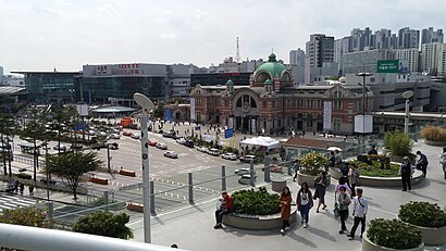
See 서울로 7017, 중구, 서울시, on the map
Public Transit to 서울로 7017 in 중구, 서울시
How to get to 서울로 7017 in 중구, 서울시, South Korea?
It’s easy with Moovit. Type in your street address and Moovit’s route finder will locate the fastest way to get you there! Not sure where to get off on the street? Download the Moovit App to find live directions (including where to get off on 서울로 7017), see timetables and get the estimated arrival times for your favorite subway or bus lines.
Looking for the nearest stop or station to 서울로 7017? Check out this list of closest stops available to your destination: 남대문시장.회현역; 남대문시장악세사리전문상가; 밀레니엄힐튼호텔.하차(가상); 숭례문; 북창동.남대문시장; 시청 City Hall; 서울 Seoul; 서울(경의선).
Bus: 105, 163, 262, 402, 463, 604, 7011, 7016, 773, N16, 104, 03, 421, 505, 507, 05, 405.Subway: 1, 4, 2, 경의선 (GYEONGUI LINE), 공항철도 (AREX).
Download the Moovit App to see the current schedule and routes available for 중구, 서울시. No need to install a special bus app to check the bus time or a train app to get train time. Moovit is the only all-in-one transit app that helps you get where you need to go.
We make riding on public transit to 서울로 7017 easy, which is why over 1.5 million users, including users in 중구, 서울시 trust Moovit as the best app for public transit.
Use the app to navigate to popular places including to the airport, hospital, stadium, grocery store, mall, coffee shop, school, college, and university.
Location: 중구, 서울시, Seoul
- 퇴계로2길, 중구, 서울시,
- 소월로1길, 중구, 서울시,
- 남대문시장4길, 중구, 서울시,
- 퇴계로6길, 중구, 서울시,
- 세종대로2가길, 중구, 서울시,
- 퇴계로6가길, 중구, 서울시,
- 남대문시장2가길, 중구, 서울시,
- 퇴계로4길, 중구, 서울시,
- 남대문시장2길, 중구, 서울시,
- 세종대로4길, 중구, 서울시,
- 소월로, 중구, 서울시,
- 세종대로2나길, 중구, 서울시,
- 남대문시장8길, 중구, 서울시,
- 퇴계로8길, 중구, 서울시,
- 세종대로2길, 중구, 서울시,
- 대우-힐튼 연결다리, 중구, 서울시,
- 남대문시장길, 중구, 서울시,
- 세종대로, 중구, 서울시,
- 남대문시장6길, 중구, 서울시,
- 서울한양도성 3코스 남산구간, 중구, 서울시
Streets near 서울로 7017, 중구, 서울시
Get around 중구, 서울시 by public transit!
Traveling around 중구, 서울시 has never been so easy. See step by step directions as you travel to any attraction, street or major public transit station. View bus and train schedules, arrival times, service alerts and detailed routes on a map, so you know exactly how to get to anywhere in 중구, 서울시.
When traveling to any destination around 중구, 서울시 use Moovit's Live Directions with Get Off Notifications to know exactly where and how far to walk, how long to wait for your line, and how many stops are left. Moovit will alert you when it's time to get off — no need to constantly re-check whether yours is the next stop.
Wondering how to use public transit in 중구, 서울시 or how to pay for public transit in 중구, 서울시? Moovit public transit app can help you navigate your way with public transit easily, and at minimum cost. It includes public transit fees, ticket prices, and costs. Looking for a map of 중구, 서울시 public transit lines? Moovit public transit app shows all public transit maps in 중구, 서울시 with all Bus, Subway and Light Rail routes and stops on an interactive map.
Seoul has 3 transit type(s), including: Bus, Subway and Light Rail, operated by several transit agencies, including 서울교통공사, 인천교통공사, 네오트랜스, 한국철도공사, 경기, 공항, 간선, 지선, 순환, 광역, 인천, 김포 도시철도, 경기고속, 대원고속 and 삼환교통