Directions to 한국해양대학교 (영도구) with public transportation
The following transit lines have routes that pass near 한국해양대학교
 Bus: 101, 135, 30, 66, 88(A).
How to get to 한국해양대학교 by bus?
Click on the bus route to see step by step directions with maps, line arrival times and updated time schedules.
Bus stops near 한국해양대학교 in 영도구
- 해양대입구, 13 min walk,
- 국립해양박물관, 26 min walk,
Bus lines to 한국해양대학교 in 영도구
- 8, 태종대 - 서부터미널,
- 30, 태종대 - 송도해수욕장,
- 66, 태종대 - 부산역,
- 88(A), 태종대 - 당감동,
- 88(B), 태종대 - 당감동,
- 101, 태종대 - 대연R,
- 135, 해양대 - 중앙공원,
- 186, 국립해양박물관,
What are the closest stations to 한국해양대학교?
The closest stations to 한국해양대학교 are:
- 해양대입구 is 956 meters away, 13 min walk.
- 국립해양박물관 is 1995 meters away, 26 min walk.
Which bus lines stop near 한국해양대학교?
These bus lines stop near 한국해양대학교: 101, 135, 30, 66, 88(A), 88(B).
What’s the nearest bus station to 한국해양대학교 in 영도구?
The nearest bus station to 한국해양대학교 in 영도구 is 해양대입구. It’s a 13 min walk away.
What time is the first bus to 한국해양대학교 in 영도구?
The 30 is the first bus that goes to 한국해양대학교 in 영도구. It stops nearby at 4:36 AM.
What time is the last bus to 한국해양대학교 in 영도구?
The 30 is the last bus that goes to 한국해양대학교 in 영도구. It stops nearby at 12:27 AM.
See 한국해양대학교, 영도구, on the map
Public Transit to 한국해양대학교 in 영도구
Wondering how to get to 한국해양대학교 in 영도구? Moovit helps you find the best way to get to 한국해양대학교 with step-by-step directions from the nearest public transit station.
Moovit provides free maps and live directions to help you navigate through your city. View schedules, routes, timetables, and find out how long does it take to get to 한국해양대학교 in real time.
Looking for the nearest stop or station to 한국해양대학교? Check out this list of stops closest to your destination: 해양대입구; 국립해양박물관.
Bus: 101, 135, 30, 66, 88(A), 88(B), 8, 186.
Want to see if there’s another route that gets you there at an earlier time? Moovit helps you find alternative routes or times. Get directions from and directions to 한국해양대학교 easily from the Moovit App or Website.
We make riding to 한국해양대학교 easy, which is why over 1.5 million users, including users in 영도구, trust Moovit as the best app for public transit. You don’t need to download an individual bus app or train app, Moovit is your all-in-one transit app that helps you find the best bus time or train time available.
For information on prices of bus and metro, costs and ride fares to 한국해양대학교, please check the Moovit app.
Use the app to navigate to popular places including to the airport, hospital, stadium, grocery store, mall, coffee shop, school, college, and university.
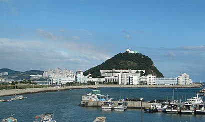
한국해양대학교 Address: 영도구 태종로 727 street in 영도구
- 한국해양대학교 혁신지구 캠퍼스,
- 한국해양대학교 자갈마당,
- 한국 해양과학 기술원,
- 국립해양박물관 해양도서관,
- Taejongdae Resort Park,
- Korean Institute Of Maritime and Fisheries Technology (KIMFT),
- 한국해양과학기술원 KIOST,
- 한국해양수산연수원 생활관,
- 한국해양수산연수원,
- 부산해양경찰서,
- 동삼교회앞삼거리,
- 태종대온천찜질방,
- 동삼절영3차아파트,
- 롯데리아 영도동삼점,
- 중리초등학교,
- 동삼동,
- 태종대불백,
- 태종대 자갈마당,
- 부산체고,
- 동삼동
Places Near 한국해양대학교 (영도구)
- 부산서부버스터미널, 사상구,
- 천성산온천 24시찜질방, 양산시,
- AAAAAAA, 남구,
- 용산초등학교, 남구,
- 부산 영도, 중구,
- 해운대 백병원, 해운대구,
- 물금역, 양산시,
- 시원청24시찜질방, 사상구,
- 김해공항 리무진버스 승차장,
- 양산부산대학교병원, 양산시,
- 이기대 공원, 남구,
- Pornhub.com, 연제구,
- 광안리해수욕장,
- 부산보훈병원, 사상구,
- 부산남부운전면허시험장, 남구,
- 부산시민장례식장, 부산진구,
- 황산문화체육공원, 양산시,
- 북부운전면허시험장, 사상구,
- Costco Wholesale (코스트코), 연제구,
- 해군작전사령부, 남구
How to get to popular places in Busan with public transit
Get around 영도구 by public transit!
Traveling around 영도구 has never been so easy. See step by step directions as you travel to any attraction, street or major public transit station. View bus and train schedules, arrival times, service alerts and detailed routes on a map, so you know exactly how to get to anywhere in 영도구.
When traveling to any destination around 영도구 use Moovit's Live Directions with Get Off Notifications to know exactly where and how far to walk, how long to wait for your line, and how many stops are left. Moovit will alert you when it's time to get off — no need to constantly re-check whether yours is the next stop.
Wondering how to use public transit in 영도구 or how to pay for public transit in 영도구? Moovit public transit app can help you navigate your way with public transit easily, and at minimum cost. It includes public transit fees, ticket prices, and costs. Looking for a map of 영도구 public transit lines? Moovit public transit app shows all public transit maps in 영도구 with all Bus, Metro and Light Rail routes and stops on an interactive map.
Busan has 3 transit type(s), including: Bus, Metro and Light Rail, operated by several transit agencies, including 부산교통공사, 일반버스, 급행버스, 심야버스(급행), 심야버스(일반), 좌석버스(산성), 좌석버스(장유) and 좌석버스(용원)