How to get to 0 & Locksmith by bus?
Click on the bus route to see step by step directions with maps, line arrival times and updated time schedules.
From City of Lauderdale Lakes, Fort Lauderdale
50 minFrom CCA Calvary Christian Academy, Fort Lauderdale
61 minFrom Coral Square Mall Shopping Center, Coral Springs-Margate
45 minFrom State Road 7 & West Sunrise Boulevard, Plantation
92 minFrom State Road 7 & West Sunrise Boulevard, Fort Lauderdale
60 minFrom Jay's Professional Enterprises, Fort Lauderdale
40 minFrom Sawgrass Mills Mall, Plantation
69 minFrom Florida Turnpike Sunrise Blvd. Toll Plaza, Plantation
81 minFrom N University Dr, Plantation
53 minFrom Lauderhill Mall, Plantation
55 min
Bus stops near 0 & Locksmith in Plantation
What are the closest stations to 0 & Locksmith?
The closest stations to 0 & Locksmith are:
- Commercial Boulevard & Nob Hill Road is 785 yards away, 10 min walk.
- McNab Road/Northwest 100th Avenue is 1997 yards away, 24 min walk.
Which bus lines stop near 0 & Locksmith?
These bus lines stop near 0 & Locksmith: 55, 62.
What’s the nearest bus station to 0 & Locksmith in Plantation?
The nearest bus station to 0 & Locksmith in Plantation is Commercial Boulevard & Nob Hill Road. It’s a 10 min walk away.
What time is the first bus to 0 & Locksmith in Plantation?
The 62 is the first bus that goes to 0 & Locksmith in Plantation. It stops nearby at 5:06 AM.
What time is the last bus to 0 & Locksmith in Plantation?
The 62 is the last bus that goes to 0 & Locksmith in Plantation. It stops nearby at 11:40 PM.
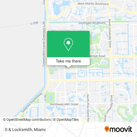
See 0 & Locksmith, Plantation, on the map
Public Transit to 0 & Locksmith in Plantation
Wondering how to get to 0 & Locksmith in Plantation? Moovit helps you find the best way to get to 0 & Locksmith with step-by-step directions from the nearest public transit station.
Moovit provides free maps and live directions to help you navigate through your city. View schedules, routes, timetables, and find out how long does it take to get to 0 & Locksmith in real time.
Looking for the nearest stop or station to 0 & Locksmith? Check out this list of stops closest to your destination: Commercial Boulevard & Nob Hill Road; McNab Road/Northwest 100th Avenue.
Bus: 55, 62.
Want to see if there’s another route that gets you there at an earlier time? Moovit helps you find alternative routes or times. Get directions from and directions to 0 & Locksmith easily from the Moovit App or Website.
We make riding to 0 & Locksmith easy, which is why over 1.5 million users, including users in Plantation, trust Moovit as the best app for public transit. You don’t need to download an individual bus app or train app, Moovit is your all-in-one transit app that helps you find the best bus time or train time available.
For information on prices of bus, costs and ride fares to 0 & Locksmith, please check the Moovit app.
Use the app to navigate to popular places including to the airport, hospital, stadium, grocery store, mall, coffee shop, school, college, and university.
0 & Locksmith Address: 9793 N Grand Duke Cir Tamarac, FL 33321 street in Plantation
- Shop Carpet,
- Ashthorpe,
- Life at William R Nash,
- Sonny's Carwash Signage by MR. Foamer,
- 7-Eleven,
- Shift4shop,
- Applegate Extreme Christmas,
- Elegant Edgings,
- Millennium 6-12 Collegiate Academy,
- Tamarac Public Works Department,
- Joyful Yoga,
- Valerie McVay DC,
- Car Locks & Keys Fort Lauderdale,
- Discover Fort Lauderdale with Local Stories From Autio,
- Car Wash Equipment & Supplies,
- Saratoga Veter,
- Guillero P.,
- MCCT Maranatha Community Church, Tamarac AG,
- Bellevue Pharamcy,
- Excelsior Charter of Broward
Places Near 0 & Locksmith (Plantation)
- Aventura Mall, Miami Beach,
- Dolphin Mall, Miami,
- Sawgrass Mall, Miami,
- Zoo Miami, Miami,
- Marlins Park, Miami,
- Richard E. Gerstein Justice Building, Miami,
- Bayside Marketplace, Miami,
- Dolphin Mall Bus, Miami,
- Wynwood, Miami,
- Hard Rock Stadium, Miami Gardens,
- Port of Miami Cruise Terminal, Miami,
- Miami Design District, Miami,
- Little Havana, Miami,
- Brickell City Centre, Miami,
- Miami VA Hospital, Miami,
- Keiser University Flagship Campus, West Palm Beach,
- Aventura Mall, Miami,
- Miami-Dade County Courthouse, Miami,
- Miami Freedom Park, Miami,
- Sawgrass mall ( FL ), Miami Beach
How to get to popular places in Miami with public transit
Get around Plantation by public transit!
Traveling around Plantation has never been so easy. See step by step directions as you travel to any attraction, street or major public transit station. View bus and train schedules, arrival times, service alerts and detailed routes on a map, so you know exactly how to get to anywhere in Plantation.
When traveling to any destination around Plantation use Moovit's Live Directions with Get Off Notifications to know exactly where and how far to walk, how long to wait for your line, and how many stops are left. Moovit will alert you when it's time to get off — no need to constantly re-check whether yours is the next stop.
Wondering how to use public transit in Plantation or how to pay for public transit in Plantation? Moovit public transit app can help you navigate your way with public transit easily, and at minimum cost. It includes public transit fees, ticket prices, and costs. Looking for a map of Plantation public transit lines? Moovit public transit app shows all public transit maps in Plantation with all Bus, Train, Light Rail and Ferry routes and stops on an interactive map.
Miami has 4 transit type(s), including: Bus, Train, Light Rail and Ferry, operated by several transit agencies, including Broward County Transit, Miami-Dade Transit, Metrorail, Palm Tran, Tri-Rail, Brightline, MARTY, City of Homestead Trolley, Key West Transit, Treasure Coast Connector, GoLine IRT, Amtrak, Greyhound-us, FlixBus-us and Aventura Express Shuttle Bus