Directions to 100p (Xaxim) with public transportation
The following transit lines have routes that pass near 100p
How to get to 100p by bus?
Click on the bus route to see step by step directions with maps, line arrival times and updated time schedules.
From Alphasonic, Batel
58 minFrom Hospital Inc, Campo Comprido
76 minFrom Park Shopping Barigui-Saída Estacionamento, Mossunguê
62 minFrom Avenida Prefeito Maurício Fruet 2150, Cajuru
48 minFrom HEMEPAR, Alto Da Rua XV
58 minFrom Aeroporto, São José Dos Pinhais
59 minFrom Rua Doutor Roberto Barrozo, São Francisco
51 minFrom INC, Campo Comprido
76 minFrom Rua Engenheiro Eduardo Afonso Nadolny, Cic
76 minFrom Rua Deputado Heitor Alencar Furtado, Mossunguê
61 min
Bus stops near 100p in Xaxim
Bus lines to 100p in Xaxim
What are the closest stations to 100p?
The closest stations to 100p are:
- R. Francisco Derosso, 1584 is 109 meters away, 2 min walk.
- R. Coronel Luiz José Dos Santos, 3707 is 221 meters away, 3 min walk.
- R. Francisco Derosso, 1938 is 362 meters away, 5 min walk.
Which bus lines stop near 100p?
These bus lines stop near 100p: 525 HAUER / CAPÃO RASO, 526 ITAMARATI / VILA SÃO PEDRO, 629 ALTO BOQUEIRÃO.
What’s the nearest bus station to 100p in Xaxim?
The nearest bus station to 100p in Xaxim is R. Francisco Derosso, 1584. It’s a 2 min walk away.
What time is the first bus to 100p in Xaxim?
The 519 MAD. SÃO FRANCISCO / IGUAPE is the first bus that goes to 100p in Xaxim. It stops nearby at 3:26 AM.
What time is the last bus to 100p in Xaxim?
The 519 MAD. SÃO FRANCISCO / IGUAPE is the last bus that goes to 100p in Xaxim. It stops nearby at 2:26 AM.
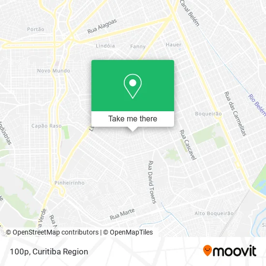
See 100p, Xaxim, on the map
Public Transit to 100p in Xaxim
Wondering how to get to 100p in Xaxim? Moovit helps you find the best way to get to 100p with step-by-step directions from the nearest public transit station.
Moovit provides free maps and live directions to help you navigate through your city. View schedules, routes, timetables, and find out how long does it take to get to 100p in real time.
Looking for the nearest stop or station to 100p? Check out this list of stops closest to your destination: R. Francisco Derosso; R. Coronel Luiz José Dos Santos; R. Francisco Derosso.
Bus: 525 HAUER / CAPÃO RASO, 526 ITAMARATI / VILA SÃO PEDRO, 629 ALTO BOQUEIRÃO, 519 MAD. SÃO FRANCISCO / IGUAPE.
Want to see if there’s another route that gets you there at an earlier time? Moovit helps you find alternative routes or times. Get directions from and directions to 100p easily from the Moovit App or Website.
We make riding to 100p easy, which is why over 1.5 million users, including users in Xaxim, trust Moovit as the best app for public transit. You don’t need to download an individual bus app or train app, Moovit is your all-in-one transit app that helps you find the best bus time or train time available.
For information on prices of bus, costs and ride fares to 100p, please check the Moovit app.
Use the app to navigate to popular places including to the airport, hospital, stadium, grocery store, mall, coffee shop, school, college, and university.
100p Address: Rua Cornelius Pries, 97 Xaxim Curitiba-PR 81830-090 street in Xaxim
- Diego Raimann,
- Simone Paes,
- Casalimpa,
- Jungles Store,
- Nega Polaca,
- Espaco Colorido,
- Limplus Comercio De Produtos De Limpeza,
- Limplus Comércio de Material de Limpeza,
- Trcon,
- Grcell,
- Kaleb Street Food,
- Kaleb Grill e Cia,
- Dvd Transportes,
- Loretto Engenharia,
- Camarim de Pintura Dido Festas,
- L L P Vidros,
- Mimo's and Sonhos,
- Green Apple Online English Course,
- Nascimento Transportes,
- Erapinturas Em Geral
Places Near 100p (Xaxim)
- Arena Da Baixada - Curitiba,
- Hospital Da Cruz Vermelha, Batel,
- Campo Largo, Campo,
- Jardim Botânico de Curitiba PR, Centro,
- Hospital Universitário Evangélico de Curitiba, Bigorrilho,
- Shopping Palladium, Portão,
- Rua Martim Afonso 558, Mercês,
- Jockey Plaza Shopping Center, Tarumã,
- Hospital do Rocio, Campo,
- Hhhhh, Fazendinha,
- Hospital Angelina Caron, Campina Grande Do Sul,
- Hospital Madalena Sofia, Bairro Alto,
- Shopping Estação, Rebouças,
- Parque Barigui, Mercês,
- Hospital Erasto Gaertner, Jardim Das Américas,
- Hospital Nossa Senhora Das Graças, Mercês,
- Rua General Mário Tourinho, Campina Do Siqueira,
- Park Shopping Barigüi, Mossunguê,
- Pontifícia Universidade Católica do Paraná (PUCPR), Prado Velho,
- Hospital de Clínicas (HC - UFPR), Centro
How to get to popular places in Curitiba Region with public transit
Get around Xaxim by public transit!
Traveling around Xaxim has never been so easy. See step by step directions as you travel to any attraction, street or major public transit station. View bus and train schedules, arrival times, service alerts and detailed routes on a map, so you know exactly how to get to anywhere in Xaxim.
When traveling to any destination around Xaxim use Moovit's Live Directions with Get Off Notifications to know exactly where and how far to walk, how long to wait for your line, and how many stops are left. Moovit will alert you when it's time to get off — no need to constantly re-check whether yours is the next stop.
Wondering how to use public transit in Xaxim or how to pay for public transit in Xaxim? Moovit public transit app can help you navigate your way with public transit easily, and at minimum cost. It includes public transit fees, ticket prices, and costs. Looking for a map of Xaxim public transit lines? Moovit public transit app shows all public transit maps in Xaxim with all Bus and Cable Car routes and stops on an interactive map.
Curitiba Region has 2 transit type(s), including: Bus and Cable Car, operated by several transit agencies, including Sistema Integrado de Mobilidade (URBS), Sistema Integrado de Mobilidade (AMEP), URBS (Cartões bancários e Dinheiro), URBS (Cartões bancários / Cartão URBS), AMEP (Cartões bancários / Cartão MetroCard), AMEP (Cartões bancários / Cartão MetroCard / Dinheiro), Viação Colombo (Dinheiro), TRIAR (Cartão TRIAR / Dinheiro), Empresa Curitiba Cerro Azul (Dinheiro), Expresso Nossa Senhora da Penha (Dinheiro), Empresa Campo Alto Tijucas (Dinheiro), Auto Viação São José (Cartão VEM / Dinheiro), BRT S/A (Cartão VEM / Dinheiro), TransPiedade (Cartão Cidadão / Dinheiro) and Oceânica Sul (Cartão Transporte / Dinheiro)