How to get to 102 by bus?
Click on the bus route to see step by step directions with maps, line arrival times and updated time schedules.
From Guinness Open Gate Brewery & Barrel House, Baltimore County
62 minFrom NSA Friendship Annex (FANX), Anne Arundel County
75 minFrom University Of Maryland Baltimore (Umbc), Baltimore County
45 minFrom Baltimore Polytechnic Institute, Baltimore
47 minFrom Reisterstown Road Plaza, Baltimore
67 minFrom MVA Glen Burnie, Anne Arundel County
36 minFrom Sinai Hospital, Baltimore
53 minFrom I-695 @ Exit 17 (Security Blvd/MD 122), Baltimore County
40 minFrom Pimlico Race Course, Baltimore
70 minFrom Baltimore Poly Tech High School, Baltimore
42 min
How to get to 102 by train?
Click on the train route to see step by step directions with maps, line arrival times and updated time schedules.
How to get to 102 by metro?
Click on the metro route to see step by step directions with maps, line arrival times and updated time schedules.
Bus stops near 102 in Baltimore
- Guilford Ave & Fayette St FS Sb, 2 min walk,VIEW
- Baltimore St & Calvert St, 2 min walk,VIEW
- Baltimore St & Calvert St FS Eb, 2 min walk,VIEW
- Calvert St & Redwood St Nb, 3 min walk,VIEW
- Calvert St & Baltimore St FS Nb, 3 min walk,VIEW
- Fayette St & Holliday St Wb, 4 min walk,VIEW
- Lombard St & Calvert St, 4 min walk,VIEW
- Commerce St (Wb), 4 min walk,VIEW
- Lexington St & Holliday St Eb, 4 min walk,VIEW
Metro station near 102 in Baltimore
- Charles Center Metro, 6 min walk,VIEW
Ferry station near 102 in Baltimore
- Pier Five, 10 min walk,VIEW
Light Rail stations near 102 in Baltimore
- Baltimore Arena (University Center), 11 min walk,VIEW
Bus lines to 102 in Baltimore
- CITYLINK YELLOW, Patapsco Station,VIEW
- 54, Clifton Park,VIEW
- 91, Mondawmin Station,VIEW
- 154, Hillendale,VIEW
- CITYLINK ORANGE, Essex - West Baltimore Marc,VIEW
- CITYLINK PURPLE, City Hall - Paradise/catonsville,VIEW
- CITYLINK RED, Downtown - Towson/lutherville,VIEW
- 67, Downtown - Marley Neck,VIEW
- 78, Downtown - Cms,VIEW
- 105, Cedonia - Downtown,VIEW
- 150, Columbia - Downtown/harbor East,VIEW
- 160, Downtown/hopkins - Essex,VIEW
- 210, 210/3 Annapolis/Baltimore,VIEW
- 215, 215/6 Baltimore,VIEW
- 310, 310/4 Johns Hopkins,VIEW
- 71, Downtown,VIEW
- 56, Downtown - White Marsh,VIEW
- 120, White Marsh - Downtown/hopkins,VIEW
- 76, Ccbc Catonsville,VIEW
- CITYLINK BROWN, Um Medical Center,VIEW
What are the closest stations to 102?
The closest stations to 102 are:
- Guilford Ave & Fayette St FS Sb is 92 yards away, 2 min walk.
- Baltimore St & Calvert St is 117 yards away, 2 min walk.
- Baltimore St & Calvert St FS Eb is 117 yards away, 2 min walk.
- Calvert St & Redwood St Nb is 197 yards away, 3 min walk.
- Calvert St & Baltimore St FS Nb is 198 yards away, 3 min walk.
- Fayette St & Holliday St Wb is 248 yards away, 4 min walk.
- Lombard St & Calvert St is 261 yards away, 4 min walk.
- Commerce St (Wb) is 282 yards away, 4 min walk.
- Lexington St & Holliday St Eb is 295 yards away, 4 min walk.
- Charles Center Metro is 460 yards away, 6 min walk.
- Pier Five is 813 yards away, 10 min walk.
- Baltimore Arena (University Center) is 892 yards away, 11 min walk.
Which bus lines stop near 102?
These bus lines stop near 102: 40, 54, 76, 91, CITYLINK ORANGE, CITYLINK PURPLE, CITYLINK RED, CITYLINK SILVER, CITYLINK YELLOW.
Which train line stops near 102?
MARC (Inbound - Penn)
Which metro line stops near 102?
METRO (Towards John Hopkins)
What’s the nearest light rail station to 102 in Baltimore?
The nearest light rail station to 102 in Baltimore is Baltimore Arena (University Center). It’s a 11 min walk away.
What’s the nearest metro station to 102 in Baltimore?
The nearest metro station to 102 in Baltimore is Charles Center Metro. It’s a 6 min walk away.
What’s the nearest bus station to 102 in Baltimore?
The nearest bus stations to 102 in Baltimore are Guilford Ave & Fayette St FS Sb, Baltimore St & Calvert St and Baltimore St & Calvert St FS Eb. The closest one is a 2 min walk away.
What’s the nearest ferry station to 102 in Baltimore?
The nearest ferry station to 102 in Baltimore is Pier Five. It’s a 10 min walk away.
What time is the first light rail to 102 in Baltimore?
The LIGHT RAILLINK is the first light rail that goes to 102 in Baltimore. It stops nearby at 3:56 AM.
What time is the last light rail to 102 in Baltimore?
The LIGHT RAILLINK is the last light rail that goes to 102 in Baltimore. It stops nearby at 1:20 AM.
What time is the first metro to 102 in Baltimore?
The METRO is the first metro that goes to 102 in Baltimore. It stops nearby at 5:07 AM.
What time is the last metro to 102 in Baltimore?
The METRO is the last metro that goes to 102 in Baltimore. It stops nearby at 12:27 AM.
What time is the first bus to 102 in Baltimore?
The CITYLINK YELLOW is the first bus that goes to 102 in Baltimore. It stops nearby at 3:05 AM.
What time is the last bus to 102 in Baltimore?
The CITYLINK YELLOW is the last bus that goes to 102 in Baltimore. It stops nearby at 3:25 AM.
What time is the first ferry to 102 in Baltimore?
The HC3 is the first ferry that goes to 102 in Baltimore. It stops nearby at 6:07 AM.
What time is the last ferry to 102 in Baltimore?
The HC3 is the last ferry that goes to 102 in Baltimore. It stops nearby at 8:07 PM.
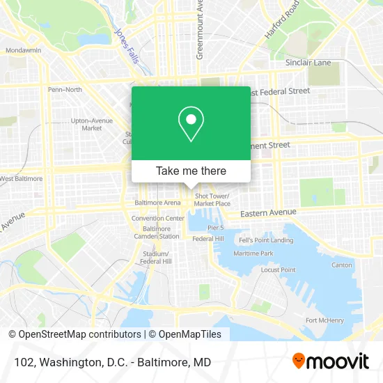
See 102, Baltimore, on the map
Public Transit to 102 in Baltimore
Wondering how to get to 102 in Baltimore? Moovit helps you find the best way to get to 102 with step-by-step directions from the nearest public transit station.
Moovit provides free maps and live directions to help you navigate through your city. View schedules, routes, timetables, and find out how long does it take to get to 102 in real time.
Looking for the nearest stop or station to 102? Check out this list of stops closest to your destination: Guilford Ave & Fayette St FS Sb; Baltimore St & Calvert St; Baltimore St & Calvert St FS Eb; Calvert St & Redwood St Nb; Calvert St & Baltimore St FS Nb; Fayette St & Holliday St Wb; Lombard St & Calvert St; Commerce St (Wb); Lexington St & Holliday St Eb; Charles Center Metro; Pier Five; Baltimore Arena (University Center).
Bus: 40, 54, 76, 91, CITYLINK ORANGE, CITYLINK PURPLE, CITYLINK RED, CITYLINK SILVER, CITYLINK YELLOW, 154, 67, 78, 210, 215, 310, 71.Train: MARC.Metro: METRO.Ferry: HC3.
Want to see if there’s another route that gets you there at an earlier time? Moovit helps you find alternative routes or times. Get directions from and directions to 102 easily from the Moovit App or Website.
We make riding to 102 easy, which is why over 1.5 million users, including users in Baltimore, trust Moovit as the best app for public transit. You don’t need to download an individual bus app or train app, Moovit is your all-in-one transit app that helps you find the best bus time or train time available.
For information on prices of bus, light rail, metro and train, costs and ride fares to 102, please check the Moovit app.
Use the app to navigate to popular places including to the airport, hospital, stadium, grocery store, mall, coffee shop, school, college, and university.
102 Address: 231 E Baltimore St #102, Baltimore, MD 21202, USA street in Baltimore
- City of Baltimore,
- Trademark Properties,
- Baltimore St & Calvert St FS Eb,
- Hotel RL Baltimore Inner Harbor,
- S Cal Cal St,
- Redwood Redwood St MD-2,
- Naing International Enterprises,
- Staybridge Suites Baltimore - Inner Harbor,
- Amos Transportation Black Car Service,
- South Beach Sandwicherie Food Truck,
- Cella,
- John C Baldwin Lawyer,
- Hampton Inn & Suites-Baltimore (Baltimore Harbor),
- Springhill Suites-Baltimore,
- E St & MD-2,
- Fayette St and Calvert St,
- Fayette & Calvert St,
- SpringHill Suites by Marriott Baltimore Downtown Inner Harbor,
- Andora's Healing Light,
- Crafty Crab Inner Harbor
Places Near 102 (Baltimore)
- National Museum of African American History and Culture, Washington,
- Pennsylvania Ave NW (3rd st and pennsylvania), Washington,
- Museum Of The Bible, Washington,
- Sibley Memorial Hospital, Washington,
- Westfield Montgomery Mall, Montgomery County,
- Basilica of the National Shrine, Washington,
- The Anthem, Washington,
- National Zoo, Washington,
- Amazon Hq2, Arlington County,
- Washington DC VA Medical Center, Washington,
- PG Mall, Prince George's County,
- Georgetown, Washington,
- National Mall, Washington,
- Camden Yards, Baltimore,
- M&T Bank Stadium, Baltimore,
- Rock Creek Tennis Center, Washington,
- Capital One Arena, Washington,
- Washington National Cathedral, Washington,
- Marriott Marquis Washington, DC, Washington,
- Warner Theatre, Washington
How to get to popular places in Washington, D.C. - Baltimore, MD with public transit
Get around Baltimore by public transit!
Traveling around Baltimore has never been so easy. See step by step directions as you travel to any attraction, street or major public transit station. View bus and train schedules, arrival times, service alerts and detailed routes on a map, so you know exactly how to get to anywhere in Baltimore.
When traveling to any destination around Baltimore use Moovit's Live Directions with Get Off Notifications to know exactly where and how far to walk, how long to wait for your line, and how many stops are left. Moovit will alert you when it's time to get off — no need to constantly re-check whether yours is the next stop.
Wondering how to use public transit in Baltimore or how to pay for public transit in Baltimore? Moovit public transit app can help you navigate your way with public transit easily, and at minimum cost. It includes public transit fees, ticket prices, and costs. Looking for a map of Baltimore public transit lines? Moovit public transit app shows all public transit maps in Baltimore with all Bus, Train, Metro, Light Rail and Ferry routes and stops on an interactive map.
Washington, D.C. - Baltimore, MD has 5 transit type(s), including: Bus, Train, Metro, Light Rail and Ferry, operated by several transit agencies, including WMATA, Montgomery County Ride On, Fairfax Connector, TheBus, PRTC, DASH - Alexandria, Arlington Transit (ART), RTA of Central Maryland, MDOT MTA, MDOT MTA Light RailLink, MDOT MTA Commuter Bus, MDOT MTA Local Bus, FXBGO!, Virginia Railway Express (VRE) and MARC