How to get to 12 Panel Now by bus?
Click on the bus route to see step by step directions with maps, line arrival times and updated time schedules.
From Palm Beach State College, Lake Worth
34 minFrom Forest Hill Community High School, West Palm Beach
56 minFrom John I. Leonard High School, Lake Worth
57 minFrom Greenacres, FL, Lake Worth
60 minFrom Brazzers, Boca Raton
59 minFrom Lake Worth Tri Rail Station, Lake Worth
43 minFrom I-95, Boynton Beach-Delray Beach
58 minFrom JFK Medical Center, Lake Worth
26 minFrom 1661B South Congress Avenue, Lake Worth
41 min
Bus stops near 12 Panel Now in Boynton Beach-Delray Beach
Bus lines to 12 Panel Now in Boynton Beach-Delray Beach
What are the closest stations to 12 Panel Now?
The closest stations to 12 Panel Now are:
- WINCHESTER BLVD at OLD NAVY is 531 yards away, 7 min walk.
- CONGRESS AVE at BBCH MALL EN is 635 yards away, 8 min walk.
- CONGRESS AVE at BOYNTON TWN CTR is 676 yards away, 9 min walk.
Which bus lines stop near 12 Panel Now?
These bus lines stop near 12 Panel Now: 2, 73.
What’s the nearest bus station to 12 Panel Now in Boynton Beach-Delray Beach?
The nearest bus station to 12 Panel Now in Boynton Beach-Delray Beach is WINCHESTER BLVD at OLD NAVY. It’s a 7 min walk away.
What time is the first bus to 12 Panel Now in Boynton Beach-Delray Beach?
The 73 is the first bus that goes to 12 Panel Now in Boynton Beach-Delray Beach. It stops nearby at 5:32 AM.
What time is the last bus to 12 Panel Now in Boynton Beach-Delray Beach?
The 2 is the last bus that goes to 12 Panel Now in Boynton Beach-Delray Beach. It stops nearby at 10:41 PM.
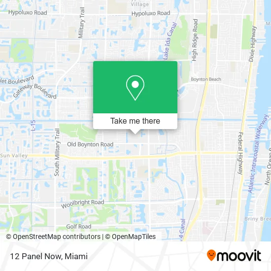
See 12 Panel Now, Boynton Beach-Delray Beach, on the map
Public Transit to 12 Panel Now in Boynton Beach-Delray Beach
Wondering how to get to 12 Panel Now in Boynton Beach-Delray Beach? Moovit helps you find the best way to get to 12 Panel Now with step-by-step directions from the nearest public transit station.
Moovit provides free maps and live directions to help you navigate through your city. View schedules, routes, timetables, and find out how long does it take to get to 12 Panel Now in real time.
Looking for the nearest stop or station to 12 Panel Now? Check out this list of stops closest to your destination: WINCHESTER BLVD at OLD NAVY; CONGRESS AVE at BBCH MALL EN; CONGRESS AVE at BOYNTON TWN CTR.
Bus: 2, 73, 4.
Want to see if there’s another route that gets you there at an earlier time? Moovit helps you find alternative routes or times. Get directions from and directions to 12 Panel Now easily from the Moovit App or Website.
We make riding to 12 Panel Now easy, which is why over 1.5 million users, including users in Boynton Beach-Delray Beach, trust Moovit as the best app for public transit. You don’t need to download an individual bus app or train app, Moovit is your all-in-one transit app that helps you find the best bus time or train time available.
For information on prices of bus and train, costs and ride fares to 12 Panel Now, please check the Moovit app.
Use the app to navigate to popular places including to the airport, hospital, stadium, grocery store, mall, coffee shop, school, college, and university.
12 Panel Now Address: 801 N Congress Ave Boynton Beach, FL 33436 street in Boynton Beach-Delray Beach
- Stay Sharp Lux,
- Eye Glass World,
- Christ Fellowship,
- Champs Sports,
- Perfume Collection,
- Capoeira Karkara,
- Plumb Gold,
- Boba Tea Corner,
- Comcast Cable Sales,
- Annie's Cookie Factory,
- Tropical Favors +Flavors,
- Sprint,
- Arch Telecom Boynton B,
- Budget,
- Affair of the Arts,
- Artesania Zunun,
- Macy's Furniture Gallery,
- Roxy's Jewelry,
- Holiday Market,
- Shell Bell's Beauty
Places Near 12 Panel Now (Boynton Beach-Delray Beach)
- Brickell City Centre, Miami,
- Sawgrass mall ( FL ), Miami Beach,
- Dolphin Mall Bus, Miami,
- Marlins Park, Miami,
- Sawgrass Mall, Miami,
- Miami Freedom Park, Miami,
- Little Havana, Miami,
- Miami-Dade County Courthouse, Miami,
- Dolphin Mall, Miami,
- Miami VA Hospital, Miami,
- Port of Miami Cruise Terminal, Miami,
- Hard Rock Stadium, Miami Gardens,
- Aventura Mall, Miami,
- Wynwood, Miami,
- Bayside Marketplace, Miami,
- Miami Design District, Miami,
- Richard E. Gerstein Justice Building, Miami,
- Keiser University Flagship Campus, West Palm Beach,
- Aventura Mall, Miami Beach,
- Zoo Miami, Miami
How to get to popular places in Miami with public transit
Get around Boynton Beach-Delray Beach by public transit!
Traveling around Boynton Beach-Delray Beach has never been so easy. See step by step directions as you travel to any attraction, street or major public transit station. View bus and train schedules, arrival times, service alerts and detailed routes on a map, so you know exactly how to get to anywhere in Boynton Beach-Delray Beach.
When traveling to any destination around Boynton Beach-Delray Beach use Moovit's Live Directions with Get Off Notifications to know exactly where and how far to walk, how long to wait for your line, and how many stops are left. Moovit will alert you when it's time to get off — no need to constantly re-check whether yours is the next stop.
Wondering how to use public transit in Boynton Beach-Delray Beach or how to pay for public transit in Boynton Beach-Delray Beach? Moovit public transit app can help you navigate your way with public transit easily, and at minimum cost. It includes public transit fees, ticket prices, and costs. Looking for a map of Boynton Beach-Delray Beach public transit lines? Moovit public transit app shows all public transit maps in Boynton Beach-Delray Beach with all Bus, Train, Light Rail and Ferry routes and stops on an interactive map.
Miami has 4 transit type(s), including: Bus, Train, Light Rail and Ferry, operated by several transit agencies, including Broward County Transit, Miami-Dade Transit, Metrorail, Palm Tran, Tri-Rail, Brightline, MARTY, City of Homestead Trolley, Key West Transit, Treasure Coast Connector, GoLine IRT, Amtrak, Greyhound-us, FlixBus-us and Aventura Express Shuttle Bus