How to get to 15halim by bus?
Click on the bus route to see step by step directions with maps, line arrival times and updated time schedules.
From Raoul Wallenberg, Tel Aviv-Yafo
44 minFrom Menachem Begin Park, Tel Aviv-Yafo
75 minFrom Ramat Gan National Park, Ramat Gan
52 minFrom Bialik, Ramat Gan
45 minFrom Peace Road, Tel Aviv-Yafo
39 minFrom National Insurance Institute Ramat Gan Branch, Ramat Gan
45 minFrom Dudaim Halls, Bnei Brak
40 minFrom Nachshonim Camp, Hevel Modi'in Regional Council
60 minFrom Pinchas Rosen, Tel Aviv-Yafo
50 minFrom 23 Bar Kochba, Bnei Brak
41 min
Bus stops near 15halim in Nechalim
Bus lines to 15halim in Nechalim
What are the closest stations to 15halim?
The closest stations to 15halim are:
- Tzarchaniya is 265 meters away, 4 min walk.
- Road 40/Nechalim Junction is 1222 meters away, 16 min walk.
Which bus lines stop near 15halim?
These bus lines stop near 15halim: 180, 249, 472, 85.
What’s the nearest bus station to 15halim in Nechalim?
The nearest bus station to 15halim in Nechalim is Tzarchaniya. It’s a 4 min walk away.
What time is the first bus to 15halim in Nechalim?
The 84 is the first bus that goes to 15halim in Nechalim. It stops nearby at 5:11 AM.
What time is the last bus to 15halim in Nechalim?
The 249 is the last bus that goes to 15halim in Nechalim. It stops nearby at 11:54 PM.
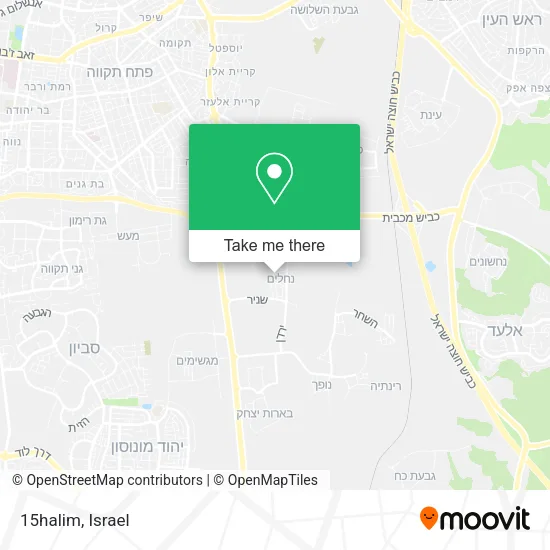
See 15halim, Nechalim, on the map
Public Transit to 15halim in Nechalim
Wondering how to get to 15halim in Nechalim? Moovit helps you find the best way to get to 15halim with step-by-step directions from the nearest public transit station.
Moovit provides free maps and live directions to help you navigate through your city. View schedules, routes, timetables, and find out how long does it take to get to 15halim in real time.
Looking for the nearest stop or station to 15halim? Check out this list of stops closest to your destination: Tzarchaniya; Road 40/Nechalim Junction.
Bus: 180, 249, 472, 85, 84, 84A, 78, 78A, 872.
Want to see if there’s another route that gets you there at an earlier time? Moovit helps you find alternative routes or times. Get directions from and directions to 15halim easily from the Moovit App or Website.
We make riding to 15halim easy, which is why over 1.5 million users, including users in Nechalim, trust Moovit as the best app for public transit. You don’t need to download an individual bus app or train app, Moovit is your all-in-one transit app that helps you find the best bus time or train time available.
For information on prices of bus, costs and ride fares to 15halim, please check the Moovit app.
Use the app to navigate to popular places including to the airport, hospital, stadium, grocery store, mall, coffee shop, school, college, and university.
15halim Address: 15halim, לשם 1, נחלים, ישראל street in Nechalim
- Shelter - Nahalim, Hermon,
- Nahalim Shelter,
- Nahalim Shelter,
- Shelter - Nahalim, Hermon,
- Shelter - Nahalim, Hermon,
- Nahalim Shelter,
- Ballot 2.2 Beit Ha'am-Beit Danny Nechalim,
- Nachalim Secretariat,
- Neta in the Chocolate Path,
- Everything for Nahalim Garden,
- Bnei Akiva Yeshiva Nahalim,
- Shelter - Nahalim, Snir,
- Danny Glai Second-Hand Furniture,
- 42,
- Shelter - Nahalim,
- Markovich Dairy - Land of Milk,
- Shelter - Nahalim, Snir,
- Nahalim Shelter,
- Nehardea Yeshiva,
- Nahalim Shelter
Places Near 15halim (Nechalim)
- Moovit Office, Nes Ziona,
- Tel Hashomer Base, Ramat Gan,
- Southern Medical Center, Ramat Negev Regional Council,
- Bloomfield Stadium, Tel Aviv-Yafo,
- Azrieli, Tel Aviv-Yafo,
- Assuta Hospital - Ramat HaHayal, Tel Aviv-Yafo,
- HaKotel, Jerusalem,
- Ramat Gan Stadium, Ramat Gan,
- Expo Tel Aviv, Tel Aviv-Yafo,
- Yarkon Park, Tel Aviv-Yafo,
- Glilot Complex, Hof HaSharon Regional Council,
- Tel HaShomer North Gate, Ramat Gan,
- Beilinson Hospital, Petah Tikva,
- Kashcafe, Kiryat Ata,
- Menora Mivtachim Arena, Tel Aviv-Yafo,
- Bislach 17, Ramat Negev Regional Council,
- Carmel Market, Tel Aviv-Yafo,
- Ichilov Hospital, Tel Aviv-Yafo,
- Dizengoff Center, Tel Aviv-Yafo,
- Gideon Camp - Military Base 7, Emek Lod Regional Council
How to get to popular places in Israel with public transit
Get around Nechalim by public transit!
Traveling around Nechalim has never been so easy. See step by step directions as you travel to any attraction, street or major public transit station. View bus and train schedules, arrival times, service alerts and detailed routes on a map, so you know exactly how to get to anywhere in Nechalim.
When traveling to any destination around Nechalim use Moovit's Live Directions with Get Off Notifications to know exactly where and how far to walk, how long to wait for your line, and how many stops are left. Moovit will alert you when it's time to get off — no need to constantly re-check whether yours is the next stop.
Wondering how to use public transit in Nechalim or how to pay for public transit in Nechalim? Moovit public transit app can help you navigate your way with public transit easily, and at minimum cost. It includes public transit fees, ticket prices, and costs. Looking for a map of Nechalim public transit lines? Moovit public transit app shows all public transit maps in Nechalim with all Bus, Israel Railways, Light Rail, Carmelit / Rachbalit and Shuttle routes and stops on an interactive map.
Israel has 5 transit type(s), including: Bus, Israel Railways, Light Rail, Carmelit / Rachbalit and Shuttle, operated by several transit agencies, including Dan, Tel Aviv Light Rail - Tevel - Red Line, Israel Railways, Egged, Metropoline, Kavim, Electra Afikim, Nateev Express, Extra, Extra Jerusalem, Jerusalem Light Rail - Kfir, Egged Jerusalem Envelope Route, Dan Badarom, Dan Beer-Sheva and Electra Afikim Transport