How to get to 174 by bus?
Click on the bus route to see step by step directions with maps, line arrival times and updated time schedules.
From Walmart Supercenter, Washington
54 minFrom Sheraton Pentagon City Hotel, Arlington County
63 minFrom Knollwood, Washington
82 minFrom Hilton Alexandria Old Town, Alexandria
71 minFrom Embassy of France, Washington
47 minFrom Sibley Memorial Hospital, Washington
68 minFrom Alfred Street Baptist Church, Alexandria
65 minFrom Comet Ping Pong, Washington
62 minFrom The Catholic University Of America, Washington
49 minFrom British Embassy, Washington
75 min
How to get to 174 by train?
Click on the train route to see step by step directions with maps, line arrival times and updated time schedules.
How to get to 174 by metro?
Click on the metro route to see step by step directions with maps, line arrival times and updated time schedules.
Bus stops near 174 in Washington
Train station near 174 in Washington
- Union Station, 14 min walk,VIEW
Bus lines to 174 in Washington
- D10, West To Foggy Bottom,VIEW
- 230, 230/8 Severna Park,VIEW
- 250, 250/4 Washington Dc,VIEW
- 305, 305/6 Columbia,VIEW
- 325, 325/6 Columbia,VIEW
- 335, 335/1 Washington Dc,VIEW
- 345, 345/2 Washington Dc,VIEW
- 630, 630/10 La Plata,VIEW
- 725, 725/4 California,VIEW
- 810, 810/2 Washington Dc,VIEW
- 820, 820/2 Washington Dc,VIEW
- 830, 830/3 Washington Dc,VIEW
- 840, 840/7 Prince Frederick / St Leonard,VIEW
- D1X, East To Naylor Rd,VIEW
- C55, West To L'Enfant Plaza,VIEW
What are the closest stations to 174?
The closest stations to 174 are:
- SW Independence Av & SW Capital Pz is 118 yards away, 2 min walk.
- Independence Ave & New Jersey Ave SE Wb is 119 yards away, 2 min walk.
- Independence Ave & 1st St SE Wb is 323 yards away, 4 min walk.
- Independence Av Se+1 St SE is 336 yards away, 5 min walk.
- Capital South is 518 yards away, 7 min walk.
- 4 St Ne+E Capitol St NE is 897 yards away, 11 min walk.
- Union Station is 1160 yards away, 14 min walk.
Which bus lines stop near 174?
These bus lines stop near 174: D10, D30.
Which train line stops near 174?
NORTHEAST REGIONAL (Boston)
Which metro lines stop near 174?
These metro lines stop near 174: BLUE, ORANGE, RED, SILVER.
What’s the nearest metro station to 174 in Washington?
The nearest metro station to 174 in Washington is Capital South. It’s a 7 min walk away.
What’s the nearest train station to 174 in Washington?
The nearest train station to 174 in Washington is Union Station. It’s a 14 min walk away.
What’s the nearest bus station to 174 in Washington?
The nearest bus stations to 174 in Washington are SW Independence Av & SW Capital Pz and Independence Ave & New Jersey Ave SE Wb. The closest one is a 2 min walk away.
What time is the first metro to 174 in Washington?
The BLUE is the first metro that goes to 174 in Washington. It stops nearby at 5:14 AM.
What time is the last metro to 174 in Washington?
The SILVER is the last metro that goes to 174 in Washington. It stops nearby at 12:12 AM.
What time is the first train to 174 in Washington?
The ACELA is the first train that goes to 174 in Washington. It stops nearby at 5:00 AM.
What time is the last train to 174 in Washington?
The SILVER METEOR is the last train that goes to 174 in Washington. It stops nearby at 7:10 AM.
What time is the first bus to 174 in Washington?
The D10 is the first bus that goes to 174 in Washington. It stops nearby at 3:01 AM.
What time is the last bus to 174 in Washington?
The D10 is the last bus that goes to 174 in Washington. It stops nearby at 3:15 AM.
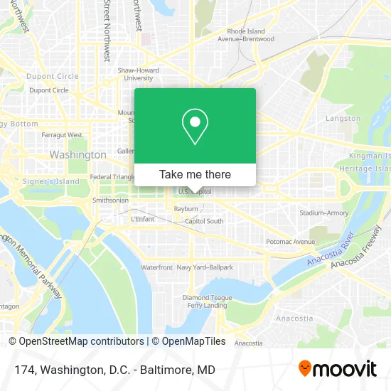
See 174, Washington, on the map
Public Transit to 174 in Washington
Wondering how to get to 174 in Washington? Moovit helps you find the best way to get to 174 with step-by-step directions from the nearest public transit station.
Moovit provides free maps and live directions to help you navigate through your city. View schedules, routes, timetables, and find out how long does it take to get to 174 in real time.
Looking for the nearest stop or station to 174? Check out this list of stops closest to your destination: SW Independence Av & SW Capital Pz; Independence Ave & New Jersey Ave SE Wb; Independence Ave & 1st St SE Wb; Independence Av Se+1 St SE; Capital South; 4 St Ne+E Capitol St NE; Union Station.
Bus: D10, D30, 230, 250, 305, 325, 335, 345, 630.Train: NORTHEAST REGIONAL, ACELA, CARDINAL, CAROLINIAN, CRESCENT, FLORIDIAN.Metro: BLUE, ORANGE, RED, SILVER.
Want to see if there’s another route that gets you there at an earlier time? Moovit helps you find alternative routes or times. Get directions from and directions to 174 easily from the Moovit App or Website.
We make riding to 174 easy, which is why over 1.5 million users, including users in Washington, trust Moovit as the best app for public transit. You don’t need to download an individual bus app or train app, Moovit is your all-in-one transit app that helps you find the best bus time or train time available.
For information on prices of bus, metro and train, costs and ride fares to 174, please check the Moovit app.
Use the app to navigate to popular places including to the airport, hospital, stadium, grocery store, mall, coffee shop, school, college, and university.
174 Address: Capitol Circle Drive street in Washington
- HVC-215, Capitol Visitors Center,
- HVC 201 Conference Room,
- H-140 The Capitol,
- US Capitol Visitor Center (The Capitol Building),
- The Porch @ Speaker's Balcony,
- First Street and East Capitol Street NE,
- Emancipation Hall,
- U.S. Capitol Visitor Center,
- 165,
- Longworth House Office Building,
- Us Capitol,
- Dunkin Donuts - Longworth,
- The Court of Neptune Fountain Sculpture,
- The Court Of Neptune Fountain,
- Cannon House Office Building,
- U.S. Senate,
- U.S. Capitol Complex SVC-209,
- Rayburn Foyer,
- A Capitol Fourth,
- U.S. Capitol Rotunda Steps
Places Near 174 (Washington)
- Rock Creek Tennis Center, Washington,
- Washington National Cathedral, Washington,
- Museum Of The Bible, Washington,
- Washington DC VA Medical Center, Washington,
- Amazon Hq2, Arlington County,
- Marriott Marquis Washington, DC, Washington,
- Camden Yards, Baltimore,
- Pennsylvania Ave NW (3rd st and pennsylvania), Washington,
- Westfield Montgomery Mall, Montgomery County,
- PG Mall, Prince George's County,
- Warner Theatre, Washington,
- Georgetown, Washington,
- M&T Bank Stadium, Baltimore,
- The Anthem, Washington,
- Basilica of the National Shrine, Washington,
- Capital One Arena, Washington,
- National Zoo, Washington,
- National Museum of African American History and Culture, Washington,
- National Theatre, Washington,
- Sibley Memorial Hospital, Washington
How to get to popular places in Washington, D.C. - Baltimore, MD with public transit
Get around Washington by public transit!
Traveling around Washington has never been so easy. See step by step directions as you travel to any attraction, street or major public transit station. View bus and train schedules, arrival times, service alerts and detailed routes on a map, so you know exactly how to get to anywhere in Washington.
When traveling to any destination around Washington use Moovit's Live Directions with Get Off Notifications to know exactly where and how far to walk, how long to wait for your line, and how many stops are left. Moovit will alert you when it's time to get off — no need to constantly re-check whether yours is the next stop.
Wondering how to use public transit in Washington or how to pay for public transit in Washington? Moovit public transit app can help you navigate your way with public transit easily, and at minimum cost. It includes public transit fees, ticket prices, and costs. Looking for a map of Washington public transit lines? Moovit public transit app shows all public transit maps in Washington with all Bus, Train, Metro, Light Rail and Ferry routes and stops on an interactive map.
Washington, D.C. - Baltimore, MD has 5 transit type(s), including: Bus, Train, Metro, Light Rail and Ferry, operated by several transit agencies, including WMATA, Montgomery County Ride On, Fairfax Connector, TheBus, PRTC, DASH - Alexandria, Arlington Transit (ART), RTA of Central Maryland, MDOT MTA, MDOT MTA Light RailLink, MDOT MTA Commuter Bus, MDOT MTA Local Bus, FXBGO!, Virginia Railway Express (VRE) and MARC