Directions to 1944 S Chateau St (Wichita) with public transportation
The following transit lines have routes that pass near 1944 S Chateau St
 Bus: ROUTE22: S BDWY-, SOUTHEAST HIGH.
How to get to 1944 S Chateau St by bus?
Click on the bus route to see step by step directions with maps, line arrival times and updated time schedules.
From Michele M. Riggins, MD, Wichita
65 minFrom Exit 7B/9th Street/N, Wichita
76 minFrom Simba Dojang Taekwon-do Academy, Wichita
36 minFrom Nathan Pfeifer, MD, Wichita
69 minFrom Cpi Technologies, Wichita
61 minFrom Tacos Y Gorditas Torres, Wichita
40 minFrom Bennett Packaging, Wichita
68 minFrom S Fountain St, Wichita
54 minFrom Robin Wiggans, Wichita
80 min
Bus stop near 1944 S Chateau St in Wichita
- Harry And Smithmoor Ob, 8 min walk,VIEW
Bus lines to 1944 S Chateau St in Wichita
What are the closest stations to 1944 S Chateau St?
The closest stations to 1944 S Chateau St are:
- Harry And Smithmoor Ob is 636 yards away, 8 min walk.
Which bus line stops near 1944 S Chateau St?
ROUTE22: S BDWY- (2201ob)
What’s the nearest bus station to 1944 S Chateau St in Wichita?
The nearest bus station to 1944 S Chateau St in Wichita is Harry And Smithmoor Ob. It’s a 8 min walk away.
What time is the first bus to 1944 S Chateau St in Wichita?
The ROUTE22: S BDWY- is the first bus that goes to 1944 S Chateau St in Wichita. It stops nearby at 5:27 AM.
What time is the last bus to 1944 S Chateau St in Wichita?
The ROUTE22: S BDWY- is the last bus that goes to 1944 S Chateau St in Wichita. It stops nearby at 9:58 PM.
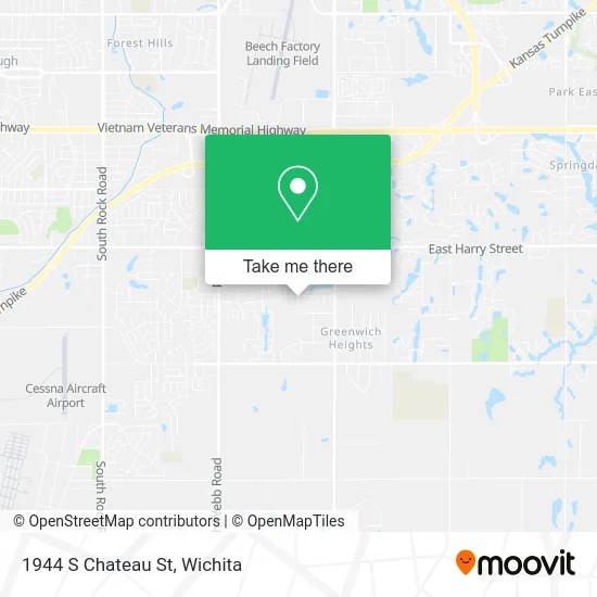
See 1944 S Chateau St, Wichita, on the map
Public Transit to 1944 S Chateau St in Wichita
Wondering how to get to 1944 S Chateau St in Wichita? Moovit helps you find the best way to get to 1944 S Chateau St with step-by-step directions from the nearest public transit station.
Moovit provides free maps and live directions to help you navigate through your city. View schedules, routes, timetables, and find out how long does it take to get to 1944 S Chateau St in real time.
Looking for the nearest stop or station to 1944 S Chateau St? Check out this list of stops closest to your destination: Harry And Smithmoor Ob.
Bus: ROUTE22: S BDWY-, SOUTHEAST HIGH.
Want to see if there’s another route that gets you there at an earlier time? Moovit helps you find alternative routes or times. Get directions from and directions to 1944 S Chateau St easily from the Moovit App or Website.
We make riding to 1944 S Chateau St easy, which is why over 1.5 million users, including users in Wichita, trust Moovit as the best app for public transit. You don’t need to download an individual bus app or train app, Moovit is your all-in-one transit app that helps you find the best bus time or train time available.
For information on prices of bus, costs and ride fares to 1944 S Chateau St, please check the Moovit app.
Use the app to navigate to popular places including to the airport, hospital, stadium, grocery store, mall, coffee shop, school, college, and university.
1944 S Chateau St Address: Wichita, KS 67207 street in Wichita
- Enviroproducts,
- MDR Homes,
- Twin Beauty Salon,
- Pk Industrial,
- Jacobson Karry,
- VinFast Wichita,
- Global Superior Personnel,
- Ap Insurance Group LLC,
- Consolidated Fuel,
- Kenmore Factory Certified Appliance Repair,
- smart Start Daycare,
- TACO BELL,
- Olive Tree Catering,
- DQ Grill & Chill Restaurant,
- RE/MAX,
- Breathe Physical Therapy,
- Healthy Green Nutrition (Healthy Green KS),
- Kathy Richard Ins Agy,
- Ada Marciniak NCTMB,
- Capital Exponent
Places Near 1944 S Chateau St (Wichita)
- Four Corners Cafe @ Wesley Medical Center, Wichita,
- Spirit AeroSystems, Bldg 2-280J (Section 9),
- McConnell Air Force Base, Mcconnell Afb,
- Bmer Tech Automotive, Wichita,
- Afghan Halal Market, Wichita,
- East 21st Street North and Webb Road, Wichita,
- Ratcliff Auto and Truck Repair, Wichita,
- Paige Place Apartments, Wichita,
- Wichita Dwight D. Eisenhower National Airport (ICT) (Wichita Eisenhower National Airport), Wichita,
- Westside Athletic Field (Friends University Baseball Field), Wichita,
- 21st & Maize, Wichita,
- Lopez Services, Wichita,
- Towne East Mall, Wichita,
- Spirit Aerosystems,
- Ascencion Via Christi Hospital St Francis, Wichita,
- Hubb's glory hole, Wichita,
- North High School, Wichita,
- Spirit Aerosystems Inc, Building 1-198D,
- Total Card Solutions, Wichita,
- Sena African Hair Braiding LLC, Wichita
How to get to popular places in Wichita with public transit
Get around Wichita by public transit!
Traveling around Wichita has never been so easy. See step by step directions as you travel to any attraction, street or major public transit station. View bus and train schedules, arrival times, service alerts and detailed routes on a map, so you know exactly how to get to anywhere in Wichita.
When traveling to any destination around Wichita use Moovit's Live Directions with Get Off Notifications to know exactly where and how far to walk, how long to wait for your line, and how many stops are left. Moovit will alert you when it's time to get off — no need to constantly re-check whether yours is the next stop.
Wondering how to use public transit in Wichita or how to pay for public transit in Wichita? Moovit public transit app can help you navigate your way with public transit easily, and at minimum cost. It includes public transit fees, ticket prices, and costs. Looking for a map of Wichita public transit lines? Moovit public transit app shows all public transit maps in Wichita with all bus routes and stops on an interactive map.
Wichita has 1 transit type(s), including: bus, operated by several transit agencies, including Wichita Transit, Greyhound-us and FlixBus-us