How to get to 1st Insurance Solution by bus?
Click on the bus route to see step by step directions with maps, line arrival times and updated time schedules.
From Brightline West Palm Beach, West Palm Beach
47 minFrom Mar a Lago, West Palm Beach
93 minFrom Tri-Rail-West Palm Beach Station, West Palm Beach
42 minFrom Palm Beach County Convention Center, West Palm Beach
49 minFrom Mar A Lago Building, West Palm Beach
92 minFrom JFK Medical Center, West Palm Beach
77 minFrom Singer Island, West Palm Beach
66 minFrom 1661B South Congress Avenue, Lake Worth
69 minFrom Forest Hill Community High School, West Palm Beach
69 minFrom South Florida Fairgrounds, Royal Palm Beach-West Jupiter
69 min
Bus stops near 1st Insurance Solution in West Palm Beach
Train station near 1st Insurance Solution in West Palm Beach
- Mangonia Park Station, 50 min walk,VIEW
Bus lines to 1st Insurance Solution in West Palm Beach
What are the closest stations to 1st Insurance Solution?
The closest stations to 1st Insurance Solution are:
- MILITARY TRL at 45TH ST SW is 233 yards away, 3 min walk.
- 45TH ST at MILITARY TRL is 395 yards away, 5 min walk.
- HAVERHILL RD at MARCIA PL is 907 yards away, 11 min walk.
- Mangonia Park Station is 4275 yards away, 50 min walk.
Which bus lines stop near 1st Insurance Solution?
These bus lines stop near 1st Insurance Solution: 3, 31.
What’s the nearest bus station to 1st Insurance Solution in West Palm Beach?
The nearest bus station to 1st Insurance Solution in West Palm Beach is MILITARY TRL at 45TH ST SW. It’s a 3 min walk away.
What time is the first train to 1st Insurance Solution in West Palm Beach?
The TRIRAIL is the first train that goes to 1st Insurance Solution in West Palm Beach. It stops nearby at 3:50 AM.
What time is the last train to 1st Insurance Solution in West Palm Beach?
The TRIRAIL is the last train that goes to 1st Insurance Solution in West Palm Beach. It stops nearby at 11:45 PM.
What time is the first bus to 1st Insurance Solution in West Palm Beach?
The 3 is the first bus that goes to 1st Insurance Solution in West Palm Beach. It stops nearby at 5:13 AM.
What time is the last bus to 1st Insurance Solution in West Palm Beach?
The 3 is the last bus that goes to 1st Insurance Solution in West Palm Beach. It stops nearby at 10:25 PM.
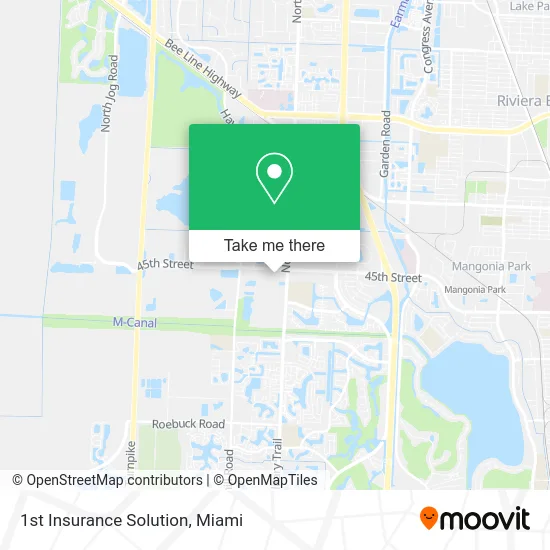
See 1st Insurance Solution, West Palm Beach, on the map
Public Transit to 1st Insurance Solution in West Palm Beach
Wondering how to get to 1st Insurance Solution in West Palm Beach? Moovit helps you find the best way to get to 1st Insurance Solution with step-by-step directions from the nearest public transit station.
Moovit provides free maps and live directions to help you navigate through your city. View schedules, routes, timetables, and find out how long does it take to get to 1st Insurance Solution in real time.
Looking for the nearest stop or station to 1st Insurance Solution? Check out this list of stops closest to your destination: MILITARY TRL at 45TH ST SW; 45TH ST at MILITARY TRL; HAVERHILL RD at MARCIA PL; Mangonia Park Station.
Bus: 3, 31, 4.Train: TRIRAIL.
Want to see if there’s another route that gets you there at an earlier time? Moovit helps you find alternative routes or times. Get directions from and directions to 1st Insurance Solution easily from the Moovit App or Website.
We make riding to 1st Insurance Solution easy, which is why over 1.5 million users, including users in West Palm Beach, trust Moovit as the best app for public transit. You don’t need to download an individual bus app or train app, Moovit is your all-in-one transit app that helps you find the best bus time or train time available.
For information on prices of bus, costs and ride fares to 1st Insurance Solution, please check the Moovit app.
Use the app to navigate to popular places including to the airport, hospital, stadium, grocery store, mall, coffee shop, school, college, and university.
1st Insurance Solution Address: 5335 N Military Trl West Palm Beach, FL 33407 street in West Palm Beach
- Foodtown Supermarket,
- Mahogany Natural Hair Salon & Spa,
- Coinstar,
- Boost Mobile,
- Au Belle Lashes & Brows,
- Coconut Hibiscus Treatment,
- T-Mobile,
- Innovative Tile TLC,
- Velocity Auto Sales,
- X-Treme Awnings & Welding,
- Ace Auto & Lite Truck Repairs Inc.,
- TACO BELL,
- DUNKIN',
- The Ballpark of the Palm Beaches,
- Shammah Baptist Worksh,
- Pro Door Service Fl,
- Western Union,
- Imeca Riviera,
- Intown Suites Extended Stay West Palm Beach Fl,
- 45th Street & Haverhill Road
Places Near 1st Insurance Solution (West Palm Beach)
- Miami VA Hospital, Miami,
- Dolphin Mall, Miami,
- Bayside Marketplace, Miami,
- Aventura Mall, Miami,
- Keiser University Flagship Campus, West Palm Beach,
- Richard E. Gerstein Justice Building, Miami,
- Marlins Park, Miami,
- Sawgrass mall ( FL ), Miami Beach,
- Miami Freedom Park, Miami,
- Port of Miami Cruise Terminal, Miami,
- Miami Design District, Miami,
- Aventura Mall, Miami Beach,
- Wynwood, Miami,
- Zoo Miami, Miami,
- Dolphin Mall Bus, Miami,
- Miami-Dade County Courthouse, Miami,
- Little Havana, Miami,
- Hard Rock Stadium, Miami Gardens,
- Sawgrass Mall, Miami,
- Brickell City Centre, Miami
How to get to popular places in Miami with public transit
Get around West Palm Beach by public transit!
Traveling around West Palm Beach has never been so easy. See step by step directions as you travel to any attraction, street or major public transit station. View bus and train schedules, arrival times, service alerts and detailed routes on a map, so you know exactly how to get to anywhere in West Palm Beach.
When traveling to any destination around West Palm Beach use Moovit's Live Directions with Get Off Notifications to know exactly where and how far to walk, how long to wait for your line, and how many stops are left. Moovit will alert you when it's time to get off — no need to constantly re-check whether yours is the next stop.
Wondering how to use public transit in West Palm Beach or how to pay for public transit in West Palm Beach? Moovit public transit app can help you navigate your way with public transit easily, and at minimum cost. It includes public transit fees, ticket prices, and costs. Looking for a map of West Palm Beach public transit lines? Moovit public transit app shows all public transit maps in West Palm Beach with all Bus, Train, Light Rail and Ferry routes and stops on an interactive map.
Miami has 4 transit type(s), including: Bus, Train, Light Rail and Ferry, operated by several transit agencies, including Broward County Transit, Miami-Dade Transit, Metrorail, Palm Tran, Tri-Rail, Brightline, MARTY, City of Homestead Trolley, Key West Transit, Treasure Coast Connector, GoLine IRT, Amtrak, Greyhound-us, FlixBus-us and Aventura Express Shuttle Bus