22 St Se+Savannah St SE stop - Thursday schedule
| Line | Direction | Time |
|---|---|---|
| D10 | West To Kennedy Center | 5:15 AM |
| D10 | West To Kennedy Center | 5:36 AM |
| D10 | West To Kennedy Center | 5:56 AM |
| D10 | West To Kennedy Center | 6:13 AM |
| D10 | West To Kennedy Center | 6:29 AM |
| D10 | West To Kennedy Center | 6:41 AM |
| D10 | West To Kennedy Center | 6:53 AM |
| D10 | West To Kennedy Center | 7:05 AM |
| D10 | West To Kennedy Center | 7:17 AM |
| D10 | West To Kennedy Center | 7:29 AM |
| D10 | West To Kennedy Center | 7:41 AM |
| D10 | West To Kennedy Center | 7:53 AM |
| D10 | West To Kennedy Center | 8:05 AM |
| D10 | West To Kennedy Center | 8:17 AM |
| D10 | West To Kennedy Center | 8:29 AM |
| D10 | West To Kennedy Center | 8:41 AM |
| D10 | West To Kennedy Center | 8:53 AM |
| D10 | West To Kennedy Center | 9:05 AM |
| D10 | West To Kennedy Center | 9:25 AM |
| D10 | West To Kennedy Center | 9:48 AM |
| D10 | West To Kennedy Center | 10:08 AM |
| D10 | West To Kennedy Center | 10:28 AM |
| D10 | West To Kennedy Center | 10:48 AM |
| D10 | West To Kennedy Center | 11:08 AM |
| D10 | West To Kennedy Center | 11:28 AM |
Directions to 22 St Se+Savannah St SE stop (Washington) with public transit
The following transit lines have routes that pass near 22 St Se+Savannah St SE
How to get to 22 St Se+Savannah St SE stop by bus?
Click on the bus route to see step by step directions with maps, line arrival times and updated time schedules.
How to get to 22 St Se+Savannah St SE stop by metro?
Click on the metro route to see step by step directions with maps, line arrival times and updated time schedules.
Bus stops near 22 St Se+Savannah St SE stop in Washington
- Savannah St Se+23 St SE, 3 min walk,
- Mississippi Av Se+21 St SE, 7 min walk,
- Alabama Av Se+22 St SE, 10 min walk,
Metro stations near 22 St Se+Savannah St SE station in Washington
- Potomac Ave, 8 min walk,
Bus lines to 22 St Se+Savannah St SE stop in Washington
- D10, West To Foggy Bottom,
- C27, East To Naylor Rd,
- C21, ALABAMA AV-BENNING RD,
- C25, POMEROY RD-SKYLAND,
- C26, STANTON RD-SKYLAND,
- C29, ANACOSTIA-SOUTHERN AV,
- C53, U ST-CONGRESS HTS,
What are the closest stations to 22 St Se+Savannah St SE?
The closest stations to 22 St Se+Savannah St SE are:
- Savannah St Se+23 St SE is 190 yards away, 3 min walk.
- Mississippi Av Se+21 St SE is 539 yards away, 7 min walk.
- Potomac Ave is 616 yards away, 8 min walk.
- Alabama Av Se+22 St SE is 784 yards away, 10 min walk.
Which bus lines stop near 22 St Se+Savannah St SE?
These bus lines stop near 22 St Se+Savannah St SE: C53, D10.
Which metro line stops near 22 St Se+Savannah St SE?
GREEN (Southern Ave)
What’s the nearest metro station to 22 St Se+Savannah St SE in Washington?
The nearest metro station to 22 St Se+Savannah St SE in Washington is Potomac Ave. It’s a 8 min walk away.
What’s the nearest bus station to 22 St Se+Savannah St SE in Washington?
The nearest bus station to 22 St Se+Savannah St SE in Washington is Savannah St Se+23 St SE. It’s a 3 min walk away.
What time is the first metro to 22 St Se+Savannah St SE in Washington?
The BLUE is the first metro that goes to 22 St Se+Savannah St SE in Washington. It stops nearby at 5:12 AM.
What time is the last metro to 22 St Se+Savannah St SE in Washington?
The ORANGE is the last metro that goes to 22 St Se+Savannah St SE in Washington. It stops nearby at 12:20 AM.
What time is the first bus to 22 St Se+Savannah St SE in Washington?
The D10 is the first bus that goes to 22 St Se+Savannah St SE in Washington. It stops nearby at 3:01 AM.
What time is the last bus to 22 St Se+Savannah St SE in Washington?
The D10 is the last bus that goes to 22 St Se+Savannah St SE in Washington. It stops nearby at 3:32 AM.
22 St Se+Savannah St SE station
 Taken by Anonymous
See 22 St Se+Savannah St SE stop, Washington, on the map
Public transit to 22 St Se+Savannah St SE stop (ID: 1000193) in Washington
Looking for directions to 22 St Se+Savannah St SE in Washington, United States?
Download the Moovit App to find the current schedule and step-by-step directions for Bus or Metro routes that pass through 22 St Se+Savannah St SE.
Looking for the nearest stops closest to 22 St Se+Savannah St SE ? Check out this list of closest stops to your destination: Savannah St Se+23 St SE; Mississippi Av Se+21 St SE; Potomac Ave; Alabama Av Se+22 St SE.
Bus: C53, D10, C27, C21, C25, C26, C29.Metro: GREEN, BLUE, ORANGE, SILVER.
We make riding on public transit to 22 St Se+Savannah St SE easy, which is why over 1.5 million users, including users in Washington trust Moovit as the best app for public transit.
Use the app to navigate to popular places including to the airport, hospital, stadium, grocery store, mall, coffee shop, school, college, and university.
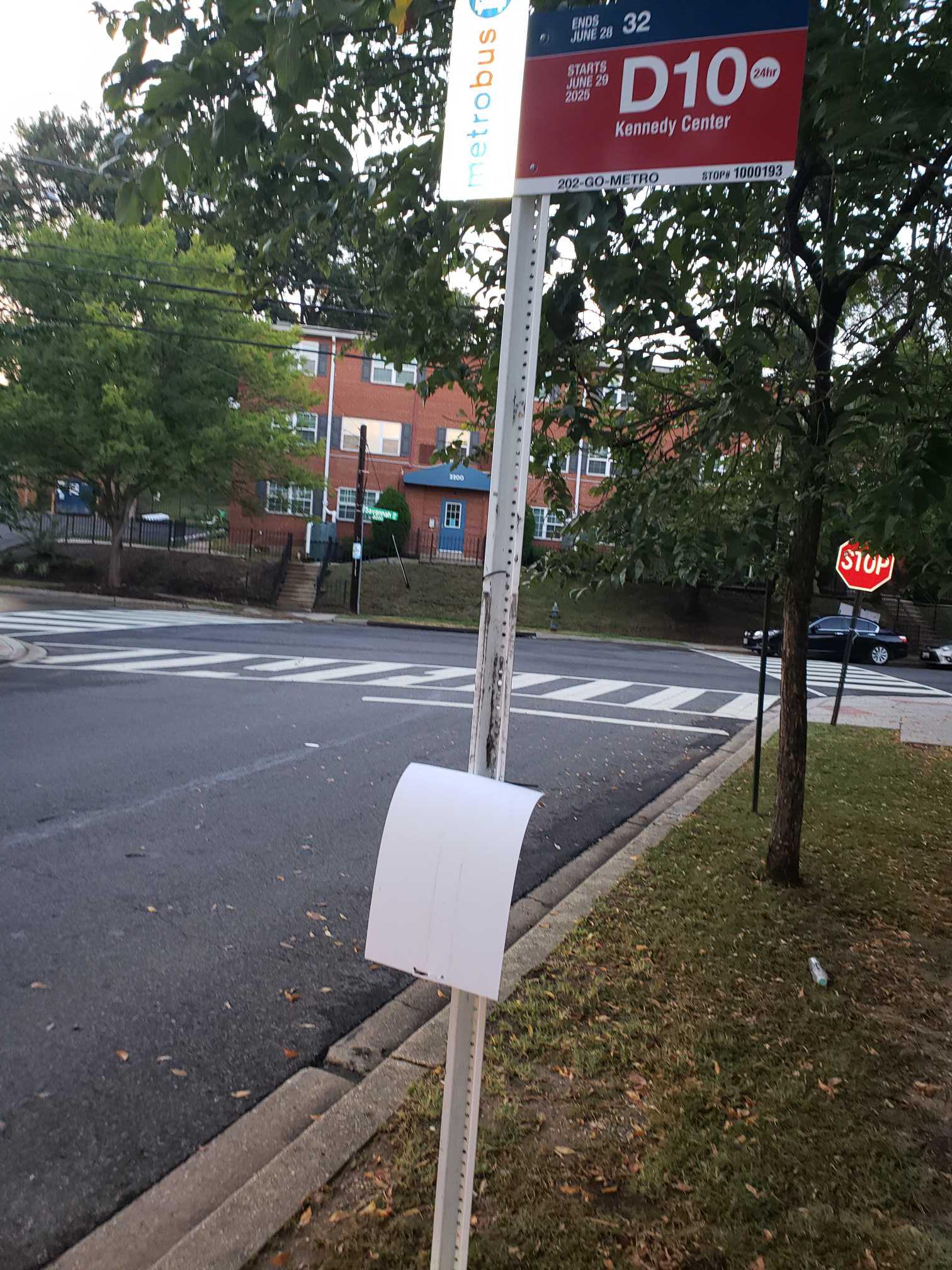
22 St Se+Savannah St SE stop’s code is 1000193
The first line to this stop is D10, at 5:15 AM, and the last line is D10 at 4:59 AM.
This stop serves WMATA’s lines
Bus stops near 22 St Se+Savannah St SE stop
Metro station near 22 St Se+Savannah St SE station
Popular public transit stations in Washington
Get around Washington by public transit!
Traveling around Washington has never been so easy. See step by step directions as you travel to any attraction, street or major public transit station. View bus and train schedules, arrival times, service alerts and detailed routes on a map, so you know exactly how to get to anywhere in Washington.
When traveling to any destination around Washington use Moovit's Live Directions with Get Off Notifications to know exactly where and how far to walk, how long to wait for your line, and how many stops are left. Moovit will alert you when it's time to get off — no need to constantly re-check whether yours is the next stop.
Wondering how to use public transit in Washington or how to pay for public transit in Washington? Moovit public transit app can help you navigate your way with public transit easily, and at minimum cost. It includes public transit fees, ticket prices, and costs. Looking for a map of Washington public transit lines? Moovit public transit app shows all public transit maps in Washington with all Bus, Train, Metro, Light Rail and Ferry routes and stops on an interactive map.
Washington, D.C. - Baltimore, MD has 5 transit type(s), including: Bus, Train, Metro, Light Rail and Ferry, operated by several transit agencies, including WMATA, Montgomery County Ride On, Fairfax Connector, TheBus, PRTC, DASH - Alexandria, Arlington Transit (ART), DC Streetcar, RTA of Central Maryland, FXBGO!, MDOT MTA, Marc, Virginia Railway Express (VRE), University of Maryland Shuttle-UM and CUE Bus - City of Fairfax