How to get to 24/7 Locksmith by bus?
Click on the bus route to see step by step directions with maps, line arrival times and updated time schedules.
From Santa Clara Metrorail Station, Miami
49 minFrom Bascom Palmer Eye Institute, Miami
69 minFrom US Passport Office, Miami
71 minFrom Florida National University (FNU), Hialeah
57 minFrom Miami Freedom Park, Miami
66 minFrom Happy Endings Massage Parlor, Miami
58 minFrom Walmart Supercenter, Hialeah
51 minFrom 1351 NW 12th St, Miami
59 minFrom Sheraton Miami Airport Hotel and Executive Meeting Center, Miami
59 minFrom Richard E. Gerstein Justice Building, Miami
59 min
Bus stops near 24/7 Locksmith in Miami
Bus lines to 24/7 Locksmith in Miami
What are the closest stations to 24/7 Locksmith?
The closest stations to 24/7 Locksmith are:
- Nw 17 Av @ Nw 111 St is 92 yards away, 2 min walk.
- Nw 22 Av & Nw 111 St is 915 yards away, 11 min walk.
- Nw 103 St @ Nw 17 Av is 981 yards away, 12 min walk.
- Nw 119 St @ Nw 17 Av is 1024 yards away, 13 min walk.
Which bus lines stop near 24/7 Locksmith?
These bus lines stop near 24/7 Locksmith: 103, 17.
What’s the nearest bus station to 24/7 Locksmith in Miami?
The nearest bus station to 24/7 Locksmith in Miami is Nw 17 Av @ Nw 111 St. It’s a 2 min walk away.
What time is the first bus to 24/7 Locksmith in Miami?
The 401 is the first bus that goes to 24/7 Locksmith in Miami. It stops nearby at 3:19 AM.
What time is the last bus to 24/7 Locksmith in Miami?
The 401 is the last bus that goes to 24/7 Locksmith in Miami. It stops nearby at 2:23 AM.
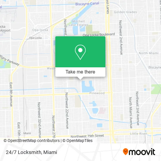
See 24/7 Locksmith, Miami, on the map
Public Transit to 24/7 Locksmith in Miami
Wondering how to get to 24/7 Locksmith in Miami? Moovit helps you find the best way to get to 24/7 Locksmith with step-by-step directions from the nearest public transit station.
Moovit provides free maps and live directions to help you navigate through your city. View schedules, routes, timetables, and find out how long does it take to get to 24/7 Locksmith in real time.
Looking for the nearest stop or station to 24/7 Locksmith? Check out this list of stops closest to your destination: Nw 17 Av @ Nw 111 St; Nw 22 Av & Nw 111 St; Nw 103 St @ Nw 17 Av; Nw 119 St @ Nw 17 Av.
Bus: 103, 17, 22, 401, 125.
Want to see if there’s another route that gets you there at an earlier time? Moovit helps you find alternative routes or times. Get directions from and directions to 24/7 Locksmith easily from the Moovit App or Website.
We make riding to 24/7 Locksmith easy, which is why over 1.5 million users, including users in Miami, trust Moovit as the best app for public transit. You don’t need to download an individual bus app or train app, Moovit is your all-in-one transit app that helps you find the best bus time or train time available.
For information on prices of bus and train, costs and ride fares to 24/7 Locksmith, please check the Moovit app.
Use the app to navigate to popular places including to the airport, hospital, stadium, grocery store, mall, coffee shop, school, college, and university.
24/7 Locksmith Address: 11070 NW 17th Ave Miami, FL 33167 street in Miami
- Budgetcoinz Bitcoin ATM,
- Liberty City Jitney,
- Mundo Tire,
- Chesterfield Wilson Community Development,
- Faith Tabernacle Baptist Church,
- Doral Insurance,
- Rehoboth Evangelical Church,
- HJS Refrigeration,
- Boys and Girls Clubs of Miami Inc,
- Just My Kids Academy #C11md2318,
- The Lake House,
- NW 17 Av,
- EC Sewer & Drain,
- Business,
- Avila Grill,
- Mason HQ,
- Premier Group Home,
- Miami Shores Public Works Complex,
- XV Properties,
- Grill Daddy's BBQ Pit
Places Near 24/7 Locksmith (Miami)
- Little Havana, Miami,
- Sawgrass mall ( FL ), Miami Beach,
- Dolphin Mall, Miami,
- Keiser University Flagship Campus, West Palm Beach,
- Miami Freedom Park, Miami,
- Miami-Dade County Courthouse, Miami,
- Hard Rock Stadium, Miami Gardens,
- Dolphin Mall Bus, Miami,
- Wynwood, Miami,
- Marlins Park, Miami,
- Miami Design District, Miami,
- Brickell City Centre, Miami,
- Aventura Mall, Miami,
- Bayside Marketplace, Miami,
- Richard E. Gerstein Justice Building, Miami,
- Port of Miami Cruise Terminal, Miami,
- Miami VA Hospital, Miami,
- Zoo Miami, Miami,
- Aventura Mall, Miami Beach,
- Sawgrass Mall, Miami
How to get to popular places in Miami with public transit
Get around Miami by public transit!
Traveling around Miami has never been so easy. See step by step directions as you travel to any attraction, street or major public transit station. View bus and train schedules, arrival times, service alerts and detailed routes on a map, so you know exactly how to get to anywhere in Miami.
When traveling to any destination around Miami use Moovit's Live Directions with Get Off Notifications to know exactly where and how far to walk, how long to wait for your line, and how many stops are left. Moovit will alert you when it's time to get off — no need to constantly re-check whether yours is the next stop.
Wondering how to use public transit in Miami or how to pay for public transit in Miami? Moovit public transit app can help you navigate your way with public transit easily, and at minimum cost. It includes public transit fees, ticket prices, and costs. Looking for a map of Miami public transit lines? Moovit public transit app shows all public transit maps in Miami with all Bus, Train, Light Rail and Ferry routes and stops on an interactive map.
Miami has 4 transit type(s), including: Bus, Train, Light Rail and Ferry, operated by several transit agencies, including Broward County Transit, Miami-Dade Transit, Metrorail, Palm Tran, Tri-Rail, Brightline, MARTY, City of Homestead Trolley, Key West Transit, Treasure Coast Connector, GoLine IRT, Amtrak, Greyhound-us, FlixBus-us and Aventura Express Shuttle Bus