How to get to 24 7 Locksmith by bus?
Click on the bus route to see step by step directions with maps, line arrival times and updated time schedules.
From Morgan State University, Baltimore
52 minFrom Glen Burnie, MD, Anne Arundel County
63 minFrom Walmart, Baltimore County
51 minFrom Harford Road, Baltimore
50 minFrom I-695 @ Exit 17 (Security Blvd/MD 122), Baltimore County
48 minFrom Dundalk, Maryland, Baltimore County
48 minFrom Good Samaritan Hospital, Baltimore
68 minFrom Reisterstown Road Plaza, Baltimore
66 minFrom Druid Hill Park, Baltimore
48 minFrom Eastern Ave (eastern avenue and dundalk av), Baltimore
48 min
How to get to 24 7 Locksmith by metro?
Click on the metro route to see step by step directions with maps, line arrival times and updated time schedules.
Bus stops near 24 7 Locksmith in Baltimore
Light Rail stations near 24 7 Locksmith in Baltimore
- Convention Center, 6 min walk,VIEW
Train station near 24 7 Locksmith in Baltimore
- Camden Station Marc, 10 min walk,VIEW
Bus lines to 24 7 Locksmith in Baltimore
- 69, Jumpers Hole,VIEW
- 70, Um Medical Center,VIEW
- 73, State Center,VIEW
- 75, Um Medical Center Via Greyhound,VIEW
- 26, Patapsco Lr,VIEW
- 201, 201/6 Bwi Airport / Warner St,VIEW
- GREYHOUND US0164, Chicago - Cleveland - Washington,VIEW
- GREYHOUND US0235, Boston - Philadelphia - Washington,VIEW
- GREYHOUND US0305, New York - Philadelphia - Washington,VIEW
- GREYHOUND US0310, New York - Baltimore - Washington,VIEW
- GREYHOUND US0310D, New York - Baltimore - DC: Bus Moves,VIEW
- GREYHOUND US0320, Washington - Atlantic City - New York,VIEW
- GREYHOUND US0325S, New York - Philadelphia - Washington,VIEW
- GREYHOUND US0350, Philadelphia - Washington,VIEW
- GREYHOUND US0430, Washington - Harrisburg - Pittsburgh,VIEW
- GREYHOUND US0600, Dallas - Nashville - Washington,VIEW
- GREYHOUND US0670, New York - Atlanta,VIEW
- GREYHOUND US0700, New York - Richmond - Raleigh,VIEW
- FLIXBUS N2471, NYC Chinatown - Atlanta,VIEW
- FLIXBUS N2472, NYC Chinatown - Orlando,VIEW
What are the closest stations to 24 7 Locksmith?
The closest stations to 24 7 Locksmith are:
- Russell St & Bush St Sb is 242 yards away, 3 min walk.
- Bush St & Russell St Eb is 279 yards away, 4 min walk.
- Warner St (Greyhound Bus Station) is 366 yards away, 5 min walk.
- Convention Center is 454 yards away, 6 min walk.
- Baltimore Downtown Bus Station is 585 yards away, 8 min walk.
- Camden Station Marc is 774 yards away, 10 min walk.
- Washington Blvd & Bush St Sb is 1121 yards away, 14 min walk.
Which bus lines stop near 24 7 Locksmith?
These bus lines stop near 24 7 Locksmith: 26, 73.
Which metro line stops near 24 7 Locksmith?
METRO (Towards John Hopkins)
What’s the nearest light rail station to 24 7 Locksmith in Baltimore?
The nearest light rail station to 24 7 Locksmith in Baltimore is Convention Center. It’s a 6 min walk away.
What’s the nearest train station to 24 7 Locksmith in Baltimore?
The nearest train station to 24 7 Locksmith in Baltimore is Camden Station Marc. It’s a 10 min walk away.
What’s the nearest bus station to 24 7 Locksmith in Baltimore?
The nearest bus station to 24 7 Locksmith in Baltimore is Russell St & Bush St Sb. It’s a 3 min walk away.
What time is the first light rail to 24 7 Locksmith in Baltimore?
The LIGHT RAILLINK is the first light rail that goes to 24 7 Locksmith in Baltimore. It stops nearby at 4:01 AM.
What time is the last light rail to 24 7 Locksmith in Baltimore?
The LIGHT RAILLINK is the last light rail that goes to 24 7 Locksmith in Baltimore. It stops nearby at 1:15 AM.
What time is the first train to 24 7 Locksmith in Baltimore?
The MARC is the first train that goes to 24 7 Locksmith in Baltimore. It stops nearby at 5:00 AM.
What time is the last train to 24 7 Locksmith in Baltimore?
The MARC is the last train that goes to 24 7 Locksmith in Baltimore. It stops nearby at 8:55 PM.
What time is the first bus to 24 7 Locksmith in Baltimore?
The 75 is the first bus that goes to 24 7 Locksmith in Baltimore. It stops nearby at 3:11 AM.
What time is the last bus to 24 7 Locksmith in Baltimore?
The GREYHOUND US0670 is the last bus that goes to 24 7 Locksmith in Baltimore. It stops nearby at 6:45 PM.
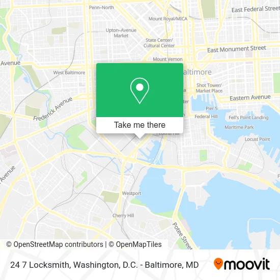
See 24 7 Locksmith, Baltimore, on the map
Public Transit to 24 7 Locksmith in Baltimore
Wondering how to get to 24 7 Locksmith in Baltimore? Moovit helps you find the best way to get to 24 7 Locksmith with step-by-step directions from the nearest public transit station.
Moovit provides free maps and live directions to help you navigate through your city. View schedules, routes, timetables, and find out how long does it take to get to 24 7 Locksmith in real time.
Looking for the nearest stop or station to 24 7 Locksmith? Check out this list of stops closest to your destination: Russell St & Bush St Sb; Bush St & Russell St Eb; Warner St (Greyhound Bus Station); Convention Center; Baltimore Downtown Bus Station; Camden Station Marc; Washington Blvd & Bush St Sb.
Bus: 26, 73, 69, 70, 75, 201, GREYHOUND US0164, GREYHOUND US0235, GREYHOUND US0305, GREYHOUND US0310, GREYHOUND US0310D, CITYLINK YELLOW.Train: MARC.Metro: METRO.
Want to see if there’s another route that gets you there at an earlier time? Moovit helps you find alternative routes or times. Get directions from and directions to 24 7 Locksmith easily from the Moovit App or Website.
We make riding to 24 7 Locksmith easy, which is why over 1.5 million users, including users in Baltimore, trust Moovit as the best app for public transit. You don’t need to download an individual bus app or train app, Moovit is your all-in-one transit app that helps you find the best bus time or train time available.
For information on prices of bus and metro, costs and ride fares to 24 7 Locksmith, please check the Moovit app.
Use the app to navigate to popular places including to the airport, hospital, stadium, grocery store, mall, coffee shop, school, college, and university.
24 7 Locksmith Address: 1571 Ridgely St Baltimore, MD 21230 street in Baltimore
- W C Food Lines,
- Plaza at Horseshoe Casino Baltimore,
- Holiday Inn Express Baltimore At The Stadiums an IHG Hotel,
- Foundation Building Materials,
- Horstmeier Lumber,
- Precision Machining Services,
- Centers for Behavioral Health,
- Horseshoe Casino Baltimore,
- Horseshoe Baltimore (Horseshoe Casino Baltimore),
- Banquets and More Services,
- Terrace Bar,
- Foster Cassandra,
- Legends Lounge,
- Horseshoe Casino Diamond Lounge,
- Horseshoe Baltimore,
- Company History Products & Services Specialty Coatings,
- Bush St St Russell St,
- Second Chance,
- The Sign Man,
- Bush St (russell street and bush)
Places Near 24 7 Locksmith (Baltimore)
- PG Mall, Prince George's County,
- National Museum of African American History and Culture, Washington,
- Museum Of The Bible, Washington,
- National Mall, Washington,
- Camden Yards, Baltimore,
- National Zoo, Washington,
- Basilica of the National Shrine, Washington,
- Rock Creek Tennis Center, Washington,
- Capital One Arena, Washington,
- Pennsylvania Ave NW (3rd st and pennsylvania), Washington,
- Marriott Marquis Washington, DC, Washington,
- Warner Theatre, Washington,
- Georgetown, Washington,
- Washington National Cathedral, Washington,
- The Anthem, Washington,
- Westfield Montgomery Mall, Montgomery County,
- Amazon Hq2, Arlington County,
- M&T Bank Stadium, Baltimore,
- Washington DC VA Medical Center, Washington,
- Sibley Memorial Hospital, Washington
How to get to popular places in Washington, D.C. - Baltimore, MD with public transit
Get around Baltimore by public transit!
Traveling around Baltimore has never been so easy. See step by step directions as you travel to any attraction, street or major public transit station. View bus and train schedules, arrival times, service alerts and detailed routes on a map, so you know exactly how to get to anywhere in Baltimore.
When traveling to any destination around Baltimore use Moovit's Live Directions with Get Off Notifications to know exactly where and how far to walk, how long to wait for your line, and how many stops are left. Moovit will alert you when it's time to get off — no need to constantly re-check whether yours is the next stop.
Wondering how to use public transit in Baltimore or how to pay for public transit in Baltimore? Moovit public transit app can help you navigate your way with public transit easily, and at minimum cost. It includes public transit fees, ticket prices, and costs. Looking for a map of Baltimore public transit lines? Moovit public transit app shows all public transit maps in Baltimore with all Bus, Train, Metro, Light Rail and Ferry routes and stops on an interactive map.
Washington, D.C. - Baltimore, MD has 5 transit type(s), including: Bus, Train, Metro, Light Rail and Ferry, operated by several transit agencies, including WMATA, Montgomery County Ride On, Fairfax Connector, TheBus, PRTC, DASH - Alexandria, Arlington Transit (ART), RTA of Central Maryland, MDOT MTA, MDOT MTA Light RailLink, MDOT MTA Commuter Bus, MDOT MTA Local Bus, FXBGO!, Virginia Railway Express (VRE) and MARC