Directions to 24 Hours Locksmith In Baltimore with public transportation
The following transit lines have routes that pass near 24 Hours Locksmith In Baltimore
 Bus: 94, CITYLINK NAVY, CITYLINK PURPLE, CITYLINK YELLOW, 76.
- Train: MARC.
- Metro: METRO.
How to get to 24 Hours Locksmith In Baltimore by bus?
Click on the bus route to see step by step directions with maps, line arrival times and updated time schedules.
From I-695 @ Exit 17 (Security Blvd/MD 122)
58 minFrom I-695 @ Exit 18 (Liberty Rd/MD 26)
55 minFrom NSA Friendship Annex (FANX)
74 minFrom Walmart
54 minFrom Baltimore Polytechnic Institute
47 minFrom Guinness Open Gate Brewery & Barrel House
48 minFrom Reisterstown Road Plaza
58 minFrom Pimlico Race Course
61 minFrom Harford Road
31 minFrom Baltimore Poly Tech High School
48 min
How to get to 24 Hours Locksmith In Baltimore by train?
Click on the train route to see step by step directions with maps, line arrival times and updated time schedules.
How to get to 24 Hours Locksmith In Baltimore by metro?
Click on the metro route to see step by step directions with maps, line arrival times and updated time schedules.
Bus stops near 24 Hours Locksmith In Baltimore
Light Rail stations near 24 Hours Locksmith In Baltimore
- Convention Center, 8 min walk,VIEW
Train station near 24 Hours Locksmith In Baltimore
- Camden Station Marc, 8 min walk,VIEW
Bus lines to 24 Hours Locksmith In Baltimore
What are the closest stations to 24 Hours Locksmith In Baltimore?
The closest stations to 24 Hours Locksmith In Baltimore are:
- Washington Blvd & Barre St Wb is 170 yards away, 3 min walk.
- Pratt St & Mlk Blvd is 548 yards away, 7 min walk.
- Russell St & Lee St Sb is 568 yards away, 7 min walk.
- Convention Center is 640 yards away, 8 min walk.
- Camden Station Marc is 675 yards away, 8 min walk.
Which bus lines stop near 24 Hours Locksmith In Baltimore?
These bus lines stop near 24 Hours Locksmith In Baltimore: 94, CITYLINK NAVY, CITYLINK PURPLE, CITYLINK YELLOW.
Which train line stops near 24 Hours Locksmith In Baltimore?
MARC (Inbound - Penn)
Which metro line stops near 24 Hours Locksmith In Baltimore?
METRO (Towards John Hopkins)
What’s the nearest light rail station to 24 Hours Locksmith In Baltimore?
The nearest light rail station to 24 Hours Locksmith In Baltimore is Convention Center. It’s a 8 min walk away.
What’s the nearest train station to 24 Hours Locksmith In Baltimore?
The nearest train station to 24 Hours Locksmith In Baltimore is Camden Station Marc. It’s a 8 min walk away.
What’s the nearest bus station to 24 Hours Locksmith In Baltimore?
The nearest bus station to 24 Hours Locksmith In Baltimore is Washington Blvd & Barre St Wb. It’s a 3 min walk away.
What time is the first light rail to 24 Hours Locksmith In Baltimore?
The LIGHT RAILLINK is the first light rail that goes to 24 Hours Locksmith In Baltimore. It stops nearby at 3:59 AM.
What time is the last light rail to 24 Hours Locksmith In Baltimore?
The LIGHT RAILLINK is the last light rail that goes to 24 Hours Locksmith In Baltimore. It stops nearby at 1:17 AM.
What time is the first train to 24 Hours Locksmith In Baltimore?
The MARC is the first train that goes to 24 Hours Locksmith In Baltimore. It stops nearby at 5:00 AM.
What time is the last train to 24 Hours Locksmith In Baltimore?
The MARC is the last train that goes to 24 Hours Locksmith In Baltimore. It stops nearby at 8:55 PM.
What time is the first bus to 24 Hours Locksmith In Baltimore?
The 75 is the first bus that goes to 24 Hours Locksmith In Baltimore. It stops nearby at 3:09 AM.
What time is the last bus to 24 Hours Locksmith In Baltimore?
The CITYLINK YELLOW is the last bus that goes to 24 Hours Locksmith In Baltimore. It stops nearby at 3:16 AM.
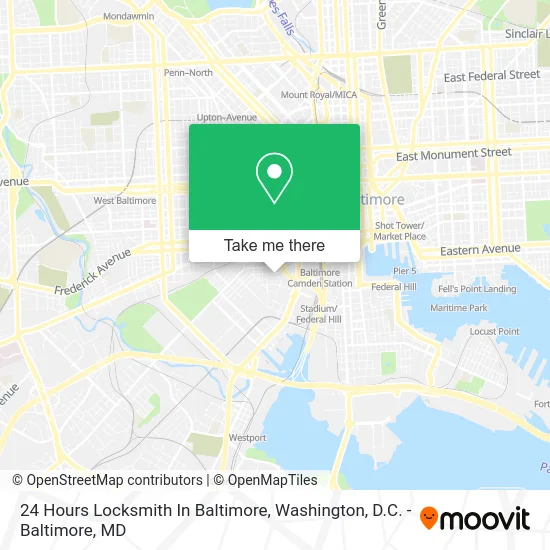
See 24 Hours Locksmith In Baltimore on the map
Public Transportation to 24 Hours Locksmith In Baltimore
Wondering how to get to 24 Hours Locksmith In Baltimore? Moovit helps you find the best way to get to 24 Hours Locksmith In Baltimore with step-by-step directions from the nearest public transit station.
Moovit provides free maps and live directions to help you navigate through your city. View schedules, routes, timetables, and find out how long does it take to get to 24 Hours Locksmith In Baltimore in real time.
Looking for the nearest stop or station to 24 Hours Locksmith In Baltimore? Check out this list of stops closest to your destination: Washington Blvd & Barre St Wb; Pratt St & Mlk Blvd; Russell St & Lee St Sb; Convention Center; Camden Station Marc.
Bus: 94, CITYLINK NAVY, CITYLINK PURPLE, CITYLINK YELLOW, 76, 69, 70, 73, 75.Train: MARC.Metro: METRO.
Want to see if there’s another route that gets you there at an earlier time? Moovit helps you find alternative routes or times. Get directions from and directions to 24 Hours Locksmith In Baltimore easily from the Moovit App or Website.
We make riding to 24 Hours Locksmith In Baltimore easy, which is why over 1.5 million users, including users in Baltimore, trust Moovit as the best app for public transit. You don’t need to download an individual bus app or train app, Moovit is your all-in-one transit app that helps you find the best bus time or train time available.
For information on prices of bus, light rail, metro and train, costs and ride fares to 24 Hours Locksmith In Baltimore, please check the Moovit app.
Use the app to navigate to popular places including to the airport, hospital, stadium, grocery store, mall, coffee shop, school, college, and university.
24 Hours Locksmith In Baltimore Address: 737 Carroll St Baltimore, MD 21230 street in Baltimore
- Mcnair Enterprise,
- Creative Styles Gentleman Lounge,
- TJS Cleaning Service,
- Philadelphia Hoagie Factory,
- Martin Luther King Jr Blvd & Washington Blvd,
- Main Street Mart,
- Baltimart,
- Zeke's Coffee - Pigtown,
- Stoop,
- Luigi's Philly Hoagies - Pigtown,
- Pigtown Main Street,
- Dr. Suyi Park MD,
- Fixture Installation & Repair,
- Little Miner - TR,
- Health Mart Pharmacy,
- Catholic Charities Head Start,
- Washington Blvd (washington blvd and S Martin Luther King Jr Blvd),
- Miss Maryland Crab,
- Residential Carpet Cleaning Carpet Cleaning,
- smart Realty
Places Near 24 Hours Locksmith In Baltimore
- Washington DC VA Medical Center, Washington,
- National Mall, Washington,
- Georgetown, Washington,
- Capital One Arena, Washington,
- Marriott Marquis Washington, DC, Washington,
- National Museum of African American History and Culture, Washington,
- M&T Bank Stadium, Baltimore,
- Basilica of the National Shrine, Washington,
- Rock Creek Tennis Center, Washington,
- PG Mall, Prince George's County,
- Sibley Memorial Hospital, Washington,
- Amazon Hq2, Arlington County,
- Pennsylvania Ave NW (3rd st and pennsylvania), Washington,
- Washington National Cathedral, Washington,
- Warner Theatre, Washington,
- National Zoo, Washington,
- Westfield Montgomery Mall, Montgomery County,
- Camden Yards, Baltimore,
- Museum Of The Bible, Washington,
- The Anthem, Washington
How to get to popular places in Washington, D.C. - Baltimore, MD with public transit
Get around Baltimore by public transit!
Traveling around Baltimore has never been so easy. See step by step directions as you travel to any attraction, street or major public transit station. View bus and train schedules, arrival times, service alerts and detailed routes on a map, so you know exactly how to get to anywhere in Baltimore.
When traveling to any destination around Baltimore use Moovit's Live Directions with Get Off Notifications to know exactly where and how far to walk, how long to wait for your line, and how many stops are left. Moovit will alert you when it's time to get off — no need to constantly re-check whether yours is the next stop.
Wondering how to use public transit in Baltimore or how to pay for public transit in Baltimore? Moovit public transit app can help you navigate your way with public transit easily, and at minimum cost. It includes public transit fees, ticket prices, and costs. Looking for a map of Baltimore public transit lines? Moovit public transit app shows all public transit maps in Baltimore with all Bus, Train, Metro, Light Rail and Ferry routes and stops on an interactive map.
Washington, D.C. - Baltimore, MD has 5 transit type(s), including: Bus, Train, Metro, Light Rail and Ferry, operated by several transit agencies, including WMATA, Montgomery County Ride On, Fairfax Connector, TheBus, PRTC, DASH - Alexandria, Arlington Transit (ART), RTA of Central Maryland, MDOT MTA, MDOT MTA Light RailLink, MDOT MTA Commuter Bus, MDOT MTA Local Bus, FXBGO!, Virginia Railway Express (VRE) and MARC