Directions to 2nd Floor Kitchen (Grafton) with public transportation
The following transit lines have routes that pass near 2nd Floor Kitchen
How to get to 2nd Floor Kitchen by bus?
Click on the bus route to see step by step directions with maps, line arrival times and updated time schedules.
From White River Junction Train Station (WRJ) - Amtrak, Windsor
28 minFrom Synergistic Balance, Windsor
95 minFrom Birkenstock, Grafton
20 minFrom Hartland/Windsor Park and Ride, Windsor
47 minFrom Manuel Iriondo, MD, Grafton
25 minFrom George Petrescu-Boboc DDS, Grafton
29 minFrom Coco Fox, Grafton
20 minFrom Wheelers Landscaping, Windsor
100 min
Bus stops near 2nd Floor Kitchen in Grafton
Bus lines to 2nd Floor Kitchen in Grafton
What are the closest stations to 2nd Floor Kitchen?
The closest stations to 2nd Floor Kitchen are:
- G Lot is 168 yards away, 3 min walk.
- Vail Dms is 183 yards away, 3 min walk.
- Dms - Vail is 188 yards away, 3 min walk.
- Burke is 422 yards away, 5 min walk.
- Maynard Street is 521 yards away, 7 min walk.
Which bus lines stop near 2nd Floor Kitchen?
These bus lines stop near 2nd Floor Kitchen: BLUE ROUTE, GREEN ROUTE, ORANGE ROUTE, YELLOW ROUTE.
What’s the nearest bus station to 2nd Floor Kitchen in Grafton?
The nearest bus stations to 2nd Floor Kitchen in Grafton are G Lot, Vail Dms and Dms - Vail. The closest one is a 3 min walk away.
What time is the first bus to 2nd Floor Kitchen in Grafton?
The 1 is the first bus that goes to 2nd Floor Kitchen in Grafton. It stops nearby at 5:12 AM.
What time is the last bus to 2nd Floor Kitchen in Grafton?
The 1 is the last bus that goes to 2nd Floor Kitchen in Grafton. It stops nearby at 2:21 AM.
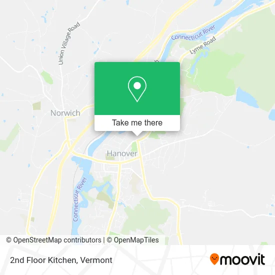
See 2nd Floor Kitchen, Grafton, on the map
Public Transit to 2nd Floor Kitchen in Grafton
Wondering how to get to 2nd Floor Kitchen in Grafton? Moovit helps you find the best way to get to 2nd Floor Kitchen with step-by-step directions from the nearest public transit station.
Moovit provides free maps and live directions to help you navigate through your city. View schedules, routes, timetables, and find out how long does it take to get to 2nd Floor Kitchen in real time.
Looking for the nearest stop or station to 2nd Floor Kitchen? Check out this list of stops closest to your destination: G Lot; Vail Dms; Dms - Vail; Burke; Maynard Street.
Bus: BLUE ROUTE, GREEN ROUTE, ORANGE ROUTE, YELLOW ROUTE, DOWNTOWN SHUTTLE, BLUE-RED ROUTE, BROWN ROUTE, 1, 2.
Want to see if there’s another route that gets you there at an earlier time? Moovit helps you find alternative routes or times. Get directions from and directions to 2nd Floor Kitchen easily from the Moovit App or Website.
We make riding to 2nd Floor Kitchen easy, which is why over 1.5 million users, including users in Grafton, trust Moovit as the best app for public transit. You don’t need to download an individual bus app or train app, Moovit is your all-in-one transit app that helps you find the best bus time or train time available.
For information on prices of bus, costs and ride fares to 2nd Floor Kitchen, please check the Moovit app.
Use the app to navigate to popular places including to the airport, hospital, stadium, grocery store, mall, coffee shop, school, college, and university.
2nd Floor Kitchen Address: 37 Dewey Field Rd Hanover, NH 03755 street in Grafton
- Office 228,
- Life Sciences Center,
- Dewey Parking Lot,
- Dartmouth Healthcare Foundations,
- Dragon Secret Society,
- Dartmouth-Hitchcock Medical School,
- Maynard Parking Lot,
- FedEx,
- Windover Construction,
- Sew What Alterations,
- Rollins Musalla,
- SAE,
- Baker Memorial Library,
- Dartmouth Alpha XI Delta,
- Dickey Center for International Understanding,
- GDX,
- Byrne Dining at Tuck,
- Fetch Softworks,
- Bissell,
- Hanover NH USA
Places Near 2nd Floor Kitchen (Grafton)
- GLOBALFOUNDRIES, Chittenden,
- Sugarbush Resort,
- Springfield, VT, Windsor,
- Champlain Valley Exposition, Chittenden,
- Missisquoi River Basin Association,
- Rutland, VT, Rutland,
- Dartmouth-Hitchcock Medical Center, Clinical Systems, Grafton,
- Ecco,
- Derby Line Stanstead Border Crossing,
- Waterbury, VT,
- Castleton University, Rutland,
- WXXX, Chittenden,
- Castleton, VT, Rutland,
- Barre, VT,
- Richford Auto,
- Hannaford, Rutland,
- MVU,
- Spring Step,
- Xxxxxxxxxxxxx, Chittenden,
- University of Vermont Medical Center - Fanny Allen Campus, Chittenden
How to get to popular places in Vermont with public transit
Get around Grafton by public transit!
Traveling around Grafton has never been so easy. See step by step directions as you travel to any attraction, street or major public transit station. View bus and train schedules, arrival times, service alerts and detailed routes on a map, so you know exactly how to get to anywhere in Grafton.
When traveling to any destination around Grafton use Moovit's Live Directions with Get Off Notifications to know exactly where and how far to walk, how long to wait for your line, and how many stops are left. Moovit will alert you when it's time to get off — no need to constantly re-check whether yours is the next stop.
Wondering how to use public transit in Grafton or how to pay for public transit in Grafton? Moovit public transit app can help you navigate your way with public transit easily, and at minimum cost. It includes public transit fees, ticket prices, and costs. Looking for a map of Grafton public transit lines? Moovit public transit app shows all public transit maps in Grafton with all Bus, Train and Ferry routes and stops on an interactive map.
Vermont has 3 transit type(s), including: Bus, Train and Ferry, operated by several transit agencies, including Green Mountain Transit, Wilmington MOOver, Advance Transit, Vermont Translines, Rockingham MOOver, The Bus (Marble Valley Regional Transit District), Green Mountain Express, Rural Community Transportation, Addison County Transit Resources, Stagecoach Transportation Services, Amtrak, Greyhound-us, Dartmouth Campus Connector and Lake Champlain Ferries