30th Street station - Wednesday schedule
| Line | Direction | Time |
|---|---|---|
| TRE | #Tre9703 - Trenton | 4:45 AM |
| NORTHEAST REGIONAL | Newport News | 4:45 AM |
| NORTHEAST REGIONAL | Roanoke | 4:57 AM |
| AIR | #Air403 - Airport Terminals E & F | 4:59 AM |
| MED | #Med3500 - Center City Philadelphia | 5:05 AM |
| WIL | #Wil9213 - Newark De | 5:06 AM |
| WIL | #Wil9203 - Newark De | 5:06 AM |
| KEYSTONE SERVICE | Harrisburg | 5:10 AM |
| PAO | #Pao5300 - Center City Philadelphia | 5:23 AM |
| NOR | #Nor6200 - Norristown Elm Street | 5:25 AM |
| MED | #Med3200 - Center City Philadelphia | 5:27 AM |
| AIR | #Air405 - Airport Terminals E & F | 5:29 AM |
| TRE | #Tre1705 - Trenton | 5:30 AM |
| AIR | #Air402 - Temple University | 5:30 AM |
| MED | #Med3502 - Center City Philadelphia | 5:45 AM |
| TRE | #Tre700 - Center City Philadelphia | 5:46 AM |
| TRE | #Tre780 - Center City Philadelphia | 5:46 AM |
| NEC | Trenton | 5:47 AM |
| PAO | #Pao514 - Center City Philadelphia | 5:49 AM |
| WIL | #Wil7281 - Newark De | 5:50 AM |
| MED | #Med302 - Center City Philadelphia | 5:54 AM |
| TRE | #Tre9707 - Trenton | 5:55 AM |
| NORTHEAST REGIONAL | Boston | 5:58 AM |
| AIR | #Air407 - Airport Terminals E & F | 5:59 AM |
| CHW | #Chw800 - Temple University | 6:00 AM |
Directions to 30th Street station (Philadelphia) with public transit
The following transit lines have routes that pass near 30th Street
 Bus: 125, 21, 42, 44, 49.
- Train: AIR, CYN, FOX, MED, WTR.
- Metro: L1, T1, T2, T3, T4.
How to get to 30th Street station by bus?
Click on the bus route to see step by step directions with maps, line arrival times and updated time schedules.
How to get to 30th Street station by train?
Click on the train route to see step by step directions with maps, line arrival times and updated time schedules.
How to get to 30th Street station by metro?
Click on the metro route to see step by step directions with maps, line arrival times and updated time schedules.
Bus stops near 30th Street stop in Philadelphia
- JFK Blvd & 30th St, 1 min walk,
- JFK Blvd at 30th St, 1 min walk,
- Schuylkill Av & JFK Blvd, 2 min walk,
- Market St & 24th St, 4 min walk,
- Chestnut St & Schuykill Av, 6 min walk,
- Market St at 30th St, 7 min walk,
Metro stations near 30th Street station in Philadelphia
- 33rd St, 10 min walk,
- 30th St Station, 12 min walk,
Bus lines to 30th Street station in Philadelphia
- LUCYGO, Gold Loop,
- LUCYGR, Green Loop,
- 313, Cape May - Wildwood - 30th Street Philadelphia,
- 315, Cape May - Wildwood - 30th Street Philadelphia,
- 316, Cape May - Wildwood - Philadelphia Express,
- 414, Philadelphia - Moorestown,
- 417, Willingboro Express,
- 555, Avandale-30th Street Philadelphia,
- 9, 4th-Walnut,
- 44, Front-Market,
- 62, Andorra,
- 124, 13th-Market,
- 125, Valley Forge,
- 31, City Hall,
- 49, 33rd-Dauphin,
- 21, Columbus-Dock,
- 42, 2nd-Spruce,
- L1 OWL, Frankford Transit Center,
- 30, Amtrak-30th Street Station,
What are the closest stations to 30th Street?
The closest stations to 30th Street are:
- JFK Blvd & 30th St stop is 50 yards away, 1 min walk.
- JFK Blvd at 30th St stop is 75 yards away, 1 min walk.
- Schuylkill Av & JFK Blvd stop is 118 yards away, 2 min walk.
- Market St & 24th St stop is 254 yards away, 4 min walk.
- Chestnut St & Schuykill Av stop is 444 yards away, 6 min walk.
- Market St at 30th St stop is 573 yards away, 7 min walk.
- 33rd St station is 764 yards away, 10 min walk.
- 30th St Station is 974 yards away, 12 min walk.
Which bus lines stop near 30th Street?
These bus lines stop near 30th Street: 125, 21, 42, 44, 49, 7, 9.
Which train lines stop near 30th Street?
These train lines stop near 30th Street: AIR, CYN, FOX, MED, WTR.
Which metro line stops near 30th Street?
L1 (69th St Transit Center)
What’s the nearest metro station to 30th Street in Philadelphia?
The nearest metro station to 30th Street in Philadelphia is 33rd St. It’s a 10 min walk away.
What’s the nearest bus station to 30th Street in Philadelphia?
The nearest bus stations to 30th Street in Philadelphia are JFK Blvd & 30th St and JFK Blvd at 30th St. The closest one is a 1 min walk away.
What time is the first metro to 30th Street in Philadelphia?
The L1 is the first metro that goes to 30th Street in Philadelphia. It stops nearby at 5:02 AM.
What time is the last metro to 30th Street in Philadelphia?
The T1 is the last metro that goes to 30th Street in Philadelphia. It stops nearby at 3:05 AM.
What time is the first bus to 30th Street in Philadelphia?
The L1 OWL is the first bus that goes to 30th Street in Philadelphia. It stops nearby at 3:01 AM.
What time is the last bus to 30th Street in Philadelphia?
The L1 OWL is the last bus that goes to 30th Street in Philadelphia. It stops nearby at 3:31 AM.
See 30th Street station, Philadelphia, on the map
Public transit to 30th Street station in Philadelphia
Looking for directions to 30th Street in Philadelphia, United States?
Download the Moovit App to find the current schedule and step-by-step directions for Bus, Metro or Train routes that pass through 30th Street.
Looking for the nearest stops closest to 30th Street ? Check out this list of closest stops to your destination: JFK Blvd & 30th St; JFK Blvd at 30th St; Schuylkill Av & JFK Blvd; Market St & 24th St; Chestnut St & Schuykill Av; Market St at 30th St; 33rd St; 30th St Station.
Bus: 125, 21, 42, 44, 49, 7, 9, LUCYGO, LUCYGR, 313, 315, 316, 414, 417, 62, 124, 31.Train: AIR, CYN, FOX, MED, WTR.Metro: L1, T1, T2, T3, T4, T5.
We make riding on public transit to 30th Street easy, which is why over 1.7 billion users, including users in Philadelphia trust Moovit as the best app for public transit.
Use the app to navigate to popular places including to the airport, hospital, stadium, grocery store, mall, coffee shop, school, college, and university.
The station has the following entrances: William H. Gray III 30th Street, Market St, N 30th St, JFK Blvd & 30th St, Market St & Schuylkill Av, JFK Memorial Bridge and Market St & Arch St
The first line to this station is TRE, at 4:45 AM, and the last line is AIR at 4:29 AM.
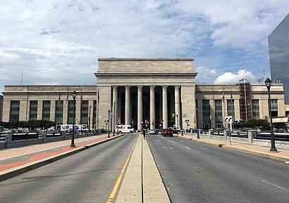
2955 Market Street, Philadelphia, PA, USA
This station serves SEPTA Rail, Amtrak and NJ Transit Rail’s lines
Popular routes from 30th Street station, Philadelphia
- JFK Blvd & 30th St,
- JFK Blvd at 30th St,
- Schuylkill Av & JFK Blvd,
- Market St & 24th St,
- Chestnut St & Schuykill Av,
- Market St at 30th St
Bus stops near 30th Street stop
- 33rd St,
- 30th St Station
Metro stations near 30th Street station
- 22nd St & Tioga St,
- Lehigh Av & 5th St,
- 63rd St Station,
- Roosevelt Blvd & Goodnaw St,
- Woodland Av & 72nd St ,
- Macdade Blvd & South Av,
- Oregon Av & 23rd St ,
- Baltimore Av & 47th St,
- 15th St Station,
- Quaker Bridge Rd at Lawrence Square Blvd S,
- Morrell Av & Kayford Circle - 2,
- Garrett Rd & Burmont Rd,
- Spruce St & 58th St,
- 52nd St & Pine St,
- Ardmore Ave Station,
- Woodbourne Rd & Trenton Rd,
- Inspira Medical Center Mullica Hill,
- Tacony St & Fraley St ,
- JFK Blvd & 17th St,
- 2nd St & Poplar St
Popular public transit stations in Philadelphia
Get around Philadelphia by public transit!
Traveling around Philadelphia has never been so easy. See step by step directions as you travel to any attraction, street or major public transit station. View bus and train schedules, arrival times, service alerts and detailed routes on a map, so you know exactly how to get to anywhere in Philadelphia.
When traveling to any destination around Philadelphia use Moovit's Live Directions with Get Off Notifications to know exactly where and how far to walk, how long to wait for your line, and how many stops are left. Moovit will alert you when it's time to get off — no need to constantly re-check whether yours is the next stop.
Wondering how to use public transit in Philadelphia or how to pay for public transit in Philadelphia? Moovit public transit app can help you navigate your way with public transit easily, and at minimum cost. It includes public transit fees, ticket prices, and costs. Looking for a map of Philadelphia public transit lines? Moovit public transit app shows all public transit maps in Philadelphia with all Bus, Train, Metro, Light Rail and Cable Car routes and stops on an interactive map.
Philadelphia has 5 transit type(s), including: Bus, Train, Metro, Light Rail and Cable Car, operated by several transit agencies, including SEPTA Subway, SEPTA Rail, SEPTA, SEPTA Trolley, NJ Transit Rail, NJ Transit, Port Authority Transit Corporation, Navy Yard, Penn Transit, Drexel University, Pottstown Area Rapid Transit (PART), Fullington Tours, Chescobus, Amtrak and Greyhound-us