How to get to 331 Veranda St by bus?
Click on the bus route to see step by step directions with maps, line arrival times and updated time schedules.
Bus stop near 331 Veranda St in Portland, ME
- Veranda St + Marine Hospital, 4 min walk,VIEW
Ferry station near 331 Veranda St in Portland, ME
- Casco Bay Lines Terminal, 19 min walk,VIEW
Bus lines to 331 Veranda St in Portland, ME
- 7, Portland Jetport,VIEW
What are the closest stations to 331 Veranda St?
The closest stations to 331 Veranda St are:
- Veranda St + Marine Hospital is 247 yards away, 4 min walk.
- Casco Bay Lines Terminal is 1511 yards away, 19 min walk.
Which bus line stops near 331 Veranda St?
7 (Portland Jetport→Falmouth Shaw's)
What’s the nearest bus station to 331 Veranda St in Portland, ME?
The nearest bus station to 331 Veranda St in Portland, ME is Veranda St + Marine Hospital. It’s a 4 min walk away.
What’s the nearest ferry station to 331 Veranda St in Portland, ME?
The nearest ferry station to 331 Veranda St in Portland, ME is Casco Bay Lines Terminal. It’s a 19 min walk away.
What time is the first bus to 331 Veranda St in Portland, ME?
The 7 is the first bus that goes to 331 Veranda St in Portland, ME. It stops nearby at 6:18 AM.
What time is the last bus to 331 Veranda St in Portland, ME?
The 7 is the last bus that goes to 331 Veranda St in Portland, ME. It stops nearby at 10:39 PM.
What time is the first ferry to 331 Veranda St in Portland, ME?
The DB is the first ferry that goes to 331 Veranda St in Portland, ME. It stops nearby at 5:00 AM.
What time is the last ferry to 331 Veranda St in Portland, ME?
The PK is the last ferry that goes to 331 Veranda St in Portland, ME. It stops nearby at 11:10 PM.
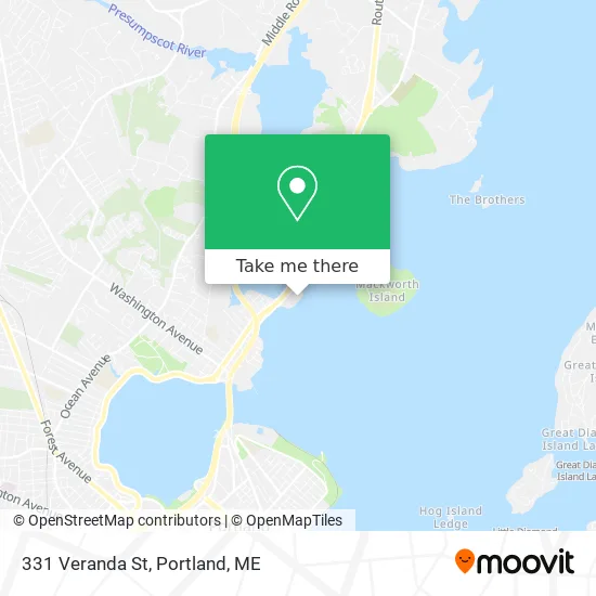
See 331 Veranda St, Portland, ME, on the map
Public Transit to 331 Veranda St in Portland, ME
Wondering how to get to 331 Veranda St in Portland, ME? Moovit helps you find the best way to get to 331 Veranda St with step-by-step directions from the nearest public transit station.
Moovit provides free maps and live directions to help you navigate through your city. View schedules, routes, timetables, and find out how long does it take to get to 331 Veranda St in real time.
Looking for the nearest stop or station to 331 Veranda St? Check out this list of stops closest to your destination: Veranda St + Marine Hospital; Casco Bay Lines Terminal.
Bus: 7.Ferry: DB, IB, PK.
Want to see if there’s another route that gets you there at an earlier time? Moovit helps you find alternative routes or times. Get directions from and directions to 331 Veranda St easily from the Moovit App or Website.
We make riding to 331 Veranda St easy, which is why over 1.5 million users, including users in Portland, ME, trust Moovit as the best app for public transit. You don’t need to download an individual bus app or train app, Moovit is your all-in-one transit app that helps you find the best bus time or train time available.
For information on prices of bus, costs and ride fares to 331 Veranda St, please check the Moovit app.
Use the app to navigate to popular places including to the airport, hospital, stadium, grocery store, mall, coffee shop, school, college, and university.
331 Veranda St Address: Portland, ME 04103 street in Portland, ME
- Jeffrey J Holmstrom do,
- Laura Hill NP,
- Martins Point Health Care,
- Amana Factory Certified Appliance Repair,
- RE/MAX,
- Search Homes in Portland,
- Saccarappa Falls,
- Olympia St & Victoria St,
- 3 G's Tire,
- US-1,
- 2g Properties,
- Boxing Instruction,
- Fortland,
- Arcadia St,
- I-95 South (Portland),
- Prentiss St,
- Cumberland Glass,
- D&M Distributors,
- Landmarx Construction,
- ABC Woodworks
Places Near 331 Veranda St (Portland, ME)
- Maine Medical Center,
- Walmart Scarborough Supercenter,
- The Old Port,
- Cape Elizabeth, ME, Cape Elizabeth,
- Exit 45 Park And Ride, South Portland,
- On a bus to Kennebunkport,
- Cross Insurance Arena,
- Portland International Jetport (PWM) (Portland International Jetport),
- Clarion Hotel Portland,
- Portland Transportation Center,
- House Island,
- Southern Maine Community College, South Portland,
- Jewell Island,
- Walmart,
- Casco Bay Ferry Terminal,
- Fort Gorges,
- Mercy Hospital - Fore River Campus,
- ZzZzZzZzZzZ, Westbrook,
- Fort Williams Park, Cape Elizabeth,
- L. L. Bean Outlet
How to get to popular places in Portland, ME with public transit
Get around Portland, ME by public transit!
Traveling around Portland, ME has never been so easy. See step by step directions as you travel to any attraction, street or major public transit station. View bus and train schedules, arrival times, service alerts and detailed routes on a map, so you know exactly how to get to anywhere in Portland, ME.
When traveling to any destination around Portland, ME use Moovit's Live Directions with Get Off Notifications to know exactly where and how far to walk, how long to wait for your line, and how many stops are left. Moovit will alert you when it's time to get off — no need to constantly re-check whether yours is the next stop.
Wondering how to use public transit in Portland, ME or how to pay for public transit in Portland, ME? Moovit public transit app can help you navigate your way with public transit easily, and at minimum cost. It includes public transit fees, ticket prices, and costs. Looking for a map of Portland, ME public transit lines? Moovit public transit app shows all public transit maps in Portland, ME with all Bus, Train and Ferry routes and stops on an interactive map.
Portland, ME has 3 transit type(s), including: Bus, Train and Ferry, operated by several transit agencies, including Greater Portland Metro, City of South Portland, Biddeford Saco Old Orchard Beach Transit, Casco Bay Lines, Amtrak, Greyhound-us and FlixBus-us