Directions to 333 Plantbased (Plantation) with public transportation
The following transit lines have routes that pass near 333 Plantbased
 Bus: 55.
How to get to 333 Plantbased by bus?
Click on the bus route to see step by step directions with maps, line arrival times and updated time schedules.
From Walmart, Fort Lauderdale
52 minFrom Naples, Florida, Plantation
67 minFrom Westfield Broward Mall, Plantation
62 minFrom City of Lauderdale Lakes, Fort Lauderdale
48 minFrom W Commercial Blvd & 441 (SR 7), Fort Lauderdale
30 minFrom Oakland Park Boulevard & State Road 7, Fort Lauderdale
49 minFrom Lauderhill Mall, Plantation
53 minFrom State Road 7 & West Sunrise Boulevard, Fort Lauderdale
58 minFrom State Road 7 & West Sunrise Boulevard, Plantation
90 minFrom Margate, FL, Coral Springs-Margate
78 min
Bus stop near 333 Plantbased in Plantation
- Nob Hill Road/Northwest 55th Street, 1 min walk,VIEW
Bus lines to 333 Plantbased in Plantation
- 55, Hiatus - Oakland,VIEW
What are the closest stations to 333 Plantbased?
The closest stations to 333 Plantbased are:
- Nob Hill Road/Northwest 55th Street is 25 yards away, 1 min walk.
Which bus line stops near 333 Plantbased?
55 (Hiatus - Oakland)
What’s the nearest bus station to 333 Plantbased in Plantation?
The nearest bus station to 333 Plantbased in Plantation is Nob Hill Road/Northwest 55th Street. It’s a 1 min walk away.
What time is the first bus to 333 Plantbased in Plantation?
The 55 is the first bus that goes to 333 Plantbased in Plantation. It stops nearby at 5:23 AM.
What time is the last bus to 333 Plantbased in Plantation?
The 55 is the last bus that goes to 333 Plantbased in Plantation. It stops nearby at 11:35 PM.
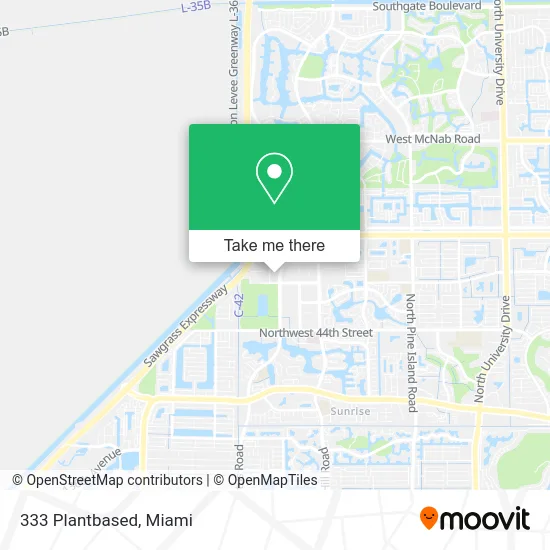
See 333 Plantbased, Plantation, on the map
Public Transit to 333 Plantbased in Plantation
Wondering how to get to 333 Plantbased in Plantation? Moovit helps you find the best way to get to 333 Plantbased with step-by-step directions from the nearest public transit station.
Moovit provides free maps and live directions to help you navigate through your city. View schedules, routes, timetables, and find out how long does it take to get to 333 Plantbased in real time.
Looking for the nearest stop or station to 333 Plantbased? Check out this list of stops closest to your destination: Nob Hill Road/Northwest 55th Street.
Bus: 55.
Want to see if there’s another route that gets you there at an earlier time? Moovit helps you find alternative routes or times. Get directions from and directions to 333 Plantbased easily from the Moovit App or Website.
We make riding to 333 Plantbased easy, which is why over 1.5 million users, including users in Plantation, trust Moovit as the best app for public transit. You don’t need to download an individual bus app or train app, Moovit is your all-in-one transit app that helps you find the best bus time or train time available.
For information on prices of bus, costs and ride fares to 333 Plantbased, please check the Moovit app.
Use the app to navigate to popular places including to the airport, hospital, stadium, grocery store, mall, coffee shop, school, college, and university.
333 Plantbased Address: 5007 N Hiatus Rd Fort Lauderdale, FL 33351 street in Plantation
- Conch Mania,
- Mikes Big Mouth BBQ,
- Halaal Eats,
- Mantuanas,
- Jerkies Grill,
- Stacked Weenies,
- 3D Delicious,
- Joey's Spot,
- HOM Fresh,
- Rebekah Aparicio,
- Pepe's Street Tacos,
- The Greek's Grill,
- Country Kitchen Mobile,
- Forkin Slammin,
- Can't Beat My Meat,
- For the Love of Coffee and Ice Cream,
- Yaadman Style,
- New Manahattan Pizza,
- Tastys by THM,
- The Mac Bowl
Places Near 333 Plantbased (Plantation)
- Sawgrass mall ( FL ), Miami Beach,
- Hard Rock Stadium, Miami Gardens,
- Marlins Park, Miami,
- Sawgrass Mall, Miami,
- Dolphin Mall Bus, Miami,
- Zoo Miami, Miami,
- Dolphin Mall, Miami,
- Aventura Mall, Miami Beach,
- Miami Freedom Park, Miami,
- Wynwood, Miami,
- Bayside Marketplace, Miami,
- Miami VA Hospital, Miami,
- Port of Miami Cruise Terminal, Miami,
- Miami-Dade County Courthouse, Miami,
- Richard E. Gerstein Justice Building, Miami,
- Keiser University Flagship Campus, West Palm Beach,
- Brickell City Centre, Miami,
- Little Havana, Miami,
- Miami Design District, Miami,
- Aventura Mall, Miami
How to get to popular places in Miami with public transit
Get around Plantation by public transit!
Traveling around Plantation has never been so easy. See step by step directions as you travel to any attraction, street or major public transit station. View bus and train schedules, arrival times, service alerts and detailed routes on a map, so you know exactly how to get to anywhere in Plantation.
When traveling to any destination around Plantation use Moovit's Live Directions with Get Off Notifications to know exactly where and how far to walk, how long to wait for your line, and how many stops are left. Moovit will alert you when it's time to get off — no need to constantly re-check whether yours is the next stop.
Wondering how to use public transit in Plantation or how to pay for public transit in Plantation? Moovit public transit app can help you navigate your way with public transit easily, and at minimum cost. It includes public transit fees, ticket prices, and costs. Looking for a map of Plantation public transit lines? Moovit public transit app shows all public transit maps in Plantation with all Bus, Train, Light Rail and Ferry routes and stops on an interactive map.
Miami has 4 transit type(s), including: Bus, Train, Light Rail and Ferry, operated by several transit agencies, including Broward County Transit, Miami-Dade Transit, Metrorail, Palm Tran, Tri-Rail, Brightline, MARTY, City of Homestead Trolley, Key West Transit, Treasure Coast Connector, GoLine IRT, Amtrak, Greyhound-us, FlixBus-us and Aventura Express Shuttle Bus