3 St Se+#4501 stop - Sunday schedule
| Line | Direction | Time |
|---|---|---|
| C13 | South To Eastover | 5:17 AM |
| C13 | South To Eastover | 5:37 AM |
| C13 | South To Eastover | 5:57 AM |
| C13 | South To Eastover | 6:13 AM |
| C13 | South To Eastover | 6:29 AM |
| C13 | South To Eastover | 6:41 AM |
| C13 | South To Eastover | 6:53 AM |
| C13 | South To Eastover | 7:05 AM |
| C13 | South To Eastover | 7:17 AM |
| C15 | South To Southern Av | 7:20 AM |
| C13 | South To Eastover | 7:29 AM |
| C15 | South To Southern Av | 7:40 AM |
| C13 | South To Eastover | 7:41 AM |
| C13 | South To Eastover | 7:53 AM |
| C15 | South To Southern Av | 8:00 AM |
| C13 | South To Eastover | 8:05 AM |
| C13 | South To Eastover | 8:17 AM |
| C15 | South To Southern Av | 8:20 AM |
| C13 | South To Eastover | 8:29 AM |
| C15 | South To Southern Av | 8:40 AM |
| C13 | South To Eastover | 8:44 AM |
| C13 | South To Eastover | 8:56 AM |
| C15 | South To Southern Av | 9:00 AM |
| C13 | South To Eastover | 9:08 AM |
| C13 | South To Eastover | 9:20 AM |
Directions to 3 St Se+#4501 stop (Washington) with public transit
The following transit lines have routes that pass near 3 St Se+#4501
 Bus: C15, C13, C27, P97, P95.
- Metro: GREEN.
How to get to 3 St Se+#4501 stop by bus?
Click on the bus route to see step by step directions with maps, line arrival times and updated time schedules.
How to get to 3 St Se+#4501 stop by metro?
Click on the metro route to see step by step directions with maps, line arrival times and updated time schedules.
Bus stops near 3 St Se+#4501 stop in Washington
- Se 3rd St & Se Livingston Rd, 2 min walk,
- Southern Av Se+S Capitol St SW, 7 min walk,
- Southern Av+S Capitol St, 7 min walk,
- Southern Ave + 6th St, 9 min walk,
- S Capitol St Sw+1 St SW, 9 min walk,
Metro stations near 3 St Se+#4501 station in Washington
- Congress Heights, 38 min walk,
Bus lines to 3 St Se+#4501 stop in Washington
- C13, South To Eastover,
- C15, North To Potomac Av,
- C27, East To Naylor Rd,
- P97, North To Southern Av,
- P95, Bock Road Tech & Rec Complex,
- C11, North To Anacostia,
What are the closest stations to 3 St Se+#4501?
The closest stations to 3 St Se+#4501 are:
- Se 3rd St & Se Livingston Rd stop is 131 yards away, 2 min walk.
- Southern Av Se+S Capitol St SW stop is 550 yards away, 7 min walk.
- Southern Av+S Capitol St stop is 604 yards away, 7 min walk.
- Southern Ave + 6th St stop is 722 yards away, 9 min walk.
- S Capitol St Sw+1 St SW stop is 755 yards away, 9 min walk.
- Congress Heights station is 3309 yards away, 38 min walk.
Which bus line stops near 3 St Se+#4501?
C15 (South To Southern Av)
Which metro line stops near 3 St Se+#4501?
GREEN (Branch Av)
What’s the nearest bus station to 3 St Se+#4501 in Washington?
The nearest bus station to 3 St Se+#4501 in Washington is Se 3rd St & Se Livingston Rd. It’s a 2 min walk away.
What time is the first metro to 3 St Se+#4501 in Washington?
The GREEN is the first metro that goes to 3 St Se+#4501 in Washington. It stops nearby at 5:08 AM.
What time is the last metro to 3 St Se+#4501 in Washington?
The GREEN is the last metro that goes to 3 St Se+#4501 in Washington. It stops nearby at 12:30 AM.
What time is the first bus to 3 St Se+#4501 in Washington?
The C11 is the first bus that goes to 3 St Se+#4501 in Washington. It stops nearby at 3:05 AM.
What time is the last bus to 3 St Se+#4501 in Washington?
The C11 is the last bus that goes to 3 St Se+#4501 in Washington. It stops nearby at 3:09 AM.
3 St Se+#4501 station
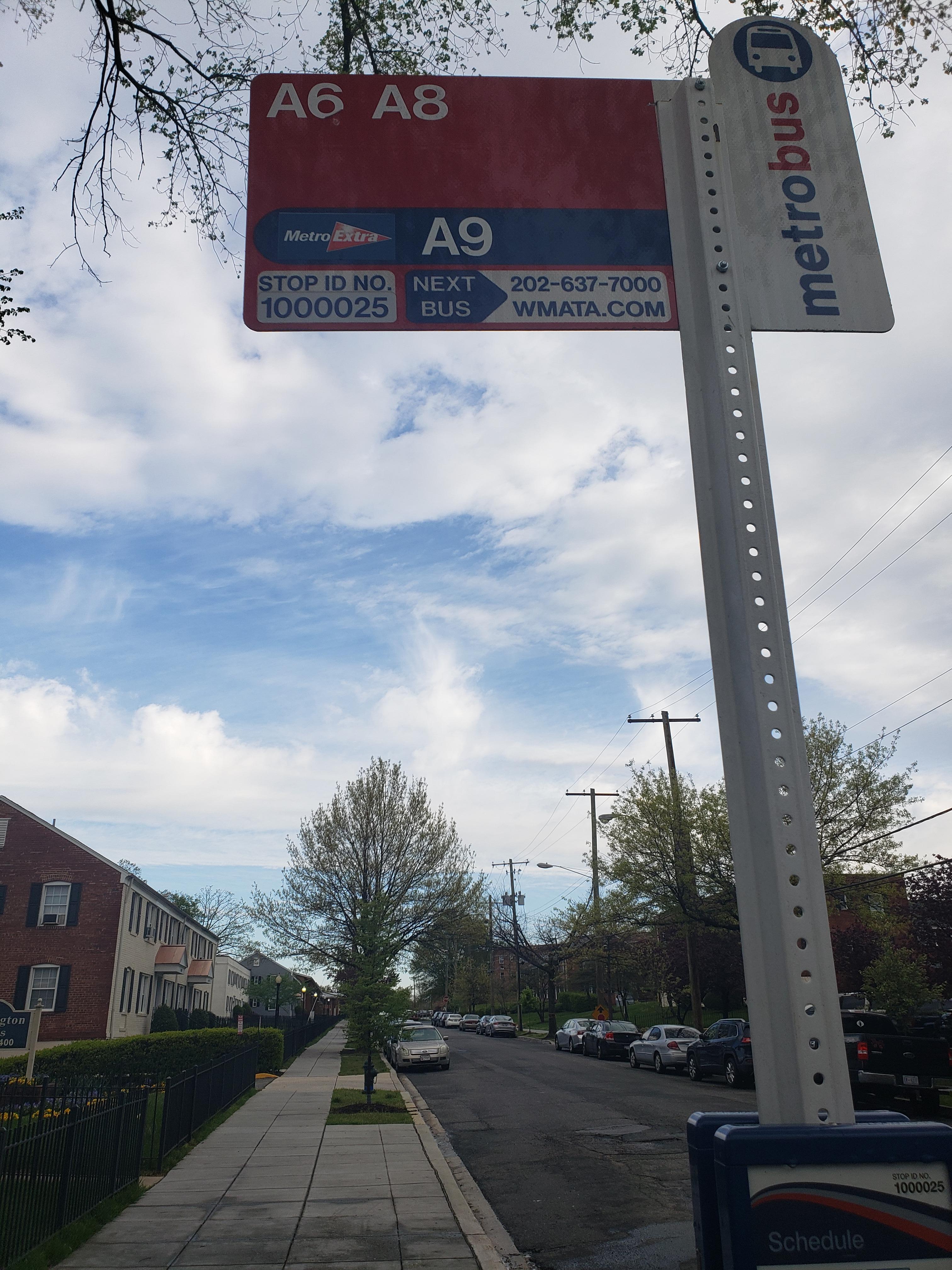 Taken by Derrick C.
See 3 St Se+#4501 stop, Washington, on the map
Public transit to 3 St Se+#4501 stop (ID: 1000025) in Washington
Looking for directions to 3 St Se+#4501 in Washington, United States?
Download the Moovit App to find the current schedule and step-by-step directions for Bus or Metro routes that pass through 3 St Se+#4501.
Looking for the nearest stops closest to 3 St Se+#4501 ? Check out this list of closest stops to your destination: Se 3rd St & Se Livingston Rd; Southern Av Se+S Capitol St SW; Southern Av+S Capitol St; Southern Ave + 6th St; S Capitol St Sw+1 St SW; Congress Heights.
Bus: C15, C13, C27, P97, P95, C11.Metro: GREEN.
We make riding on public transit to 3 St Se+#4501 easy, which is why over 1.7 billion users, including users in Washington trust Moovit as the best app for public transit.
Use the app to navigate to popular places including to the airport, hospital, stadium, grocery store, mall, coffee shop, school, college, and university.
3 St Se+#4501 stop’s code is 1000025
The first line to this stop is C13, at 5:17 AM, and the last line is C13 at 4:57 AM.
This stop serves WMATA’s lines
- Se 3rd St & Se Livingston Rd,
- Southern Av Se+S Capitol St SW,
- Southern Av+S Capitol St,
- Southern Ave + 6th St,
- S Capitol St Sw+1 St SW
Bus stops near 3 St Se+#4501 stop
- Congress Heights
Metro station near 3 St Se+#4501 station
- New Carrollton+Bay C,
- Baltimore Avenue And Powder Mill Road (Southbound),
- Pendleton St And N Henry St,
- 600 S Pickett St,
- Observation Dr & Ridge Rd,
- Executive Blvd & @6006,
- Smithsonian Metrorail,
- Georgia Av Nw+Piney Branch Rd NW,
- S Van Dorn St @ Kingstowne Blvd,
- Horner Rd Commuter Lot Stop 2 AM,
- Germantown Marc Station & Parking Lot,
- Cherry Lane And 4th Street,
- Huntsman Bl+Fairfax County Pkwy,
- Irving St Nw+Georgia Av NW,
- Market St Ne+Lowes,
- Federal Center SW,
- Harford County Health Dept (Hays St & Thomas St),
- Walker Mill Rd & Rochelle Ave,
- Iverson St & Iverson Mall,
- Linden Park And Ride
Popular public transit stations in Washington
Get around Washington by public transit!
Traveling around Washington has never been so easy. See step by step directions as you travel to any attraction, street or major public transit station. View bus and train schedules, arrival times, service alerts and detailed routes on a map, so you know exactly how to get to anywhere in Washington.
When traveling to any destination around Washington use Moovit's Live Directions with Get Off Notifications to know exactly where and how far to walk, how long to wait for your line, and how many stops are left. Moovit will alert you when it's time to get off — no need to constantly re-check whether yours is the next stop.
Wondering how to use public transit in Washington or how to pay for public transit in Washington? Moovit public transit app can help you navigate your way with public transit easily, and at minimum cost. It includes public transit fees, ticket prices, and costs. Looking for a map of Washington public transit lines? Moovit public transit app shows all public transit maps in Washington with all Bus, Train, Metro, Light Rail and Ferry routes and stops on an interactive map.
Washington, D.C. - Baltimore, MD has 5 transit type(s), including: Bus, Train, Metro, Light Rail and Ferry, operated by several transit agencies, including WMATA, Montgomery County Ride On, Fairfax Connector, Prince Georges County's TheBus, PRTC, DASH - Alexandria, Arlington Transit (ART), RTA of Central Maryland, MDOT MTA, MDOT MTA Light RailLink, MDOT MTA Commuter Bus, MDOT MTA Local Bus, FXBGO!, Virginia Railway Express (VRE) and MARC