How to get to 3aaa by bus?
Click on the bus route to see step by step directions with maps, line arrival times and updated time schedules.
From UGC Ciné Cité Bercy, Paris
83 minFrom AccorHotels Arena, Paris
62 minFrom Stade Charléty, Paris
55 minFrom Quartier Chinois, Paris
61 minFrom Parc André Citroën, Paris
55 minFrom Rueil-Malmaison, Rueil-Malmaison
59 minFrom Le Marché de Sarcelles, Sarcelles
71 minFrom Amphi 1A Ernest Vilgrain UP7, Paris
62 minFrom Hôpital Privé Des Peupliers, Paris
61 minFrom Paris Marriott Rive Gauche Hotel & Conference Center, Paris
51 min
How to get to 3aaa by train?
Click on the train route to see step by step directions with maps, line arrival times and updated time schedules.
How to get to 3aaa by metro?
Click on the metro route to see step by step directions with maps, line arrival times and updated time schedules.
From UGC Ciné Cité Bercy, Paris
42 minFrom AccorHotels Arena, Paris
41 minFrom Stade Charléty, Paris
61 minFrom Quartier Chinois, Paris
51 minFrom Parc André Citroën, Paris
52 minFrom Amphi 1A Ernest Vilgrain UP7, Paris
47 minFrom Hôpital Privé Des Peupliers, Paris
51 minFrom Paris Marriott Rive Gauche Hotel & Conference Center, Paris
54 min
Bus stops near 3aaa in Clichy
Train stations near 3aaa in Clichy
Metro stations near 3aaa in Clichy
Bus lines to 3aaa in Clichy
What are the closest stations to 3aaa?
The closest stations to 3aaa are:
- Danielle Casanova is 58 meters away, 1 min walk.
- Landy - Martre is 132 meters away, 2 min walk.
- Gabriel Péri is 287 meters away, 4 min walk.
- Clichy - Levallois is 947 meters away, 13 min walk.
- Gare D'Asnieres is 1207 meters away, 16 min walk.
- Mairie de Clichy is 1244 meters away, 16 min walk.
- Porte de Clichy is 1247 meters away, 17 min walk.
Which bus lines stop near 3aaa?
These bus lines stop near 3aaa: 174, 274, 341, 54.
Which train line stops near 3aaa?
L (Cergy-le-Haut/ Versailles-Rive-Droite/ Saint-Nom-la-Bretèche - Forêt de Marly)
Which metro line stops near 3aaa?
14 (Olympiades)
What’s the nearest metro station to 3aaa in Clichy?
The nearest metro station to 3aaa in Clichy is Mairie de Clichy. It’s a 16 min walk away.
What’s the nearest train station to 3aaa in Clichy?
The nearest train station to 3aaa in Clichy is Clichy - Levallois. It’s a 13 min walk away.
What’s the nearest bus station to 3aaa in Clichy?
The nearest bus station to 3aaa in Clichy is Danielle Casanova. It’s a 1 min walk away.
What time is the first light rail to 3aaa in Clichy?
The T3B is the first light rail that goes to 3aaa in Clichy. It stops nearby at 6:06 AM.
What time is the last light rail to 3aaa in Clichy?
The T3B is the last light rail that goes to 3aaa in Clichy. It stops nearby at 1:12 AM.
What time is the first metro to 3aaa in Clichy?
The 14 is the first metro that goes to 3aaa in Clichy. It stops nearby at 5:30 AM.
What time is the last metro to 3aaa in Clichy?
The 14 is the last metro that goes to 3aaa in Clichy. It stops nearby at 1:15 AM.
What time is the first train to 3aaa in Clichy?
The J is the first train that goes to 3aaa in Clichy. It stops nearby at 5:02 AM.
What time is the last train to 3aaa in Clichy?
The J is the last train that goes to 3aaa in Clichy. It stops nearby at 1:07 AM.
What time is the first bus to 3aaa in Clichy?
The N51 is the first bus that goes to 3aaa in Clichy. It stops nearby at 3:01 AM.
What time is the last bus to 3aaa in Clichy?
The N51 is the last bus that goes to 3aaa in Clichy. It stops nearby at 3:38 AM.
What time is the first RER to 3aaa in Clichy?
The C is the first RER that goes to 3aaa in Clichy. It stops nearby at 5:21 AM.
What time is the last RER to 3aaa in Clichy?
The C is the last RER that goes to 3aaa in Clichy. It stops nearby at 12:39 AM.
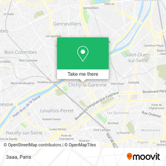
See 3aaa, Clichy, on the map
Public Transit to 3aaa in Clichy
Wondering how to get to 3aaa in Clichy? Moovit helps you find the best way to get to 3aaa with step-by-step directions from the nearest public transit station.
Moovit provides free maps and live directions to help you navigate through your city. View schedules, routes, timetables, and find out how long does it take to get to 3aaa in real time.
Looking for the nearest stop or station to 3aaa? Check out this list of stops closest to your destination: Danielle Casanova; Landy - Martre; Gabriel Péri; Clichy - Levallois; Gare D'Asnieres; Mairie de Clichy; Porte de Clichy.
Bus: 174, 274, 341, 54.Train: L, J.Metro: 14, 13, C, T3B.
Want to see if there’s another route that gets you there at an earlier time? Moovit helps you find alternative routes or times. Get directions from and directions to 3aaa easily from the Moovit App or Website.
We make riding to 3aaa easy, which is why over 1.5 million users, including users in Clichy, trust Moovit as the best app for public transit. You don’t need to download an individual bus app or train app, Moovit is your all-in-one transit app that helps you find the best bus time or train time available.
For information on prices of bus, metro, light rail, train and RER, costs and ride fares to 3aaa, please check the Moovit app.
Use the app to navigate to popular places including to the airport, hospital, stadium, grocery store, mall, coffee shop, school, college, and university.
3aaa Address: 1 Rue du Landy 92110 Clichy street in Clichy
- D a C V,
- Abeille Assurances-Clichy,
- Retoucherie 102,
- Century 21,
- Sabrina Retouches,
- Sarl Malik Bazar,
- Paroisse Saint-Vincent de Paul de Clichy,
- Malik Bazar,
- Aprium Pharmacie de l'Avenir,
- Arrêt Daniel Casanova [54, 174],
- Tribe Paris Clichy,
- Sca Assurances,
- Ot Clichy,
- Banque Populaire,
- Sgta Sud,
- Auto École Clichoise,
- Fiduciaire Union Nord,
- Axa Assurance Willy Hatho,
- Dr. Fiszenson Olivier,
- Agence Immobilière Guy Hoquet Clichy la Garenne
Places Near 3aaa (Clichy)
- Fondation Louis Vuitton, Paris,
- Hopital Lariboisière, Paris,
- Beaugrenelle, Paris,
- Galeries Lafayette Haussmann, Paris,
- 29 Rue Manin, Paris,
- Hôpital Cochin, Paris,
- Centre Hospitalier des 15/20, Paris,
- Hôpital de la Pitié-Salpêtrière, Paris,
- Atelier Des Lumieres, Paris,
- Hôpital Henri Mondor, Creteil,
- Hôpital Saint-Joseph, Paris,
- Créteil Soleil, Creteil,
- Hôpital Beaujon, Clichy,
- Théâtre Mogador, Paris,
- Gare Routière Flixbus, Paris,
- Marché Saint-Pierre, Paris,
- Hopital Foch, Suresnes,
- Hôpital Pitié Salpêtrière, Paris,
- Hôpital Necker, Paris,
- Galeries Lafayette, Paris
How to get to popular places in Paris with public transit
Get around Clichy by public transit!
Traveling around Clichy has never been so easy. See step by step directions as you travel to any attraction, street or major public transit station. View bus and train schedules, arrival times, service alerts and detailed routes on a map, so you know exactly how to get to anywhere in Clichy.
When traveling to any destination around Clichy use Moovit's Live Directions with Get Off Notifications to know exactly where and how far to walk, how long to wait for your line, and how many stops are left. Moovit will alert you when it's time to get off — no need to constantly re-check whether yours is the next stop.
Wondering how to use public transit in Clichy or how to pay for public transit in Clichy? Moovit public transit app can help you navigate your way with public transit easily, and at minimum cost. It includes public transit fees, ticket prices, and costs. Looking for a map of Clichy public transit lines? Moovit public transit app shows all public transit maps in Clichy with all Bus, Train, Metro, Light Rail, RER, Funicular and Gondola routes and stops on an interactive map.
Paris has 7 transit type(s), including: Bus, Train, Metro, Light Rail, RER, Funicular and Gondola, operated by several transit agencies, including RATP, RER, RER Bus de remplacement, Train, Train Bus de remplacement, Tramway Bus de remplacement, TER, ADP, Magical Shuttle, Argenteuil - Boucles de Seine, Autocars Dominique, Bièvre, Brie et 2 Morin, Le Bus - C.C. du Clermontois and Cœur d’Essonne