How to get to 4th @ Stewart (N) by bus?
Click on the bus route to see step by step directions with maps, line arrival times and updated time schedules.
From Krab Kingz Seafood, Spring Valley
65 minFrom The Boulevard Mall, Paradise
29 minFrom Tree Line Dr / E Sahara Ave, Sunrise Manor
63 minFrom Threat Museum petting zoo, Nellis Afb
68 minFrom LAVO Italian Restaurant & Lounge, Paradise
36 minFrom Blackbird Comics, North Las Vegas
39 minFrom Yardbird Southern Table & Bar, Paradise
37 minFrom Ross Dress For Less, Las Vegas
31 minFrom 5103 Etm D2gate, Paradise
56 minFrom Goodwill, Las Vegas
54 min
Bus stops near 4th @ Stewart (N) in Las Vegas
Monorail station near 4th @ Stewart (N) in Las Vegas
- Sls Station, 54 min walk,VIEW
Bus lines to 4th @ Stewart (N) in Las Vegas
- 113, 113 N. Las Vegas Blvd Northbound (Ends at Craig),VIEW
- CX, Centennial Express Southbound,VIEW
- 401, 401 N. Outlets / Symphony Park,VIEW
- 215, 215 Bonanza Eastbound,VIEW
- DVX, Downtown & Veteran Medical Center Express Northbound,VIEW
- 106, 106b Centennial Hills / Rancho Southbound,VIEW
- 208, 208 Washington Westbound,VIEW
- 214, 214 West -D Street,VIEW
- DEUCE, Deuce on the Strip Southbound,VIEW
- 207, 207 Alta / Stewart Eastbound,VIEW
- DOWNTOWN LOOP, Loop,VIEW
What are the closest stations to 4th @ Stewart (N)?
The closest stations to 4th @ Stewart (N) are:
- Sb Las Vegas Before Bonanza is 56 yards away, 1 min walk.
- Sb Casino Center Before Fremont is 95 yards away, 2 min walk.
- Wb Bonanza Before Las Vegas is 218 yards away, 3 min walk.
- Nb Main After Ogden is 384 yards away, 6 min walk.
- Sb Lv Blvd at Fremont St Experience is 460 yards away, 7 min walk.
- Wb Stewart After 6th is 579 yards away, 7 min walk.
- The Mob Museum is 858 yards away, 11 min walk.
- Sls Station is 4559 yards away, 54 min walk.
Which bus lines stop near 4th @ Stewart (N)?
These bus lines stop near 4th @ Stewart (N): 207, 215, DEUCE.
What’s the nearest bus station to 4th @ Stewart (N) in Las Vegas?
The nearest bus station to 4th @ Stewart (N) in Las Vegas is Sb Las Vegas Before Bonanza. It’s a 1 min walk away.
What time is the first bus to 4th @ Stewart (N) in Las Vegas?
The 113 is the first bus that goes to 4th @ Stewart (N) in Las Vegas. It stops nearby at 3:00 AM.
What time is the last bus to 4th @ Stewart (N) in Las Vegas?
The DEUCE is the last bus that goes to 4th @ Stewart (N) in Las Vegas. It stops nearby at 3:37 AM.
What time is the first Monorail to 4th @ Stewart (N) in Las Vegas?
The LVM is the first Monorail that goes to 4th @ Stewart (N) in Las Vegas. It stops nearby at 7:00 AM.
What time is the last Monorail to 4th @ Stewart (N) in Las Vegas?
The LVM is the last Monorail that goes to 4th @ Stewart (N) in Las Vegas. It stops nearby at 12:02 AM.
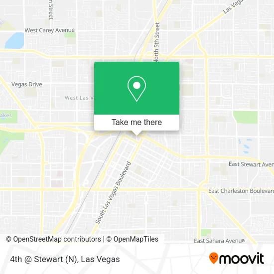
See 4th @ Stewart (N), Las Vegas, on the map
Public Transit to 4th @ Stewart (N) in Las Vegas
Wondering how to get to 4th @ Stewart (N) in Las Vegas? Moovit helps you find the best way to get to 4th @ Stewart (N) with step-by-step directions from the nearest public transit station.
Moovit provides free maps and live directions to help you navigate through your city. View schedules, routes, timetables, and find out how long does it take to get to 4th @ Stewart (N) in real time.
Looking for the nearest stop or station to 4th @ Stewart (N)? Check out this list of stops closest to your destination: Sb Las Vegas Before Bonanza; Sb Casino Center Before Fremont; Wb Bonanza Before Las Vegas; Nb Main After Ogden; Sb Lv Blvd at Fremont St Experience; Wb Stewart After 6th; The Mob Museum; Sls Station.
Bus: 207, 215, DEUCE, 113, CX, 401, DVX, 106, 208, 214.Monorail: LVM.
Want to see if there’s another route that gets you there at an earlier time? Moovit helps you find alternative routes or times. Get directions from and directions to 4th @ Stewart (N) easily from the Moovit App or Website.
We make riding to 4th @ Stewart (N) easy, which is why over 1.7 million users, including users in Las Vegas, trust Moovit as the best app for public transit. You don’t need to download an individual bus app or train app, Moovit is your all-in-one transit app that helps you find the best bus time or train time available.
For information on prices of bus, costs and ride fares to 4th @ Stewart (N), please check the Moovit app.
Use the app to navigate to popular places including to the airport, hospital, stadium, grocery store, mall, coffee shop, school, college, and university.
4th @ Stewart (N) Address: 383 N 4th St Las Vegas, NV 89101 street in Las Vegas
- Mob Museum,
- Dtc Lot,
- Parole and Probation,
- Las Vegas, Nevada,
- Stars Nackt - Das Original! Deutsche Stars Nackt!,
- Downtown Grand Las Vegas Hotel & Casino,
- Stewart Ave / Las Vegas Blvd N,
- corner of 4th & Fremont Street,
- Downtown Grand Hotel & Casino,
- Downtown Grand,
- N 3rd St / E Ogden Ave,
- EDC Downtown Shuttle Station,
- Brothels, Booze & Burlesque Tour,
- Beta Enigma,
- California Hotel and Casino,
- Don't Tell Mama (Dont Tell Mama),
- Telemundo Las Vegas,
- Neonopolis Parking Garage,
- Holo Holo - the Happy Bar,
- Seance
Places Near 4th @ Stewart (N) (Las Vegas)
- Lee Canyon, Las Vegas,
- Meow Wolf - Las Vegas (Meow Wolf's Omega Mart), Las Vegas,
- Trump International Hotel Las Vegas, Paradise,
- Las Vegas South Premium Outlets, Enterprise,
- Walmart, Las Vegas,
- Gold & Silver Pawn Shop, Las Vegas,
- Welcome To Fabulous Las Vegas Sign, Paradise,
- Las Vegas Premium Outlets-North, Enterprise,
- The Deuce Bus Stop at Fremont St, Las Vegas,
- The Palms Casino Resort, Paradise,
- Area15, Las Vegas,
- Town Square, Enterprise,
- Allegiant Stadium, Paradise,
- Koolsville Tattoos, Las Vegas,
- The Neon Museum, Las Vegas,
- Las Vegas North Premium Outlets, Las Vegas,
- Arte Museum Las Vegas, Paradise,
- Omega Mart, Las Vegas,
- Walmart Supercenter, Las Vegas,
- Zak Bagans Haunted Museum, Las Vegas
How to get to popular places in Las Vegas with public transit
Get around Las Vegas by public transit!
Traveling around Las Vegas has never been so easy. See step by step directions as you travel to any attraction, street or major public transit station. View bus and train schedules, arrival times, service alerts and detailed routes on a map, so you know exactly how to get to anywhere in Las Vegas.
When traveling to any destination around Las Vegas use Moovit's Live Directions with Get Off Notifications to know exactly where and how far to walk, how long to wait for your line, and how many stops are left. Moovit will alert you when it's time to get off — no need to constantly re-check whether yours is the next stop.
Wondering how to use public transit in Las Vegas or how to pay for public transit in Las Vegas? Moovit public transit app can help you navigate your way with public transit easily, and at minimum cost. It includes public transit fees, ticket prices, and costs. Looking for a map of Las Vegas public transit lines? Moovit public transit app shows all public transit maps in Las Vegas with all Bus and Monorail routes and stops on an interactive map.
Las Vegas has 2 transit type(s), including: Bus and Monorail, operated by several transit agencies, including RTCSNV, City of Las Vegas, Alvand Transportation, Vegas Airporter, Las Vegas Monorail, FlixBus-us and Greyhound-us