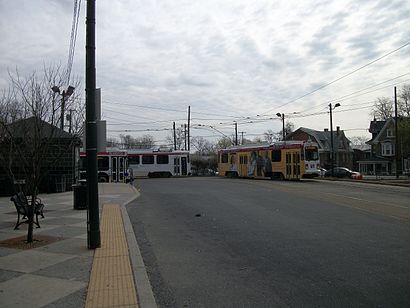
63rd-Malvern stop - Thursday schedule
| Line | Direction | Time |
|---|---|---|
| T1 | 63rd-Malvern | 4:45 AM |
| 46 | 58th-Baltimore | 4:53 AM |
| T1 | 13th St | 4:55 AM |
| T1 | 13th St | 5:17 AM |
| 46 | 58th-Baltimore | 5:18 AM |
| T1 | 63rd-Malvern | 5:21 AM |
| 46 | 63rd-Malvern | 5:33 AM |
| T1 | 13th St | 5:36 AM |
| 46 | 58th-Baltimore | 5:38 AM |
| T1 | 13th St | 5:48 AM |
| 46 | 58th-Baltimore | 5:52 AM |
| T1 | 63rd-Malvern | 5:52 AM |
| 46 | 63rd-Malvern | 5:58 AM |
| T1 | 13th St | 5:59 AM |
| 46 | 58th-Baltimore | 6:05 AM |
| T1 | 13th St | 6:09 AM |
| T1 | 63rd-Malvern | 6:15 AM |
| 46 | 58th-Baltimore | 6:18 AM |
| T1 | 13th St | 6:19 AM |
| 46 | 63rd-Malvern | 6:20 AM |
| T1 | 13th St | 6:27 AM |
| 46 | 58th-Baltimore | 6:31 AM |
| T1 | 13th St | 6:34 AM |
| 46 | 63rd-Malvern | 6:36 AM |
| T1 | 63rd-Malvern | 6:36 AM |
Directions to 63rd-Malvern stop (Philadelphia) with public transit
The following transit lines have routes that pass near 63rd-Malvern
 Bus: 46, 65, 105, T1, 63.
- Train: PAO.
- Metro: T1.
How to get to 63rd-Malvern stop by bus?
Click on the bus route to see step by step directions with maps, line arrival times and updated time schedules.
How to get to 63rd-Malvern stop by train?
Click on the train route to see step by step directions with maps, line arrival times and updated time schedules.
How to get to 63rd-Malvern stop by metro?
Click on the metro route to see step by step directions with maps, line arrival times and updated time schedules.
Bus stops near 63rd-Malvern stop in Philadelphia
- Malvern Av & 63rd St Loop, 1 min walk,
- Malvern Av & 63rd St, 2 min walk,
Train stations near 63rd-Malvern station in Philadelphia
- Overbrook, 10 min walk,
Bus lines to 63rd-Malvern stop in Philadelphia
- 65, Germantown-Chelten,
- 105, Ardmore,
- T1, 13th St to 63rd-Malvern/Overbrook,
- 46, 58th-Baltimore to 63rd-Malvern,
- 63, Lanknau/Overbrk to ColCom/FdCtr,
What are the closest stations to 63rd-Malvern?
The closest stations to 63rd-Malvern are:
- Malvern Av & 63rd St Loop is 23 yards away, 1 min walk.
- Malvern Av & 63rd St is 81 yards away, 2 min walk.
- Overbrook is 803 yards away, 10 min walk.
Which bus lines stop near 63rd-Malvern?
These bus lines stop near 63rd-Malvern: 46, 65.
Which train line stops near 63rd-Malvern?
PAO (Malvern)
Which metro line stops near 63rd-Malvern?
T1 (63rd-Malvern)
What’s the nearest train station to 63rd-Malvern in Philadelphia?
The nearest train station to 63rd-Malvern in Philadelphia is Overbrook. It’s a 10 min walk away.
What’s the nearest bus station to 63rd-Malvern in Philadelphia?
The nearest bus station to 63rd-Malvern in Philadelphia is Malvern Av & 63rd St Loop. It’s a 1 min walk away.
What time is the first metro to 63rd-Malvern in Philadelphia?
The T1 is the first metro that goes to 63rd-Malvern in Philadelphia. It stops nearby at 3:18 AM.
What time is the last metro to 63rd-Malvern in Philadelphia?
The T1 is the last metro that goes to 63rd-Malvern in Philadelphia. It stops nearby at 1:13 AM.
What time is the first train to 63rd-Malvern in Philadelphia?
The PAO is the first train that goes to 63rd-Malvern in Philadelphia. It stops nearby at 5:37 AM.
What time is the last train to 63rd-Malvern in Philadelphia?
The PAO is the last train that goes to 63rd-Malvern in Philadelphia. It stops nearby at 12:14 AM.
What time is the first bus to 63rd-Malvern in Philadelphia?
The 65 is the first bus that goes to 63rd-Malvern in Philadelphia. It stops nearby at 4:43 AM.
What time is the last bus to 63rd-Malvern in Philadelphia?
The 65 is the last bus that goes to 63rd-Malvern in Philadelphia. It stops nearby at 1:43 AM.
See 63rd-Malvern stop, Philadelphia, on the map
Public transit to 63rd-Malvern stop (ID: 31294) in Philadelphia
Looking for directions to 63rd-Malvern in Philadelphia, United States?
Download the Moovit App to find the current schedule and step-by-step directions for Bus, Metro or Train routes that pass through 63rd-Malvern.
Looking for the nearest stops closest to 63rd-Malvern ? Check out this list of closest stops to your destination: Malvern Av & 63rd St Loop; Malvern Av & 63rd St; Overbrook.
Bus: 46, 65, 105, T1, 63.Train: PAO.Metro: T1.
We make riding on public transit to 63rd-Malvern easy, which is why over 1.5 million users, including users in Philadelphia trust Moovit as the best app for public transit.
Use the app to navigate to popular places including to the airport, hospital, stadium, grocery store, mall, coffee shop, school, college, and university.
63rd-Malvern stop’s code is 31294
The first line to this stop is T1, at 4:45 AM, and the last line is T1 at 4:28 AM.
6210 Malvern Ave, Philadelphia, PA, USA
This stop serves SEPTA Subway and SEPTA’s lines
Popular routes from 63rd-Malvern stop, Philadelphia
- Malvern Av & 63rd St Loop,
- Malvern Av & 63rd St
Bus stops near 63rd-Malvern stop
- Overbrook
Train station near 63rd-Malvern station
- Amazon Fulfillment Ctr - West Deptford,
- Erie Av & Castor Av ,
- 41st St & Parkside Av,
- 63rd St & City Line Av - Fs,
- Spring Garden St & 8th St,
- Broad St & Girard Av,
- Market St & 21st St - FS,
- 69th Av & 11th St,
- Neshaminy,
- Arrott Transportation Center,
- Wallingford,
- Us-30 at Berlin - Cross Keys Rd,
- 17th St & Huntingdon St,
- Broad St & Shunk St,
- Nj State Police Headquarters,
- 33rd St & Cumberland St,
- Broad St & Vine St,
- 62nd St & Dicks Av ,
- Walter Rand Transportation Ctr,
- 11th St & Spruce St
Popular public transit stations in Philadelphia
Get around Philadelphia by public transit!
Traveling around Philadelphia has never been so easy. See step by step directions as you travel to any attraction, street or major public transit station. View bus and train schedules, arrival times, service alerts and detailed routes on a map, so you know exactly how to get to anywhere in Philadelphia.
When traveling to any destination around Philadelphia use Moovit's Live Directions with Get Off Notifications to know exactly where and how far to walk, how long to wait for your line, and how many stops are left. Moovit will alert you when it's time to get off — no need to constantly re-check whether yours is the next stop.
Wondering how to use public transit in Philadelphia or how to pay for public transit in Philadelphia? Moovit public transit app can help you navigate your way with public transit easily, and at minimum cost. It includes public transit fees, ticket prices, and costs. Looking for a map of Philadelphia public transit lines? Moovit public transit app shows all public transit maps in Philadelphia with all Bus, Train, Metro, Light Rail and Cable Car routes and stops on an interactive map.
Philadelphia has 5 transit type(s), including: Bus, Train, Metro, Light Rail and Cable Car, operated by several transit agencies, including SEPTA Subway, SEPTA Rail, SEPTA, SEPTA Trolley, NJ Transit Rail, NJ Transit Bus, Port Authority Transit Corporation, Navy Yard, Penn Transit, Drexel University, Pottstown Area Rapid Transit (PART), Fullington Tours, Chescobus, Amtrak and Greyhound-us