How to get to 66 Photo by bus?
Click on the bus route to see step by step directions with maps, line arrival times and updated time schedules.
From Pujiang Royal Scenery Bay, Hunnan District
72 minFrom Yuanmeng Fate Dance Hall, Shenhe District
52 minFrom Golden Valley Drink Bar (Wuzhou Spring City Store), Heping District
34 minFrom Lao Shen Tou Bao Zi Porridge Shop (Shenyang Headquarters), Shenhe District
47 minFrom Jinyang Avenue Metro Station - Exit A, Hunnan District
55 minFrom First House, Heping District
46 minFrom Suning Electrical (Zhongjie Cultural Building Store), Shenhe District
47 minFrom Shenhe District Real Estate Administrative Management Office, Shenhe District
61 minFrom Nanta Shoe City, Shenhe District
41 minFrom Shenyang North Station - North B Entrance, Huanggu District
48 min
How to get to 66 Photo by metro?
Click on the metro route to see step by step directions with maps, line arrival times and updated time schedules.
From Yuanmeng Fate Dance Hall, Shenhe District
71 minFrom Golden Valley Drink Bar (Wuzhou Spring City Store), Heping District
46 minFrom Lao Shen Tou Bao Zi Porridge Shop (Shenyang Headquarters), Shenhe District
61 minFrom Suning Electrical (Zhongjie Cultural Building Store), Shenhe District
47 minFrom Shenyang North Station - North B Entrance, Huanggu District
61 min
Metro stations near 66 Photo in Tiexi District
Bus stops near 66 Photo in Tiexi District
Bus lines to 66 Photo in Tiexi District
What are the closest stations to 66 Photo?
The closest stations to 66 Photo are:
- Shen Liao Road is 135 meters away, 3 min walk.
- Qigong No.2 School is 387 meters away, 6 min walk.
- Labor Park North is 422 meters away, 6 min walk.
- Zhaogong Street South 10th Road is 471 meters away, 7 min walk.
- Heavy Industry Street is 1700 meters away, 22 min walk.
Which bus lines stop near 66 Photo?
These bus lines stop near 66 Photo: Route 161, Route 204, Route 226, Route 240, Route 278, Route 288.
Which metro line stops near 66 Photo?
Line 1 (13th Street)
What’s the nearest metro station to 66 Photo in Tiexi District?
The nearest metro station to 66 Photo in Tiexi District is Shen Liao Road. It’s a 3 min walk away.
What’s the nearest bus station to 66 Photo in Tiexi District?
The nearest bus stations to 66 Photo in Tiexi District are Qigong No.2 School and Labor Park North. The closest one is a 6 min walk away.
What time is the first metro to 66 Photo in Tiexi District?
The Line 9 is the first metro that goes to 66 Photo in Tiexi District. It stops nearby at 5:37 AM.
What time is the last metro to 66 Photo in Tiexi District?
The Line 1 is the last metro that goes to 66 Photo in Tiexi District. It stops nearby at 10:32 PM.
What time is the first bus to 66 Photo in Tiexi District?
The Route 240 is the first bus that goes to 66 Photo in Tiexi District. It stops nearby at 4:57 AM.
What time is the last bus to 66 Photo in Tiexi District?
The Route 240 is the last bus that goes to 66 Photo in Tiexi District. It stops nearby at 11:18 PM.
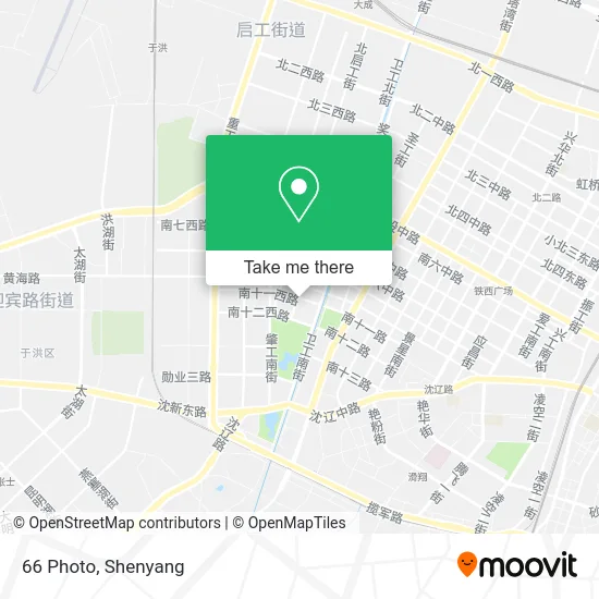
See 66 Photo, Tiexi District, on the map
Public Transit to 66 Photo in Tiexi District
Wondering how to get to 66 Photo in Tiexi District? Moovit helps you find the best way to get to 66 Photo with step-by-step directions from the nearest public transit station.
Moovit provides free maps and live directions to help you navigate through your city. View schedules, routes, timetables, and find out how long does it take to get to 66 Photo in real time.
Looking for the nearest stop or station to 66 Photo? Check out this list of stops closest to your destination: Shen Liao Road; Qigong No.2 School; Labor Park North; Zhaogong Street South 10th Road; Heavy Industry Street.
Bus: Route 161, Route 204, Route 226, Route 240, Route 278, Route 288, Route 204, Route 226, Route 278, Route 104, Route 161, Route 240, Route 181.Metro: Line 1, Line 9, Line 1.
Want to see if there’s another route that gets you there at an earlier time? Moovit helps you find alternative routes or times. Get directions from and directions to 66 Photo easily from the Moovit App or Website.
We make riding to 66 Photo easy, which is why over 1.5 million users, including users in Tiexi District, trust Moovit as the best app for public transit. You don’t need to download an individual bus app or train app, Moovit is your all-in-one transit app that helps you find the best bus time or train time available.
For information on prices of bus and metro, costs and ride fares to 66 Photo, please check the Moovit app.
Use the app to navigate to popular places including to the airport, hospital, stadium, grocery store, mall, coffee shop, school, college, and university.
66 Photo Address: 南十一西路9号 street in Tiexi District
- Lao Tongguan Meat Sandwich,
- Shaanxi Snacks (11th Road Branch),
- ZY Styling,
- Lani International Kindergarten (Mazhuang Street) - Southwest Gate,
- Shenyang Tiexi District Second Hospital,
- Whale King Aquarium,
- Yuan Shi Barbecue,
- China Petroleum (Liaoning Shenyang Company Zhaogang Gas Station),
- Fragrant Fate Pavilion,
- Omaxi Dessert (11th Road Store),
- Hengda Flowers,
- Hundred Flowers Valley Ecological Museum,
- China Unicom (South 11th Road Branch),
- Weigong South Street, Lane 50,
- Weigong South Street Lane 50 / Ma Zhuang Street (Intersection),
- Zhonghuan Dance Hall,
- Wangjia Convenience Store,
- Yinbin Apartment Garden - Building 8,
- Baishan Pool,
- Tiexi District Workers' Village Cultural Tourism Area (Community) Anti-Pornography Work Station
Places Near 66 Photo (Tiexi District)
- Parlement Dance Hall, Heping District,
- Red National Dance Hall, Huanggu District,
- Shenyang Shimao Wuyue Plaza,
- Heavy Industry Dance Hall, Tiexi District,
- High-Speed Guchengzi Service Area (North) Gas Station, Hunnan District,
- Puhe Grand Market, Shenbei New District,
- Zaohua Grand Market,
- Tianxiang Dance Hall, Huanggu District,
- Hundred Flowers Dance Hall, Tiexi District,
- Big World Dance Hall (Bashan Road), Huanggu District,
- Harbor Dance Hall, Tiexi District,
- Shenyang Fourth People's Hospital, Huanggu District,
- Liaoning Provincial People's Hospital, Shenhe District,
- Da Xi Dance Hall, Shenhe District,
- Sate Outlet, Tiexi District,
- Sam's Club Shenyang, Hunnan District,
- China Medical University First Hospital Hunnan Branch, Hunnan District,
- First Affiliated Hospital of China Medical University, Heping District,
- Liaoning Provincial People's Hospital, Shenhe District,
- Puhe Grand Market, Shenbei New District
How to get to popular places in Shenyang with public transit
Get around Tiexi District by public transit!
Traveling around Tiexi District has never been so easy. See step by step directions as you travel to any attraction, street or major public transit station. View bus and train schedules, arrival times, service alerts and detailed routes on a map, so you know exactly how to get to anywhere in Tiexi District.
When traveling to any destination around Tiexi District use Moovit's Live Directions with Get Off Notifications to know exactly where and how far to walk, how long to wait for your line, and how many stops are left. Moovit will alert you when it's time to get off — no need to constantly re-check whether yours is the next stop.
Wondering how to use public transit in Tiexi District or how to pay for public transit in Tiexi District? Moovit public transit app can help you navigate your way with public transit easily, and at minimum cost. It includes public transit fees, ticket prices, and costs. Looking for a map of Tiexi District public transit lines? Moovit public transit app shows all public transit maps in Tiexi District with all Bus, Metro and Light Rail routes and stops on an interactive map.
Shenyang has 3 transit type(s), including: Bus, Metro and Light Rail, operated by several transit agencies, including Shenyang Metro Group Co., Ltd., Shenyang Hunnan Modern Tram and Shenyang Bus