Directions to 7Days Inn (Yuelu District) with public transportation
The following transit lines have routes that pass near 7Days Inn
 Bus: Route 202, Temporary Route 106, Temporary Route 63, Tourist Route 1, Lishan Express.
- Metro: Line 2, Line 4, Line 2, Line 4.
How to get to 7Days Inn by bus?
Click on the bus route to see step by step directions with maps, line arrival times and updated time schedules.
From Hunan TV Station, Kaifu District
22 minFrom Hunan Provincial Second People's Hospital - Parking Lot, Yuhua District
33 minFrom Junyi Mountain Water Hotel - Shopping Mall, Furong District
30 minFrom Changsha Tianxin District Public Security Bureau Population and Exit-Entry Reception Hall, Tianxin District
54 minFrom Blower Factory Dormitory, Yuhua District
40 minFrom Hunan Science and Technology Museum - Lecture Hall, Tianxin District
57 minFrom Hunan Provincial Government Office, Tianxin District
39 minFrom Xiangjiang Happy City, Wangcheng District
41 minFrom China Postal Savings Bank (Sifangping Branch), Kaifu District
28 minFrom Xiang Shao Charm, Yuhua District
47 min
How to get to 7Days Inn by metro?
Click on the metro route to see step by step directions with maps, line arrival times and updated time schedules.
From Hunan TV Station, Kaifu District
49 minFrom Hunan Provincial Second People's Hospital - Parking Lot, Yuhua District
41 minFrom Junyi Mountain Water Hotel - Shopping Mall, Furong District
41 minFrom Changsha Tianxin District Public Security Bureau Population and Exit-Entry Reception Hall, Tianxin District
51 minFrom Blower Factory Dormitory, Yuhua District
50 minFrom Hunan Science and Technology Museum - Lecture Hall, Tianxin District
40 minFrom Hunan Provincial Government Office, Tianxin District
40 minFrom Xiangjiang Happy City, Wangcheng District
49 minFrom China Postal Savings Bank (Sifangping Branch), Kaifu District
38 min
Bus stops near 7Days Inn in Yuelu District
Metro stations near 7Days Inn in Yuelu District
Bus lines to 7Days Inn in Yuelu District
- Temporary Route 63, Changsha South Railway,VIEW
- Temporary Route 106, Taohualing Bus Terminal,VIEW
- Temporary Route 315, Taozi Lake Intersection,VIEW
- Route 132, Pailou Entrance,VIEW
- 309, Jinnan Garden Bus Terminal,VIEW
- Route 318, Yingshan Road-Yuehua Road Junction,VIEW
- Route 902, Central South University Dormitory,VIEW
- Route 305, Taohualing Bus Terminal,VIEW
- Route 325, Provincial Party School,VIEW
- Tourist Route 3 Branch, Orange Isle Scenic Area - Yuelu Mountain South,VIEW
- Tourist Route 1, Changsha Railway Station - Science Education New Village,VIEW
- Lishan Express, Changsha Railway Station - Central South University Student Apartments,VIEW
- Route 202, Changsha Railway Station - Wangjiawan,VIEW
- Route 903, Taozi Lake Intersection - Wangcheng Bus Station,VIEW
- Route 908 Limited, West Auto Station,VIEW
- Temporary Route 109, Chenjia Lake,VIEW
- Temporary Route 117, Changsha Railway Station - Guanshaling Community,VIEW
- Temporary Route 317, Changhua Complex - Hunan Agricultural University,VIEW
- Temporary Route 401, Changsha Railway Station - Chazishan Community,VIEW
- Route 308 Express, Dezheng Garden - Yuelu District Government North,VIEW
What are the closest stations to 7Days Inn?
The closest stations to 7Days Inn are:
- New Citizens Study Society Site is 56 meters away, 2 min walk.
- City Fourth Hospital is 98 meters away, 2 min walk.
- Yuelu Mountain North is 179 meters away, 3 min walk.
- Liwan Town is 491 meters away, 7 min walk.
- Aimin Road is 549 meters away, 8 min walk.
- East Xinmin Road is 580 meters away, 8 min walk.
- Hunan Normal University is 798 meters away, 11 min walk.
Which bus lines stop near 7Days Inn?
These bus lines stop near 7Days Inn: Route 202, Temporary Route 106, Temporary Route 63, Tourist Route 1, Lishan Express.
Which metro lines stop near 7Days Inn?
These metro lines stop near 7Days Inn: Line 2, Line 4.
What’s the nearest metro station to 7Days Inn in Yuelu District?
The nearest metro station to 7Days Inn in Yuelu District is Liwan Town. It’s a 7 min walk away.
What’s the nearest bus station to 7Days Inn in Yuelu District?
The nearest bus stations to 7Days Inn in Yuelu District are New Citizens Study Society Site and City Fourth Hospital. The closest one is a 2 min walk away.
What time is the first metro to 7Days Inn in Yuelu District?
The Line 2 is the first metro that goes to 7Days Inn in Yuelu District. It stops nearby at 6:30 AM.
What time is the last metro to 7Days Inn in Yuelu District?
The Line 4 is the last metro that goes to 7Days Inn in Yuelu District. It stops nearby at 11:35 PM.
What time is the first bus to 7Days Inn in Yuelu District?
The Lishan Express is the first bus that goes to 7Days Inn in Yuelu District. It stops nearby at 5:39 AM.
What time is the last bus to 7Days Inn in Yuelu District?
The Temporary Route 314 is the last bus that goes to 7Days Inn in Yuelu District. It stops nearby at 1:08 AM.
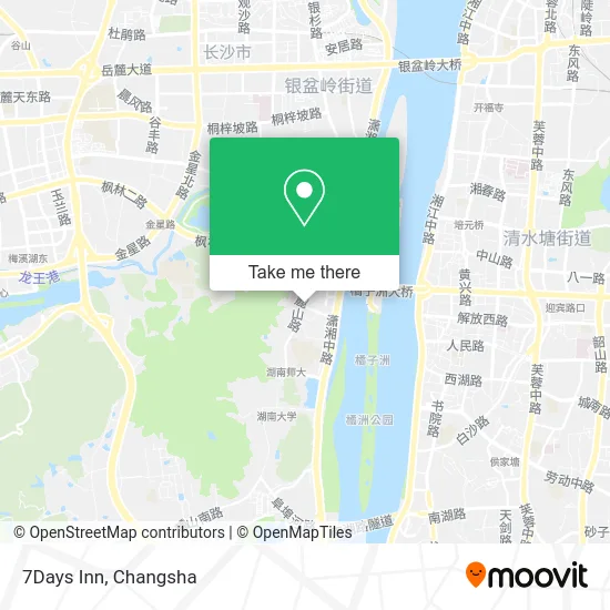
See 7Days Inn, Yuelu District, on the map
Public Transit to 7Days Inn in Yuelu District
Wondering how to get to 7Days Inn in Yuelu District? Moovit helps you find the best way to get to 7Days Inn with step-by-step directions from the nearest public transit station.
Moovit provides free maps and live directions to help you navigate through your city. View schedules, routes, timetables, and find out how long does it take to get to 7Days Inn in real time.
Looking for the nearest stop or station to 7Days Inn? Check out this list of stops closest to your destination: New Citizens Study Society Site; City Fourth Hospital; Yuelu Mountain North; Liwan Town; Aimin Road; East Xinmin Road; Hunan Normal University.
Bus: Route 202, Temporary Route 106, Temporary Route 63, Tourist Route 1, Lishan Express, Temporary Route 63, Temporary Route 106, Temporary Route 315, Route 132, 309, Route 305, Route 325, Tourist Route 3 Branch, Tourist Route 1, Lishan Express, Route 202, Route 903, Route 908 Limited.Metro: Line 2, Line 4, Line 2, Line 4.
Want to see if there’s another route that gets you there at an earlier time? Moovit helps you find alternative routes or times. Get directions from and directions to 7Days Inn easily from the Moovit App or Website.
We make riding to 7Days Inn easy, which is why over 1.5 million users, including users in Yuelu District, trust Moovit as the best app for public transit. You don’t need to download an individual bus app or train app, Moovit is your all-in-one transit app that helps you find the best bus time or train time available.
For information on prices of bus and metro, costs and ride fares to 7Days Inn, please check the Moovit app.
Use the app to navigate to popular places including to the airport, hospital, stadium, grocery store, mall, coffee shop, school, college, and university.
7Days Inn Address: 湖南省长沙市岳麓区麓山路33号 street in Yuelu District
- Hunan Zhongxing Manganese Industry Powder Company,
- Ai Yi Fu (Lushan Road Store),
- Hechengxing (Luwan Town Store),
- Le Tu,
- 7 Days Inn,
- 7 Days Quick Hotel,
- Love Dress Flowers (Xinmin Road Store),
- Le'er Le Discount Wholesale Supermarket (Yuanwan Branch),
- Zheng Yue Porridge Shop (Hexi Luwan Town Branch),
- Lushan Road 29,
- Hanting Express Inn,
- Songgui Fang (Xinmin Road Branch),
- Yuelu Mountain West Gate,
- Yuelu Mountain West Gate,
- Yuelu Mountain Western Entrance,
- Xinmin Road,
- Yue Yi,
- Songgui Fang Specialty Claypot Rice (Xinmin Road Branch),
- Changsha Fourth Hospital - Dermatology,
- Changsha Mingyang Mountain Funeral Home Mortuary Service Station at City Hospital
Places Near 7Days Inn (Yuelu District)
- Changsha Bank ATM (Sifang Branch), Kaifu District,
- Central South University Xiangya Second Hospital, Furong District,
- Changsha South Station Square, Yuelu District,
- Wanjiali International Mall, Furong District,
- First Affiliated Hospital of Hunan University of Traditional Chinese Medicine - Outpatient Department, Yuhua District,
- Xingsha Police Station Songya Community Police Room, Changsha County,
- Apple Authorized Dealer (Sam Changsha Store), Yuhua District,
- Changsha Yangming Mountain Funeral Home, Yuhua District,
- Desiqin City Square, Yuhua District,
- Hunan Provincial Museum - Multipurpose Hall, Kaifu District,
- First Club, Kaifu District,
- Hunan Provincial Maternal and Child Health Hospital - Outpatient Department, Kaifu District,
- Yuelu Mountain Juzizhou Tourist Area, Yuelu District,
- Changsha Bank (Sifang Branch), Kaifu District,
- Changsha South Station, Yuhua District,
- Zhongnan University Xiangya Hospital, Kaifu District,
- Hunan Province Tumor Hospital, Yuelu District,
- National University of Defense Technology (North Gate), Kaifu District,
- Hunan University of Traditional Chinese Medicine First Affiliated Hospital, Yuhua District,
- Du Fu River Pavilion, Tianxin District
How to get to popular places in Changsha with public transit
Get around Yuelu District by public transit!
Traveling around Yuelu District has never been so easy. See step by step directions as you travel to any attraction, street or major public transit station. View bus and train schedules, arrival times, service alerts and detailed routes on a map, so you know exactly how to get to anywhere in Yuelu District.
When traveling to any destination around Yuelu District use Moovit's Live Directions with Get Off Notifications to know exactly where and how far to walk, how long to wait for your line, and how many stops are left. Moovit will alert you when it's time to get off — no need to constantly re-check whether yours is the next stop.
Wondering how to use public transit in Yuelu District or how to pay for public transit in Yuelu District? Moovit public transit app can help you navigate your way with public transit easily, and at minimum cost. It includes public transit fees, ticket prices, and costs. Looking for a map of Yuelu District public transit lines? Moovit public transit app shows all public transit maps in Yuelu District with all Bus and Metro routes and stops on an interactive map.
Changsha has 2 transit type(s), including: Bus and Metro, operated by several transit agencies, including Changsha Metro and Changsha Bus Group
Public transit lines with stations closest to 7Days Inn in Yuelu District
Metro lines with stations closest to 7Days Inn in Yuelu District
Bus lines with stations closest to 7Days Inn in Yuelu District
City Fourth Hospital
- Tourist Route 3 BranchOrange Isle Scenic Area - Yuelu Mountain South
- Tourist Route 1Changsha Railway Station - Science Education New Village
- Lishan ExpressChangsha Railway Station - Central South University Student Apartments
- Route 202Changsha Railway Station - Wangjiawan
- Route 903Taozi Lake Intersection - Wangcheng Bus Station