How to get to 7th & Indiana by bus?
Click on the bus route to see step by step directions with maps, line arrival times and updated time schedules.
From Germantown Md, Washington
43 minFrom Washington Hebrew Congregation, Washington
49 minFrom Old Town Alexandria, Alexandria
41 minFrom Alexandria, VA, Alexandria
46 minFrom 2 Amys, Washington
43 minFrom Alexandria Courthouse, Alexandria
42 minFrom The Mall at Prince Georges, Prince George's County
74 minFrom Marymount University Campus, Arlington County
64 minFrom Allstate Insurance Agent: Azqa Goraya, Prince George's County
63 minFrom Nova- Alexandria Campus, Alexandria
61 min
How to get to 7th & Indiana by train?
Click on the train route to see step by step directions with maps, line arrival times and updated time schedules.
How to get to 7th & Indiana by metro?
Click on the metro route to see step by step directions with maps, line arrival times and updated time schedules.
From Washington Hebrew Congregation, Washington
44 minFrom Old Town Alexandria, Alexandria
38 minFrom Alexandria, VA, Alexandria
33 minFrom 2 Amys, Washington
40 minFrom Alexandria Courthouse, Alexandria
40 minFrom The Mall at Prince Georges, Prince George's County
37 minFrom Marymount University Campus, Arlington County
33 minFrom Allstate Insurance Agent: Azqa Goraya, Prince George's County
42 min
Bus stops near 7th & Indiana in Washington
- 7 St Nw+Pennsylvania Av NW, 1 min walk,VIEW
- Pennsylvania Ave & 7th St NW FS Wb, 2 min walk,VIEW
- Pennsylvania Ave Nw & 7th St Nw, 2 min walk,VIEW
- Pennsylvania Av Nw+7 St NW, 2 min walk,VIEW
- Pennsylvania Ave & 9th St NW Wb, 3 min walk,VIEW
- 7th St NW & Constitution Ave Eb, 3 min walk,VIEW
- Pennsylvania Ave & 9th St NW Eb, 3 min walk,VIEW
Metro stations near 7th & Indiana in Washington
Bus lines to 7th & Indiana in Washington
- D4X, 7 St-Georgia Av Limited,VIEW
- D40, 7 St-Georgia Av,VIEW
- 610, 610/7 Washington Dc,VIEW
- 640, 640/5 Washington Dc,VIEW
- 650, 650/8 La Plata,VIEW
- 705, 705/3 Washington Dc,VIEW
- 810, 810/5 Pindell,VIEW
- 820, 820/2 Washington Dc,VIEW
- 830, 830/2 Washington Dc,VIEW
- 840, 840/7 Prince Frederick / St Leonard,VIEW
- 943, 543 - L'Enfant Plaza - Washington, Dc,VIEW
- 953, 234 Lot / Montclair,VIEW
- D10, West To Foggy Bottom,VIEW
- D1X, East To Naylor Rd,VIEW
- D60, South To L'Enfant Plaza,VIEW
- 230, 230/9 Annapolis,VIEW
- 250, 250/1 Washington Dc,VIEW
- 305, 305/3 Washington Dc,VIEW
- 315, 315/2 Washington Dc,VIEW
- 325, 325/6 Columbia,VIEW
What are the closest stations to 7th & Indiana?
The closest stations to 7th & Indiana are:
- 7 St Nw+Pennsylvania Av NW is 17 yards away, 1 min walk.
- Gallery Place-Chinatown is 39 yards away, 1 min walk.
- Pennsylvania Ave & 7th St NW FS Wb is 78 yards away, 2 min walk.
- Pennsylvania Ave Nw & 7th St Nw is 86 yards away, 2 min walk.
- Pennsylvania Av Nw+7 St NW is 107 yards away, 2 min walk.
- Pennsylvania Ave & 9th St NW Wb is 189 yards away, 3 min walk.
- 7th St NW & Constitution Ave Eb is 225 yards away, 3 min walk.
- Pennsylvania Ave & 9th St NW Eb is 231 yards away, 3 min walk.
- Metro Center is 489 yards away, 6 min walk.
Which bus lines stop near 7th & Indiana?
These bus lines stop near 7th & Indiana: D10, D30, D4X, D6X, F19.
Which train line stops near 7th & Indiana?
MANASSAS LINE (Broad Run)
Which metro lines stop near 7th & Indiana?
These metro lines stop near 7th & Indiana: GREEN, RED, YELLOW.
What’s the nearest metro station to 7th & Indiana in Washington?
The nearest metro station to 7th & Indiana in Washington is Gallery Place-Chinatown. It’s a 1 min walk away.
What’s the nearest bus station to 7th & Indiana in Washington?
The nearest bus station to 7th & Indiana in Washington is 7 St Nw+Pennsylvania Av NW. It’s a 1 min walk away.
What time is the first metro to 7th & Indiana in Washington?
The BLUE is the first metro that goes to 7th & Indiana in Washington. It stops nearby at 5:20 AM.
What time is the last metro to 7th & Indiana in Washington?
The GREEN is the last metro that goes to 7th & Indiana in Washington. It stops nearby at 12:17 AM.
What time is the first bus to 7th & Indiana in Washington?
The D40 is the first bus that goes to 7th & Indiana in Washington. It stops nearby at 3:00 AM.
What time is the last bus to 7th & Indiana in Washington?
The D40 is the last bus that goes to 7th & Indiana in Washington. It stops nearby at 3:20 AM.
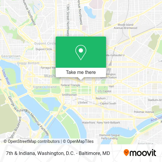
See 7th & Indiana, Washington, on the map
Public Transit to 7th & Indiana in Washington
Wondering how to get to 7th & Indiana in Washington? Moovit helps you find the best way to get to 7th & Indiana with step-by-step directions from the nearest public transit station.
Moovit provides free maps and live directions to help you navigate through your city. View schedules, routes, timetables, and find out how long does it take to get to 7th & Indiana in real time.
Looking for the nearest stop or station to 7th & Indiana? Check out this list of stops closest to your destination: 7 St Nw+Pennsylvania Av NW; Gallery Place-Chinatown; Pennsylvania Ave & 7th St NW FS Wb; Pennsylvania Ave Nw & 7th St Nw; Pennsylvania Av Nw+7 St NW; Pennsylvania Ave & 9th St NW Wb; 7th St NW & Constitution Ave Eb; Pennsylvania Ave & 9th St NW Eb; Metro Center.
Bus: D10, D30, D4X, D6X, F19, D40, 610, 640, 650, 705, 810, 943, 953, D1X, D60.Train: MANASSAS LINE.Metro: GREEN, RED, YELLOW, BLUE, ORANGE, SILVER.
Want to see if there’s another route that gets you there at an earlier time? Moovit helps you find alternative routes or times. Get directions from and directions to 7th & Indiana easily from the Moovit App or Website.
We make riding to 7th & Indiana easy, which is why over 1.5 million users, including users in Washington, trust Moovit as the best app for public transit. You don’t need to download an individual bus app or train app, Moovit is your all-in-one transit app that helps you find the best bus time or train time available.
For information on prices of bus, metro and train, costs and ride fares to 7th & Indiana, please check the Moovit app.
Use the app to navigate to popular places including to the airport, hospital, stadium, grocery store, mall, coffee shop, school, college, and university.
7th & Indiana Address: Washington, DC 20004 street in Washington
- Kaya Dispensary,
- Penn Quarter Sports Tavern,
- Snallygaster,
- Archives-Navy Memorial Metro Station,
- Metro-Archives-Navy Memorial-Penn Quarter,
- 701 Pennsylvania Avenue Restaurant & Bar,
- Navy Memorial,
- Liberty Place Property,
- United States Navy Memorial,
- Eastern Market Metro Park,
- Think Food Group (Think Food Lab),
- 7th & D St,
- Penn Quarter,
- 601 Pennsylvania Ave North Buiding,
- Rasika,
- Woolly Mammoth Theatre Company,
- Oyamel Cocina Mexicana,
- National Law Enforcement Officers Memorial Visitors Center,
- Woolly Mammoth Theatre,
- Rasika Restaurant
Places Near 7th & Indiana (Washington)
- Basilica of the National Shrine, Washington,
- Washington DC VA Medical Center, Washington,
- National Mall, Washington,
- Georgetown, Washington,
- National Zoo, Washington,
- The Anthem, Washington,
- Marriott Marquis Washington, DC, Washington,
- Sibley Memorial Hospital, Washington,
- PG Mall, Prince George's County,
- National Museum of African American History and Culture, Washington,
- Pennsylvania Ave NW (3rd st and pennsylvania), Washington,
- Museum Of The Bible, Washington,
- Warner Theatre, Washington,
- Amazon Hq2, Arlington County,
- Capital One Arena, Washington,
- Camden Yards, Baltimore,
- M&T Bank Stadium, Baltimore,
- Rock Creek Tennis Center, Washington,
- Washington National Cathedral, Washington,
- Westfield Montgomery Mall, Montgomery County
How to get to popular places in Washington, D.C. - Baltimore, MD with public transit
Get around Washington by public transit!
Traveling around Washington has never been so easy. See step by step directions as you travel to any attraction, street or major public transit station. View bus and train schedules, arrival times, service alerts and detailed routes on a map, so you know exactly how to get to anywhere in Washington.
When traveling to any destination around Washington use Moovit's Live Directions with Get Off Notifications to know exactly where and how far to walk, how long to wait for your line, and how many stops are left. Moovit will alert you when it's time to get off — no need to constantly re-check whether yours is the next stop.
Wondering how to use public transit in Washington or how to pay for public transit in Washington? Moovit public transit app can help you navigate your way with public transit easily, and at minimum cost. It includes public transit fees, ticket prices, and costs. Looking for a map of Washington public transit lines? Moovit public transit app shows all public transit maps in Washington with all Bus, Train, Metro, Light Rail and Ferry routes and stops on an interactive map.
Washington, D.C. - Baltimore, MD has 5 transit type(s), including: Bus, Train, Metro, Light Rail and Ferry, operated by several transit agencies, including WMATA, Montgomery County Ride On, Fairfax Connector, TheBus, PRTC, DASH - Alexandria, Arlington Transit (ART), RTA of Central Maryland, MDOT MTA, MDOT MTA Light RailLink, MDOT MTA Commuter Bus, MDOT MTA Local Bus, FXBGO!, Virginia Railway Express (VRE) and MARC