Directions to @ Dwayne's desk. (Baltimore County) with public transportation
The following transit lines have routes that pass near @ Dwayne's desk.
 Bus: 31, 37, 40, CITYLINK BLUE, 79.
How to get to @ Dwayne's desk. by bus?
Click on the bus route to see step by step directions with maps, line arrival times and updated time schedules.
From Lexington Market, Baltimore
45 minFrom Baltimore VA Medical Center, Baltimore
52 minFrom Baltimore Penn Station, Baltimore
37 minFrom Mva, Baltimore
34 minFrom University Of Maryland Medical Center, Baltimore
56 minFrom Randallstown, MD, Baltimore County
58 minFrom Western High School, Baltimore
65 minFrom Horseshoe Casino Baltimore, Baltimore
59 minFrom Hippodrome Theatre, Baltimore
47 minFrom Pimlico Race Course, Baltimore
51 min
Bus stops near @ Dwayne's desk. in Baltimore County
Bus lines to @ Dwayne's desk. in Baltimore County
What are the closest stations to @ Dwayne's desk.?
The closest stations to @ Dwayne's desk. are:
- Woodlawn Dr & Parallel Dr Sb is 472 yards away, 6 min walk.
- Woodlawn Dr & Security Blvd FS is 1004 yards away, 12 min walk.
- Security Blvd & Woodlawn Dr Wb is 1246 yards away, 15 min walk.
- Security Blvd & Gwynn Oak Ave FS Wb is 1381 yards away, 17 min walk.
Which bus lines stop near @ Dwayne's desk.?
These bus lines stop near @ Dwayne's desk.: 31, 37, 40, CITYLINK BLUE.
What’s the nearest bus station to @ Dwayne's desk. in Baltimore County?
The nearest bus station to @ Dwayne's desk. in Baltimore County is Woodlawn Dr & Parallel Dr Sb. It’s a 6 min walk away.
What time is the first bus to @ Dwayne's desk. in Baltimore County?
The 31 is the first bus that goes to @ Dwayne's desk. in Baltimore County. It stops nearby at 4:00 AM.
What time is the last bus to @ Dwayne's desk. in Baltimore County?
The 31 is the last bus that goes to @ Dwayne's desk. in Baltimore County. It stops nearby at 1:53 AM.
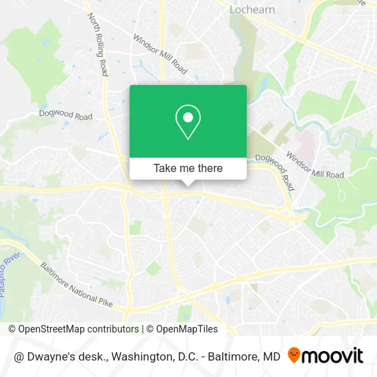
See @ Dwayne's desk., Baltimore County, on the map
Public Transit to @ Dwayne's desk. in Baltimore County
Wondering how to get to @ Dwayne's desk. in Baltimore County? Moovit helps you find the best way to get to @ Dwayne's desk. with step-by-step directions from the nearest public transit station.
Moovit provides free maps and live directions to help you navigate through your city. View schedules, routes, timetables, and find out how long does it take to get to @ Dwayne's desk. in real time.
Looking for the nearest stop or station to @ Dwayne's desk.? Check out this list of stops closest to your destination: Woodlawn Dr & Parallel Dr Sb; Woodlawn Dr & Security Blvd FS; Security Blvd & Woodlawn Dr Wb; Security Blvd & Gwynn Oak Ave FS Wb.
Bus: 31, 37, 40, CITYLINK BLUE, 79.
Want to see if there’s another route that gets you there at an earlier time? Moovit helps you find alternative routes or times. Get directions from and directions to @ Dwayne's desk. easily from the Moovit App or Website.
We make riding to @ Dwayne's desk. easy, which is why over 1.5 million users, including users in Baltimore County, trust Moovit as the best app for public transit. You don’t need to download an individual bus app or train app, Moovit is your all-in-one transit app that helps you find the best bus time or train time available.
For information on prices of bus, costs and ride fares to @ Dwayne's desk., please check the Moovit app.
Use the app to navigate to popular places including to the airport, hospital, stadium, grocery store, mall, coffee shop, school, college, and university.
Location: Baltimore County, Washington, D.C. - Baltimore, MD
- @ My Desk,
- Lockheed Martin,
- Al Madina Masjid,
- Excel Business Brokerage,
- Health Insurance Brokers Woodlawn,
- Asap Windshield,
- Jonas Way Monika Pl,
- Sodexo,
- Fox CHEVROLET, MITSUBISHI Security Service Center,
- Ssa Baltimore Federal Credit Union,
- Super Fresh Markets Regional Office,
- Child Care Center,
- Rodeway Inn,
- Baltimore Empowerment Basketball League,
- Security Blvd & Whitehead Rd Eb,
- Fox and Owl Hand M,
- Monika Pl (monika place woodlawn),
- Priyanka's Eyebrow Threading St.,
- Round Table Music Group,
- Wendy's
Places Near @ Dwayne's desk. (Baltimore County)
- Washington National Cathedral, Washington,
- Georgetown, Washington,
- The Anthem, Washington,
- Washington DC VA Medical Center, Washington,
- Amazon Hq2, Arlington County,
- Sibley Memorial Hospital, Washington,
- Warner Theatre, Washington,
- PG Mall, Prince George's County,
- Pennsylvania Ave NW (3rd st and pennsylvania), Washington,
- National Museum of African American History and Culture, Washington,
- Marriott Marquis Washington, DC, Washington,
- Westfield Montgomery Mall, Montgomery County,
- Camden Yards, Baltimore,
- National Zoo, Washington,
- M&T Bank Stadium, Baltimore,
- Basilica of the National Shrine, Washington,
- National Mall, Washington,
- Rock Creek Tennis Center, Washington,
- Museum Of The Bible, Washington,
- Capital One Arena, Washington
How to get to popular places in Washington, D.C. - Baltimore, MD with public transit
Get around Baltimore County by public transit!
Traveling around Baltimore County has never been so easy. See step by step directions as you travel to any attraction, street or major public transit station. View bus and train schedules, arrival times, service alerts and detailed routes on a map, so you know exactly how to get to anywhere in Baltimore County.
When traveling to any destination around Baltimore County use Moovit's Live Directions with Get Off Notifications to know exactly where and how far to walk, how long to wait for your line, and how many stops are left. Moovit will alert you when it's time to get off — no need to constantly re-check whether yours is the next stop.
Wondering how to use public transit in Baltimore County or how to pay for public transit in Baltimore County? Moovit public transit app can help you navigate your way with public transit easily, and at minimum cost. It includes public transit fees, ticket prices, and costs. Looking for a map of Baltimore County public transit lines? Moovit public transit app shows all public transit maps in Baltimore County with all Bus, Train, Metro, Light Rail and Ferry routes and stops on an interactive map.
Washington, D.C. - Baltimore, MD has 5 transit type(s), including: Bus, Train, Metro, Light Rail and Ferry, operated by several transit agencies, including WMATA, Montgomery County Ride On, Fairfax Connector, TheBus, PRTC, DASH - Alexandria, Arlington Transit (ART), RTA of Central Maryland, MDOT MTA, MDOT MTA Light RailLink, MDOT MTA Commuter Bus, MDOT MTA Local Bus, FXBGO!, Virginia Railway Express (VRE) and MARC