How to get to A1 Lock and Key LL by bus?
Click on the bus route to see step by step directions with maps, line arrival times and updated time schedules.
From Chanel, Indianapolis City (Balance)
95 minFrom Indianapolis, Indiana, Indianapolis City (Balance)
101 minFrom Crown Hill Funeral Home & Cemetery, Indianapolis City (Balance)
54 minFrom Ripple Deli, Indianapolis City (Balance)
50 minFrom Indianapolis Seo Company, Indianapolis City (Balance)
82 minFrom Carniceria Guanajuato, Indianapolis
82 minFrom Lafayette Square Mall, Indianapolis City (Balance)
71 minFrom Begreat Fitness / Strongnotskinny LLC, Indianapolis City (Balance)
74 minFrom Pike High School, Indianapolis City (Balance)
142 minFrom RSC Developments, Indianapolis City (Balance)
109 min
Bus stop near A1 Lock and Key LL in Indianapolis City (Balance)
- 86th St & Harcourt Rd, 6 min walk,VIEW
Bus lines to A1 Lock and Key LL in Indianapolis City (Balance)
What are the closest stations to A1 Lock and Key LL?
The closest stations to A1 Lock and Key LL are:
- 86th St & Harcourt Rd is 462 yards away, 6 min walk.
Which bus lines stop near A1 Lock and Key LL?
These bus lines stop near A1 Lock and Key LL: 28, 34.
What’s the nearest bus station to A1 Lock and Key LL in Indianapolis City (Balance)?
The nearest bus station to A1 Lock and Key LL in Indianapolis City (Balance) is 86th St & Harcourt Rd. It’s a 6 min walk away.
What time is the first bus to A1 Lock and Key LL in Indianapolis City (Balance)?
The 34 is the first bus that goes to A1 Lock and Key LL in Indianapolis City (Balance). It stops nearby at 4:36 AM.
What time is the last bus to A1 Lock and Key LL in Indianapolis City (Balance)?
The 34 is the last bus that goes to A1 Lock and Key LL in Indianapolis City (Balance). It stops nearby at 11:24 PM.
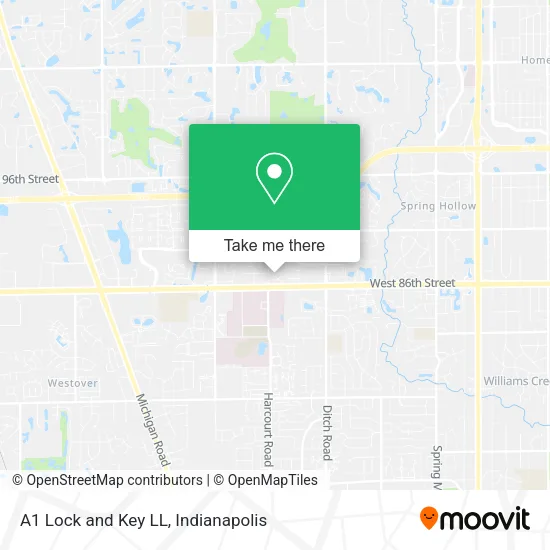
See A1 Lock and Key LL, Indianapolis City (Balance), on the map
Public Transit to A1 Lock and Key LL in Indianapolis City (Balance)
Wondering how to get to A1 Lock and Key LL in Indianapolis City (Balance)? Moovit helps you find the best way to get to A1 Lock and Key LL with step-by-step directions from the nearest public transit station.
Moovit provides free maps and live directions to help you navigate through your city. View schedules, routes, timetables, and find out how long does it take to get to A1 Lock and Key LL in real time.
Looking for the nearest stop or station to A1 Lock and Key LL? Check out this list of stops closest to your destination: 86th St & Harcourt Rd.
Bus: 28, 34.
Want to see if there’s another route that gets you there at an earlier time? Moovit helps you find alternative routes or times. Get directions from and directions to A1 Lock and Key LL easily from the Moovit App or Website.
We make riding to A1 Lock and Key LL easy, which is why over 1.5 million users, including users in Indianapolis City (Balance), trust Moovit as the best app for public transit. You don’t need to download an individual bus app or train app, Moovit is your all-in-one transit app that helps you find the best bus time or train time available.
For information on prices of bus, costs and ride fares to A1 Lock and Key LL, please check the Moovit app.
Use the app to navigate to popular places including to the airport, hospital, stadium, grocery store, mall, coffee shop, school, college, and university.
A1 Lock and Key LL Address: 8708 Pemberton Cir Indianapolis, IN 46260 street in Indianapolis City (Balance)
- TJC Event Solutions,
- Virginia Wiesjahn Crose DDS,
- Corvasc physicians specialty clinic,
- Hurtado-Hursh Elvia PHD,
- Fresenius Med Care Indnpolis N,
- Indianapolis Sub Zero Factory Certified Appliance Repair,
- Dr. Ferguson, Chiropractor,
- North Willow Farms Pool,
- Dr Jeffrey A Greenberg MD,
- Denise K Thornberry, MD,
- Gregmerrellmd,
- St. Vincent's Hospital Medical Records,
- Gentry James E Rev,
- Fire Department,
- Paul A Frascella, do,
- Ups,
- St. Vincent Hospital - Indianapolis,
- St Vincent Medical Group Family Medicine & Internal Medicine,
- Dr David L Madison Doctor of Medicine,
- Dr Nicholas E Fohl MD
Places Near A1 Lock and Key LL (Indianapolis City (Balance))
- Methodist Hospital of Indianapolis, Indianapolis City (Balance),
- THE BALT, Indianapolis City (Balance),
- I U Health Methodist Hospital, Indianapolis City (Balance),
- Cotter's Massage Parlor With Happy Endings, Indianapolis City (Balance),
- Castleton Square Mall, Indianapolis,
- 119 W 19th St Parking, Indianapolis City (Balance),
- Jersey Barn, Indianapolis City (Balance),
- St. Vincent Hospital - Indianapolis, Indianapolis City (Balance),
- Lucas Oil Stadium, Indianapolis City (Balance),
- Indiana, Indianapolis City (Balance),
- I-465 / I-65 Interchange, Indianapolis City (Balance),
- Plainfield, IN, Plainfield,
- Eskenazi Hospital, Indianapolis City (Balance),
- Lilly Corporate Center (Eli Lilly & Co), Indianapolis City (Balance),
- Indianapolis Airport Zone 2, Indianapolis City (Balance),
- Indianapolis Motor Speedway, Speedway,
- Indiana Convention Center, Indianapolis City (Balance),
- Gainbridge Fieldhouse, Indianapolis City (Balance),
- Train Ride At Castleton Mall, Indianapolis City (Balance),
- St. Vincent entrance #1, Indianapolis City (Balance)
How to get to popular places in Indianapolis with public transit
Get around Indianapolis City (Balance) by public transit!
Traveling around Indianapolis City (Balance) has never been so easy. See step by step directions as you travel to any attraction, street or major public transit station. View bus and train schedules, arrival times, service alerts and detailed routes on a map, so you know exactly how to get to anywhere in Indianapolis City (Balance).
When traveling to any destination around Indianapolis City (Balance) use Moovit's Live Directions with Get Off Notifications to know exactly where and how far to walk, how long to wait for your line, and how many stops are left. Moovit will alert you when it's time to get off — no need to constantly re-check whether yours is the next stop.
Wondering how to use public transit in Indianapolis City (Balance) or how to pay for public transit in Indianapolis City (Balance)? Moovit public transit app can help you navigate your way with public transit easily, and at minimum cost. It includes public transit fees, ticket prices, and costs. Looking for a map of Indianapolis City (Balance) public transit lines? Moovit public transit app shows all public transit maps in Indianapolis City (Balance) with all bus routes and stops on an interactive map.
Indianapolis has 1 transit type(s), including: bus, operated by several transit agencies, including IndyGo, FlixBus-us and Greyhound-us