Directions to ABC Imaging (Arlington County) with public transportation
The following transit lines have routes that pass near ABC Imaging
 Bus: 87, A12, A70, 75.
- Train: FREDERICKSBURG LINE, MANASSAS LINE.
- Metro: BLUE, YELLOW, METRO STATION CLOSURE SHUTTLE.
How to get to ABC Imaging by bus?
Click on the bus route to see step by step directions with maps, line arrival times and updated time schedules.
From The Queen Vic, Washington
108 minFrom Social Security Administration, Washington
105 minFrom Howard University, Washington
113 minFrom Congressional Cemetery, Washington
106 minFrom American University, Washington
94 minFrom The Darcy Hotel Washington DC, Washington
83 minFrom Waterfront Metro Station, Washington
94 minFrom Fairfield Inn by Marriott-Washington (Fairfield Inn & Suites by Marriott Washington, DC/Downtown), Washington
89 minFrom D.C. Jail, Washington
107 minFrom Hampton Inn-Washington, Washington
91 min
Bus stops near ABC Imaging in Arlington County
Metro stations near ABC Imaging in Arlington County
Train station near ABC Imaging in Arlington County
- Crystal City, 60 min walk,VIEW
Bus lines to ABC Imaging in Arlington County
What are the closest stations to ABC Imaging?
The closest stations to ABC Imaging are:
- Shirlington Rd Eb @ Kemper Rd FS is 98 yards away, 2 min walk.
- S Shirlington Rd & S 25th St is 199 yards away, 3 min walk.
- S Four Mile Run Dr Wb @ Shirlington Rd FS is 272 yards away, 4 min walk.
- S Kenmore St + 24th St is 401 yards away, 5 min walk.
- Martha Custis Dr @ Parc East Apts #1225 is 1512 yards away, 19 min walk.
- Potomac Yard is 4438 yards away, 53 min walk.
- Pentagon City is 4505 yards away, 53 min walk.
- Crystal City is 5097 yards away, 60 min walk.
Which bus lines stop near ABC Imaging?
These bus lines stop near ABC Imaging: 87, A12, A70.
What’s the nearest bus station to ABC Imaging in Arlington County?
The nearest bus station to ABC Imaging in Arlington County is Shirlington Rd Eb @ Kemper Rd FS. It’s a 2 min walk away.
What time is the first metro to ABC Imaging in Arlington County?
The YELLOW is the first metro that goes to ABC Imaging in Arlington County. It stops nearby at 5:08 AM.
What time is the last metro to ABC Imaging in Arlington County?
The BLUE is the last metro that goes to ABC Imaging in Arlington County. It stops nearby at 12:29 AM.
What time is the first train to ABC Imaging in Arlington County?
The MANASSAS LINE is the first train that goes to ABC Imaging in Arlington County. It stops nearby at 6:04 AM.
What time is the last train to ABC Imaging in Arlington County?
The MANASSAS LINE is the last train that goes to ABC Imaging in Arlington County. It stops nearby at 7:15 PM.
What time is the first bus to ABC Imaging in Arlington County?
The 75 is the first bus that goes to ABC Imaging in Arlington County. It stops nearby at 5:32 AM.
What time is the last bus to ABC Imaging in Arlington County?
The A70 is the last bus that goes to ABC Imaging in Arlington County. It stops nearby at 12:46 AM.
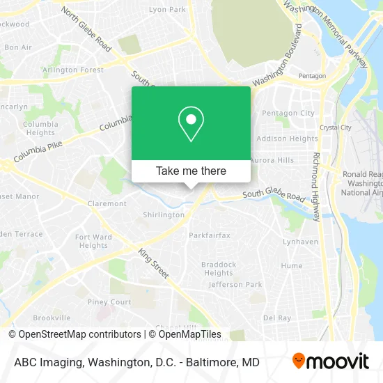
See ABC Imaging, Arlington County, on the map
Public Transit to ABC Imaging in Arlington County
Wondering how to get to ABC Imaging in Arlington County? Moovit helps you find the best way to get to ABC Imaging with step-by-step directions from the nearest public transit station.
Moovit provides free maps and live directions to help you navigate through your city. View schedules, routes, timetables, and find out how long does it take to get to ABC Imaging in real time.
Looking for the nearest stop or station to ABC Imaging? Check out this list of stops closest to your destination: Shirlington Rd Eb @ Kemper Rd FS; S Shirlington Rd & S 25th St; S Four Mile Run Dr Wb @ Shirlington Rd FS; S Kenmore St + 24th St; Martha Custis Dr @ Parc East Apts #1225; Potomac Yard; Pentagon City; Crystal City.
Bus: 87, A12, A70, 75.Train: FREDERICKSBURG LINE, MANASSAS LINE.Metro: BLUE, YELLOW, METRO STATION CLOSURE SHUTTLE.
Want to see if there’s another route that gets you there at an earlier time? Moovit helps you find alternative routes or times. Get directions from and directions to ABC Imaging easily from the Moovit App or Website.
We make riding to ABC Imaging easy, which is why over 1.5 million users, including users in Arlington County, trust Moovit as the best app for public transit. You don’t need to download an individual bus app or train app, Moovit is your all-in-one transit app that helps you find the best bus time or train time available.
For information on prices of bus and metro, costs and ride fares to ABC Imaging, please check the Moovit app.
Use the app to navigate to popular places including to the airport, hospital, stadium, grocery store, mall, coffee shop, school, college, and university.
ABC Imaging Address: 2620 S Shirlington Rd Arlington, VA 22206 street in Arlington County
- St. Timothy and St. Athanasius Coptic Orthodox Church,
- Chinn Baker Funeral Service,
- Ashu Auto Repair and Body Shop,
- American Used Tires,
- Post Office,
- Affordable Top Notch Moving,
- USPS Collection Box - Apc,
- Virginia Official Auto Safety & Emission Testing Station,
- Washington & Old Dominion Trail,
- W&Od Trail 1 Mile Marker,
- Allied Barton Security,
- Afsc,
- Bradson,
- FedEx,
- Ascd,
- The Jackson Clinics, Physical Therapy,
- Jeffrey A Sisel DDS,
- Edo Professional Services,
- Deshi Nursery of Arlington আরলিংটন দেশী নার্সারী,
- Virginia Hospital Center Physician Group
Places Near ABC Imaging (Arlington County)
- Marriott Marquis Washington, DC, Washington,
- The Anthem, Washington,
- Pennsylvania Ave NW (3rd st and pennsylvania), Washington,
- National Zoo, Washington,
- Westfield Montgomery Mall, Montgomery County,
- National Mall, Washington,
- M&T Bank Stadium, Baltimore,
- National Museum of African American History and Culture, Washington,
- Capital One Arena, Washington,
- Georgetown, Washington,
- Washington DC VA Medical Center, Washington,
- Rock Creek Tennis Center, Washington,
- Amazon Hq2, Arlington County,
- Warner Theatre, Washington,
- Camden Yards, Baltimore,
- Washington National Cathedral, Washington,
- Museum Of The Bible, Washington,
- Basilica of the National Shrine, Washington,
- Sibley Memorial Hospital, Washington,
- PG Mall, Prince George's County
How to get to popular places in Washington, D.C. - Baltimore, MD with public transit
Get around Arlington County by public transit!
Traveling around Arlington County has never been so easy. See step by step directions as you travel to any attraction, street or major public transit station. View bus and train schedules, arrival times, service alerts and detailed routes on a map, so you know exactly how to get to anywhere in Arlington County.
When traveling to any destination around Arlington County use Moovit's Live Directions with Get Off Notifications to know exactly where and how far to walk, how long to wait for your line, and how many stops are left. Moovit will alert you when it's time to get off — no need to constantly re-check whether yours is the next stop.
Wondering how to use public transit in Arlington County or how to pay for public transit in Arlington County? Moovit public transit app can help you navigate your way with public transit easily, and at minimum cost. It includes public transit fees, ticket prices, and costs. Looking for a map of Arlington County public transit lines? Moovit public transit app shows all public transit maps in Arlington County with all Bus, Train, Metro, Light Rail and Ferry routes and stops on an interactive map.
Washington, D.C. - Baltimore, MD has 5 transit type(s), including: Bus, Train, Metro, Light Rail and Ferry, operated by several transit agencies, including WMATA, Montgomery County Ride On, Fairfax Connector, TheBus, PRTC, DASH - Alexandria, Arlington Transit (ART), RTA of Central Maryland, MDOT MTA, MDOT MTA Light RailLink, MDOT MTA Commuter Bus, MDOT MTA Local Bus, FXBGO!, Virginia Railway Express (VRE) and MARC