Directions to ADT (Montgomery County) with public transportation
The following transit lines have routes that pass near ADT
 Bus: M82.
How to get to ADT by bus?
Click on the bus route to see step by step directions with maps, line arrival times and updated time schedules.
From Kaiser Permanente Tysons Corner Medical Center, Fairfax County
113 minFrom The Watermark Hotel, Fairfax County
115 minFrom Walter Reed National Military Medical Center, Montgomery County
76 minFrom Rockville, MD, Montgomery County
24 minFrom Walmart, Fairfax County
123 minFrom Pike & Rose (Pike and Rose), Montgomery County
50 minFrom National Institutes of Health (NIH), Montgomery County
63 minFrom Glenstone Museum, Montgomery County
56 minFrom HJF, Montgomery County
36 minFrom Hilton McLean Tysons Corner, Fairfax County
106 min
Bus stop near ADT in Montgomery County
- Falls Rd+River Rd, 2 min walk,VIEW
Bus lines to ADT in Montgomery County
- M82, North To Rockville,VIEW
What are the closest stations to ADT?
The closest stations to ADT are:
- Falls Rd+River Rd is 79 yards away, 2 min walk.
Which bus line stops near ADT?
M82 (North To Rockville)
What’s the nearest bus station to ADT in Montgomery County?
The nearest bus station to ADT in Montgomery County is Falls Rd+River Rd. It’s a 2 min walk away.
What time is the first bus to ADT in Montgomery County?
The M82 is the first bus that goes to ADT in Montgomery County. It stops nearby at 5:47 AM.
What time is the last bus to ADT in Montgomery County?
The M82 is the last bus that goes to ADT in Montgomery County. It stops nearby at 7:54 PM.
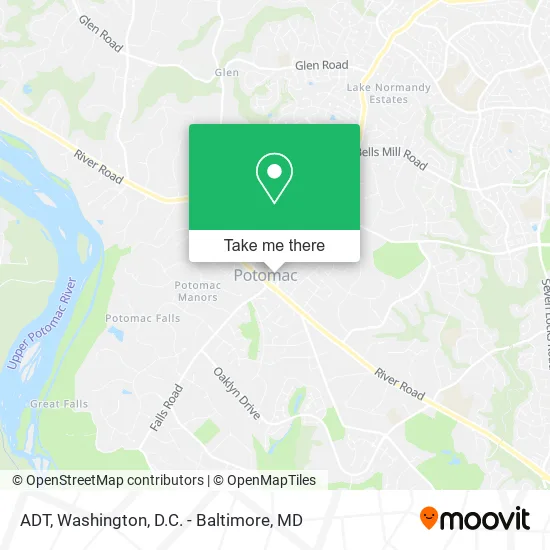
See ADT, Montgomery County, on the map
Public Transit to ADT in Montgomery County
Wondering how to get to ADT in Montgomery County? Moovit helps you find the best way to get to ADT with step-by-step directions from the nearest public transit station.
Moovit provides free maps and live directions to help you navigate through your city. View schedules, routes, timetables, and find out how long does it take to get to ADT in real time.
Looking for the nearest stop or station to ADT? Check out this list of stops closest to your destination: Falls Rd+River Rd.
Bus: M82.
Want to see if there’s another route that gets you there at an earlier time? Moovit helps you find alternative routes or times. Get directions from and directions to ADT easily from the Moovit App or Website.
We make riding to ADT easy, which is why over 1.5 million users, including users in Montgomery County, trust Moovit as the best app for public transit. You don’t need to download an individual bus app or train app, Moovit is your all-in-one transit app that helps you find the best bus time or train time available.
For information on prices of bus and metro, costs and ride fares to ADT, please check the Moovit app.
Use the app to navigate to popular places including to the airport, hospital, stadium, grocery store, mall, coffee shop, school, college, and university.
ADT Address: 10101 Glenolden Dr Potomac, MD 20854 street in Montgomery County
- Potomac Pilates,
- Citi,
- Bailah Home Care,
- Woodbury Financial,
- Abrahams Wolf-Rodda,
- Potomac Chiropractor,
- Spa65 Thai Massage & Bodywork,
- Federal Title & Escrow Company,
- Hill Locks Change,
- Locksmith Express,
- Hair by Moses,
- Mozafar Somekhian,
- Falls Rd (falls road & river road),
- Falls and River,
- Potomac, Maryland,
- Cortjet,
- Home Lock Repair,
- Hill Rekey My Lock,
- Dan Porto - Chase Home Lending Advisor - NMLS ID,
- 1to1 Fitness
Places Near ADT (Montgomery County)
- Camden Yards, Baltimore,
- Basilica of the National Shrine, Washington,
- PG Mall, Prince George's County,
- Georgetown, Washington,
- Warner Theatre, Washington,
- Museum Of The Bible, Washington,
- Washington DC VA Medical Center, Washington,
- The Anthem, Washington,
- Sibley Memorial Hospital, Washington,
- National Museum of African American History and Culture, Washington,
- M&T Bank Stadium, Baltimore,
- Marriott Marquis Washington, DC, Washington,
- National Theatre, Washington,
- Amazon Hq2, Arlington County,
- Capital One Arena, Washington,
- Pennsylvania Ave NW (3rd st and pennsylvania), Washington,
- National Zoo, Washington,
- Rock Creek Tennis Center, Washington,
- Washington National Cathedral, Washington,
- Westfield Montgomery Mall, Montgomery County
How to get to popular places in Washington, D.C. - Baltimore, MD with public transit
Get around Montgomery County by public transit!
Traveling around Montgomery County has never been so easy. See step by step directions as you travel to any attraction, street or major public transit station. View bus and train schedules, arrival times, service alerts and detailed routes on a map, so you know exactly how to get to anywhere in Montgomery County.
When traveling to any destination around Montgomery County use Moovit's Live Directions with Get Off Notifications to know exactly where and how far to walk, how long to wait for your line, and how many stops are left. Moovit will alert you when it's time to get off — no need to constantly re-check whether yours is the next stop.
Wondering how to use public transit in Montgomery County or how to pay for public transit in Montgomery County? Moovit public transit app can help you navigate your way with public transit easily, and at minimum cost. It includes public transit fees, ticket prices, and costs. Looking for a map of Montgomery County public transit lines? Moovit public transit app shows all public transit maps in Montgomery County with all Bus, Train, Metro, Light Rail and Ferry routes and stops on an interactive map.
Washington, D.C. - Baltimore, MD has 5 transit type(s), including: Bus, Train, Metro, Light Rail and Ferry, operated by several transit agencies, including WMATA, Montgomery County Ride On, Fairfax Connector, TheBus, PRTC, DASH - Alexandria, Arlington Transit (ART), RTA of Central Maryland, MDOT MTA, MDOT MTA Light RailLink, MDOT MTA Commuter Bus, MDOT MTA Local Bus, FXBGO!, Virginia Railway Express (VRE) and MARC