How to get to ALDI by bus?
Click on the bus route to see step by step directions with maps, line arrival times and updated time schedules.
From Beltway Plaza Mall, Prince George's County
66 minFrom Riderwood Senior Living Community, Montgomery County
71 minFrom Adventist HealthCare White Oak Medical Center-ER (Adventist White Oak Med Ctr-ER), Montgomery County
75 minFrom IKEA - College Park, Prince George's County
32 minFrom Lincoln Tech, Howard County
52 minFrom Doctors Community Hospital, Prince George's County
76 minFrom National Archives at College Park, Prince George's County
62 minFrom IKEA, Prince George's County
55 minFrom Beltsville, Maryland, Prince George's County
23 minFrom Bowie, MD, Prince George's County
92 min
Bus stops near ALDI in Prince George's County
Train station near ALDI in Prince George's County
- Muirkirk Marc Sb, 40 min walk,VIEW
Bus lines to ALDI in Prince George's County
What are the closest stations to ALDI?
The closest stations to ALDI are:
- Mulberry St / Briston St (Northbound) is 80 yards away, 2 min walk.
- Baltimore Av+Cypress St is 176 yards away, 3 min walk.
- Laurel Lakes Ct / Laurel Lakes Senior Housing is 498 yards away, 7 min walk.
- Muirkirk Marc Sb is 3323 yards away, 40 min walk.
Which bus lines stop near ALDI?
These bus lines stop near ALDI: 502, P12.
What’s the nearest bus station to ALDI in Prince George's County?
The nearest bus station to ALDI in Prince George's County is Mulberry St / Briston St (Northbound). It’s a 2 min walk away.
What time is the first train to ALDI in Prince George's County?
The MARC is the first train that goes to ALDI in Prince George's County. It stops nearby at 5:28 AM.
What time is the last train to ALDI in Prince George's County?
The MARC is the last train that goes to ALDI in Prince George's County. It stops nearby at 8:13 PM.
What time is the first bus to ALDI in Prince George's County?
The P12 is the first bus that goes to ALDI in Prince George's County. It stops nearby at 5:33 AM.
What time is the last bus to ALDI in Prince George's County?
The P12 is the last bus that goes to ALDI in Prince George's County. It stops nearby at 10:41 PM.
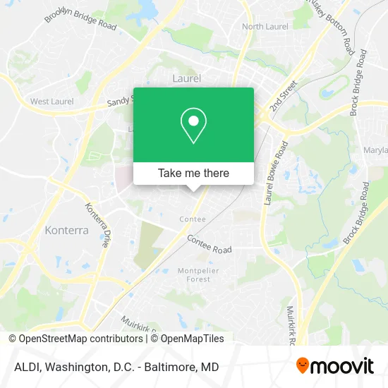
See ALDI, Prince George's County, on the map
Public Transit to ALDI in Prince George's County
Wondering how to get to ALDI in Prince George's County? Moovit helps you find the best way to get to ALDI with step-by-step directions from the nearest public transit station.
Moovit provides free maps and live directions to help you navigate through your city. View schedules, routes, timetables, and find out how long does it take to get to ALDI in real time.
Looking for the nearest stop or station to ALDI? Check out this list of stops closest to your destination: Mulberry St / Briston St (Northbound); Baltimore Av+Cypress St; Laurel Lakes Ct / Laurel Lakes Senior Housing; Muirkirk Marc Sb.
Bus: 502, P12, 301.Train: MARC.
Want to see if there’s another route that gets you there at an earlier time? Moovit helps you find alternative routes or times. Get directions from and directions to ALDI easily from the Moovit App or Website.
We make riding to ALDI easy, which is why over 1.5 million users, including users in Prince George's County, trust Moovit as the best app for public transit. You don’t need to download an individual bus app or train app, Moovit is your all-in-one transit app that helps you find the best bus time or train time available.
For information on prices of bus, costs and ride fares to ALDI, please check the Moovit app.
Get to ALDI with public transit and pay for the ride in the Moovit app. In addition to all info you may need for your trip to ALDI, including live directions, real-time arrivals and fare prices, you can also buy public transit passes for your rides. No need for cash or paper tickets to get to ALDI - everything you need is accessible in the app with a click of the button.
Use the app to navigate to popular places including to the airport, hospital, stadium, grocery store, mall, coffee shop, school, college, and university.
ALDI Address: 14100 Baltimore Ave Laurel, MD 20707 street in Prince George's County
- Amazon Locker-Evangelista,
- Dollar Tree,
- STARBUCKS,
- DD's Discounts,
- Mathnasium,
- Jun Tae Bae,
- Dr Nitin Chopde,
- Acr Accounting & Consulting Resources,
- On the Watch Security & Private Investigations,
- Laurel Regional Chiropractic,
- Boston School / Mid-Atlantic School of Food Safety,
- Akbar Masood DDS,
- Tejal M. Sanghvi, Pt,
- Same Day STD Testing,
- Virtuous Brading & Weaving by,
- Amazon Locker-Defiance,
- Laurel MD,
- Gude Mansion,
- Think Big Productions,
- Massage Crystal
Places Near ALDI (Prince George's County)
- Rock Creek Tennis Center, Washington,
- M&T Bank Stadium, Baltimore,
- National Zoo, Washington,
- Basilica of the National Shrine, Washington,
- Westfield Montgomery Mall, Montgomery County,
- Warner Theatre, Washington,
- PG Mall, Prince George's County,
- The Anthem, Washington,
- Washington National Cathedral, Washington,
- Amazon Hq2, Arlington County,
- Georgetown, Washington,
- Capital One Arena, Washington,
- Pennsylvania Ave NW (3rd st and pennsylvania), Washington,
- Marriott Marquis Washington, DC, Washington,
- National Museum of African American History and Culture, Washington,
- National Mall, Washington,
- Camden Yards, Baltimore,
- Washington DC VA Medical Center, Washington,
- Sibley Memorial Hospital, Washington,
- Museum Of The Bible, Washington
How to get to popular places in Washington, D.C. - Baltimore, MD with public transit
Get around Prince George's County by public transit!
Traveling around Prince George's County has never been so easy. See step by step directions as you travel to any attraction, street or major public transit station. View bus and train schedules, arrival times, service alerts and detailed routes on a map, so you know exactly how to get to anywhere in Prince George's County.
When traveling to any destination around Prince George's County use Moovit's Live Directions with Get Off Notifications to know exactly where and how far to walk, how long to wait for your line, and how many stops are left. Moovit will alert you when it's time to get off — no need to constantly re-check whether yours is the next stop.
Wondering how to use public transit in Prince George's County or how to pay for public transit in Prince George's County? Moovit public transit app can help you navigate your way with public transit easily, and at minimum cost. It includes public transit fees, ticket prices, and costs. Looking for a map of Prince George's County public transit lines? Moovit public transit app shows all public transit maps in Prince George's County with all Bus, Train, Metro, Light Rail and Ferry routes and stops on an interactive map.
Washington, D.C. - Baltimore, MD has 5 transit type(s), including: Bus, Train, Metro, Light Rail and Ferry, operated by several transit agencies, including WMATA, Montgomery County Ride On, Fairfax Connector, TheBus, PRTC, DASH - Alexandria, Arlington Transit (ART), RTA of Central Maryland, MDOT MTA, MDOT MTA Light RailLink, MDOT MTA Commuter Bus, MDOT MTA Local Bus, FXBGO!, Virginia Railway Express (VRE) and MARC