Directions to ALFAMART (Bandung) with public transportation
The following transit lines have routes that pass near ALFAMART
 Bus: BL, CIROYOM-LEMBANG, CISARUA-LEMBANG.
How to get to ALFAMART by bus?
Click on the bus route to see step by step directions with maps, line arrival times and updated time schedules.
From Jl. Pelesiran No.6 Tamansari, Bandung, Bandung
50 minFrom Gedung Jenderal Soedirman SECAPA AD, Bandung
32 minFrom Masjid Al Jabbar, Bandung
90 minFrom Universitas Komputer Indonesia (UNIKOM), Kota Bandung
51 minFrom Nokia Care Centre BEC Lantai3, Kota Bandung
43 minFrom Angkot kalapa-cicaheum 01 <<binong>>, Kota Bandung
73 minFrom Pussenif, Kota Bandung
60 minFrom Gedung Sate, Kota Bandung
53 minFrom Mall Bec Bandung Electronik Center, Kota Bandung
45 minFrom Klinik ION, Dr.Wilbert, Kota Bandung
43 min
Bus stops near ALFAMART in Bandung
Bus lines to ALFAMART in Bandung
What are the closest stations to ALFAMART?
The closest stations to ALFAMART are:
- Jalan Kolonel Masturi 6 is 535 meters away, 7 min walk.
- Jalan Grand Hotel 35a is 624 meters away, 9 min walk.
Which bus lines stop near ALFAMART?
These bus lines stop near ALFAMART: BL, CIROYOM-LEMBANG.
What’s the nearest bus station to ALFAMART in Bandung?
The nearest bus station to ALFAMART in Bandung is Jalan Kolonel Masturi 6. It’s a 7 min walk away.
What time is the first bus to ALFAMART in Bandung?
The CIROYOM-LEMBANG is the first bus that goes to ALFAMART in Bandung. It stops nearby at 5:01 AM.
What time is the last bus to ALFAMART in Bandung?
The CIROYOM-LEMBANG is the last bus that goes to ALFAMART in Bandung. It stops nearby at 10:29 PM.
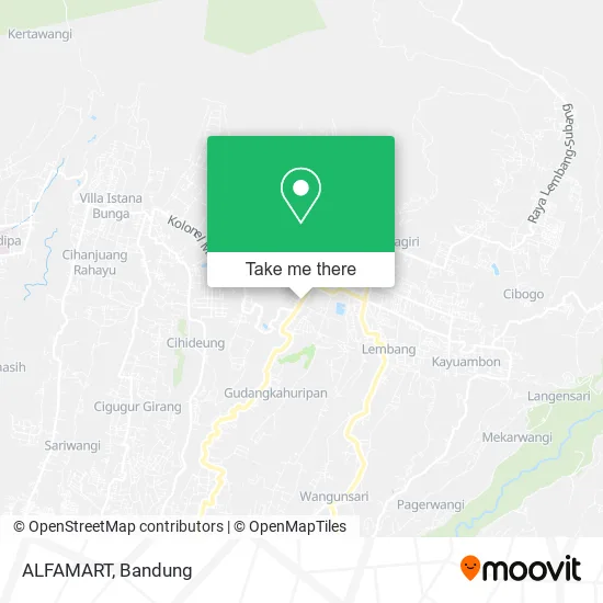
See ALFAMART, Bandung, on the map
Public Transit to ALFAMART in Bandung
Wondering how to get to ALFAMART in Bandung? Moovit helps you find the best way to get to ALFAMART with step-by-step directions from the nearest public transit station.
Moovit provides free maps and live directions to help you navigate through your city. View schedules, routes, timetables, and find out how long does it take to get to ALFAMART in real time.
Looking for the nearest stop or station to ALFAMART? Check out this list of stops closest to your destination: Jalan Kolonel Masturi 6; Jalan Grand Hotel 35a.
Bus: BL, CIROYOM-LEMBANG, CISARUA-LEMBANG.
Want to see if there’s another route that gets you there at an earlier time? Moovit helps you find alternative routes or times. Get directions from and directions to ALFAMART easily from the Moovit App or Website.
We make riding to ALFAMART easy, which is why over 1.5 million users, including users in Bandung, trust Moovit as the best app for public transit. You don’t need to download an individual bus app or train app, Moovit is your all-in-one transit app that helps you find the best bus time or train time available.
For information on prices of bus, costs and ride fares to ALFAMART, please check the Moovit app.
Use the app to navigate to popular places including to the airport, hospital, stadium, grocery store, mall, coffee shop, school, college, and university.
ALFAMART Address: Bandung Barat 40791 street in Bandung
- GBI Sukawarna Cabang Lembang,
- Coffee van Bagels,
- Cumi and the Gank Sate Seafood Khas Thailand,
- Sate Padang Pariaman,
- Public Cheese Tea,
- Kedai Ceu Ebhot,
- Sangria Resort & Spa,
- Bebek Baong,
- Toko Buah,
- Gedung Serba Guna Abadi Hash,
- Pabrik Tempe Keju,
- Factory Outlet,
- Hcr Tour Travel,
- wisma GBI,
- Yayasan Panen Berganda Pondok,
- GBI Sukawarna Lembang,
- Cafe Giri Bambu,
- Ular Kobra Toko,
- Konveski Bunga Hati,
- Jagir Kaos Lembang
Places Near ALFAMART (Bandung)
- Trans Studio Mall (TSM), Kota Bandung,
- 23 Paskal Shopping Mall, Kota Bandung,
- Subang, Kota Bandung,
- Taman Hutan Raya (TAHURA), Kota Bandung,
- Rs Hasan Sadikin, Kota Bandung,
- RSUP Dr. Hasan Sadikin (RSHS), Kota Bandung,
- Pasteur, Kota Bandung,
- Cililin, Kab. Bandung Barat, Bandung,
- Stadion Gelora Bandung Lautan Api (GBLA), Kota Bandung,
- Braga, Kota Bandung,
- Batujajar, Bandung,
- YYY, Kota Bandung,
- bus damri “Dago - Leuwi panjang”, Kota Bandung,
- Universitas Pendidikan Indonesia (UPI), Kota Bandung,
- Warung bokep, Bandung,
- Summarecon Mall Bandung, Kota Bandung,
- Jl.L.L.R.E.Martadinata no.47,Bandung Regency, Bandung,
- Rumah Sakit Hasan Sadikin, Kota Bandung,
- Pantai Santolo - Pameungpeuk Garut, Bandung,
- Bus Damri Dipati Ukur-Jatinangor, Bandung
How to get to popular places in Bandung with public transit
Get around Bandung by public transit!
Traveling around Bandung has never been so easy. See step by step directions as you travel to any attraction, street or major public transit station. View bus and train schedules, arrival times, service alerts and detailed routes on a map, so you know exactly how to get to anywhere in Bandung.
When traveling to any destination around Bandung use Moovit's Live Directions with Get Off Notifications to know exactly where and how far to walk, how long to wait for your line, and how many stops are left. Moovit will alert you when it's time to get off — no need to constantly re-check whether yours is the next stop.
Wondering how to use public transit in Bandung or how to pay for public transit in Bandung? Moovit public transit app can help you navigate your way with public transit easily, and at minimum cost. It includes public transit fees, ticket prices, and costs. Looking for a map of Bandung public transit lines? Moovit public transit app shows all public transit maps in Bandung with all Bus and Train routes and stops on an interactive map.
Bandung has 2 transit type(s), including: Bus and Train, operated by several transit agencies, including Trans Metro Bandung, Trans Metro Pasundan - Teman Bus, Angkutan Antarkota Dalam Provinsi, DAMRI, KAI Commuter, Angkutan Kota Bandung, Angkutan Kabupaten Bandung, Kobanter Baru, Bus Wisata DISHUB Kota Bandung, Bus Sekolah DISHUB Kota Bandung and Dinas Perhubungan Provinsi Jawa Barat