How to get to ALFAMART by bus?
Click on the bus route to see step by step directions with maps, line arrival times and updated time schedules.
From Terminal Bunder, Gresik
53 minFrom Krembangan, Surabaya
36 minFrom Tretes, Pandaan, Surabaya
24 minFrom Cerme, Gresik
95 minFrom Samsat Drive Thru Giant Rajawali, Dupak
28 minFrom Jl. Parang barong, Kemayoran
50 minFrom Bunder, Gresik
52 minFrom Jl. Raya Menganti Wiyung, Wiyung
56 minFrom Ada Icon Mall Gresik, Gresik
57 min
How to get to ALFAMART by train?
Click on the train route to see step by step directions with maps, line arrival times and updated time schedules.
Bus stops near ALFAMART in Sememi
Train station near ALFAMART in Sememi
- Stasiun Benowo, 31 min walk,VIEW
Bus lines to ALFAMART in Sememi
What are the closest stations to ALFAMART?
The closest stations to ALFAMART are:
- Sma Wachid Hasyim 2 is 19 meters away, 1 min walk.
- Polsek Benowo A is 492 meters away, 7 min walk.
- Indomaret Sememi is 847 meters away, 11 min walk.
- Stasiun Benowo is 2409 meters away, 31 min walk.
Which bus lines stop near ALFAMART?
These bus lines stop near ALFAMART: BJ, BP, Z, Z1.
Which train line stops near ALFAMART?
A (Bojonegoro)
What’s the nearest bus station to ALFAMART in Sememi?
The nearest bus station to ALFAMART in Sememi is Sma Wachid Hasyim 2. It’s a 1 min walk away.
What time is the first train to ALFAMART in Sememi?
The A is the first train that goes to ALFAMART in Sememi. It stops nearby at 3:10 AM.
What time is the last train to ALFAMART in Sememi?
The A is the last train that goes to ALFAMART in Sememi. It stops nearby at 5:20 PM.
What time is the first bus to ALFAMART in Sememi?
The BJ is the first bus that goes to ALFAMART in Sememi. It stops nearby at 5:04 AM.
What time is the last bus to ALFAMART in Sememi?
The Z1 is the last bus that goes to ALFAMART in Sememi. It stops nearby at 10:24 PM.
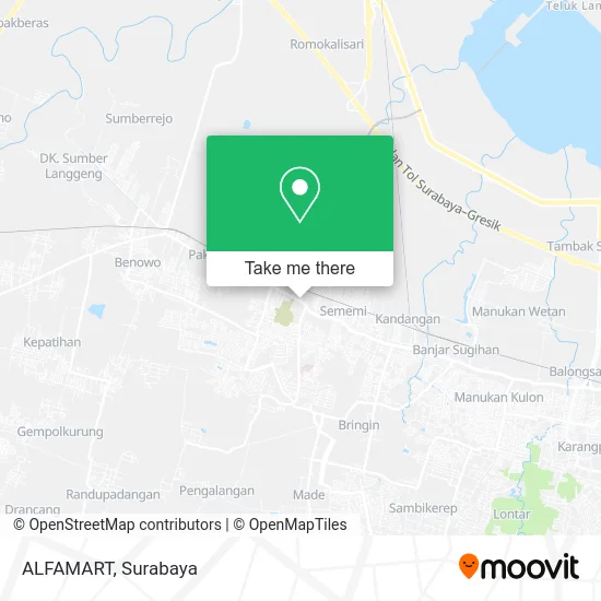
See ALFAMART, Sememi, on the map
Public Transit to ALFAMART in Sememi
Wondering how to get to ALFAMART in Sememi? Moovit helps you find the best way to get to ALFAMART with step-by-step directions from the nearest public transit station.
Moovit provides free maps and live directions to help you navigate through your city. View schedules, routes, timetables, and find out how long does it take to get to ALFAMART in real time.
Looking for the nearest stop or station to ALFAMART? Check out this list of stops closest to your destination: Sma Wachid Hasyim 2; Polsek Benowo A; Indomaret Sememi; Stasiun Benowo.
Bus: BJ, BP, Z, Z1, I, R5.Train: A.
Want to see if there’s another route that gets you there at an earlier time? Moovit helps you find alternative routes or times. Get directions from and directions to ALFAMART easily from the Moovit App or Website.
We make riding to ALFAMART easy, which is why over 1.5 million users, including users in Sememi, trust Moovit as the best app for public transit. You don’t need to download an individual bus app or train app, Moovit is your all-in-one transit app that helps you find the best bus time or train time available.
For information on prices of bus and train, costs and ride fares to ALFAMART, please check the Moovit app.
Use the app to navigate to popular places including to the airport, hospital, stadium, grocery store, mall, coffee shop, school, college, and university.
ALFAMART Address: Jalan Raya Sememi Surabaya 60192 street in Sememi
- Surya Audio,
- Ncs Agen Sememi,
- Only Lok Lok Grill,
- Kedai Bu Nanda,
- Key Cosmetic,
- ATM Bca,
- Warung Bayu,
- Pasar Induk Osowilangun,
- Toko Marcell Jaya 3,
- Pecel Espass,
- PT Waskita Beton Precast Tbk,
- Warung Nadia,
- Fried Chicken Hfc,
- Warkop Aini,
- Bca,
- PT Surya Mandiri Indoprima,
- PT Berkat Arang Sukses,
- Perumahan PALM RESIDENCE,
- Fakultas Ekonomi Universitas Wijaya Putra,
- Western Union
Places Near ALFAMART (Sememi)
- Bis Damri P1 (Perak-Bungurasih PP), Krembangan Selatan,
- Halte Bis Royal Plaza, Wonokromo,
- Grand City Mall, Surabaya, Gubeng,
- Pelabuhan Tanjung Perak,
- UPN Veteran Jawa Timur, Gunung Anyar,
- PTC, Surabaya,
- Taman Harmoni, Keputih,
- Smoking Room Terminal Domestik Juanda International Airport, Sidoarjo,
- BG Junction Mall, Bubutan,
- Galaxy Mall Surabaya, Mulyorejo,
- Pakuwon City Mall, Keputih,
- Kantor Regional II BKN Surabaya, Sidoarjo,
- Kebun Binatang Surabaya, Darmo,
- Bg Junction, Bubutan,
- Stadion gelora bung tomo(surabaya,jawa timur), Surabaya,
- Graha Pena, Ketintang,
- GBT (Gelora Bung Tomo) Surabaya, Benowo,
- Universitas Negeri Surabaya (UNESA), Lidah Wetan,
- Pakuwon Mall, Lontar,
- Masjid Al-Akbar, Surabaya
How to get to popular places in Surabaya with public transit
Get around Sememi by public transit!
Traveling around Sememi has never been so easy. See step by step directions as you travel to any attraction, street or major public transit station. View bus and train schedules, arrival times, service alerts and detailed routes on a map, so you know exactly how to get to anywhere in Sememi.
When traveling to any destination around Sememi use Moovit's Live Directions with Get Off Notifications to know exactly where and how far to walk, how long to wait for your line, and how many stops are left. Moovit will alert you when it's time to get off — no need to constantly re-check whether yours is the next stop.
Wondering how to use public transit in Sememi or how to pay for public transit in Sememi? Moovit public transit app can help you navigate your way with public transit easily, and at minimum cost. It includes public transit fees, ticket prices, and costs. Looking for a map of Sememi public transit lines? Moovit public transit app shows all public transit maps in Sememi with all Bus and Train routes and stops on an interactive map.
Surabaya has 2 transit type(s), including: Bus and Train, operated by several transit agencies, including KAI Commuter, Angkutan Surabaya, Trans Semanggi Suroboyo, Suroboyo Bus, Feeder Wira Wiri Suroboyo, Trans Jatim and DAMRI